Sun and the Super Bowl

It looks as if the day of Super Bowl LIII will have a cloudy start, as Mercedes Benz Stadium is facing overcast conditions; it is currently 53°F down in Atlanta. As far as rain is concerned, it will only have a real impact for this morning. We will possibly see some clearing in time for kick-off, and those clear conditions could continue until the very end of the game. Temperatures will also be very enjoyable as well for those who bought a ticket and the two participating teams who worked so hard to get to the Super Bowl, as they could start in the upper 50’s for kick-off and sink to the lower 50’s as the game ends.

12Z NAM SFC Temperatures (Source: College of DuPage)

Winds will possibly be very calm with few gusts during the game, and winds could come mainly from the east to northeast.

13Z SFC Observations (Source: College of DuPage)

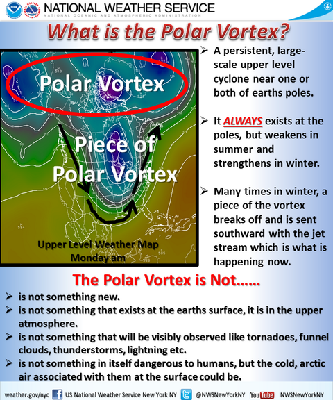
Conversely for those who are on campus this Super Bowl day, it is currently sunny, but will see an increase in cloudiness for the evening. Highs will reach the lower 60’s and lows will be in the low 40’s. For and update on Monday, class goers will face cloudy conditions, with those with evening classes possibly facing a chance of showers. Highs will reach the upper 50’s and lows will be in the lower 50’s. Tuesday could have a slight chance of showers as well, with highs in the mid 50’s and lows in the upper 40’s.

12Z NAM SLP and Precipitation (Source: College of DuPage)

Summary:

Today: Sunny for the morning, cloudy for the evening; High: 63, Low: 40

Monday: Cloudy with a 50% chance of rain for the evening; High: 58, Low: 50

Tuesday: 40% chance of showers throughout the day; High: 52, Low: 49

Posted in Kentucky Weather | Tagged , | Comments Off on Sun and the Super Bowl

The Warming Weekend

It looks like we’ll be seeing fog for our morning commutes. Remember, please drive carefully. Once the fog clears up, we’ll get to see some sunshine for our Saturday.

13Z SFC Observations (Source: College of DuPage)

A strong high pressure field will allow for us to see the sun for this weekend. Expect the highs today to reach the low 50’s, and our lows will be in the mid-upper 30’s. Expect a continuation of warmer temperatures when we come into Sunday, where the highs will reach the lower 60’s, with lows into the low 40’s. Unfortunately for us, there will be a chance for precipitation for Monday.

06Z GFS SLP and Precipitation (Source: College of DuPage)

A line of storms that could span from Northern Michigan all the way down to Southern Mississippi could make it’s way through the area for our Monday. For those with morning classes especially, bring your umbrella as you head out. Highs for Monday will be in the lower 60’s and lows will be in the upper 40’s.

Summary:

Saturday: Morning fog, otherwise sunny with clouds; High 53, Low: 35

Sunday: Sunny with a few clouds; High: 62, Low: 43

Monday: 60% chance of storms, especially for the morning; High: 60, Low: 49

Posted in Kentucky Weather | Tagged | Comments Off on The Warming Weekend

Out of the Ice Box For Now…

Welcome to the first day of February, if you can believe it! Hope you all survived our brief stint in the ice box. The good news is for now at least, we are going to recover our temperatures quite nicely just in time for the weekend.

Set Up:

High pressure anchored over the eastern half of the U.S. will build in over the weekend shifting the winds around to the S to SW aiding in the recovery of our temperatures.

2m Temperature (°F) valid for 1pm on Saturday

Temperatures will make it into the mid 50s for Saturday and then into the low 60s for Sunday. We then enter into an unsettled weather pattern for the start to the workweek with the arrival of a couple fronts. One arrives late Monday and the other arrives around the end of the week. Timing and amount of rain of the second front is uncertain at this time.

Forecast:

Tonight- areas of patchy fog developing late lows in the mid 30s. Otherwise the cloud cover will stick around overnight.

Tomorrow – Mostly sunny skies will dominate during the day with temperatures rising into the mid 50s.

Tomorrow night – A few passing clouds with lows falling back into the low 40s.

Enjoy your weekend!

Posted in Kentucky Weather | Tagged , , , | Comments Off on Out of the Ice Box For Now…

A Little Glimpse at Spring Heading into February!

Heading into the overnight hours, temperatures around the area will warm back up above freezing. The thing to watch as we head into the early hours of tomorrow morning is the increasing chance for freezing drizzle. But with the increase in temperatures, the threat for freezing drizzle will be short.

Temperatures increase throughout the day on Friday into the mid 40s. Clouds will persist throughout the day with a chance of light rain during the morning hours. The clouds will stick around heading into the evening and overnight hours with low temperatures around the area in the mid 30s. High pressure builds in from the west heading into Saturday, aiding the eastward progression of the Arctic high that the Great Lakes and Ohio River Valley regions over the past few days.

Temperatures on Saturday warm up into the upper 50s with partly cloudy skies with overnight lows right around the 40 degree mark.

Above: 2m AGL Temperature Sat 2019-02-02 21Z

Sunday looks even better with temperatures in the lower 60s with partly cloudy skies.

Friday: A chance of light rain especially before the afternoon with cloudy skies, high of 45. Winds out of the SW at 5 to 10 mph.

Friday Night: Mostly cloud skies, with a low of 34. Very light winds out of the south.

Saturday: Partly cloudy skies with a near 62. South winds at 4 to 7 mph.

Sunday: Partly cloudy skies with a high near 67.

Posted in Kentucky Weather | Comments Off on A Little Glimpse at Spring Heading into February!

Brace For Continued Cold; Will Warmth Return?

Unfortunately, the bone-chilling cold temperatures continue into tomorrow- well below freezing for most of the day. We’ll wake up to temperatures in the single digits, which will only rise to about 32º before the day is over.

02Z HRRR Temps

Above, a short range model (HRRR) reinforces the idea of bitter cold hanging on for quite some time tomorrow. Bundle up, because it’s going to be another frigid one. Thankfully, not as frigid as northwestern Minnesota, where the all-time state low temperature record of -60º could be broken…

On a positive note, it does look like a few warm-ups are coming. It’s honestly crazy to think about: We are dealing with brutal cold in the single digits today and tomorrow, but this weekend we could shoot for 70º. That’s a huge change in the weather pattern!

18Z GFS temps at 850mb

Above, we can see the change from cold (purple/blue colors) to warm (green/yellow colors) by the weekend and early into the next week. If you aren’t a fan of the chilly weather, noticing this abrupt change in the models is a cause for some relief- however it also raises a red flag. Along with the warmer temperatures, we could have a shot at some severe weather in our area on Monday and then possibly again on Wednesday, however it is a bit too far out to get into specifics. Just something to keep in the back of your mind for now, and check in again before Monday.

Quick Summary:

-Tomorrow (Thursday) is going to be bitterly cold.

-It begins to slowly warm each day until we are looking at close to 70º by Sunday/Monday.

-The warmer weather comes with the chance for severe weather, with Monday looking most likely for that.

-Stay up to date with our blog for the latest on the warmer trend and severe chances early next week!

Posted in Kentucky Weather | Comments Off on Brace For Continued Cold; Will Warmth Return?

Polar Vortex on the Move

If you were outside last night I imagine you felt that cold front go over! Unfortunately it is only going to get worse. Here is last night’s surface map and this mornings:

This was around 11 pm
https://climate.cod.edu/data/surface/US_zoom/contour/current/USZOOM.fronts.gif
Today at around 11 am

We can see where that cold front is now in the Virginias. A piece of the polar vortex can now be seen sweeping down through the northern part of the plains. Here is satellite imagery of the vortex:

The Polar vortex is marked by the blue line which will sweep across Kentucky later today.

For those who may not be familiar with what a polar vortex is, here is a small graphic made by the National Weather Service that will help give an idea:

Image result for nws polar vortex

As stated in the graphic, generally a piece breaks off of the main vortex and is dropped south. This is exactly what is happening to us as a piece over Winnipeg broke off. We will continue to see temperatures drop until Thursday. Today we’ll see it get up to 30°. Tomorrow is where the real danger will hit with an expected high of 17­° but with wind chills as low as 10°. There is a wind chill advisory in effect for 4 am tomorrow through 1 pm tomorrow.

⚠️ Wind Chill Advisory 🥶

A wind chill advisory has just been issued for Butler, Edmonson & Warren County from 4a – 1p Wednesday.

Wind chill readings of -10° will be possible. pic.twitter.com/RjesG06jcH— wxo☈notBG (@wxornotBG) January 29, 2019


https://twitter.com/wxornotBG/status/1090343192304734209/photo/1

Barren County schools have decided to close 1/30, 1/31, and 2/1 due to the cold and illnesses according to a Tweet by superintendent Bo Matthews. Right now Warren County is open and not on delay. Keep in mind that this could easily change later on in the evening.

With this system we will see some light snow tonight and tomorrow. Neither will result in any major accumulations. It will likely be trace amounts.

Thursday will at least give us a high in the mid 30s which, by the time we reach it, will feel like a tropical heatwave! Thankfully it does not look like we will be getting any snow that day either.

SUMMARY:

  • Tuesday-
    • High: 30
    • Low: 14
    • Precipitation: Some light snow
  • Wednesday-
    • High: 17
    • Low: 12
    • Precipitation: Light snow
    • WARNING: Wind Chills expected to be as low as -10!!! Please stay inside if possible. If not make sure to dress warmly! Also PLEASE bring any outdoor pets inside. If it is cold to you, it is cold to them!!
  • Thursday-
    • High: 35
    • Low: 29
    • Precipitation: none

School Closings:Jefferson County Public, Barren County, Hardin County, Warren County, and WKU. The majority are closed.

Please stay safe and warm everyone!!

Posted in Kentucky Weather | Comments Off on Polar Vortex on the Move

Colder Temperatures are on the Way

Good morning everyone! Current temperatures are in the upper 40’s with the high to peak out in the mid 50’s today. If you enjoy the warmer temperatures, take all you can in today as there is much colder temperatures coming tonight and into this week. First, it is important to note a low pressure system moving into the Great Lake Region. With this system we will see some rain this afternoon/evening followed quickly by a cold front. The trends in the deterministic models have been trending down (for our area) to less precipitation, and unfortunately for you snow lovers, much less snow. Below is the latest run of the Global Forecast System (GFS) showing the line of showers moving into our area tonight before making the transition to some light snow due to the cold front associated with the low.

Overall, accumulations will be light with little to none here in Bowling Green. Besides the precipitation associated with this system, temperatures will drastically be changing. Cold Arctic air is expected to push in with the cold front and bring high’s in the 20’s and lower this week. To add, the cold air advection associated with the low will bring wind chills in the single digits for your Tuesday. All in all, bust out the heavy winter coats this week as it will be a very cold one.

FORECAST:

Today (1/28): Mostly cloudy and breezy at times due to the system moving in tonight. High: 57
Low: 18
Tonight: Expect showers to begin this afternoon and into the early evening before transitioning to some brief snow showers.

Tuesday (1/29): Cold with mostly sunny skies. Keep in mind the wind will make temperatures feel much colder than they are.
High: 29
Low: 12

Posted in Kentucky Weather | Comments Off on Colder Temperatures are on the Way

Improving Conditions for the Week

Many woke up this morning to ice covering much of their property and a winter weather advisory. The advisory will continue until 12 pm today. There is a trough line passing through the area this morning.


Along with the front end of that trough was the wintry precipitation that we woke up to.

Now that that line has moved through the area conditions will improve. We still will likely see some wintry mix throughout the day. Monday and Tuesday see some clouds but no precipitation as a high pressure system comes into the area. HRRR has about .05 inches. RAP at .06 inches,  NAM .06 inches, NAM NEST .09 inches, and GFS at .06 inches.

SUMMARY:

  • Sunday:
    • High: 38
    • Low: 23
    • There will continue to be a wintry mix throughout the day. An overall total for precipitation will be less than a quarter of an inch across the area.
  • Monday:
    • High: 40
    • Low: 21
  • Tuesday:
    • High: 43
    • Low: 24


Posted in Kentucky Weather | Comments Off on Improving Conditions for the Week

Winter Weekend?

Surface Map (Source: COD)


A new storm system will make its way through the southeastern parts of the US, bringing rain, snow, and possibly a wintry mix for those areas. The storm will make tracks through this area Saturday, but for Bowling Green’s case, the storm will come through Saturday afternoon. Before we discuss the storm’s impact on Bowling Green, Saturday will be mostly cloudy, with highs in the mid-30’s, and low’s in low 30’s.

The above map shows the possible precipitation type that we may encounter for our weekend. Overall, the storm system will likely graze us with snow Saturday, but will resume Sunday with mixed precipitation. If you must drive these days, remember to do so carefully as there is always a possibility of slippery roads when encountering winter weather. For those with wishful thinking that Monday will have school closures for WKU, it will be very unlikely since highs for Sunday will be in the lower 40’s and lows will be in the lower 30’s. Always study for your final exams!

For the first day of exams on Monday, we are looking at cloudy conditions again, with possible clearing overnight on Tuesday. Highs will be in the lower 40’s and lows will be in the lower 30’s.

Forecast:

Saturday: 50% chance of snow, otherwise cloudy; High, 35, Low: 31

Sunday: 70% chance of mixed precipitation; High: 41, Low: 32

Monday: Cloudy skies, clearing overnight; High: 40, Low: 30

Posted in Kentucky Weather | Comments Off on Winter Weekend?

Confusing Wintry-Weekend Ahead

Greetings!

Pearl Habor was 77 years ago, so please take a moment of silence for those we lost that tragic day….

Now for the ever-changing forecast. A cold front moved through the area Thursday night. Leaving thick low-level clouds, the northerly flow is bringing really cold air to the area, with later in the day north of Bowling Green Parkway will be sunny. Friday will be mostly cloudy with highs in the upper 30s and lows in the upper 20s with winds ranging from 3-6 mph coming from the north or northeast.

A surface high pressure is sitting over the Ohio Valley this weekend, while at the same time there is an upper-level low pressure that will shoot from Mississippi River Valley to the coast. Impacting Tennessee and Carolinas, there are some trends showing Southern and maybe central Kentucky will see some impacts from this system. The timing for Kentucky will most likely be Saturday evening to Sunday afternoon. There is still a lot of uncertainties who is going to get how much, but as of right now along and south of the Cumberland Parkway could see half an inch to one inch of snow. With lesser amounts north of the Bluegrass Parkway. It is still unknown what type of precipitation that will have the most impact. with the low-level jet to the right of the entrance region of the upper-level jet, there is potential for a warm nose around the Cumberland Parkway that could stay till Sunday afternoon.

As of Right now, the NAM 12z is calling for an inch of snow across central and Southern Kentucky. Which means there could be a wintry mix with some accumulating ice.

Summary:

Friday: mostly clear a high of 39 and low of 29 winds 3-6 miles per hour.

Saturday: High of 39 with winds 6-10 miles per hour with gust around 20 miles per hour. With a low of 31. medium chance of precipitation with snow accumulation around 1 to 2 inches.

Sunday: Rain and snow likely with a chance of freezing rain before mid-afternoon. Then switching to snow and wintry mix throughout the day.  This could bring another half inch of snow. Finally clearing out Sunday night.

Posted in Kentucky Weather | Comments Off on Confusing Wintry-Weekend Ahead