
The upper level trough currently responsible for the cloudy and wet conditions across the state of Kentucky will continue to keep clouds overhead throughout the day today and most of the day on Thursday. A stray shower or two cannot be ruled out as moisture continues to wrap around the deepening cyclone at the surface on Thursday with rain chances diminishing throughout the day. Highs Thursday look to remain slightly cool in the mid to upper 50’s. Into the afternoon on Thursday high pressure will begin to build in behind the surface trough and be the dominating factor over the coming weekend with lows reaching the mid 30’s. Expect highs in the lower 60’s this weekend with lows approaching the freezing mark to mid 30’s. Temperatures will be comfortable during the day; but will cool quite efficiently under clear skies in association with a dry mid-level atmosphere and northwest flow in the mid-levels. A frost advisory may be issued into Saturday night and Sunday night as the cold air mass and high pressure system settle into the region.
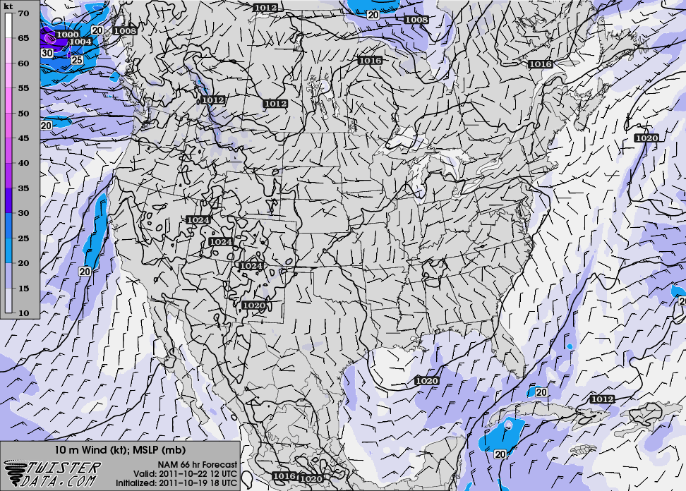
High pressure system building over the region Saturday morning
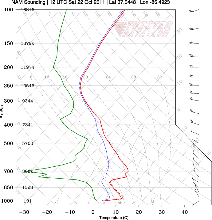
Sounding showing temperatures approaching the freezing mark and dry slot in mid-levels Saturday morning