Upcoming weekend looks pleasant

Highlights

For This Weekend

  • Highs in the upper 30’s
  • Lows in the lower 20’s

The weather pattern currently in place looks to hang around for at least the short term.  While a weak cold front will push through the area throughout the afternoon today which will provide a very small chance for precipitation, high pressure will build in behind it providing clear to most sunny skies throughout the weekend.  Highs Saturday and Sunday look to reach the upper 30’s to lower 40’s while lows will hover around the lower 20’s.  Bundle up if you have to go out at night!

In other news, following the round of heavy precipitation we received in November and December, many cities in the state have broken records for a rainfall total for a year.  The following graphic depicts new records set around the state.  (Provided by the NWS)

 Location Wettest Year Total Rainfall as of midnight EST
 Louisville (SDF) 2004, 64.60″ (Old)  65.71″ (New record) 
 Lexington 1935, 65.76″  64.04″ – 2nd wettest
 Bowling Green 1979, 75.56″  60.94″ – 7th wettest

As you can see, for the year of 2010-2011, this is the 7th wettest year on record for Bowling Green, the 2nd wettest in Lexington, and this year will become the wettest year in recorded history for the city of Louisville.


Posted in Uncategorized | Comments Off on Upcoming weekend looks pleasant

Break from rain around the corner

Highlights

  • Chance of Precipitation early/mid-day Wednesday
  • Rain chances diminishing throughout the week
  • Temperatures returning to near normal

The three day totals for the previous precipitation event has taken a toll on the waterways of Kentucky, with many counties including Warren County currently under a flood warning.  Remember to not try and cross flooded roadways and passages.  A graphic provided by the National Weather Service shows the rain distribution totals from December 4th-6th.

A high amplitude trough transitioning to a negative tilt, which signifies a trough reaching maturity, will quickly race across the region, bringing with it a chance of precipitation early Wednesday.  A mix bag of precipitation cannot be ruled out, but accumulations will be minimal, most likely less than a tenth of an inch.

NAM 500mb Absolute Vorticity

Passing of the trough will bring about clearing skies and sunshine in the afternoon with highs reaching in the mid 40’s, and lows falling into the mid 30’s.  Thursday will bring about mostly sunny skies in the mid 40’s with lows becoming quite chilly in the mid 20’s under the influence of cold air advection by the passing of the trough and radiative cooling under clear skies.

An update for the weekend will come on Thursday.

Posted in Uncategorized | Comments Off on Break from rain around the corner

A warm and dry Thanksgiving will turn into a wet weekend.

  • Thursday:  Sunny with a high near 64° and a low near 35°.
  • Friday:  Sunny with a high near 68° and a low near 42°.
  • Saturday: Clouds increasing throughout the day.  Highs near 65° and lows near 40°.
  • Sunday:  Rain showers likely, with possible snow overnight.  Highs near 45° and lows near 32°.

We couldn’t ask for a better situation to have and be thankful for the weather.  The weather for Thursday and Friday is going to have include temperatures well above average for this time of the year.  Our climatological average for late November shows high temperatures around the mid 50s and lows ranging between 32° F and 35° F.  All of the pleasant weather will move away, however, late Saturday night heading into Sunday morning with the arrival of an approaching cold front.

High pressure at the surface will quickly move out of the area early Saturday, but will dominate the weather over the course of the next two days.  This feature, combined with a ridge aloft will provide for relatively cloudless skies and temperatures that are well above average for this time of the year.  However, a strong jet streak that is currently intensifying a storm in the Gulf of Alaska will propagate to the east just in time to strengthen a developing trough in the northern Plains and cause it to dig southward toward the southeast.  An associated surface low will be centered over Wisconsin and under the front-left quadrant of the jet streak in the eastern portion of this trough, causing the necessary forcing for divergent air in the upper levels and strengthening of the low.  The deepening low and increasing pressure gradient will help to pull in a much colder air mass that will be pinched off by the trough, cause showers and possibly early Monday morning snow and keep rain chances around through the early part of next week.

This trough over the Midwest will pinch off an upper level low and keep persistent rain chances in the forecast through early next week.

Storms that do occur on Saturday and Sunday are not currently expected to reach severe limits as available moisture will be a limiting factor.  Moreover, weak lapse rates and warmer air aloft will inhibit any significant vertical velocities in existing thunderstorms.

Under what could finally be officially labeled as a La Niña, stormy conditions and above average rainfall are likely to continue.  Shown below are graphics from the NOAA Climate Prediction Center detailing typical weather patterns of a La Niña event.

Shown in the bottom picture are the jet stream and rainfall patterns typical of a La Nina.

Model forecasted Niño 3.4 region temperature anomalies indicate a weak to moderate La Niña persisting into the beginning of next year.  This, in combination with the build up of cold air along the Canadian border could mean an active winter for the Midwest and Northeast.

The blue line shows a moderate La Nina sticking around through next spring.

This is certainly something to keep an eye on for the long term.  Areas that were hammered during last year’s winter may see another active winter season given the right storm moving in.


Posted in Kentucky Weather, U.S. Weather | Comments Off on A warm and dry Thanksgiving will turn into a wet weekend.

Diminishing severe weather threat for Tuesday…

Looking at the 15z run of the RUC model, the severe weather threat for today seems almost non-existent.  An already rain-cooled air mass will not receive any extra convective energy from the sun as cloud cover will be extensive throughout the day.  This will put an end to any significant threat for the Bowling Green area and state of Kentucky.

Clouds will stop any real severe threat today

Despite the absence of a meaningful severe weather threat today, heavy rains are still probable across much of the state.  The latest 500 mb analysis puts the rain-shield sitting across the region continuing its movement toward the northeast.

Storms will continue to swing around the trough axis toward the northeast, placing most of KY under the heavy rains for the remainder of the day

PWAT values are very high and could mean that very high amounts of rain will fall before the night is over.  By tomorrow morning, SREF guidance suggests that close to 1 inch of rain will fall.  Bowling Green has already recorded 0.3 inches at the mesonet station, so the SREF forecast of around 0.85 inches by tomorrow morning is not completely out of the question.

Very high precipitable water amounts will lead to very heavy precipitation today and into tomorrow.


The drier air mass is beginning to filter toward the surface by tomorrow morning

Damaging winds may still be possible today and this evening, as bulk shear values still range between 40 and 60 knots.  Some momentum transfer is possible, but winds are not expected to meet severe criteria.

Shear values could indicate some strong winds later tonight.


Posted in Uncategorized | Comments Off on Diminishing severe weather threat for Tuesday…

Severe weather increasingly likely to start the week…

Over the last few days, operational models have been trending more and more towards solutions that show severe weather striking the area on Tuesday.  The Storm Prediction Center has now changed its forecasted “slight risk” area for Tuesday from an area that was contained in the ArkLaTex to one that now extends well into Kentucky.

Severe weather is becoming increasingly likely for Kentucky on Tuesday

Early Tuesday morning, a positively-tilted trough will swing into the area, providing the necessary momentum to push a front that is currently stalled across the state back to the north again as a warm front.  As it does so, most of Kentucky will be in the warm sector of the storm, allowing for a progressively destabilizing atmosphere to take hold in the region.  Mositure will increase ahead of the storm’s trainling cold front, with forecasted dew points in the low 60s.  An elongated area of vorticity and increased shear hint at a developing QLCS across Missouri, Arkansas and Illinois that will likely affect the Warren County area after dark.  With bulk shear values of 40-60 knots, damaging winds ahead of bowing segments of the squall line are the most probable convective mode to impact the region.

The 06z NAM Model forecasted 1000-500 mb shear.

The models are differing as to the timing of the arrival of the system.  The 06z ECMWF and the latest run of the NAM are showing a slowing storm, while the 06z runs of the GFS and NAM show the main line affecting us just after sundown on Tuesday.  Nonetheless, heavy rains and the downward transfer of high momentum winds will make for a stormy evening Tuesday, which could possibly last into Wednesday morning.  The latest forecasted rainfall totals by the HPC show well over an inch of rain falling across the western half of the state, with isolated totals being greater than that.

Heavy rains are going to fall for most of the day Tuesday.

The strong ridge off to our east that has provided for the warm weather and gusty conditions over the last few days will prevent any tornadic activity for our region.  A relatively stable boundary layer will provide a hostile environment for the sustenance of any convective activity across the Ohio Valley.

Posted in Kentucky Weather | Comments Off on Severe weather increasingly likely to start the week…

Rainfall

Monday evening began a pattern of continual precipitation throughout the Mid-South, and the rainfall amounts for the past 24 hours have been rather impressive in the Mid-South, with the bulk of the precipitation having fallen from thunderstorms at around 2am.  The Warren County Kentucky Mesonet Site has measured 1.83 in. of rain since midnight, and The National Weather Service in Louisville issued this graphic of interpolated precipitation data through today.

The rain will be coming to an end later today, and will be followed by a sharp cool down as the cold front finally progresses through the area and the cold Canadian air moves into the area.  However, forecast models have been persistent with building a ridge over the Southeast again, thus supporting more unseasonable warmth for next week.

Posted in Uncategorized | Comments Off on Rainfall

Severe Weather Update

The severe weather threat has diminished dramatically.  The lack of instability from diurnal heating has clearly taken its toll on the squall line, and the decay is quite evident in a recent radar image.  What can be expected from this decayed squall line is still some gusts upward of 30-40 mph at the very most as well as very heavy rain.

Posted in Uncategorized | Comments Off on Severe Weather Update

Update

Some breaks in the cloud cover have been occurring, which was expected based on earlier runs of the RUC showing a patch of drier air at 700mb moving through the area.  However, the limited amount of sunlight that has been allowed to come through the cloud cover will not be enough to increase instability at the surface.  Any storms that fire and move through today and into tonight are going to be heavily driven on dynamics.  It is very likely that there will be limited convection with the storms; however, the high wind threat is very real with this system.  Thus, there does not need to be any major convective activity to have a “thunderstorm” wind event.  The main tornado threat continues to be well north of the Mid-South; however, there is an outside chance of low-topped supercells forming.  Lack of surface based CAPE, however, will be a major inhibiting factor on these storms should they develop.

Posted in Uncategorized | Comments Off on Update

Strong Storms Possible

With a decent ridge in place over the Southeastern CONUS and a deep positively-tilted long wave trough axis over the Western CONUS, today looks very mild once again.  Ridging over the Southeastern CONUS similar to what is in place currently could likely be a recurring pattern based on what the forecast models suggest—the GFS in particular.  If that is indeed the case, Thanksgiving week could be rather mild.  This pattern also brings with it regular rain chances to the Mid-South, Ohio Valley, and points northward as well, with the Southeastern CONUS remaining relatively dry.

Today, however, the Storm Prediction Center has felt the need to issue a Slight Risk for severe weather for The Mid South and The Ohio Valley, much of Indiana and Ohio as well.

The main threat for the Mid South today will be from high winds, with a very low end tornado threat in place as well.  The main threat for tornadoes is up in Indiana as well where the wind shear will be at its strongest, and winds will likely be backed at the surface as well.

Currently there is a cloud deck at about 850mb as the moisture is very rich at that level right now.  There is a chance that the cloud deck will clear out toward mid to late morning and allow for some insolation.  In general, the storm mode for today looks like more linear, based on the latest RUC Sounding.

The sounding itself is not the most ideal, as there is a rather robust cap from 700mb up to 500mb.  However, that is expected to erode significantly by the afternoon hours.

What is also clear from both soundings is saturation at or just below 850mb, suggesting a cloud deck in place throughout the day.  This will definitely limit diurnal heating from the sun, which could prove to limit severe potential; however, the dynamics in place are rather impressive.  The wind shear is in place.

The current RUC Hodograph suggests linear storm mode for today, as does the forecast hodograph at 19Z by the RUC.  Winds at the surface should remain mainly out of the south and veering with height, today.

In conclusion, the cloud cover for today could prove to be an inhibiting factor to establish any significant surface based CAPE; however the dynamics and shear in place are far too impressive to ignore. If any severe weather does occur today, it will very likely be more dynamically driven.


Posted in Uncategorized | Comments Off on Strong Storms Possible

Showers/T’storms to affect middle of week

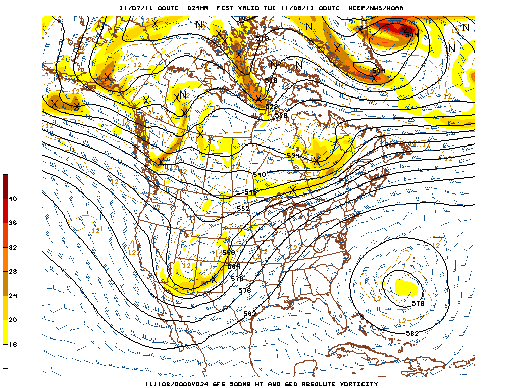
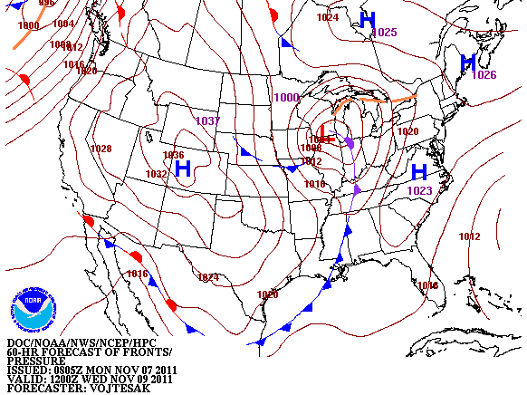
Currently the Mid-South is sitting on the ascending side of a ridge axis located over New England with a deep positively tilted trough digging over Arizona.  The trough will continue to dig eastward into the southern plains today with a surface low developing in west Texas this afternoon as well.  The low will make its way from Texas northeastward to the Great Lakes region by Tuesday evening.  A closed upper level low over Bermuda is causing the whole synoptic pattern to become quasi-stationary as the upper level low will gradually retrograde westward, inhibiting much eastward progression of the ridge over the Mid-South.  This will cause the trough to continue to dig in the west, eventually not being able to push the ridge causing the low to become negatively tilted and eject northeast towards the Great Lakes. Late Tuesday night into Wednesday morning is when this system will affect our region with possible strong thunderstorms and showers.

Until the middle of the week, the Mid-South region can expect today and Tuesday to be mild with a high today of 71 and Tuesday 72 as southerly flow starts to develop ahead of this system.  Lows will stay a bit warmer than recent nights due to the southerly flow, expect a low tonight of 47 and Tuesday 51.  Winds will increase through the day to become out of the south at 10 mph with gusts between 15-20 mph possible.  Today and Tuesday we will remain under mostly clear skies as the region remains under a ridge.  Tuesday evening the clouds will start to make its way into the region as the ridge finally pushes eastward and a cold front approaches bringing showers/Thunderstorms to the region after midnight on Tuesday into Wednesday.

There is some severe potential for the region as the vertical shear is quite impressive, however there is little to no instability ahead of the front over the Mid-South.  Will monitor the potential for severe weather and update if needed, but not expecting much in the way of severe weather at the moment.  Models will pick up on what to expect in the coming hours.  The region can expect to see around 0.25″-0.40″ of precipitation from this system Tuesday night and Wednesday.  Wednesday you can expect a high of 60 and a low dropping drastically to 35 overnight with winds around 9 mph from the south before the front and turning west after the frontal passage.


Posted in Kentucky Weather | Comments Off on Showers/T’storms to affect middle of week