HPC has backed off of totals, but Texas and Oklahoma still wet this weekend.

As I mentioned yesterday, the HPC models tend to overdo forecasted precipitation totals, expecially for long-term periods.  The new 5-day totals still show a significant change to drought conditions in the north Texas/south Oklahoma areas, and also a significant flash-flooding threat.

Notice that the hot-spots are still in the same areas as yesterday, but the forecasted rainfall totals are less than they were.

This is great news for Texas.  A dryline is serving as the main focus of thunderstorm activity today, evident from the map below.

See the tight PWAT gradient west of Midland and Lubbock

As this dryline swings eastward, it will continue to meet up with moisture advecting in off of the Gulf of Mexico.  Some severe weather is possible out of these storms, with strong moisture convergence along the boundary forming (shown in red), upper level divergence in the right exit region of the jet streak and fairly strong low-level helicity values (also shown below).  Isolated tornadoes are possible tonight in the area, but the major concern will be flooding issues.

A cold-front is developing here

The trough over the Four Corners region is helping to bring much needed rain...

This is great news for Texas and Oklahoma.  After this rainfall event has completed, it will be interesting to look at how drought conditions have changed for the area.

Posted in U.S. Weather | Comments Off on HPC has backed off of totals, but Texas and Oklahoma still wet this weekend.

Drought relief for Texas?

Over the weekend, the extremely drought stricken areas of Oklahoma and Texas could potentially get some help from mother nature.  Thanks to the blocking pattern that’s currently in place over the eastern United States, any storms that move into the country are forced to go up and over this ridge that’s kept much of our weather pleasant and unseasonably warm.  As long as the blocking pattern stays in place, which only looks to be for about the next 5 days, any forward movement will be halted, placing areas that desperately need some rain under the influence of a cold front.

Currently we can see that almost the entire area contained within Texas and Oklahoma are and have been under an exceptional drought.

Much of the area that looks to be "on fire" may have some of those flames put out.

The models at the NOAA Hydrometeorological Prediction Center, at times over-predicting rainfall totals, still  show two distinct hot-spots for precipitation for the next 5 days.  The 5-day precipitation total published on their website shows a staggering 10.8 inches of rain forecasted for an area near Witchita Falls, TX.

Notice the extremely high numbers over Florida, Oklahoma and Texas

Any totals such as this are way off base given the conditions in the area.  The lack of soil moisture available will inhibit the sustenance of any convection that develops along the boundary.  However, persistent southeasterly flow off of the Gulf of Mexico provides the moisture advection necessary to allow for what will likely be persistent rain showers with some isolated thunderstorms.  Flash-flooding will be a major concern this weekend over the area.

Current surface conditions show the synoptic setup for this weekend.  The main feature causing the HPC models to pick up on the significant rainfall is the high pressure system at the surface, encompassing much of the east.  A tight pressure gradient is developing over Florida , allowing for strong easterly winds over Florida.  Along a stationary boundary located south of Florida, an area of rotation is expected to form in the wake of this tight pressure gradient and the enhanced easterly flow.  This looks to be the source of our next chance of rain in the Bluegrass State, most likely around Tuesday or Wednesday.

Note the position of the frontal boundary from Kansas southward toward New Mexico.

High pressure is still dominating weather in Kentucky through this weekend.

The frontal boundary has not moved much by Sunday morning

The frontal boundary is marked south of Florida.

We’ll have to wait and see how the ridge in the east moves, because that will be one of the steering mechanisms of any rotation and moisture that advects northward from the Caribbean.

Posted in U.S. Weather | Comments Off on Drought relief for Texas?

Models continue to show potential tropical development around Florida.

The models are continuing to show development of a system along a quasi-stationary boundary located south of Florida.  The windy conditions and rip currents that much of the Sunshine State’s east coast is experiencing will likely sustain their current strength or even worsen in the next couple of days as high pressure centered over Pennsylvania builds.  Where this spin-up tracks will determine if areas in the south experiencing drought conditions will receive any support from mother nature.  Currently, it appears as though this area of vorticity will track up into Georgia and potentially track into eastern Tennessee and Kentucky.  As I mentioned in a previous post, this looks to potentially bring rain to the Bluegrass region and east, and likely increase cloud cover to the west.  This looks to be the next best chance for rain that the state will see, so this is the area to watch heading into the middle of next week.

Posted in Kentucky Weather | Comments Off on Models continue to show potential tropical development around Florida.

Next good chance for rain looks to be next Tuesday or Wednesday…

Under the influence of high pressure aloft and at the surface, the weather across the Bluegrass State is beautiful.  For the next few days, the conditions outside aren’t going to change much, if any at all.  Enjoy the nice weather while it lasts, because the models are suggesting the potential for some tropical moisture to infiltrate the area and possibly bring rain to the Bluegrass region and eastern Kentucky.

Gradual height falls heading into the middle of next week show the onset of a trough digging into the area from the Dakotas.  This looks to be a pretty potent trough at this point but with no real moisture advection off of the Gulf of Mexico, any significant rain chances will be dependent on what could be a named tropical system moving in.  Note the area of vorticity near Florida.

The yellow area on the map over central Florida is the important feature here.

The 500 mb height contours show this vorticity maxima following almost a perfectly south-to-north track up toward the Appalachians.

If the trough and this moisture meet up, there could be some heavy rainfall in eastern KY

As this area of rotation moves up the southeast, the majority of moisture associated with it looks to stay in the Bluegrass and eastern Kentucky areas.  Places like Lexington, London, Pikeville, Georgetown and others should at least see clouds increase with the passing system, and possibly some showers.  Until this happens, though, keep enjoying the beautiful weather that we’ve had and will keep having through the weekend and early into next week!


Posted in Kentucky Weather | Comments Off on Next good chance for rain looks to be next Tuesday or Wednesday…

Tropical Update and the Madden-Julian Oscillation

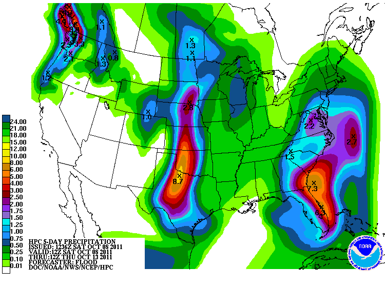
Now that we’ve finally passed the peak of the hurricane season and almost the entire eastern half of the country will experience nice weather for a while, it’s a good idea to take a look at the tropics to see what may be brewing there.

As of now, the Atlantic basin has one active tropical system, tropical storm Phillipe.

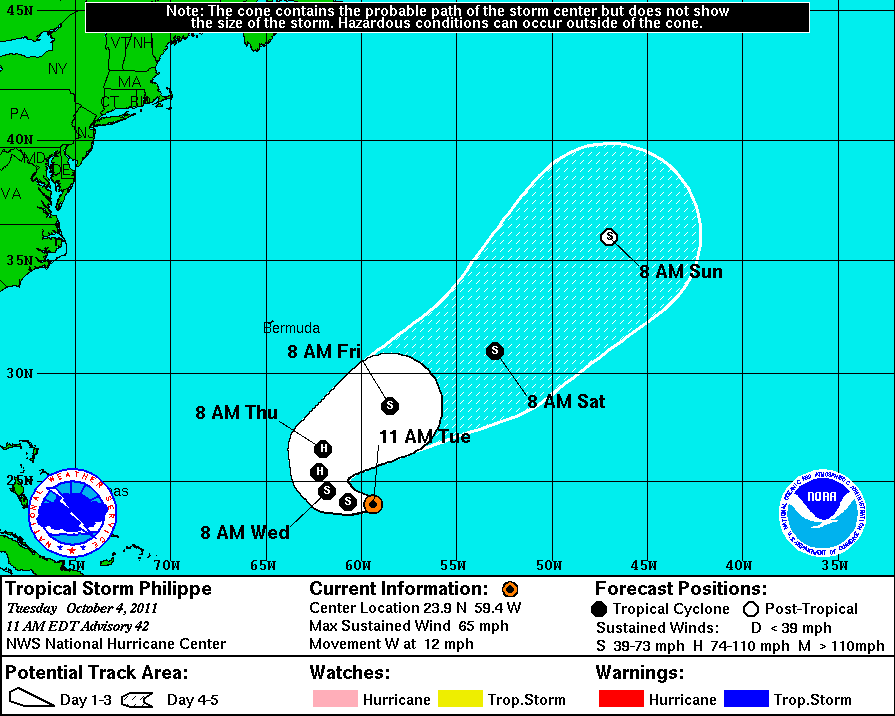
This storm should transition to post-tropical within a few days.

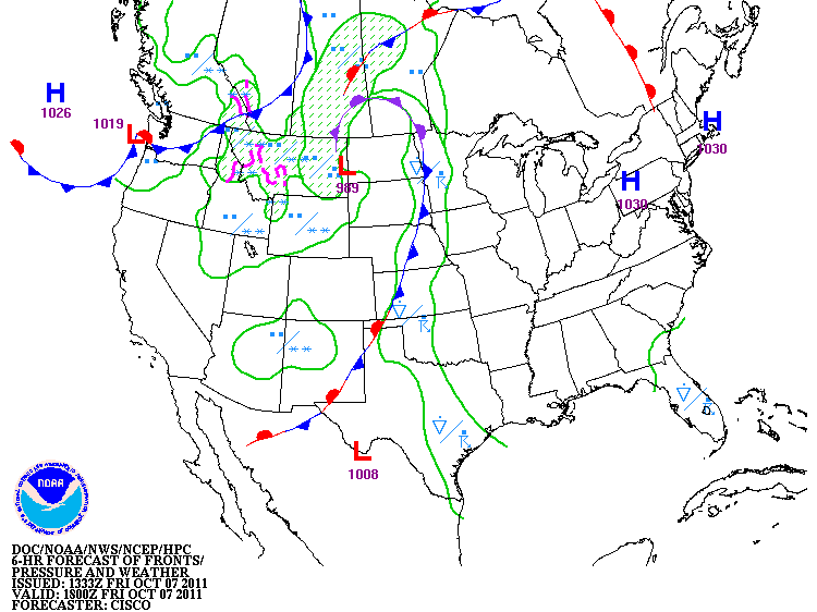
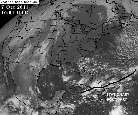
Phillipe is the only notable area of convection in the Atlantic and Caribbean at the moment.  From the graphic below, a few fronts are evident, and Phillipe is marked.

Notice the large cloud shield moving toward Phillipe. This front is forecast to become quasi-stationary, but will keep Phillipe from impacting land as a tropical system.

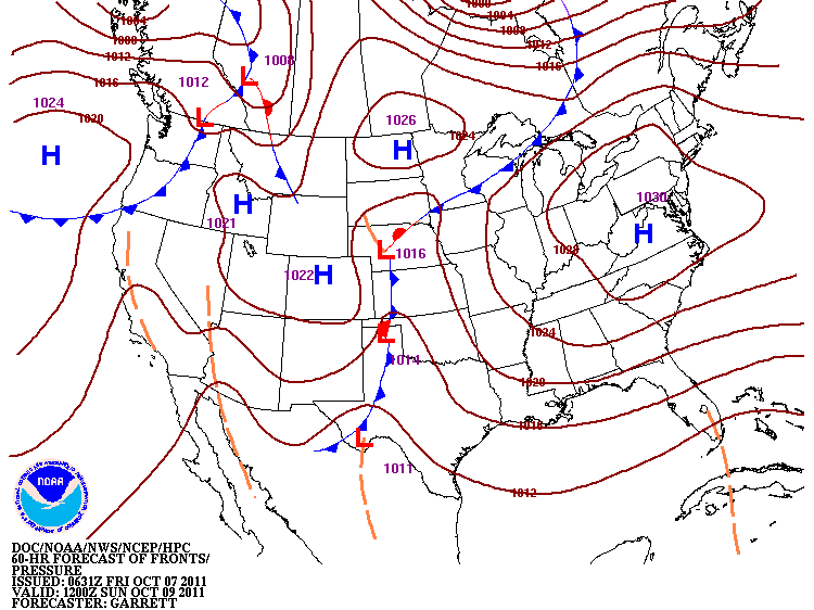
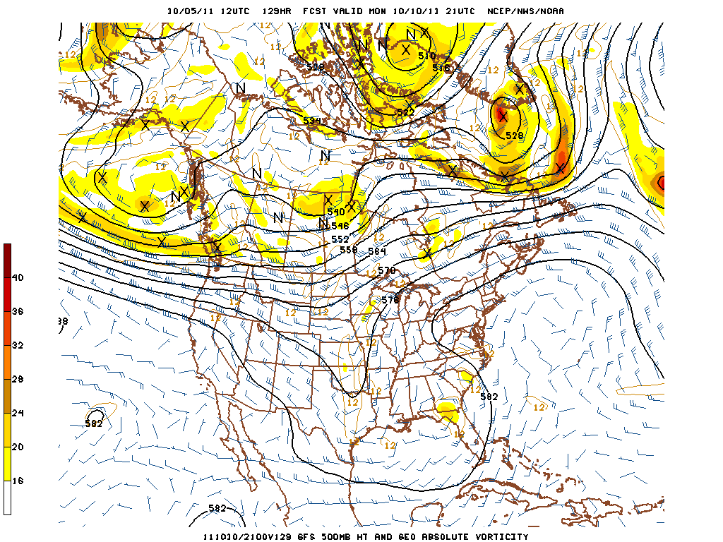
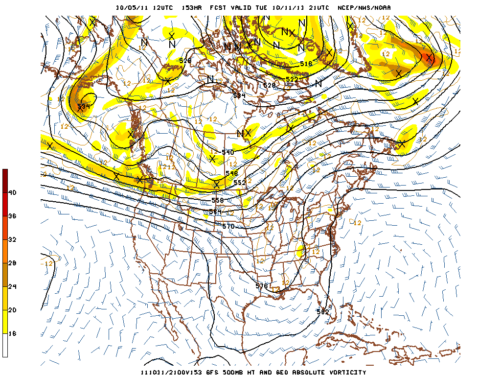
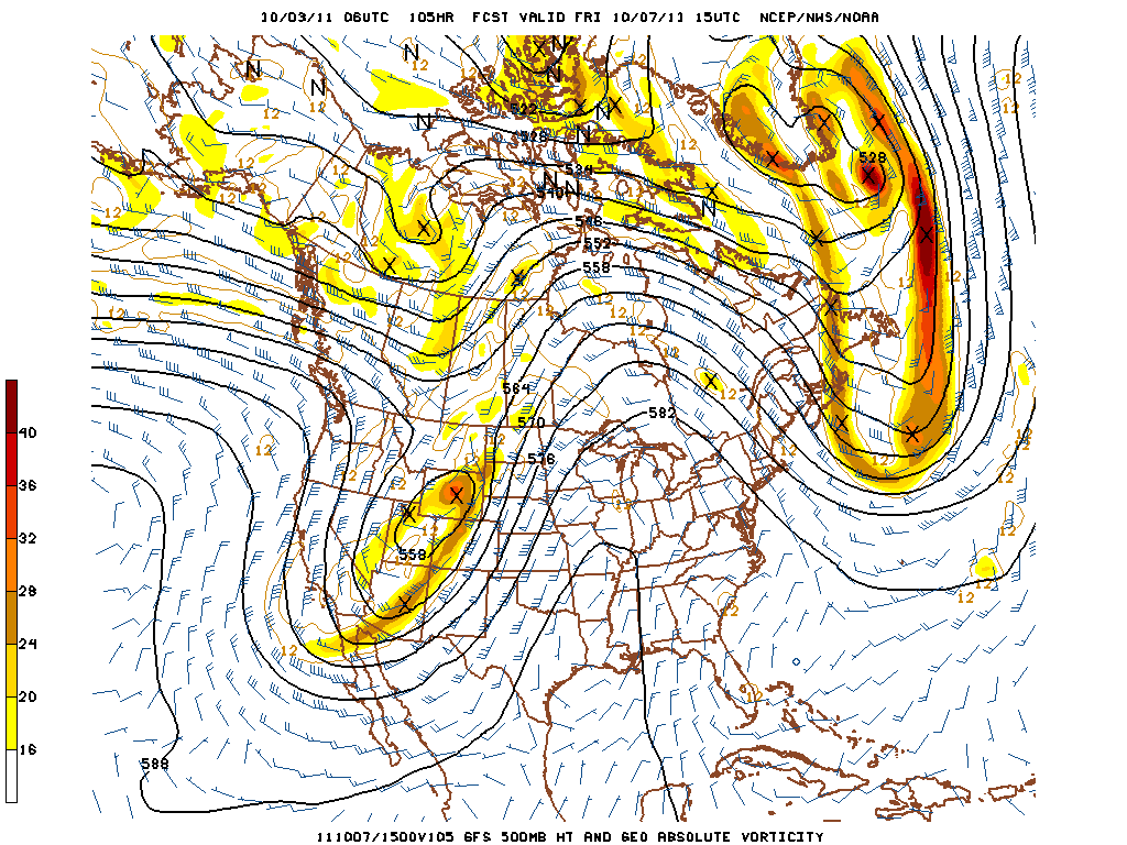
The main area that forecasters watch at this time of the year is the Caribbean Sea and the Gulf of Mexico.  These areas are showing little to no activity at the moment, but model forecasts hint at a possible storm within the next 10-14 days.  See the area of vorticity just east of Florida.  The rotation is more pronounced at the 850 mb level.

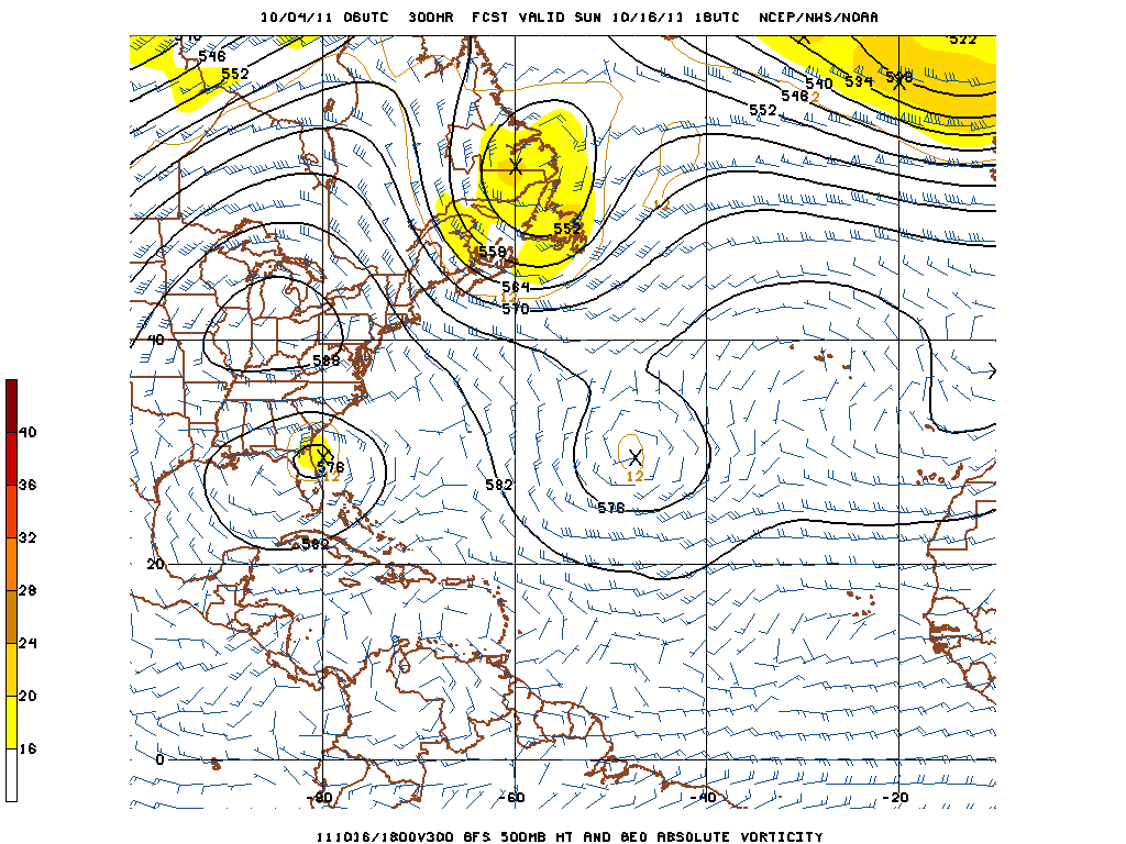
This is forecast for 300 hours out, so this is something we'll have to wait on and see if it pans out.

With all of that said, it is still important that we’re entering back into La Niña conditions in the Pacific Ocean and that we can expect an active pattern with regards to the Madden-Julian Oscillation.  Under La Niña conditions, vertical wind shear in the areas that hurricanes form within is much less than during an El Niño year.  This is important in allowing the storms to grow.  In addition to that, with a more active Madden-Julian Oscillation, increased latent heat flux provides necessary energy to the atmosphere for the storm to tap into.

So, what is the Madden-Julian Oscillation?  The Madden-Julian Oscillation is a global scale wave occurring within the tropics that promotes areas of enhanced or suppressed rainfall.  It typically lasts between 30 and 60 days, begins in the Indian Ocean and propagates eastward from there.  The phase of the oscillation is characterized by the spatial location of the center of enhanced convection (rainfall).  When we enter the later phases of the cycle, the center of convection reaches closer and closer to the U.S. Pacific Coast.  Relative humidity, westerly winds and other variables increase ahead of the center.  When the conditions are in this phase, tropical cyclones are 4 times more likely to occur (Maloney and Hartmann, 2000).

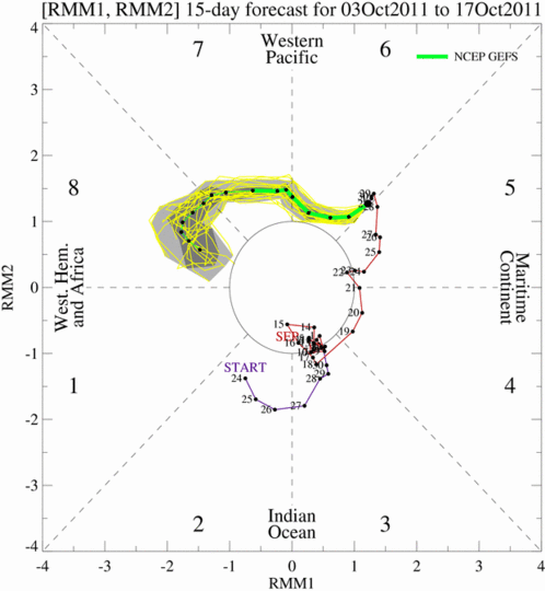
Below is the GFS forecast of the MJO.  Follow the green and yellow lines to see where the center would be located and read off the magnitude from the plot.

The GFS MJO forecast retrieved 10/04/2011We’ll have to wait and see how the forecast turns out, but in the short-term we could potentially see another storm form within two weeks, this one being more likely to impact the United States.

SOURCES:

Maloney, E.D., and D.L. Hartmann, 2000: Modulation of hurricane activity in the Gulf of Mexico by the Madden-Julian Oscillation.  Science,287,2002-2004.

Wheeler, M.C. and H.H. Hendon, 2004: An all-season real-time multivariate MJO index: Development of an index for monitoring and prediction.  Monthly Weather Review,132,1917-1932.


Posted in U.S. Weather | Comments Off on Tropical Update and the Madden-Julian Oscillation

Pleasant fall weather to continue for the next several days.

Bowling Green forecast for the next few days:
  • Tuesday: High near 78, overnight low near 46.  Sunny.
  • Wednesday: High near 81, overnight low near 49.  Sunny.
  • Thursday: High near 83, overnight low near 51.  Sunny.

Discussion:

After a brief cool down, the region will see an upper-level ridge build into the area from the west over the next several days.  Coupled with high pressure at the surface, mostly sunny to completely sunny skies can be expected through the week.  Model forecasted temperature guidance has been low for much of the summer.  Considering this, we should have just enough daylight left to bump up forecasted temperatures a degree or two, with the peak in temperatures occurring late this week.

Omega block keeping us dry!

This ridge doesn't begin to weaken until this weekend.

Tomorrow, I’ll provide a tropical update and an explanation of the Madden-Julian Oscillation, a key ingredient for the rest of our hurricane season.

Posted in Kentucky Weather | Comments Off on Pleasant fall weather to continue for the next several days.

Severe weather during the Fall in Kentucky

Now that we’re in the month of October, everyone has begun to relax, enjoy football season and get ready for the changing seasons.  It is important to remember, however, that a “second severe weather season” begins for much of the south around this time of the year.  The fall “season”, though not typically producing the prolific outbreaks that we’d witness during the spring time, can still cause a lot of devastation.  It is important to be aware of the weather during this time of the year; with decreasing daylight, there is a greater chance of a nighttime tornado.

Below is a map showing just how affected our area can be.

Many thanks also goes to the WKU Department of Geography and Geology for providing the GIS software used to create this graphic.

As you can see, many strong and long-lived tornadoes have hit the Bluegrass State over the last half-century.  South-central and western Kentucky have been much more active in regards to tornadoes during this time.  As recently as last year, Warren County witnessed an EF1 tornado touch down.  Moreover, several EF3 and one EF4 tornadoes have touched down in western Kentucky, ranging in location from south of Paducah toward Hopkinsville and northward toward Owensboro.

So the logical question would then be, why severe weather this late in the year?  We’re all aware that with the changing seasons, solar input decreases with the decreasing duration of daylight.  But, what does that have to do with anything?  This magnifies an increasing temperature gradient across much of the United States, allowing for upper-level winds (most importantly the jet stream winds) to increase in speed.  The increase in the upper-level winds helps to create stronger frontal systems to impact the country.  During this transitional season, the last bit of summer hangs on long enough to interact with one of these frontal systems, allowing for a warm and moist air mass to be in place just in time for the arrival of one of these frontal systems.  Ultimately, all of the ingredients can be in place for strong to severe storms.

Another reason to pay attention to the weather here during the “second severe weather season” is the forecasted return of La Niña.  During La Niña conditions, more significant outbreaks are seen, longer track tornadoes are seen, and more violent tornadoes are seen (Knowles and Pielke, 2005).  The La Niña influence on the positioning of the jet stream places the Ohio Valley, and certainly Kentucky, in an area of focus for fall tornadoes.

SOURCES:

Knowles, J.B., and R.A. Pielke Sr., 2005: The Southern Oscillation and its effect on tornadic activity in the United States. Atmospheric Science Paper No. 755, Colorado State University, Fort Collins, CO 80523, 15 pp. (Originally prepared in 1993, published as a Atmospheric Science Paper in March 2005).

Durkee, J.D., and G. Conner:  Fact Sheet – El Nino/La Niata and Kentucky Tornadoes. Kentucky Climate Center Fact Sheets. Accessed 10/2/2011.  http://kyclim.wku.edu/factsheets/ninokentuckytornadoeses.html

Posted in Kentucky Weather | Comments Off on Severe weather during the Fall in Kentucky

Minor Non Convective Wind Event and Possible First Frost

As the upper level low departs and as a drastic change in air mass occurs overnight, a slight gradient wind event is occurring.  The strongest pressure gradient is farther north; however, current sustained winds measured at Mesonet sites around Southern Kentucky and throughout Kentucky are reading pretty breezy at around 15 mph with the highest wind gusts approaching 30 mph.  The interesting part about the readings is the Warren County Mesonet Site seems to be getting the highest wind readings whereas surrounding Mesonet Sites are reading wind speeds lower.  Gusts have been strongest at the Warren County Mesonet Site as well.

As the weekend approaches, a drastic cool down will occur, with highs expected to be in the low 60s on Saturday.  Saturday Night, with mostly clear and nearly calm conditions expected, the first frost of the season is forecast.  This would be right on time for Bowling Green based on the average date for the first frost of the season, which is October 2.

After Saturday, a ridge will build into much of the CONUS, and more seasonable temperatures will be in place.

Posted in Kentucky Weather | Comments Off on Minor Non Convective Wind Event and Possible First Frost

Cooling Off for the Weekend

The cut-off system has been picked up by the jet-stream, and a jet streak will help dig the a trough over Central Canada down into The Mid South bringing high temperatures down into the 60s for the weekend with Saturday being the coolest day in a long time, where the high temperature will struggle to make it too far above 60°F as a very strong northwest flow will be in place continuing to dig the trough into Georgia.  The high amplitude pattern will also cut off slightly over the Eastern States.  As it moves off to the northeast temperatures will rebound during the weekend and into next week, and a broad trough will move in over much of the CONUS.

Posted in Kentucky Weather | Comments Off on Cooling Off for the Weekend

Roller Coaster Ride for This Week

The first full week of Fall 2011 looks mostly quiet with the temperature fluctuations along with the cut-off low being the main stories.

Yesterday, the weather over The Mid South was dominated by rather prolific dry slotting in the cut-off low pushing the most active weather to the Atlantic States.  Today, the main activity is in the Deep South as drier more stable air is in place once again over the Mid South.

Skies should remain mostly clear today with a few clouds moving through.  The latest GOES Sounding (11GMT) suggests a high of around 73°F, but winds out of the south should provide enough Warm Air Advection to reach a a high of 75°F.  Models suggest a small shortwave in the cut-off low should move through here tomorrow increasing the chance of rain, and Thursday should be the warmest day of the week.

As we head closer to the weekend, models suggest the cut-off low should be picked up by the jet stream and a high amplitude pattern will ensue with a trough in place over the Mid South by the weekend pushing high temperatures down to the low to mid 60s.

Posted in Kentucky Weather | Comments Off on Roller Coaster Ride for This Week