With warmer-than-average temperatures finally here across the Mid-South, some showers and storms are sure to be on the way. Continue reading
Blogroll
Login
Pages

With warmer-than-average temperatures finally here across the Mid-South, some showers and storms are sure to be on the way. Continue reading
Spring Break has arrived here at WKU!!! For some of us it means it a week off from the University to go to places that feature this. Continue reading
1. Thursday we should have some more sunshine than today with highs in the mid 40’s. While Friday will finally see a high pressure system to move north of the region allowing for an influx of warm southerly winds and mostly sunny skies with highs in the low 50’s. 60’s are still likely by the weekend. The latest model runs instead of sending a low into the lakes with surface ridging in place as indicated the other day are becoming replaced with a cut-off low solution for the region which would mean clouds and a cold rain, maybe even snow?? for spring break week. I’ll follow up on this Friday.
2. In the mean time I will recap winter 09-10 across the region. Continue reading
If you are fan of some warmer weather or accumulating snow then the first part of this week will not be to your liking. Last Sunday (Feb 21) when it was near 70, this storm coming through tommorow on modeling had a track straight west to east from Texas to the Carolina’s bringing a 6-10 inch snowstorm with cold air in place here. The modeling changed drastically as last week went on because it
1. got a handle of the nor’easter late last week
2. picked up on another week wave in front this system
3. is now showing a stronger high across the upper plains this week
– all of these will serve to keep this next system weaker and much farther to the south for tomorrow, so the model agreement of a 6-10 inch snow 8 days out gfs, euro etc a few days later became a forecast for passing rain and snow showers with snow accumulations in Atlanta.
1. With this system to our south we will still see more overcast skies with a few passing rain or snow showers and no accumulations with temperatures in the 30’s to maybe a 40 on Tuesday. Here is the nws radar to track just how close this system gets with light precipitation. The gfs is closer than the nam now for steady precipitation, based on the 500 mb level maps and the current radar it looks like the gfs with some light qpf in here tomorrow is correct. Wednesday I see low clouds lingering and a north wind developing will keep temperatures once again in the upper 20’s for lows and upper 30’s for highs about 10-15 below normal for this time of year, a passing flurrie still is possible.
2. Warm air advection should start up big time by the end of the week as high pressure moves in and east of the region. 70 possible by next Tuesday!!!!, We will go this time period later this week.
– The middle post this week will be a recap of Meteorological winter which ended Mar1.
– later this week I will further discuss the warmer weather coming by the weekend and give a spring break forecast ( mar 5-14)for those associated with WKU this will include popular spring break spots as well.
– don’t forget the tornado drill Tuesday!!
MWG
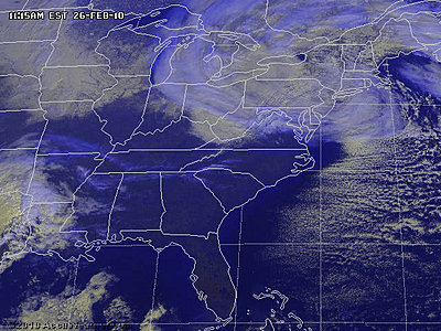
I came across this on the Accuweather site and thought it was pretty interesting. It has some facts behind the monster snow storm that has been pounding the New England coast over the last few days. Click here to read the story. Have a great Weekend!
Its Friday and it’s a beautiful day. Only if it were a little warmer. There isn’t really much going on in our area today as far as weather is concerned, so today’s write up will be shorter. Today the high temperature should reach the mid 40’s, but it will feel warmer due to the sunny conditions. With the clear skies this evening we can expect lows to be near 25 tonight. This weekends forecast is a little tricky because there is some disagreement between the NAM and the GFS. The NAM is showing that we could have some snow showers Saturday night into to Sunday morning, while the GFS keeps the precip into Eastern Kentucky. The precip is coming off the back side of the low from the storm over New England. So for Saturday and Sunday we can expect partly cloudy conditions with some sun mixing in. It really all depends on whether the precip reaches our area. If it does then we could see cloudier conditions if not then sunnier. Temps for this weekend should remain in the mid 40’s and lows in the mid to upper 20’s. In other news, the stormed I mentioned on Wednesday is still bringing snow to the New England area. Here are some of the snowfall totals thus far. Also from looking at the models, it looks like we could see a warm up next Sunday March the 7th. Models do change, especially since we are still more than a week out, but I thought I would least bring it to your attention. Even if the models do change, our next warm up should still be right around the corner. Here is what the GFS is currently showing for Sunday the 7th. Have a great Friday and a great weekend. Thanks for reading WKU’s met blog.
It’s Wednesday and it is Cold!!! Expect Highs to be in the mid 30’s today. Also, we are currently receiving some flurries here in Bowling Green. Flurries should continue on and off until around noon and then they should start to taper off. The flurries in our area are from a low pressure system currently sitting over the Great Lakes. This low pressure system is also responsible for a cold front that will be sweeping through our area in a few hours. With the passage of the cold front, this should keep us breezy for most of the day. The colder temperatures and the breezy conditions will lead to wind chill values of around 20. Even after the passage of the cold front we will still stay cloudy for the rest of the day. Tomorrow however should be mostly sunny with slightly higher temperatures. The rest of the week should remain sunny as well with high temperatures slightly increasing each day. By the weekend we should be in the mid to upper 40’s. Check back Friday for your weekend update. In other news, check out the monster storm that will be pounding the entire Northern section of the Eastern Seaboard for the next few days. Here are some current projected snowfall totals for this storm. Thanks for reading WKU’s metblog. Remember to stay warm today, its going to be cold out there.
If you didn’t get out and enjoy the weather yesterday it might be a while before you get another day like it, because another arctic outbreak is headed our way. Yesterday’s official high in Bowling Green reached 68º F. The all-time record high temp for that date was set on February 21st, 1993 with a high of 69º F. Averages for this time a year are a high of 50 and a low of 30. Today’s temps should be close to these average values. Even though it will likely be 18º cooler here today, 50 is still warmer than what we have been accustomed to over the past six weeks. Continue reading
