Storm Chase 2021: Day 7

We woke up in Sidney, Nebraska to begin the morning and held our daily forecast discussion in the lobby of the hotel. We had some people staying in the hotel ask questions before and after the discussion as well. Our drive wasn’t long, but we knew we needed to get south for storm initiation.

Atmospheric Setup

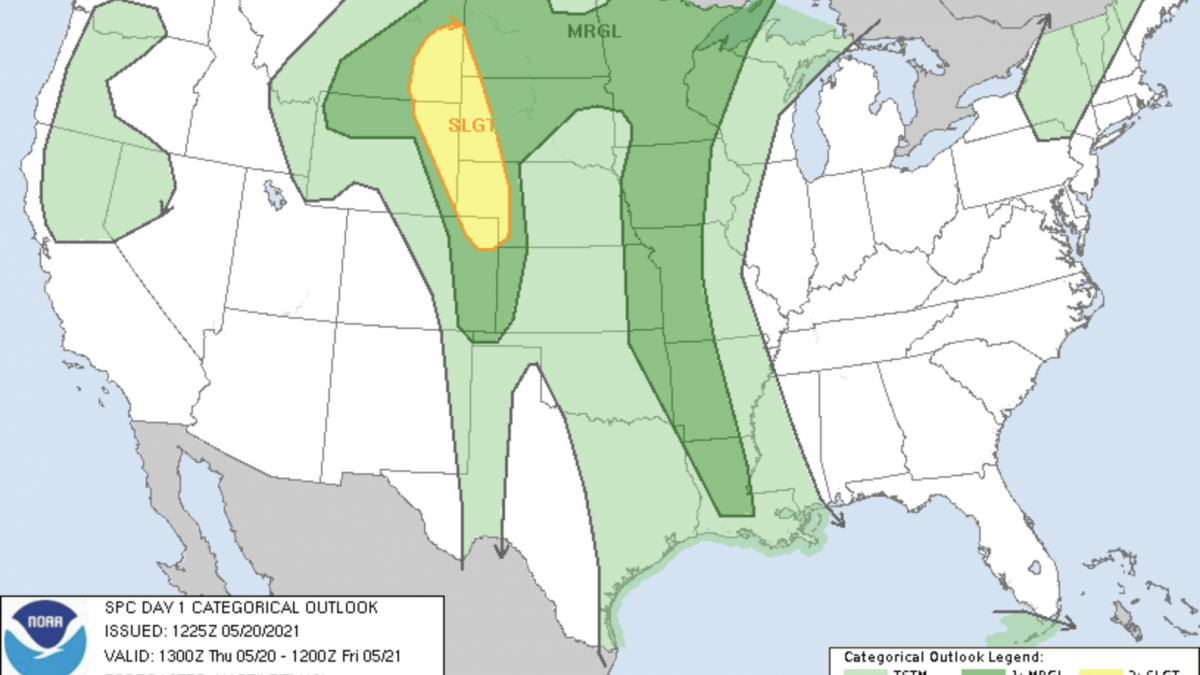
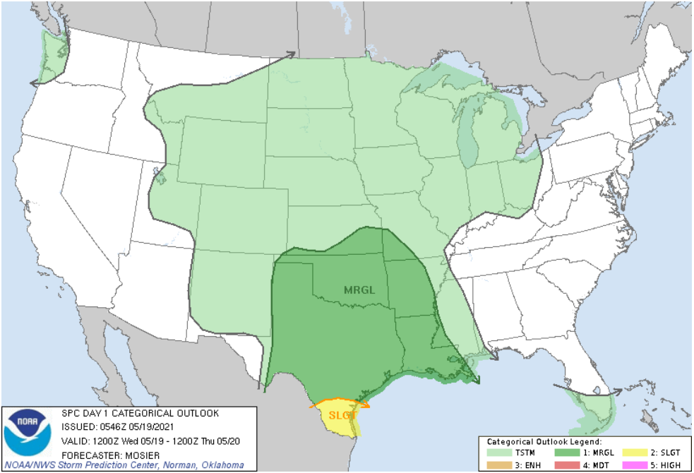
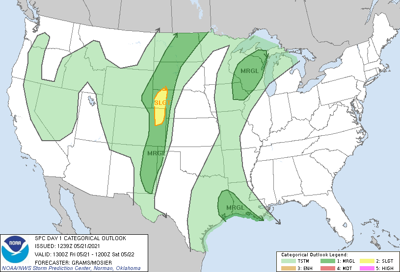
The Storm Prediction Center in Norman, Oklahoma outlined an enhanced risk (3 out of 5) over the Panhandle of Nebraska and the western half of South Dakota. A large slight risk (2 out of 5) was placed throughout the High Plains Region down through the panhandles of Oklahoma and Texas.
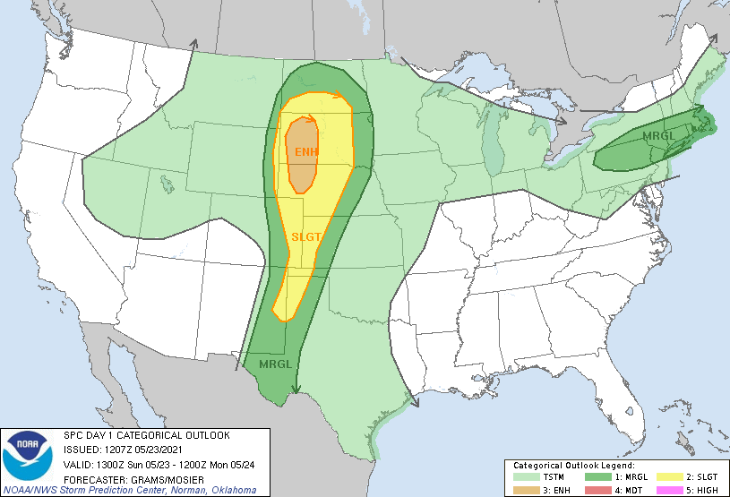
Storm Prediction Center Risk Outlook

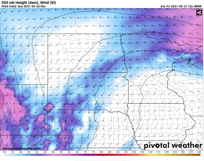
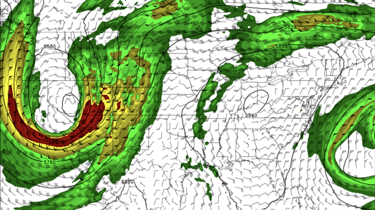
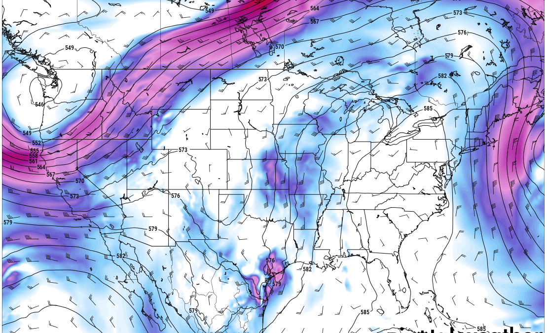
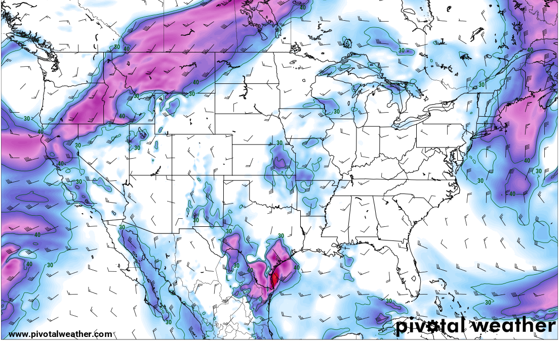
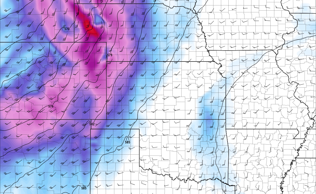
At 500 millibars (about 18,000 feet above ground level), winds were about 55-60 knots, and met criteria for severe weather. 30-40 knots is the ideal value to begin looking for severe weather. CAPE values, or instability were about 2000 joules/kilogram and were also supportive of allowing any convection to initiate. The main issue with the setup in South Dakota, was that most of the storms would be heading north into the boundary and at a very fast rate (almost too quick to successfully chase), and once they hit the boundary, we knew they would not last much longer.
At the surface

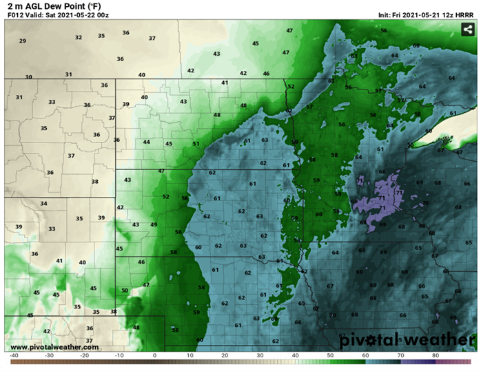
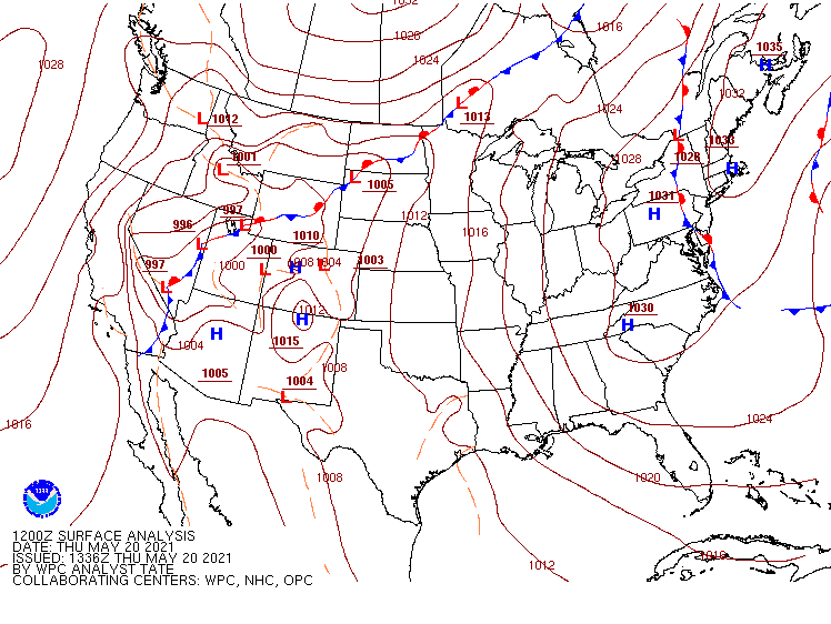
Two areas of low pressure were found over both northern and southern Colorado. A stationary boundary was draped across Nebraska and down through the Wyoming/Colorado state line. A cold front was located over the Denver Metropolitan area. As the day progressed, the cold front became stationary and moved eastward with time. Dewpoints throughout the day were in the mid to upper 50’s and some even reached the lower 60’s, which is sufficient for this location for severe weather.
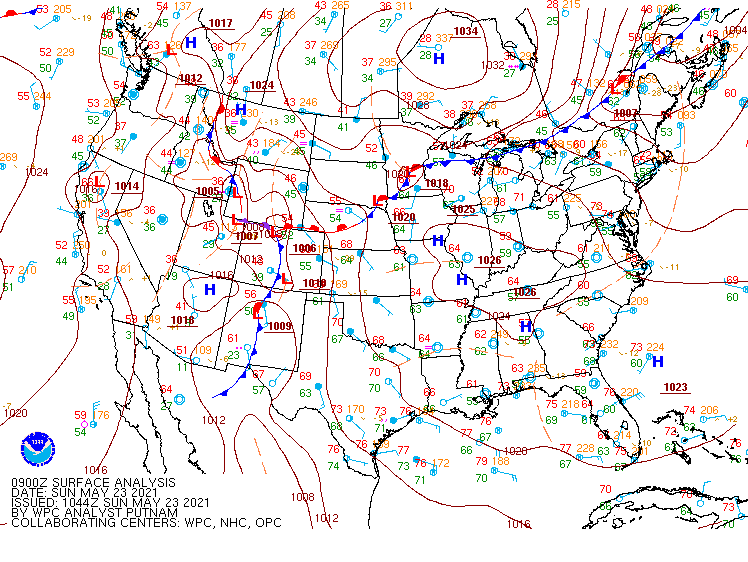
09z Surface Observations Map

Target Area

Considering the main risk of storms were located in South Dakota, we decided that the atmosphere did not look the best, and we decided to stay on the south side of the boundary, so we headed towards Limon, Colorado. Just north of Limon, a storm began wrapping around and eventually went tornado warned. Because the storms were fast movers, we had to move quick, and only had a few minutes to Rain-X the windows, gas up, and get moving again.
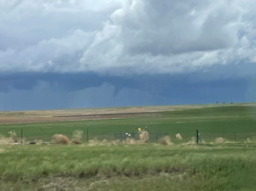
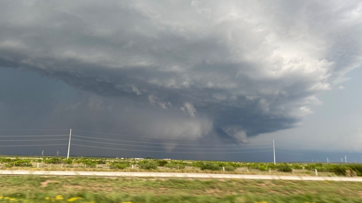
Funnel cloud near Eckley, Colorado.

We continued to follow this storm for several miles, and even saw a brief funnel before it dissipated near Akron, Colorado. We continued to follow this storm northeast to Sterling, CO where we decided to abandon that storm to head south again for the next cluster of storms. We picked up a cell near Yuma, Colorado, and followed that storm cell to Wray, Colorado. By this time, the sun had set, and we began to head to head towards Colby, Kansas, for a good nights sleep to prepare for the next day ahead.

Posted in Kentucky Weather | Comments Off on Storm Chase 2021: Day 7

Storm Chase 2021: Day 5

This morning we woke up in Chadron, Nebraska to a cool yet humid morning. We traveled a couple of hours to Sidney, NE.

Atmospheric Setup

The SPC Day 1 Outlook gave a slight risk for severe weather from southeastern South Dakota down into northeastern Colorado.

SPC Outlook

Upper level winds showed the best areas of divergence and high winds over the panhandle of Nebraska.

Pivotal 500 mb model

At the lower level, warmer temperatures advected in by southerly winds. The highest values continued to remain over the panhandle of Nebraska. These higher values could help in increasing instability and lift. This is also where the cold front can be seen drapping down across the corner of the Dakotas.

Pivotal 850 mb model

Surface dewpoints were sufficient across the panhandle offering additional moisture support for storm formation.

Pivotal surface dew point

Modeled reflectivity helped to give an idea where rain and storms may initiate.

Pivotal modeled reflectivity

Additionally, the modeled composite reflectivity, UH>75 m^2s^2 helped in us eyeing where severe storms may occur.

Pivotal composite reflectivity

All in all ingredients looked to best line up across the southern Nebraska panhandle, so we chose to drive to Sidney.

The Drive

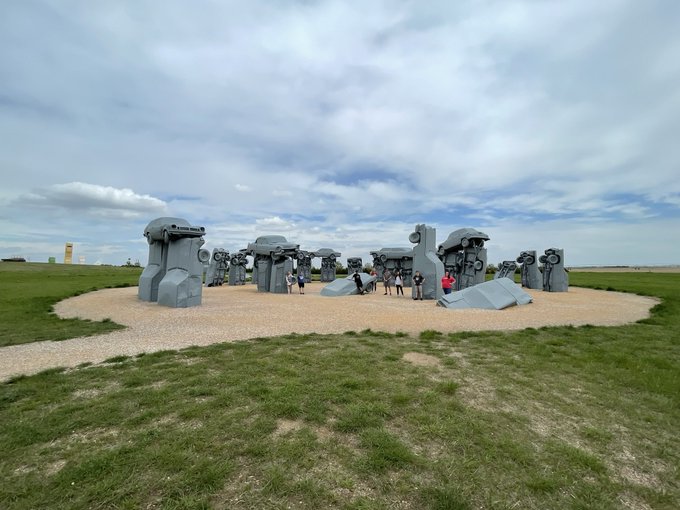
The drive was a fairly short one taking only about three hours during which we stopped in Alliance to pick up our friend Joe Sullivan. While there we stopped at Carhenge a famous roadside attraction using old cars modeled to look like Stonehenge.

Image
Group photo at Carhenge!

From there we stopped at the Subway in Alliance for a wonderful lunch. For such a large order, the staff did a fantastic job getting everyone’s sandwiches made quickly and efficiently.

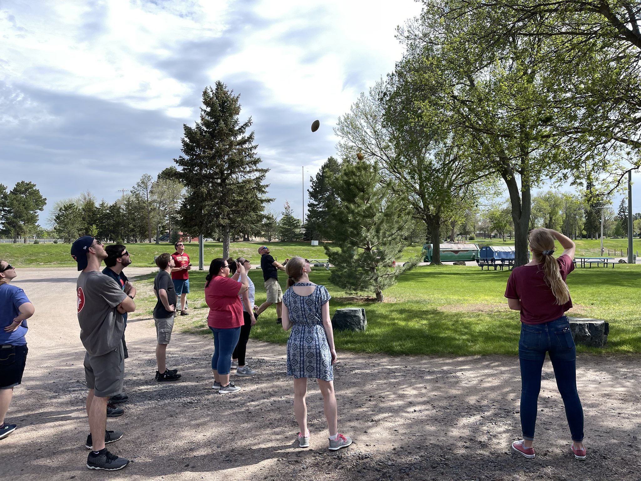
We continued on to Sidney where we stopped at a park for a little fun while waiting for storms to initiate. Within a very short time of being there one of our footballs got stuck and then the other as it was used to try and dislodge the first.

Image
Whoops!

We still had a ton of fun talking, playing, and watching the radar. We even got to speak to a very intelligent young man who wanted to know more about the meteorology program! Unfortunately any storms moved northerly away from us and into a less favorable environment.

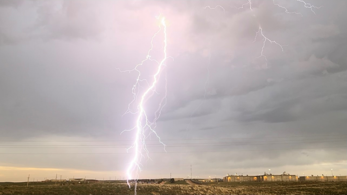
After a while we loaded up and headed down to Sterling, CO to watch a final, weak storm before eating and hitting the hay. The storm had beautiful structure and lightning.

Lightning

We went on to Parts & Labor Brewing for dinner. The staff was incredibly friendly and the food was tasty and filling! Afterwards we all crashed at the hotel to prepare for another day!

Posted in Kentucky Weather | Comments Off on Storm Chase 2021: Day 5

Storm Chase 2021: Day 4!

We woke up in Loveland, CO this morning and held our morning forecast discussion in the hotel lobby. The drive wasn’t expected to be too long, which was a big change of pace for the group!

Atmospheric Setup

The SPC Convective Outlook outlined a Slight Risk (2/5) for severe weather along eastern Montana, Wyoming, and Colorado along with western North Dakota, South Dakota, and Nebraska.

At the surface, there was a low pressure center over northeast Colorado with a stationary boundary extending northeastward across Wyoming, North Dakota, and South Dakota. As the day progressed, a dry line developed just to the east of the Rockies. Since we were at a higher elevation, dew points in the low-50s were sufficient for some storm development.

Upper level support was lacking over the Plains due to a strong and large ridge over the eastern half of the United States, which kept a trough in the far western part of the country. There was a small pocket of approximately 45 knot shear in fear eastern Wyoming, which is the area we made our target for the day.

Target Area/The Drive

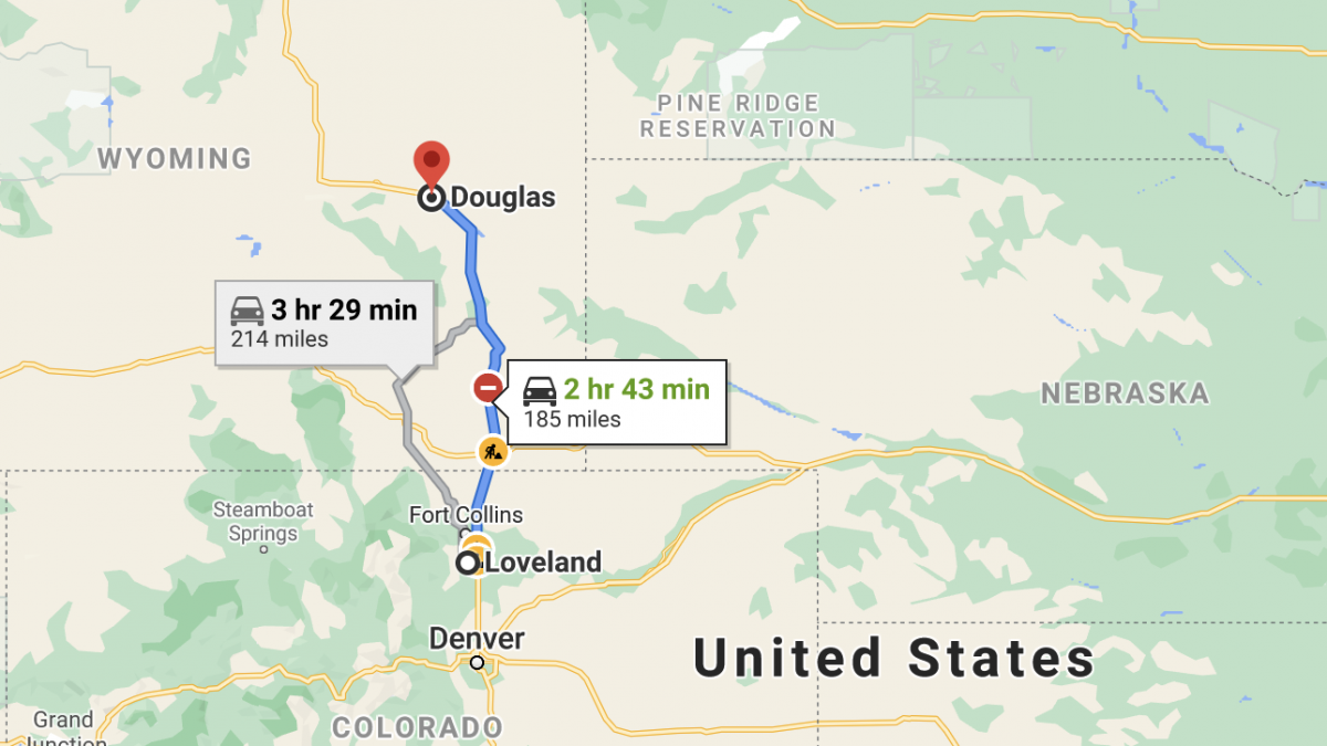
Our target area was southeast Wyoming, so we headed north from Loveland, CO to Douglas, WY. We stopped for a quick lunch at The Depot in Douglas and then hung out in a park while we waited for storms to develop.

Our route from Loveland, CO to Douglas, WY.
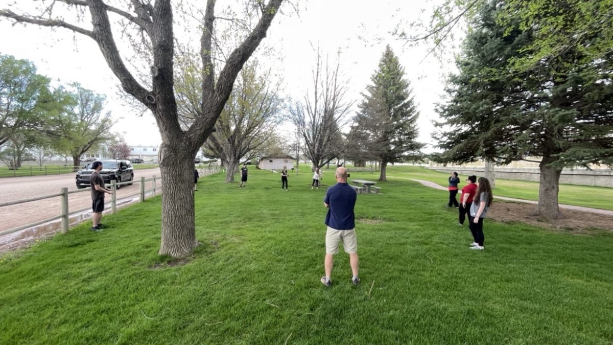
Tossing a football and frisbee!

The Chase

As storms started to develop, we encountered small hail in Douglas. We then headed southeast and encountered more hail in Torrington, WY.

Small hail in Douglas, WY.

We then made our way to the small town of Lingle, WY where we hung out and waited for more storms to develop. While there, we tossed a football and frisbee again. Our location was between two cells, which ended up being quite beautiful! We ended the day in Chadron, Nebraska and had dinner at The Ridge!

Posted in Kentucky Weather | Comments Off on Storm Chase 2021: Day 4!

Storm Chase 2021: Day 3!

The Day 3 reap of our storm chase trip is mostly a quiet one. A lot of discussion in the morning led to the decision of traveling north for the day to set up for Thursday and Friday of the trip.

We started our day in Amarillo, TX with a little bit of a lengthy forecast discussion. Today was looking to be a long travel day, so once we concluded our 9:30 AM discussion it was time to hit the road and set up for the next couple of days.

Atmospheric Setup

The ingredients needed for severe convective storms were somewhat lacking on this day as far as our possible chase targets were concerned. The SPC had outlined a large marginal area which encompassed Texas, Oklahoma, Arkansas, and Louisiana. The closed low that was present in the region had begun to get absorbed back into the main jet circulation. This resulted in weak upper level support. The wind speeds at 500mb in the panhandle of Texas did not exceed 30kts. The environment in eastern Oklahoma appeared to be slightly better with values upper level wind speeds approaching 50kts. Warm moist air was continuing to be advected into the region, so dew points and moisture and instability was not an issue for the most part.

Target Discussion

With the atmosphere not looking very impressive for this day we opted not to chase in favor of being set up for the next trough expected to deepen into the western parts of the United States. We discussed possible chase targets near Oklahoma City, but shear values remained very low and the storm mode was expected to be a clustered mess of sub-severe storms. Ultimately decided to head north to Loveland, Colorado to prepare for the next couple days of chasing for the developing low over western Montana and northern Idaho.

Surface to 500mb bulk shear at 21Z on May 19, 2021 to indicate possible clustered storm modes due to lack of strong shear.

The Drive

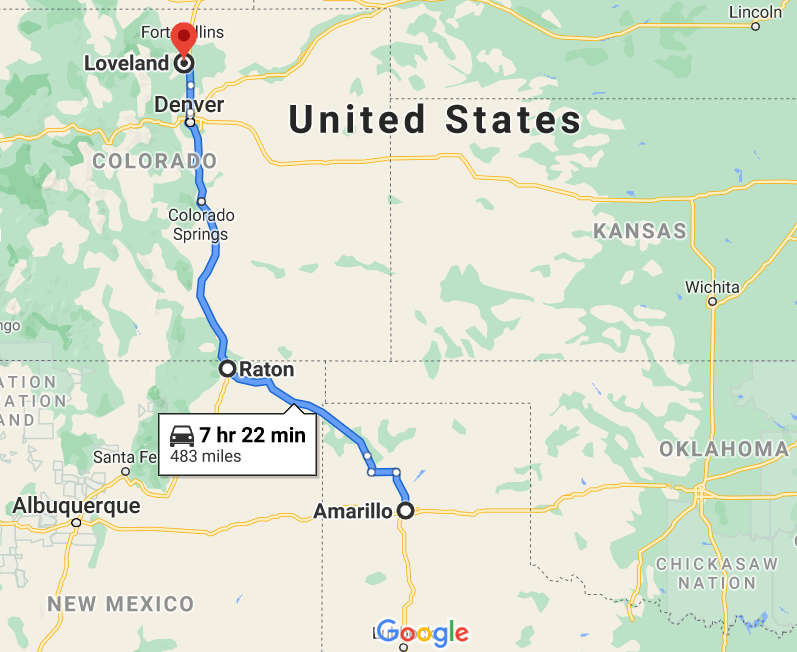
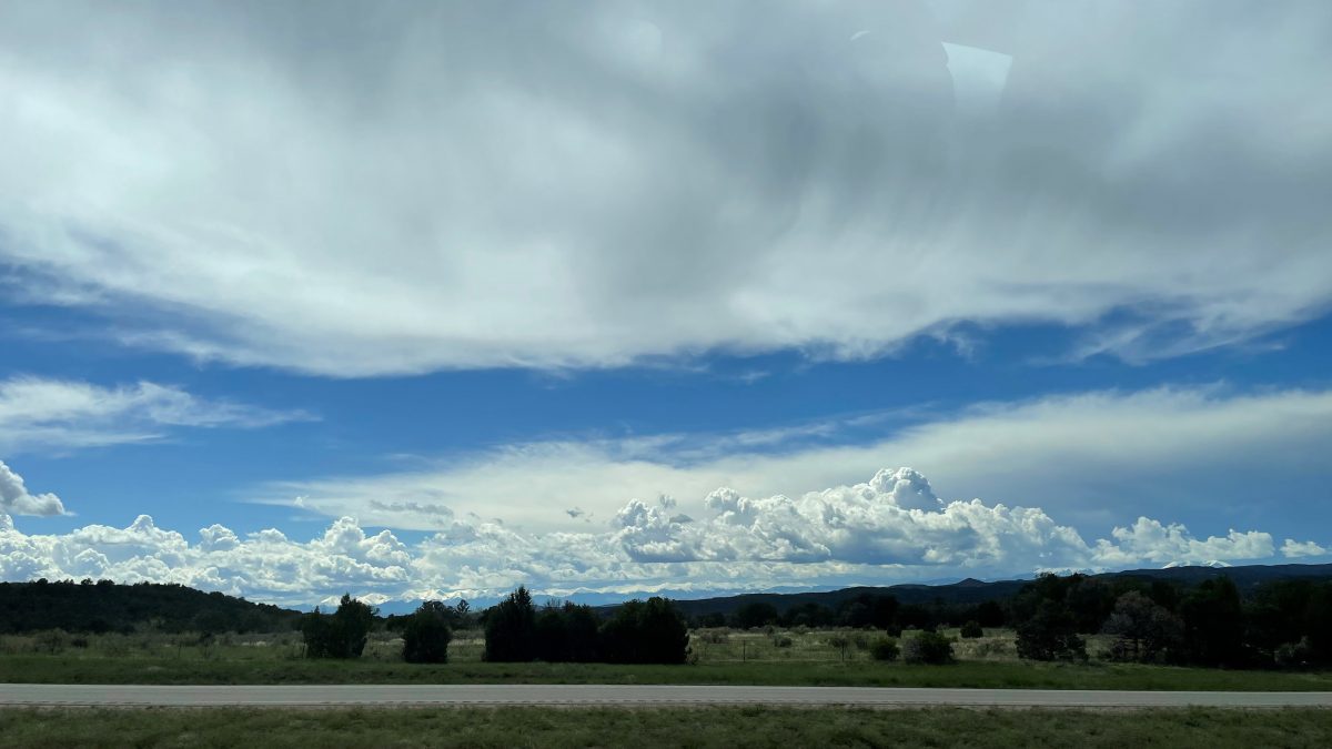
Once we left Amarillo, Texas as began making out way north to Loveland, Colorado. We took a quick stop in Dumas Texas to grab lunch at Los Potrillos, which is a place we have visited more than once on storm chase. After lunch we continued northward passing through New Mexico and getting a fantastic view of the Rocky Mountains as we crossed the Colorado/New Mexico boarder. The total drive from Amarillo to Loveland was approximately 8 hours for us, and we were relived to see the hotel once we arrived in Loveland.

Posted in Kentucky Weather | Comments Off on Storm Chase 2021: Day 3!

Storm Chase 2021: Day 2!

Hello, everyone! Here’s a recap of Day 2 of our Storm Chase Trip. It was definitely an interesting forecast and it left us having to make some difficult decisions.

We started the day off in San Angelo, TX with a forecast discussion. Within the last two days we had traveled 1,640 miles, so it was a more relaxed morning since the travel distance wouldn’t be as long. We began the forecast discussion at 10:30 AM and remotely included the EMDS (Emergency Management and Disaster Science) 504 class through zoom.

Atmospheric Setup

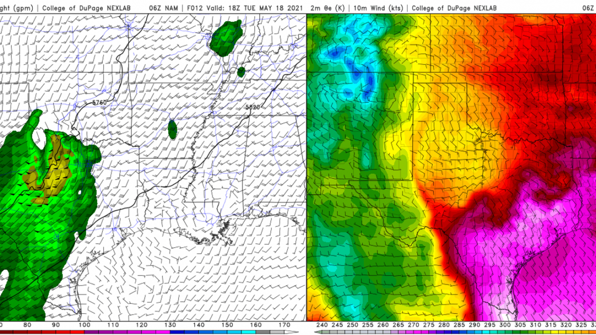
The SPC had outlined the central and south Texas within a slight risk. During the forecast discussion on Tuesday morning, the focus was on an outflow boundary and dryline moving into central Texas from the west. There was a closed low was still positioned just east of the four corners bringing divergence aloft for lift which is what also aided in producing the tornadic supercell from the day before. High values of theta-e near 350-360K were advecting from the Gulf into south central Texas bringing warm, moist air to aid in lift at the surface.

500 mb heights and winds with accompanying Theta-E maps. (COD Weather)

Target Discussion

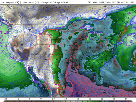
The original plan was to continue east into Texas to catch the cells that would form from the interaction of the outflow boundary and the dryline. Due to the lack of shear the cells that initiate would be disorganized and form into a linear storm mode very quickly. Looking into the future going that far south would put us out of position for future chase days that would be in the northern High Plains near Wyoming and Montana. We decided to begin to head north and target Amarillo to set up for the night and prepare for the next day of driving into position.

A dewpoint map showing a dew point filament into Montana. That’s what we’re wanting to head! (COD Weather)

The Drive

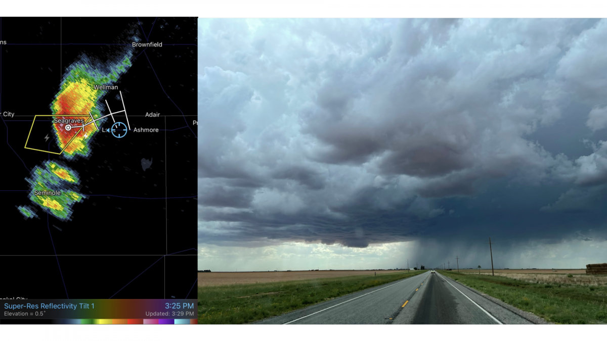
After we decided the best course of action for our day, we set out and headed north towards Amarillo. We made a brief stop for lunch at Jimmy John’s before we left the city to give us a break from Subway. On the dry, flat farmland, we caught sight of quite a few dust devils! About halfway into our trip, we took a detour to chase a rogue cell that was producing some small hail. A surprise chase! This took us into Seagraves, TX.

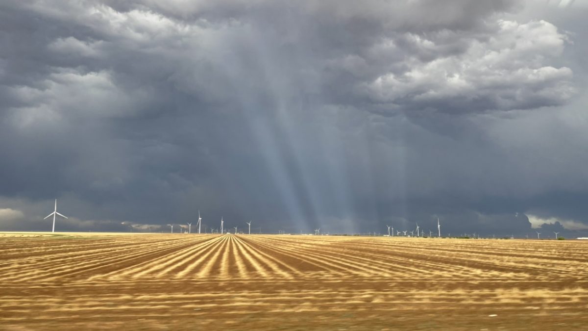
Radar view and our view of the Seagraves cell. Look at that rain shaft!

We chased this cell for about an hour driving in, out, and around the storm. We saw lots of blowing dust from localized downbursts, large rain shafts, and even caught sight of some small hail! A small notch began to form, so we watched the swirling dust closely. However, we never saw any funnel clouds or tornadoes, but some other chasers reported a small funnel after we left the storm.

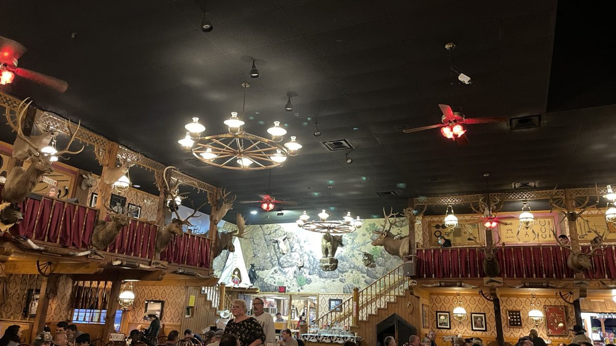
We ended up having to leave the storm to ensure we make it to Amarillo to have supper at The Big Texan, a WKU Storm Chase staple! We had to celebrate seeing two tornadoes on Monday with some steaks and fun times!

We stayed the night at Amarillo to get ready for the next day’s forecast and chase. Stay tuned for the update!

Posted in Kentucky Weather | Comments Off on Storm Chase 2021: Day 2!

Day 1 of the 2021 Storm Chase

Day 1 of storm chase was a memorable day. Many people in the class saw there first tornado in person.

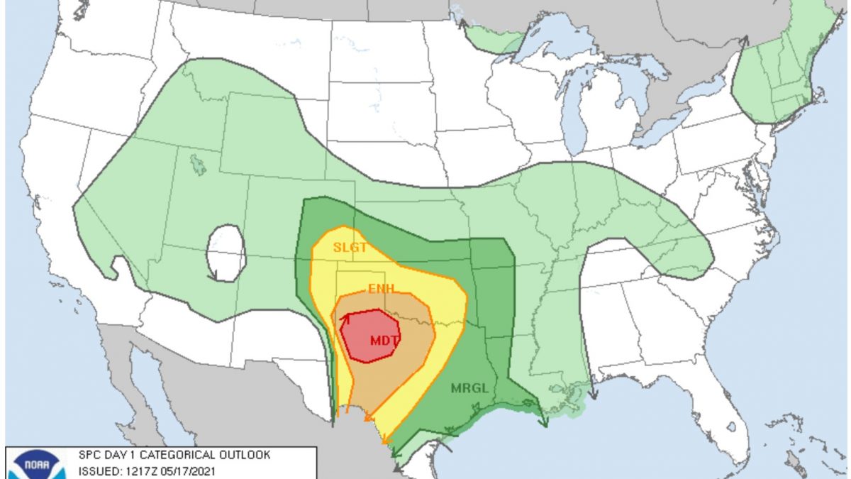
The SPC 1300 UTC Outlook for 5/17/2021

The Setup

There was a cut-off low over the four corners region, creating divergence over the Texas Panhandle and central Texas. A dry line was in place near the New Mexico-Texas border, moving east with time. The dry line was the biggest forcer for these storms. The dew points east of the dryline were in the 60s with higher values advecting from the Gulf of Mexico. The Convective Available Potential Energy (CAPE) was extremely high across the region as well. The lift, moisture, and instability were present to create severe storms. Wind shear was lacking upon initiation of the storms, but the 500 mb jet streak arrived just in time to create rotating supercells before these storms turned into an MCS.

Frist Storm Chase of 2021

Yesterday, the storm chasing class left Hays, KS at 8:00 am to head to the Texas Panhandle. We drove over 8 hours through Childress and Paducah, Texas to get to our target south of Lubbock, TX. We got there just as storms started initiating at around 4:00 pm.

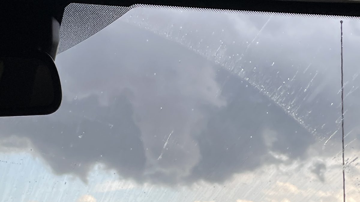
Funnel cloud

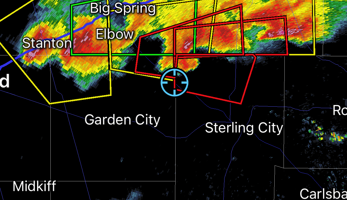
Around 6:30 pm, a rotating supercell started to form as the 500 mb jet streak entered the area. At 6:54 pm a tornado warning was put in effect for the supercell. At 7:11 pm, we saw a tornado from this supercell.

Composite Reflectivity from Radarscope of the Sterling City Tornado
The Sterling City Tornado north of Sterling City, TX

As we were driving to get ahead of the storm, we watched the tornado become rain wrapped. We found a good spot and the tornado, which had lifted, re-emerged from the rain and touched down again. The supercell eventually merged with some other cells and became a line of storms. That evening we drove to San Angelo, Texas and spent the night.

Posted in Kentucky Weather | Comments Off on Day 1 of the 2021 Storm Chase

Today in Weather History

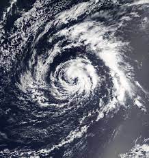
On this day, in 2003, the Atlantic saw its first tropical storm to form in the month of April. For the most part, Tropical Storm Ana remained out at sea, though it did impact Bermuda and Florida. More specifically, Bermuda saw gusty winds and sporadic rainfall whilst Florida saw an outgoing tide. This caused for a boat to capsize, killing two of its occupants. This storm produced peak winds at 60 miles per hour and achieved a pressure reading of 994 millibars. Below is a photo that shows the “eye” features of the rather scattered storm.

Tropical Storm Ana (2003)

That’s all for today! Have a great weekend and break!

Posted in Kentucky Weather | Comments Off on Today in Weather History

Prepare For Sub-Freezing Temperatures

Good morning, everyone! We hope all is well!

Today will be a stunner, with sunny skies and calm winds. Tomorrow, however, is what you need to prepare for. As of now, the National Weather Service has our county under a Freeze Watch from late Wednesday night (1 AM) to early Thursday morning (9 AM).

At the very start of Thursday, will have sub-freezing temperatures sweep through our region, posing a threat to vegetation and unprotected outdoor plumbing. To protect plants, make sure to cover them before you go to sleep Wednesday night so that they are able to pack in heat and survive the below freezing temperatures that are possible. To protect outdoor plumbing, make sure to wrap or drain any pipes that would be vulnerable.

Stay prepared!

Posted in Kentucky Weather | Comments Off on Prepare For Sub-Freezing Temperatures

A cool shot ahead!

High pressure building in eastern Texas will bring cool air from the North and West, giving us a cool kick for the remainder of the week! The high for today is 68 and the low is 44. Overall we start the day with a mix of sun and clouds before clearing occurs later in the afternoon. Definitely enjoy these conditions if you can because these warm temperatures do not stick around for long! A cold front comes through on Tuesday, bringing with it cooler overnight lows. The potential for widespread frost comes Wednesday night into Thursday morning with lows in the mid 30s. If you have any outdoor plants or animals, plan on bringing those in for the time being! Stay tuned for more information as we track the latest conditions for you. 

Be safe and have a great Monday!

Posted in Kentucky Weather | Comments Off on A cool shot ahead!

Dry today, wet tomorrow!

High pressure will be dominating your Friday, keeping our region dry and sunny! Daytime temperatures will be flirting with the mid 60s so definitely take advantage of these spring-like conditions if you can! We go to sleep to temps in the mid to upper 40s so it’ll be a chilly late night and early morning Saturday. Enjoy this break because it doesn’t last long as we are watching the potential for scattered showers to roll in through the region before 1pm. Afterwards though, expect clouds to clear out some for a partly cloudy and mostly dry remainder of your afternoon! Sunday also looks dry with highs in the mid 60s again!

Be safe and have a great weekend!

Posted in Kentucky Weather | Comments Off on Dry today, wet tomorrow!