Snowy Start to the Week

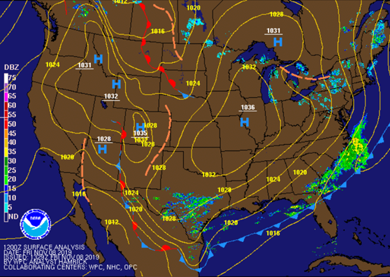
Winter made it’s first appearance a little early this year! With a cold front sweeping through the Commonwealth last night and a serious shot of cold air behind it, the moderate rainfall we had late afternoon changed over to sleet and then all snow just after the dinner hours. With the early snow came some record breaking conditions: a record snowfall of 1.2″ for Nov. 11th and a record snowfall of .1″ for Nov. 12th. We also saw a new record low max temp for the 12th with today’s high reaching only 27.

Tomorrow’s record low temp of 13 set back in 1911 is also in jeopardy as temps will drop into the teens tomorrow morning and wind chills in the single digits. With sunny skies and high temps back into the 40s, it will be much more pleasant than today once we get past noon.

Thursday’s low will be much warmer, but still far below freezing. High temps will be a lot warmer with highs reaching close to 50, and it will be sunny once again.

Friday will be a little cooler as highs drop back into the low to mid 40s, but at least skies will be clear all day long.

The weekend will be warmer as temps move into the mid 50s with continued sunshine.

Posted in Kentucky Weather | Comments Off on Snowy Start to the Week

Cold and Snowy

Today we reach a high temperature of 62°F, however the temperature quickly dropped as a cold front moved into our area this afternoon, bringing rain and now snow with it. The snow is should continue until shortly after midnight, although not much accumulation is expected on roadways, however, bridges and elevated roadways may freeze. While the snow may be ending tonight, the cold isn’t. Tuesday morning temperatures will be in the low 20s and will remain in the 20s all day. Brisk wind will accompany the cold air, causing single digit windchills for your morning commute, rising to the mid-teens later in the day.

Tuesday night and Wednesday morning will be even colder, with an overnight low in the upper teens. The temperature will rise above freezing during the day, with a high around 40°F before dropping back to the mid-20s Wednesday night.

Posted in Kentucky Weather | Comments Off on Cold and Snowy

32°F

I came to WKU this morning as usual by my motorbike but this time I felt sharp pain in my ears because the temperature was 32°F (0 °C) when I was riding the bike. I think I will stop coming by this way and start using the bus. 

It is sunny right now but cold, the temperature won’t rise up too much this afternoon but in low 40s °F. the night will be extremely cold and low temperature will be upper 20s °F. it is clear and dry due to a strong high pressure over the Mississippi Valley and will move to Ohio Valley later on (see figure 1).

Figure 1: Current surface map: Friday morning: NWS

  I prefer this time to look at SPC surface plumes to see how the temperature will oscillates during this weekend (see figure 2). All weather modules almost agree that the temperature will drop off below 0 °C this night to low 23 °F. Then the temperature will rise up on Saturday to high near 52 °F and upper 50 by Sunday due to moving the high pressure to the east. This movement will allow to warm up the area through this weekend but the low will touch again the freezing point, as plume curve shows at 6Z to 12Z. Monday will be another story because we might see snow after rain at night due to upper level flow will deepen upper level trough  and a cold front will push southeast at the same time.

Figure 2: SPC surface plumes for Bowling Green, KY

Summary

Day and time Condition High(°F) Low (°F)
Tonight Clear   23
Saturday Sunny 52   
Saturday Night Mostly clear   34 
Sunday Sunny 60  
Sunday Night  Mostly Cloudy   40 
Posted in Kentucky Weather | Comments Off on 32°F

Rain Returns Wednesday

Today was another cool fall day, our high temperature reached 60°F. We stayed dry today, however, that is a trend we will soon break
Tonight will be a frigid night, as temperatures fall back into the mid 30s. Wednesday we can expect temperatures to climb into the mid 60s. We have a chance for showers Wednesday afternoon, with rain chances increasing for the overnight hours as a cold front moves through our region early Thursday morning.

Posted in Kentucky Weather | Comments Off on Rain Returns Wednesday

Chilly Temperature

It seems we start the new month with a chilly temperature. My family w so sad yesterday because they couldn’t do the Halloween activities due to frozen temperature during all yesterday and night. The Freeze Warning was published yesterday until this morning. It is hard to think about it, how the temperature sharply dropped down but this is how the weather and climate work out in our life.

To analysis the cold event that took place yesterday, we must take into account the synoptic scale. A massive cold front moved and approached from north west toward south east, causing a severe cold weather last day (see figure 1). Not only that, but another cold front is coming and follow up the same scenario (see figure 2). Therefore, we might see another freeze warning during this fall. Additionally, a high pressure is located over central of US which in turn made the blue sky for the day with low temperatures, a high 40 °F and low 30 °F during night.

figure 1: Current surface map: NWS
Figure 2: Tomorrow forecast for surface map. A cold front is moving toward to central Kentucky

Summary

Day and time Condition High(°F) Low (°F)
Tonight Clear   30 
Saturday Sunny 52   
Saturday Night Mostly clear   28 
Sunday Sunny 54   
Sunday Night   Mostly clear   33 
Posted in Kentucky Weather | Comments Off on Chilly Temperature

Tropical Storm Olga

Tropical Storm Olga formed last Friday in the Gulf of Mexico, and briefly reached tropical storm strength before the circulation weakened and merged with a cold front. However, an important trait of tropical and post tropical systems is the substantial amount of moisture they contain, often leading to prolonged heavy rainfall and flooding. Olga was no exception, heavy rain caused flooding in the lower Mississippi River Valley Friday night, and continued northward over the weekend. By Saturday the remnants of the storm had entered the Bowling Green area, contributing to the 1.25 inches of rain recorded at the Warren County (FARM) Ky Mesonet site this weekend.

Posted in Kentucky Weather | Comments Off on Tropical Storm Olga

A rainy weekend

   It is cloudy and more clouds will be moved toward North east expecting the beginning of rain start afternoon to midnight. There is possibility for getting a thunderstorm before midnight with average precipitation between a half and three quarters inch. The high temperature will be mid 60 °F and low in mid-50 °F with some light rain. In this weekend, the weather instability is because a storm system will move into Ohio River Valley by Saturday night then North East by Saturday morning. This system will bring the moist air from the Gulf. But the rain will be light and showers this evening and tomorrow, and low level jet will be presented due to a good support from upper level.   

 Sunday, the rainfall will shut down from west to east because the cold front and upper support will lift off to the north east.

Summary

Day and time Condition High(°F) Low (°F)
Tonight Rain   54 
Saturday Showers 69   
Saturday Night Showers   51 
Sunday Chance Showers then Partly Sunny 65   
Sunday Night   Partly Cloudy   44 
Posted in Kentucky Weather | 2 Comments

Weekend Washout

Today has been the epitome of a Fall day: morning lows right around 40 and highs expected to reach into the low 70s with clear skies and calm winds all day long. It literally could not be drawn up any better. However, like all good things, this too must come to an end. A low pressure system will be moving up from the Southern Great Plains and bring with it plenty of rain over the next few days.

Tomorrow, we’ll start off at 44 degrees with partly cloudy skies. More cloud cover will be moving in by the lunch hour as rain moves up from the south. Expect the rainy weather to begin during the afternoon to evening hours and persist throughout much of the night. Highs will be in the mid-60s with dense cloud cover during peak heating keeping us cooler than what we experienced today.

Saturday will see quite an increase in temps as warm air advects into the Tennessee and Ohio Valley regions. Morning lows will be in the 50s with afternoon highs in the low to mid 70s despite the overcast skies. Models differentiate on how much rain we’ll see, but thy are starting to agree that it will likely be an inch or more. The NAM depicts less than both the GFS and the ECMWF because it is predicting a break in the constant rainfall for about half the day on Saturday. If the ECMWF and GFS prove true, we’ll see constant moderate rainfall for all of Saturday with totals amounting to 2+ inches for SOKY. Winds will be whipping as the cold front moves East toward us: 20+ mph sustained winds and gusts upwards of 35mph won’t be out of the question.

Sunday will be dry all day with temps in the 50s for the morning and highs staying down in the 60s. After such a wet weekend, a nice, cool Sunday will be a welcomed sight.

Posted in Kentucky Weather | Comments Off on Weekend Washout

Ready for Homecoming

My kids are ready for collecting the candy from this Friday`s Homecoming. I remember last year, they brought a lot of candy to house until I got fried to not eat anything except that candy so I and my wife decided to hide it for a while but it did not work because the is a big story between the children and the candy which I haven’t understand it yet.

Anyhow, the homecoming will be interesting for all different age and the weather will be perfect in some point. The temperature will be at mid-60s but I don’t advise to anyone to stay out for long after sunset because the temperature will start to drop down into high 40s and into low 40s by midnight. Tomorrow will be sunny with temperature low 70s, but there will be a chance of showers at afternoon due to some instability in upper and lower atmospheric layers such as cold front and some moist air.

There will be an important astronomical event in next few days between now until October,22 which is Orionids Meteor Shower. The astronomy enthusiasts could see a banish of meteors, about 20 meteors per hour. These meteors are basically a dust grains come from comet Halley. The pick time of this phenomenon is October 21 but we won’t see some of the faint meteors because of second quarter moon but the brighter meteors can be seen in the sky.

Summary

Time Condition High(°F) Low (°F)
Friday (Night) Clear    42 
Saturday Sunny then slight chance showers 72  
Saturday ( Night) Slight chance of showers   50
Sunday Mostly Sunny 75  
Sunday (Night) Partly Cloudy   56
Posted in Kentucky Weather | Comments Off on Ready for Homecoming

Homecoming Festivities Planner

This year’s Homecoming week has been as hectic as any other year, but the big events have yet to begin! As students finish up their respective organization’s float tonight, temperatures will drop into the lower 40s by midnight. For those pulling the dreaded all-nighter to make sure that every pomp is perfectly placed, bring some extra warm clothes tonight because morning lows will be in the upper 30s.

Friday is the day to show off the floats as students parade from the Hardin Planetarium to the Square and back up to Cherry Hall for Big Red’s Roar where this week’s winners will be announced. High temps will be in the mid-60s during the afternoon. Temps at 5:00 for the beginning of the parade at 5:00 will be around 60 degrees and dropping steadily throughout Big Red’s Roar and the NPHC Step-Show. As the official Homecoming activities wrap up around 8:30, expect temperatures to be near 50 degrees and even cooler if you are out and about for those late-night extracurricular events.

After a well deserved night of sleep, Saturday morning will be much milder than the previous couple of mornings with a low of 45 degrees. Saturday in general will be a much warmer day with a high of 74 degrees! It might get a little breezy with winds out of the north at 10 mph, but other than that it looks like a perfect day to watch our Hilltoppers clash with the Charlotte 49ers. Kickoff is at 3:00 with Homecoming celebrations and activities occurring throughout the game such as the revealing of the Homecoming Queen during halftime!

Sunday marks the end of Homecoming and introduces overcast skies ahead of the wet weather on Monday. Both Sunday and Monday will be in the 70s, but Monday will be wet most of the day with heavy rain possible for many SOKY residents.

Overall, the weather will be nice from now until the culmination of WKU’s Homecoming activities. Enjoy this good spell before the next round of wet weather approaches on Monday!

Posted in Kentucky Weather | Comments Off on Homecoming Festivities Planner