WKU Storm Chase Day 4

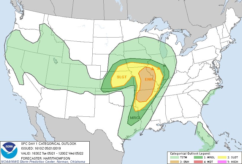
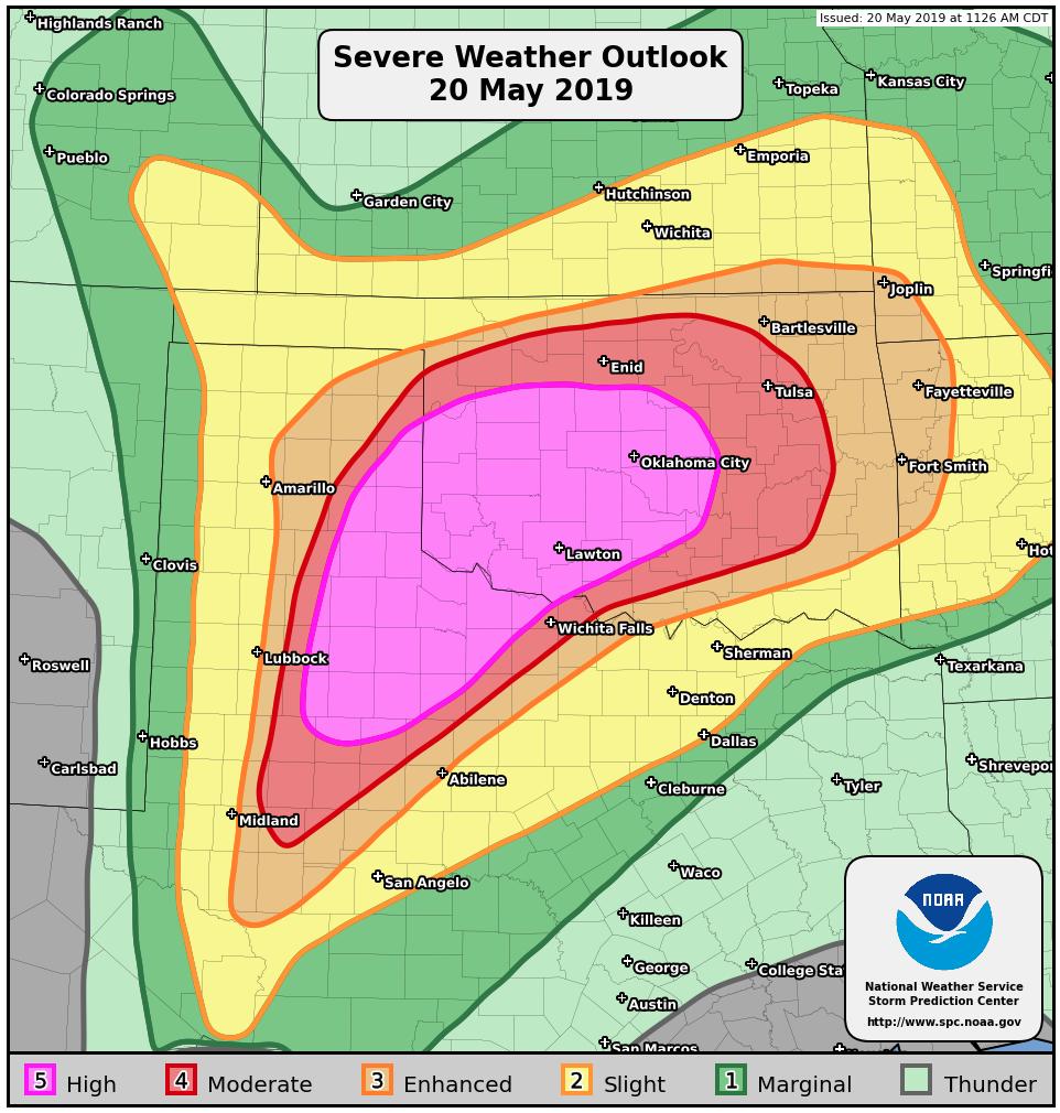
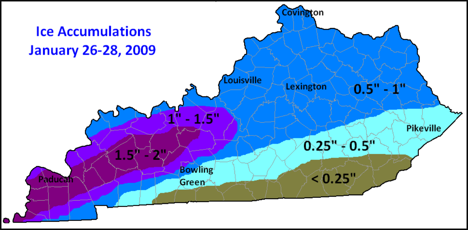
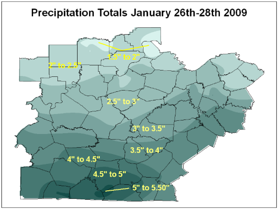
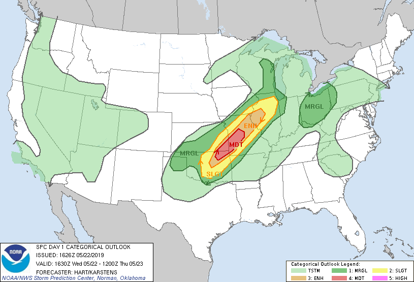
The WKU Storm Chasers started their fourth involved chase day in the city of Manhattan Kansas. The SPC Day 1 Convective Outlook had a moderate risk area stretching from northern Oklahoma up into central Missouri and parts of south east Kansas. We ended up picking northern Oklahoma and southern Kansas as an initial starting point for the day hoping that the boundary driving our storms would stall out in that area.

Atmospheric Setup

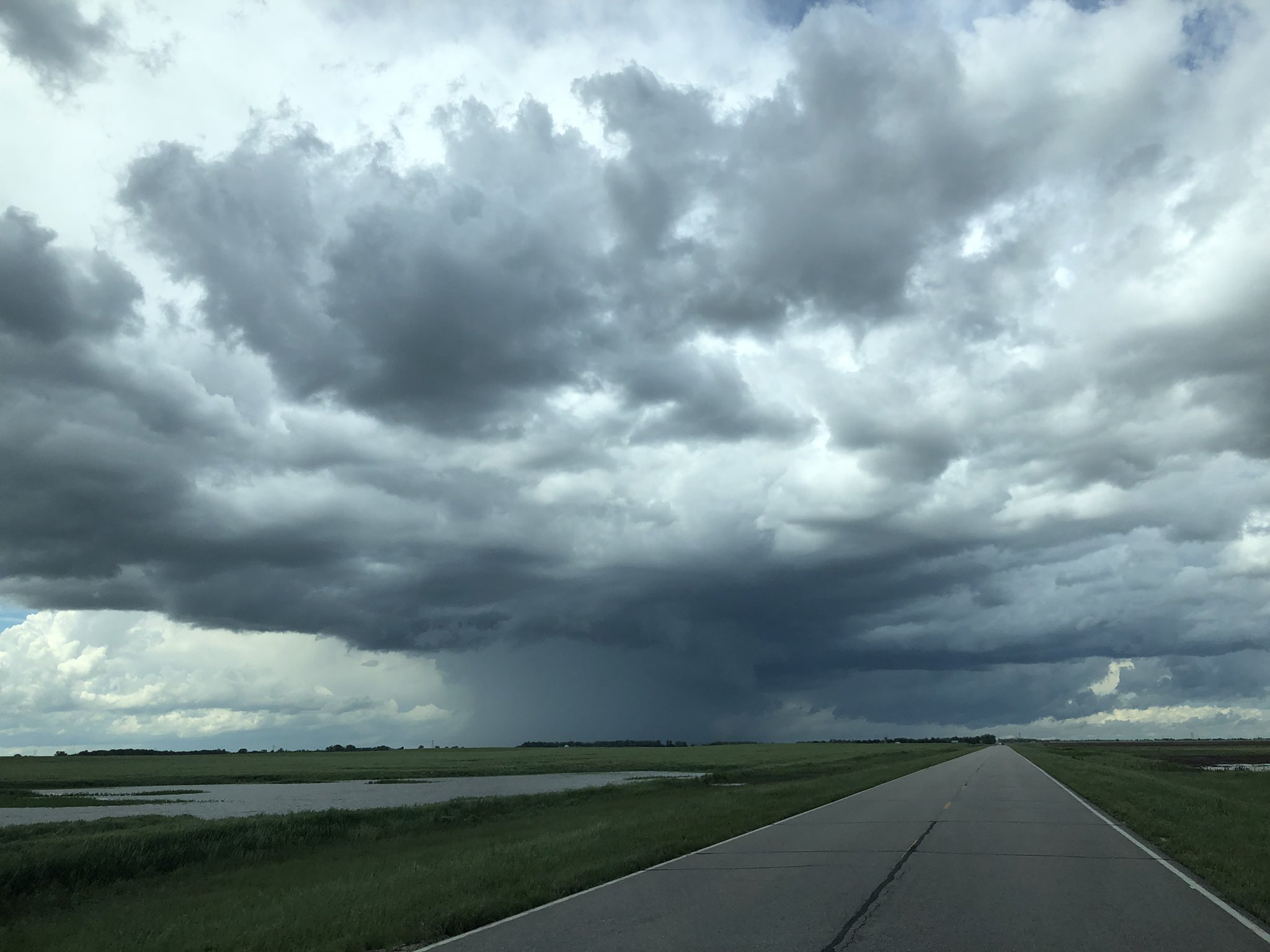
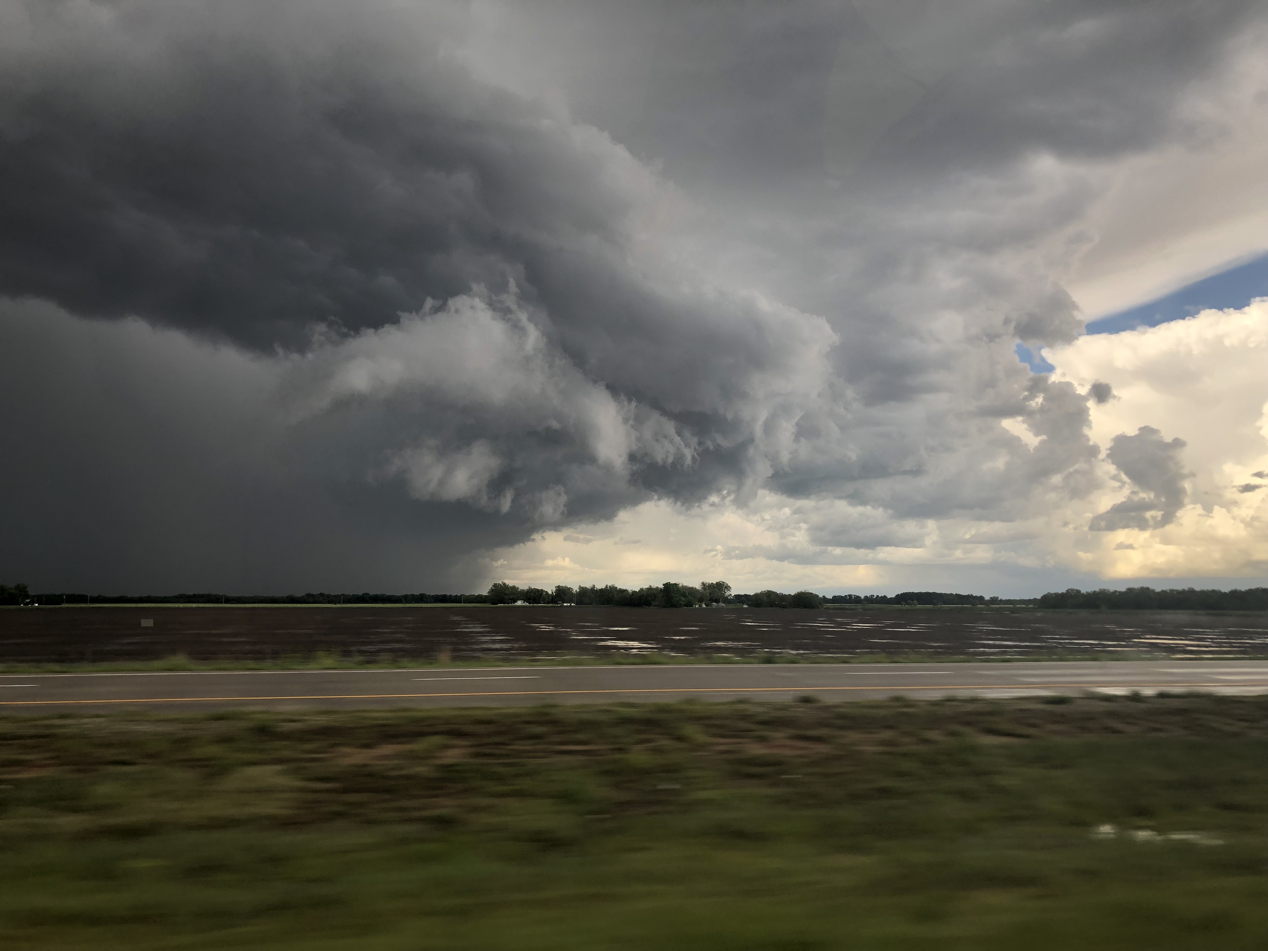
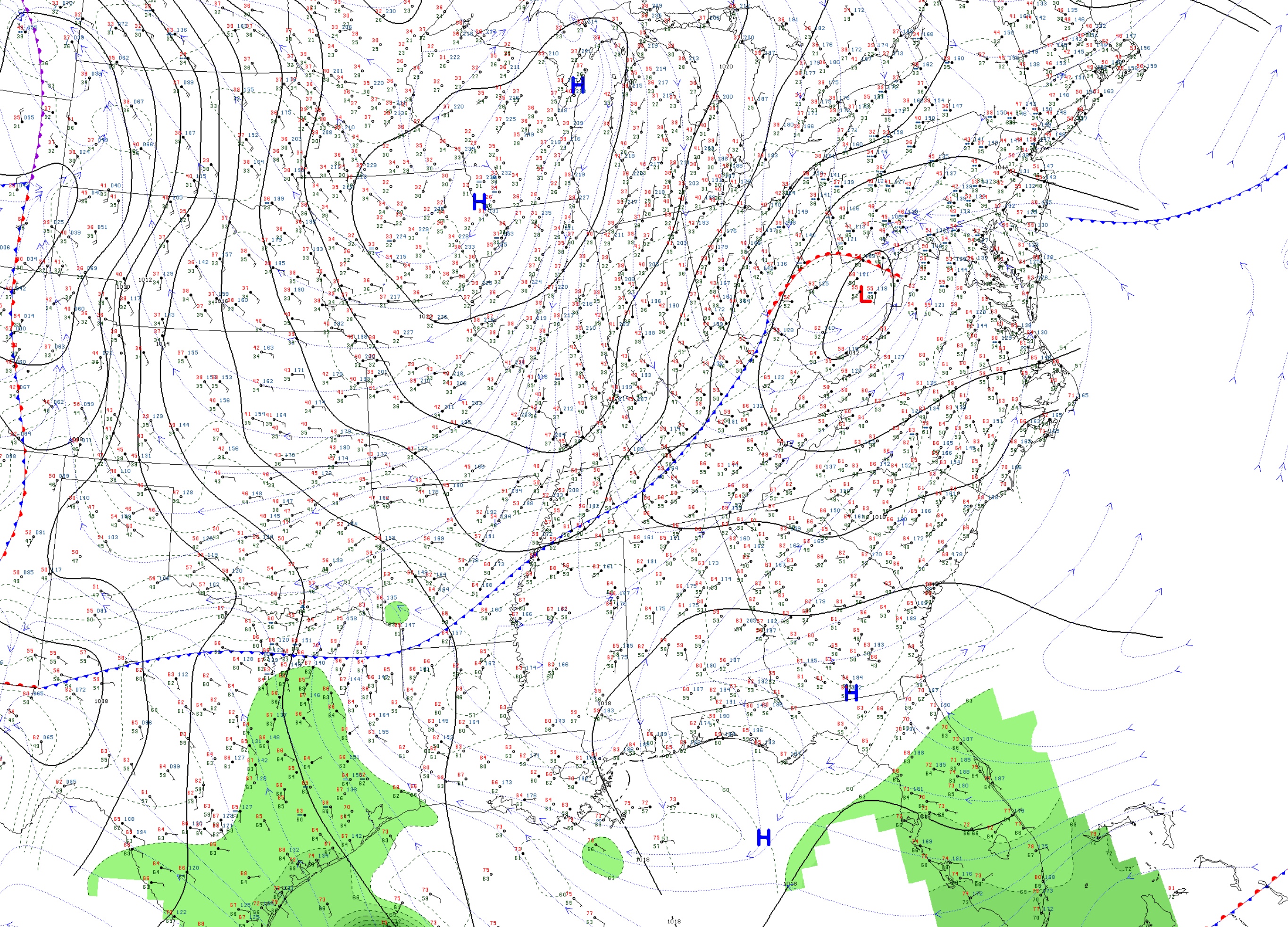
The environment today was looking to be very unstable and favorable for strong super cell development. The main point of contention was going to be a boundary that started the morning draped across Oklahoma and south western Missouri. The big question of the day is where would that boundary stall out and produce the best super cells. All of the other important ingredients were in place. There was a strong upper level jet streak moving along the Kansas Oklahoma boarder. The lower level jet brought plenty of moisture from the Gulf with the return flow. The shear and convective available potential energy (CAPE) was also in a favorable position for the day. The boundary caused an adequate amount of moisture convergence along it allowing storms to initiate and become severe, despite the poor low level laps rates that were present in eastern Oklahoma and southern Kansas.

The Chase

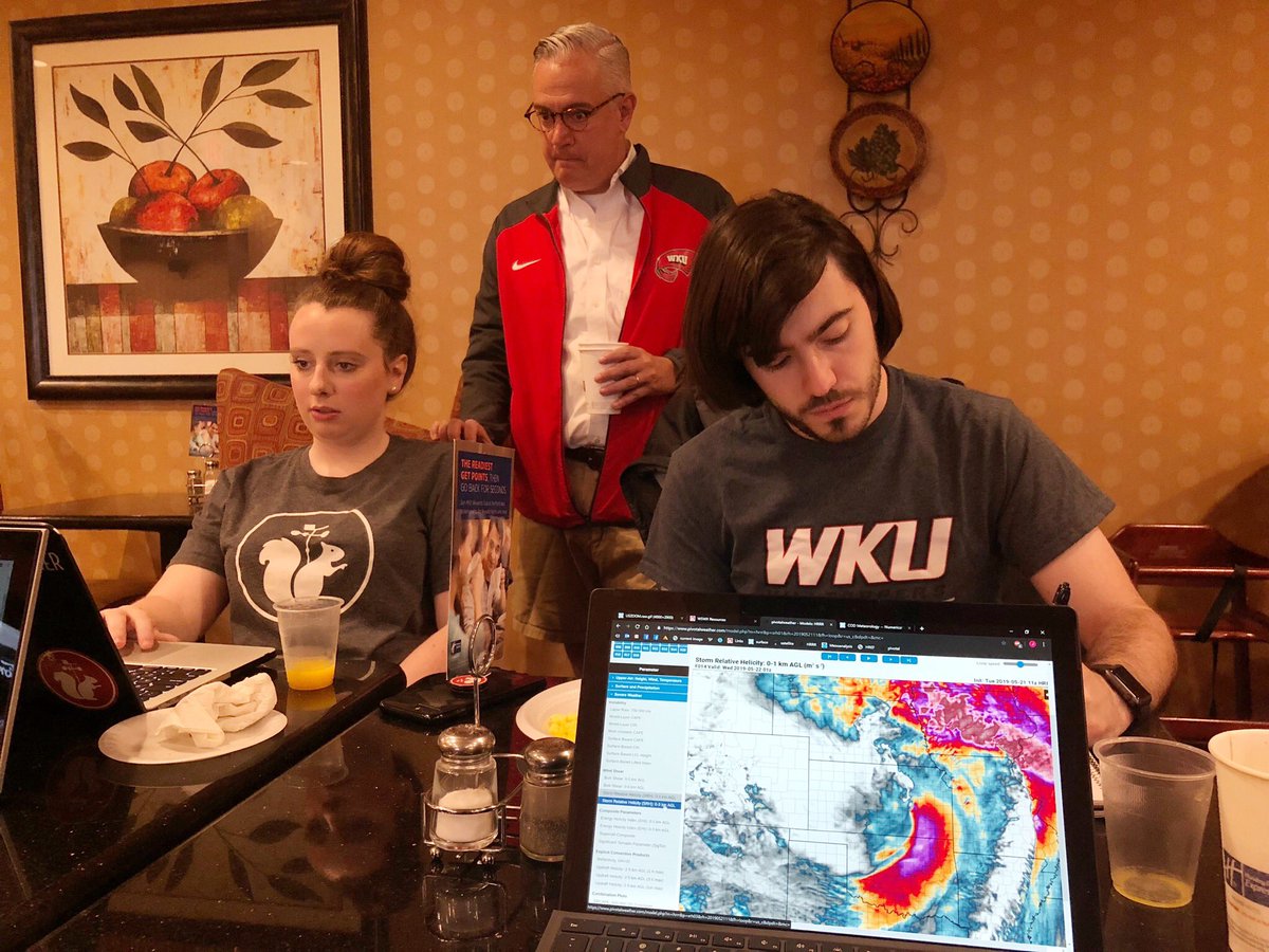
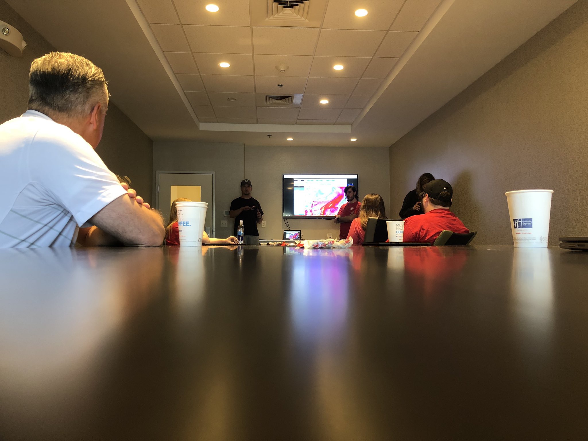
We met in the lobby of our hotel that morning to have a forecast discussion led up by students Luke Rodgers and John Bowen. We decided that the best play for the day would be to head south and be on the boarder of Kansas and Oklahoma by lunch time so that we would have a good position for the rest of the day.

Group forecast discussion led by Luke and John

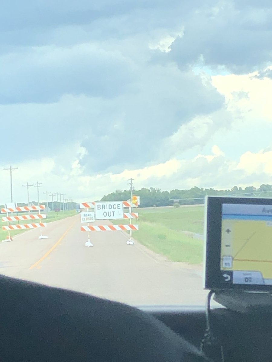
We stopped in Emporia Kansas for a quick to-go lunch from Jimmy John’s, and our target had moved south with the boundary that was going to produce storms. We dropped south towards Tulsa Oklahoma, stopping in Coffeyville to wait for storm initiation.

The park in coffeyville we stopped at while waiting for convective initiation

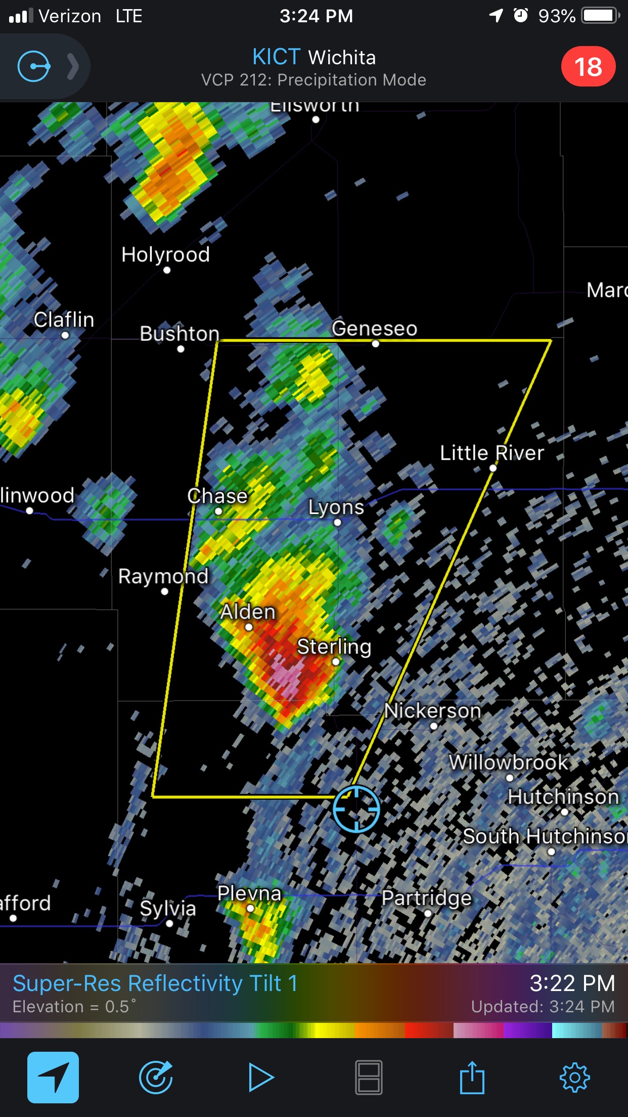
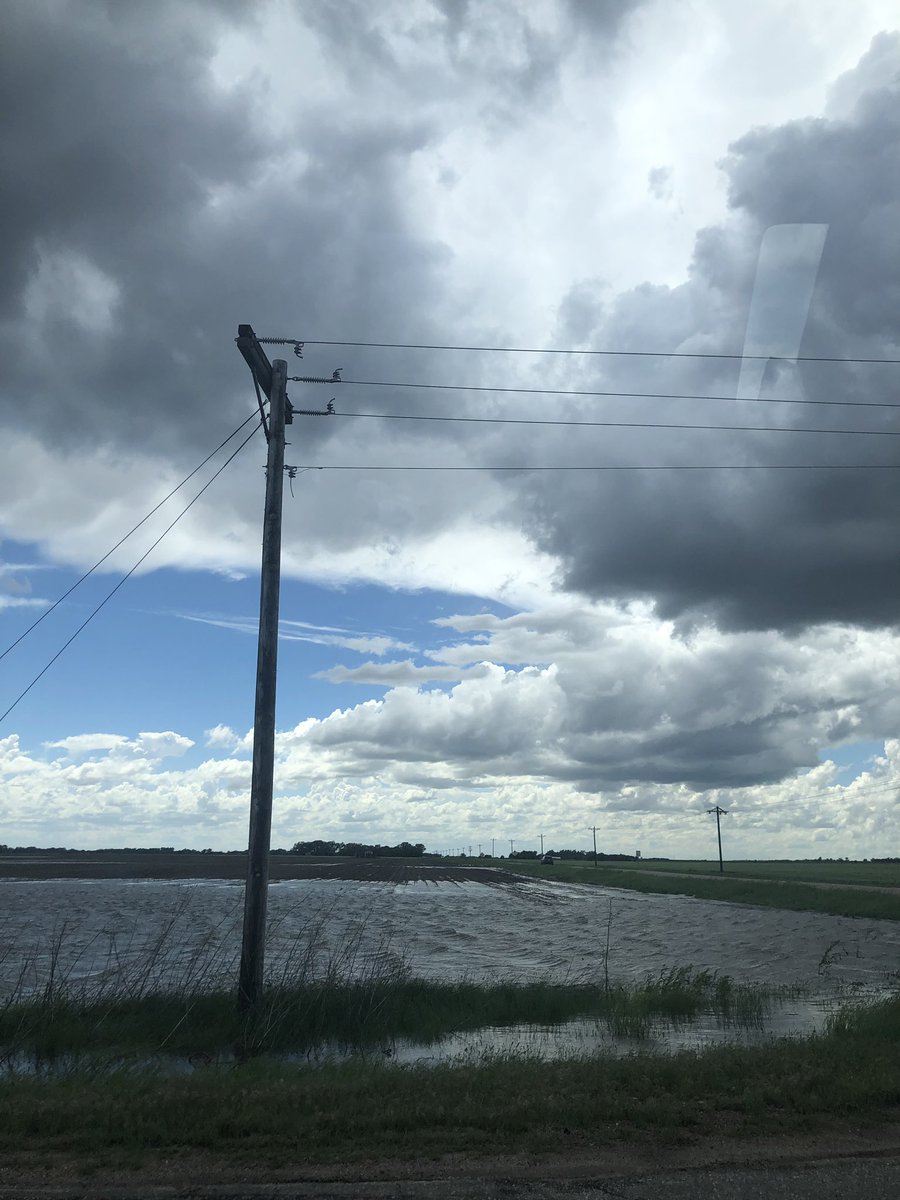
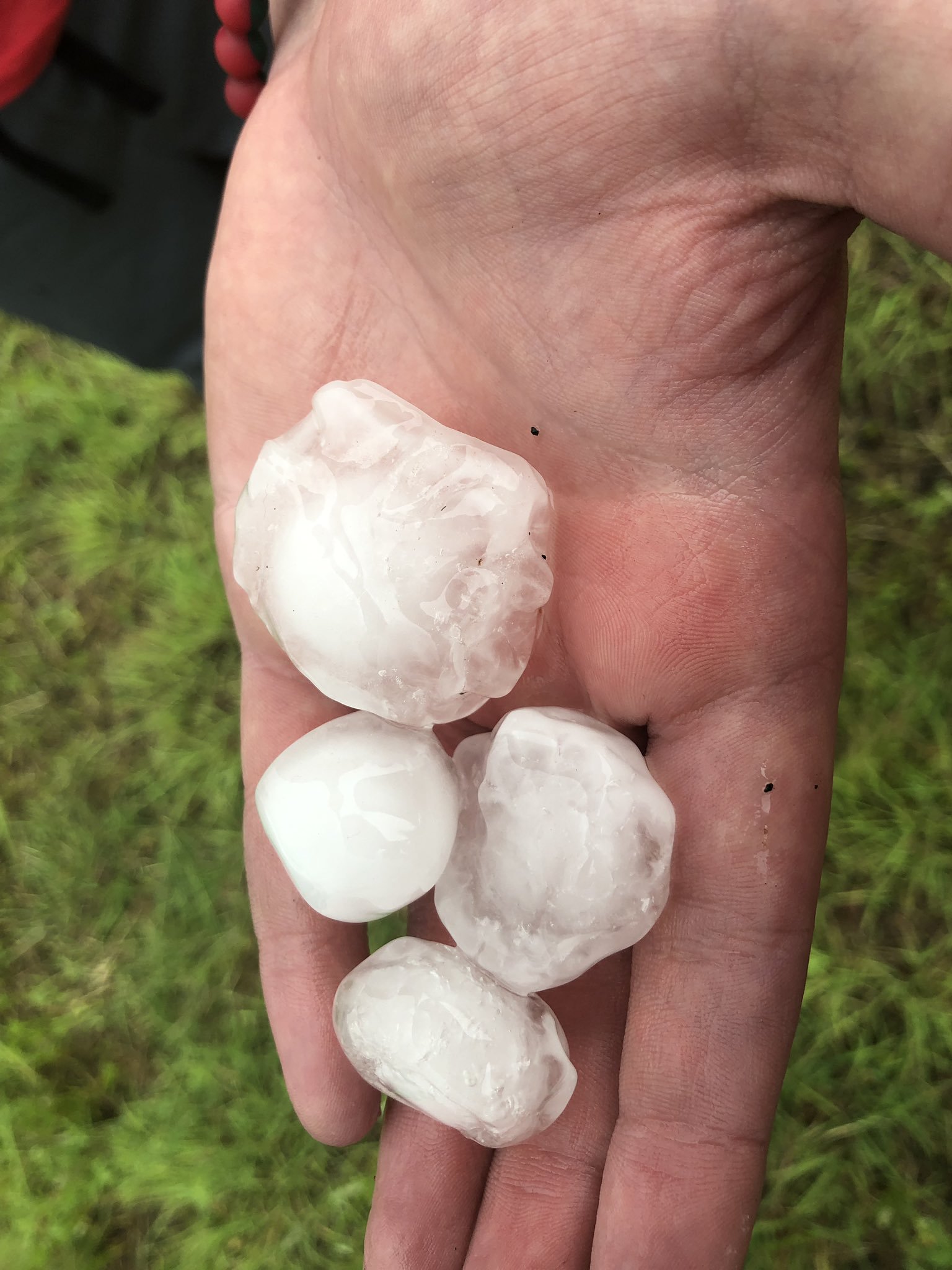
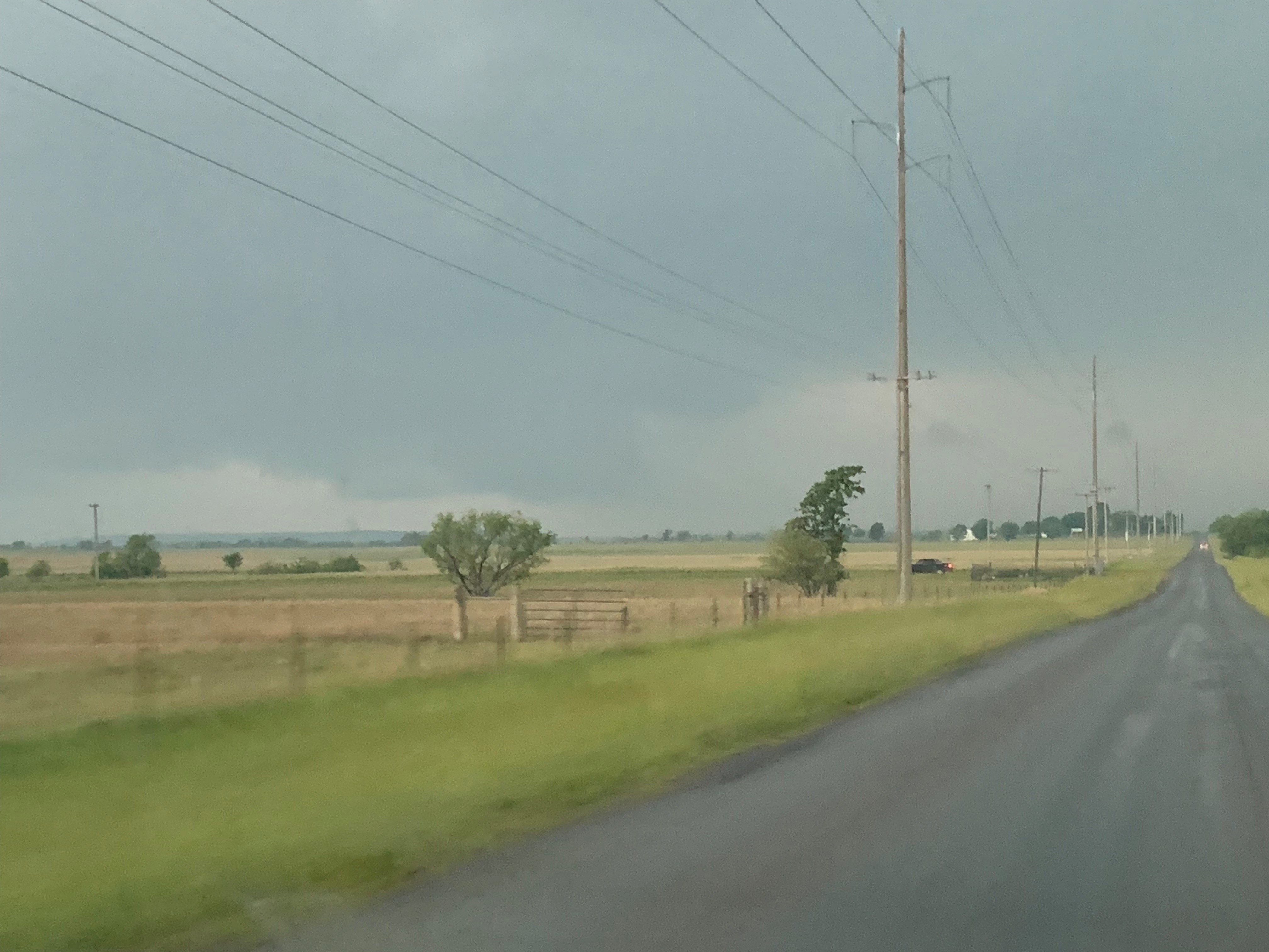
From there we quickly raced south towards Ramona Oklahoma where we saw our first storms of the day. We got caught by a strong hail core and the van was pelted with hail 2.5 inches in diameter. That is about the size of a tennis ball. Once we left that storm we headed further south east to catch a line of developing super cells in northern Oklahoma.

Tornado warned super cell moving into north eastern Oklahoma

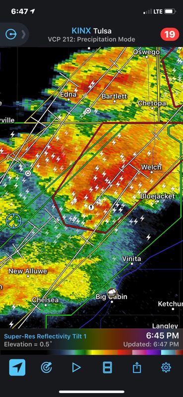
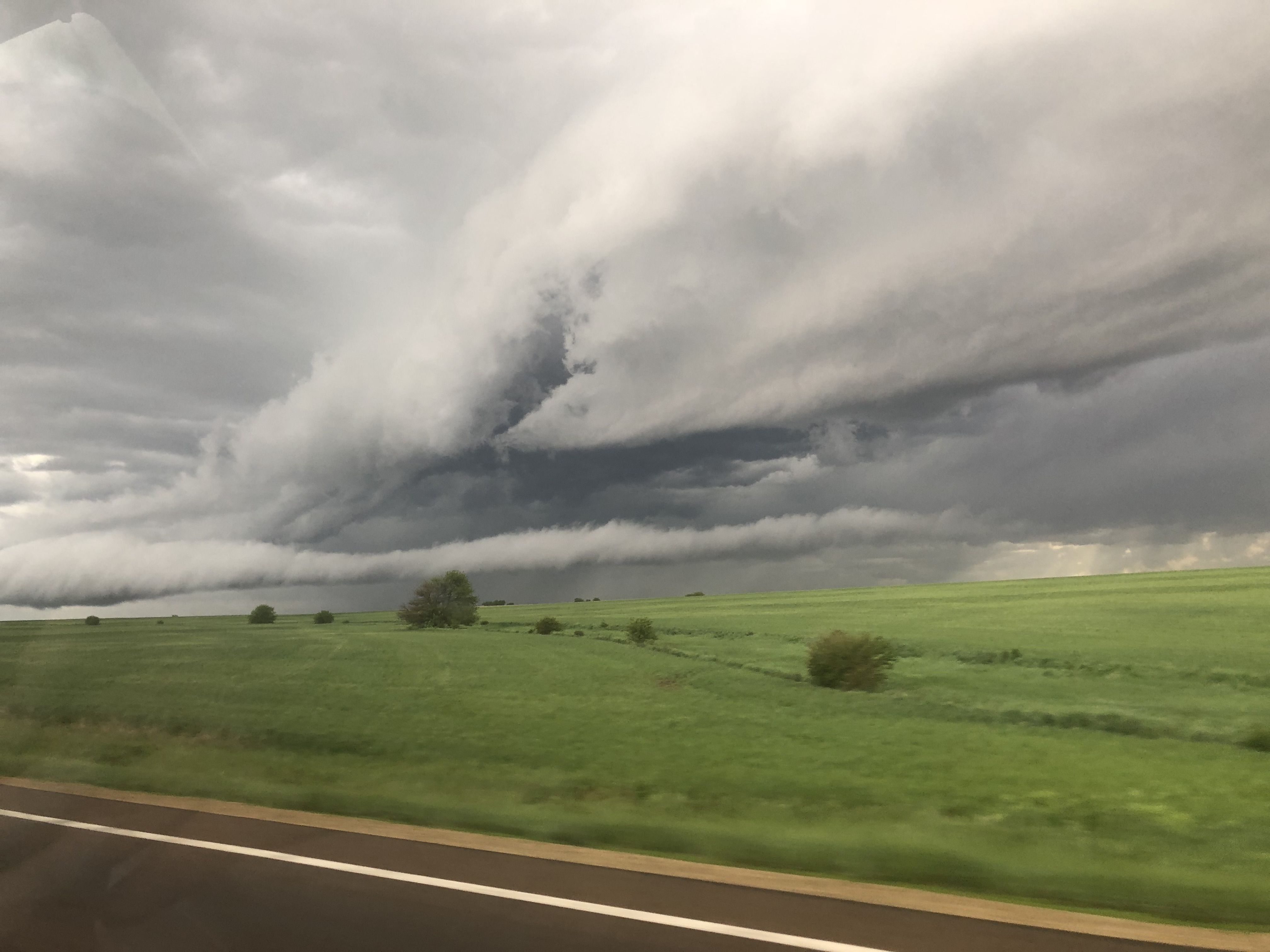
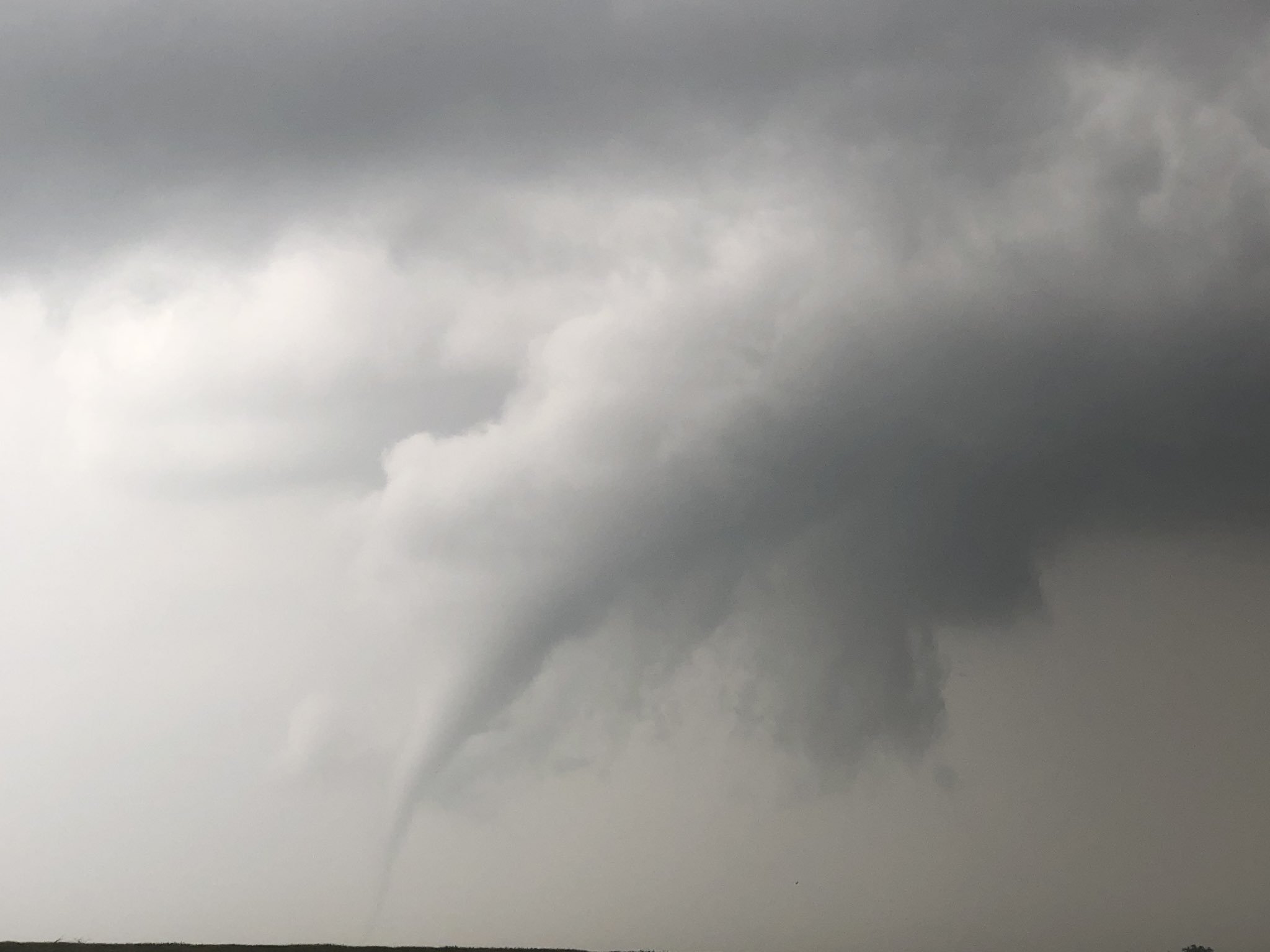
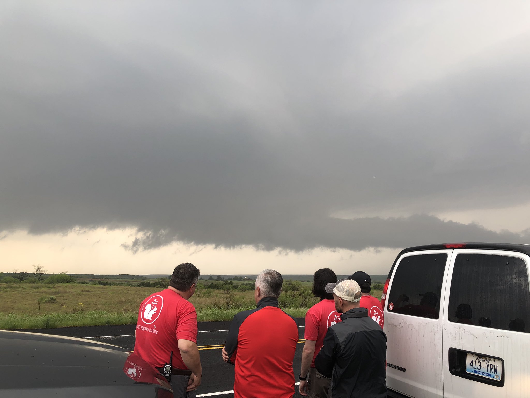
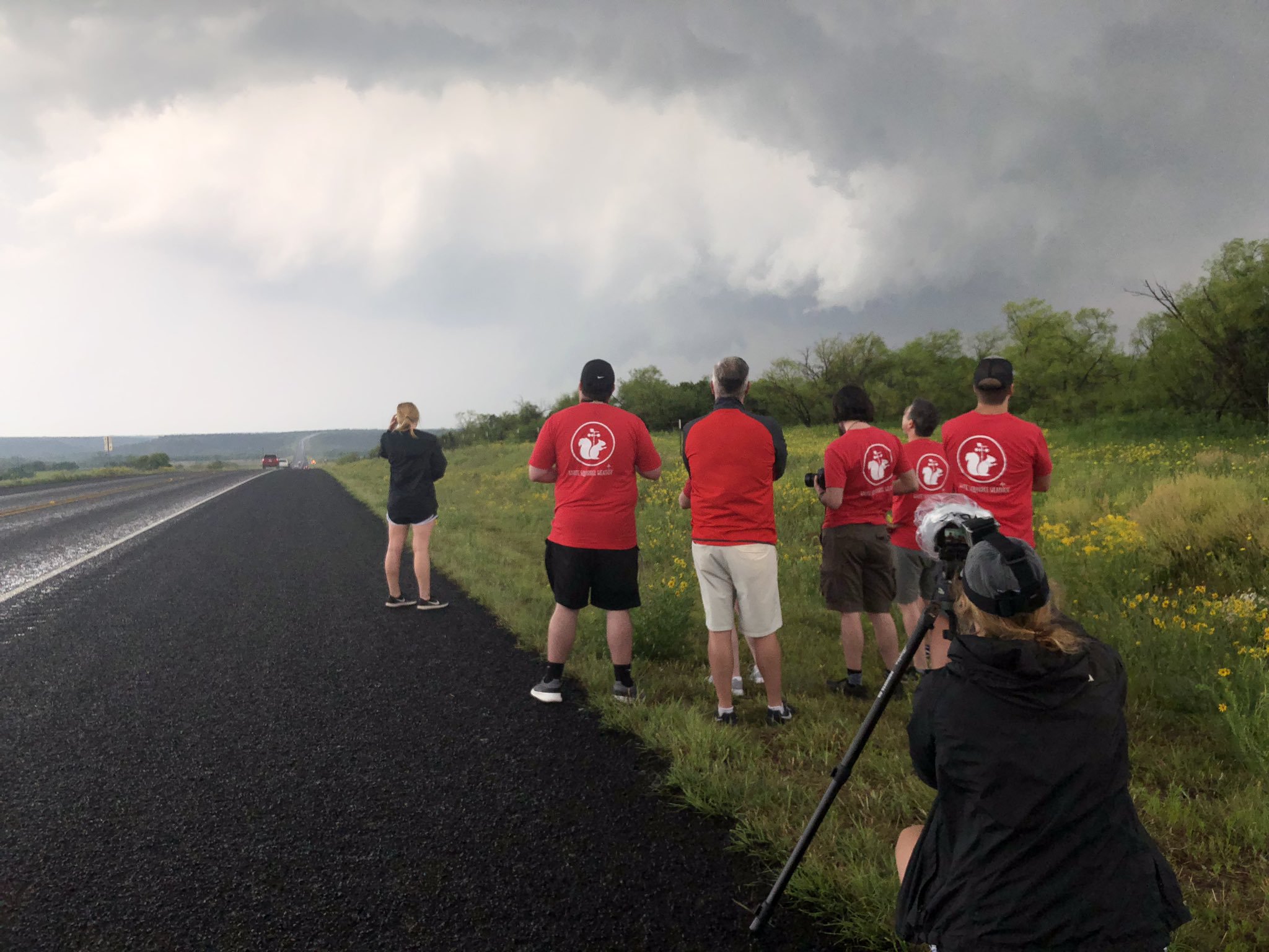
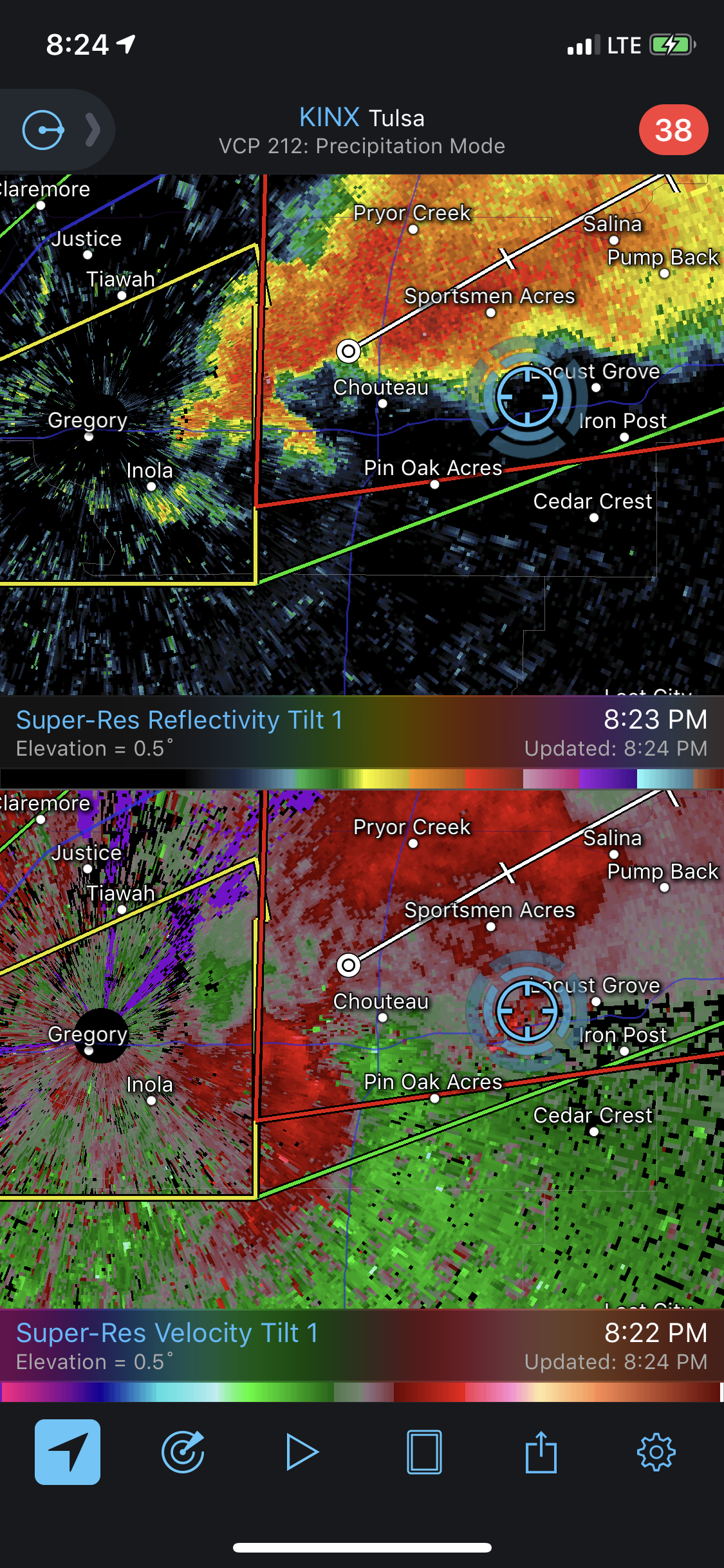
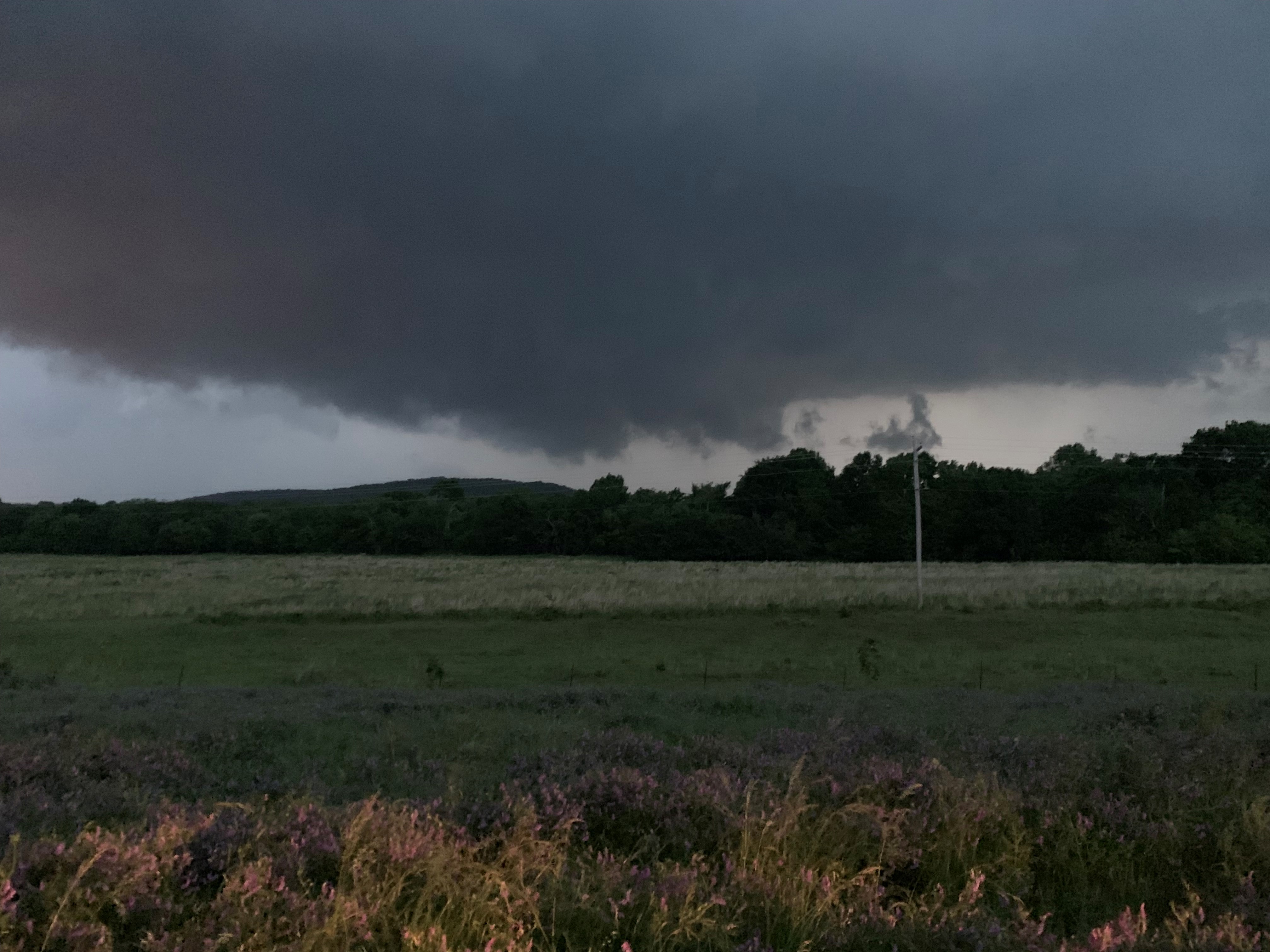
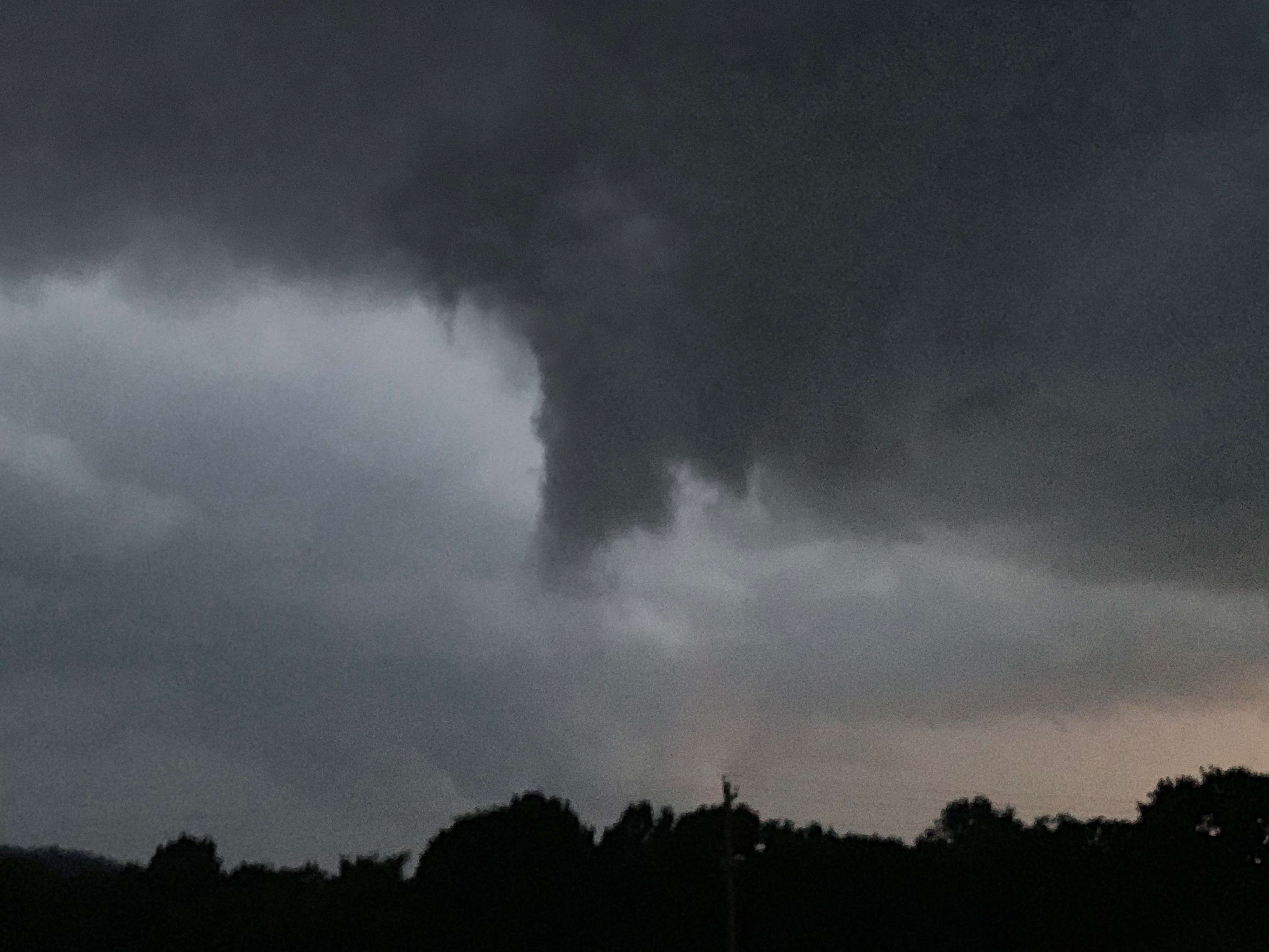
That storm was moving too quickly for us to keep up with it, and the decision was made to drop south in favor of a developing supercell north of Tulsa Oklahoma that was showing signs of rotation. We got pretty close to that storm, and we think there was a rain wrapped tornado hidden from view. We followed that storm all the way through to Chouteau Oklahoma where we watched it produce a low hanging wall cloud and an impressive funnel, but we never saw it produce a tornado.

Conclusion of day 4

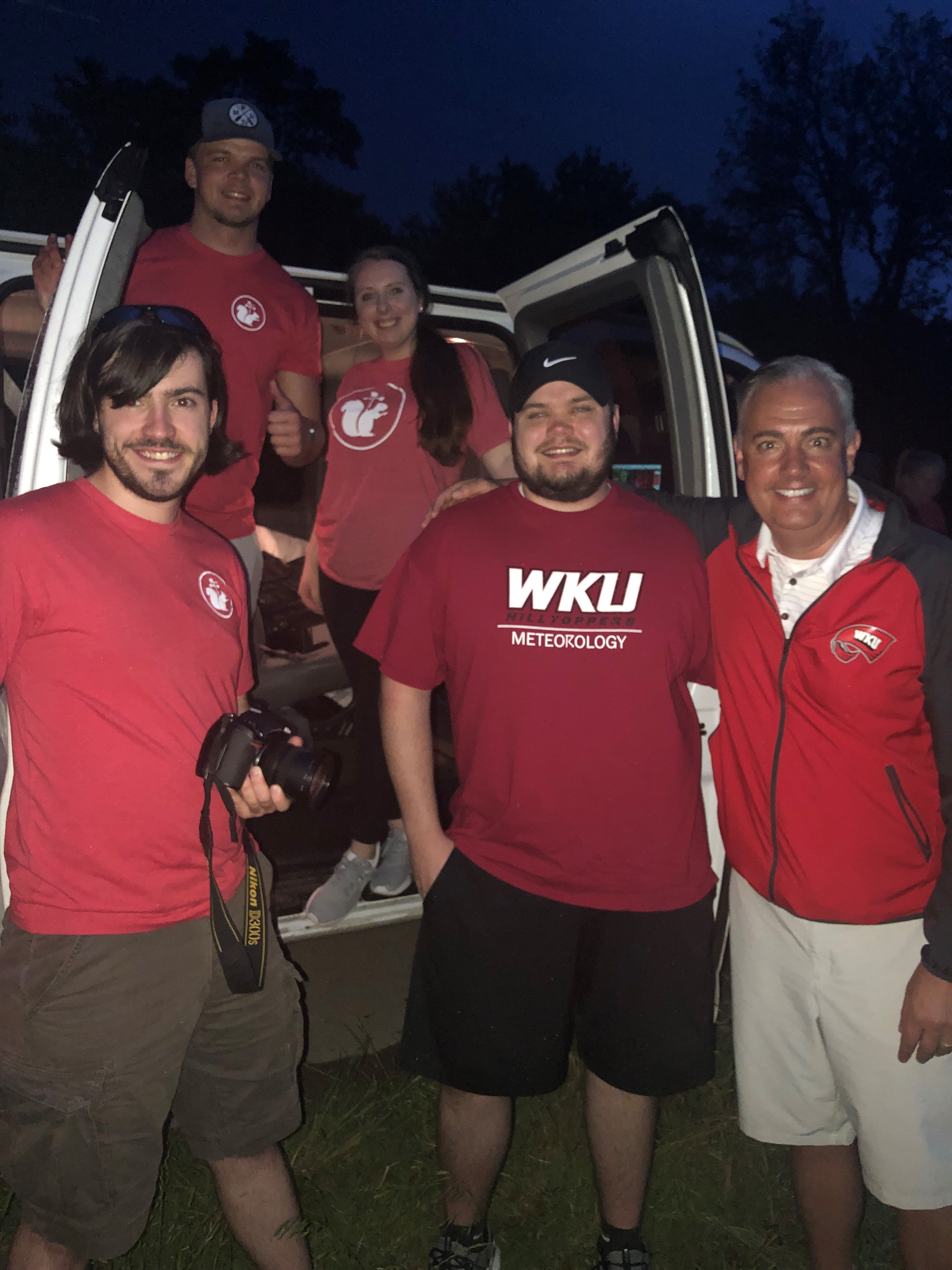
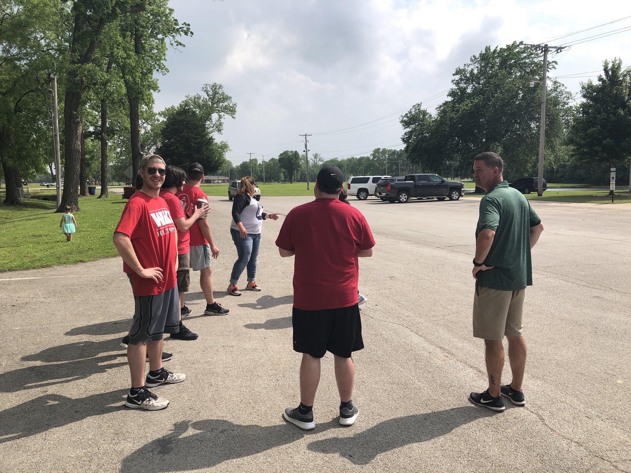
As our sunlight faded we watched the remainder of the Chouteau storm pass us by. We stood outside of our van talking with Dr. Caboni about the events of that day before heading north towards Claremore Oklahoma. We rolled into town and ate dinner at the Rib Crib before retiring to our hotel for the night.

Watching the storm roll by with Dr. Caboni!
Posted in Kentucky Weather | Tagged , , | Comments Off on WKU Storm Chase Day 4

WKU Storm Chase Day 3

Day 3 was another intense chasing day for the WKU storm chasers. The SPC Day 1 Convective Outlook highlighted much of Missouri and the northern half of Arkansas with an enhanced risk while much of Kansas remained under a slight risk. We chose to chase the storms in Kansas due to a good environment, less chasers, and to be in a better position for our upcoming chase days!

Atmospheric Setup

Thankfully, the atmosphere was not producing an environment as conducive for violent storms like it was on chase day 2. An extremely negatively tilted trough centered over the Central Plains positioned a jet streak over southeast Kansas and the northern part of Oklahoma. At the surface, the low pressure center stretched a warm front across northern Kansas and a trailing cold front down through central Kansas. The shear and convective available potential energy (CAPE) values along with a nosing area of moisture convergence along the warm front produced a conducive environment for severe weather across central and northern Kansas.

The Chase

We started our morning in Altus, OK with a forecast discussion with WKU President Dr. Caboni! Our forecast concluded with the decision to head straight north and be in south central Kansas by the time the cold front arrived.

Forecast discussion with Dr. Caboni!

We met Dr. Caboni for lunch at Taco Delight in Pratt, KS. Lunch was quickly over as towers started to go up on radar and the SPC issued a Mesoscale Discussion for that area. We headed northeast and chased our first storm into Sterling, KS where we eventually ran into issues with flooded roads that were impassable.

This RadarScope Reflectivity screenshot shows the team’s position (blue circle) at the bottom right corner of the severe thunderstorm warning.
Sterling, KS storm shot taken from inside the van!

So many roads were flooded that we had to turn around multiple times and find new routes. Bridges were closed, dirt roads were muddy, and the strong wind created waves across standing water in the fields.

We continued northeast and started tracking another cell that was headed into Salina, KS. We saw pea sized hail and interesting cloud formations as we concluded our chase in Randolph, KS.

Conclusion of the Day 3 Chase

After we finished chasing the last cell of the day in Randolph, KS we headed back south and stayed in Manhattan, KS for the night. We dropped our things off at the hotel and then walked downtown to have dinner at the Tallgrass Tap House. Former WKU meteorology professor Dr. Mahmood was in town and met up with us for dinner! We had a great chase day and can’t wait for the next!

Keep following our journey across the Great Plains! Live updates throughout the day are posted on our twitter (@wkustormchase). Thanks for checking in!

Posted in Kentucky Weather | Tagged , , | Comments Off on WKU Storm Chase Day 3

WKU Stormchase Day 2

Yesterday was a crazy day for the WKU Storm Chase Team! The threat for an intense severe weather outbreak was predicted well in advance, with an emphasis on the potential for large hail, damaging winds, and strong tornadoes. The Storm Prediction Center used this language to describe today: “tornado outbreak”, “long track violent tornadoes”, & “significant threat to life and property”.

Severe Weather Outlook for 05/20/19 (SPC)

SYNOPSIS & SETUP

The setup consisted of a large negatively-tilted trough that ejected out of the southwest and into the Southern Plains. An area of low pressure at the surface moved into southern KS with an accompanying warm front that extended eastward and a cold front and dry line that extended off to the southwest through KS and across western TX. To the south of the warm front and to the east of the cold front and dry line in the warm sector, very high values of CAPE (Convective Available Potential Energy) and wind shear dominated the area. The combination of these two variables made the environment within the warm sector conducive for the development of supercell thunderstorms.

BUSY DAY FOR WKU STORM CHASERS

The team woke up bright and early in Amarillo, TX and hit the road at 7:30 AM. The chase target that the team aimed for was located in the north-central Rolling Plains of Texas, along and to the south of the Red River Valley.

The team hit the road and headed west out of Amarillo on I-40, tracking a severe storm the developed off to the south of Amarillo during the morning hours.

Radar Image from RadarScope, the blue circle indicates where the team was located at that specific time. (WKU Storm Chasers)

After the storms moved northward, the team headed back to Amarillo for a coffee pitstop at Palace Coffee where we discussed the forecast for the day. On the road again, the team headed southeast towards Matador, TX where we had a little fun playing some catch with a football. While in Matador, TX, rapid development and intensification of thunderstorms began to initiate. The team quickly piled into the van and headed east towards Paducah, TX to intercept a tornado warned thunderstorm and meet up with WKU President Dr. Tim Caboni.

This photo of a skinny rope tornado was taken by Dr. Tim Caboni just outside of Paducah, TX.

The team continued northeastward to track and follow the same storm the produced the rope-like tornado. Along the way, we stopped on the side of the road to analyze/admire the severe thunderstorm and collected some of the hail that was produced.

WKU Storm Chasers and Dr. Tim Caboni analyzing the severe thunderstorm that dumped large hail just to the north of Paducah, TX. (WKU Storm Chasers)

The team continued onward, crossing the border into Oklahoma tracking another severe thunderstorm and then crossing the Red River back into Texas where severe thunderstorms produced a fantastic lightning show at sunset.

What a day the WKU Storm Chasers had!! We saw our first tornado while meeting up with Dr. Tim Caboni and a bunch of jaw-dropping severe thunderstorms that produced strong winds and large hail. We safely arrived in Altus, OK where we enjoyed dinner at Applebee’s!

Photo from WKU Storm Chasers

Please continue following our adventures across the Great Plains on Twitter @wkustormchase.

Posted in Kentucky Weather | Tagged , , | 1 Comment

10th Anniversary of 2009 Ice Storm

January 26th-28th marked the 10th anniversary of what Governor Steve Beshear described as the worst natural disaster in modern Kentucky history. This storm knocked out power for over 2 million people, caused dozens of deaths related to cars or improperly used generators, and closed schools a week or more in some places. It dropped between a 1/4″ to 2″ of ice over a span of hundreds of square miles and ended with snow accumulations upwards of 4-6 inches for already hard hit areas. Those located further north and not impacted as much by the ice saw snow accumulations of 10+ inches, such as in southern Indiana.

A few facts about the weather set-up/requirements for this storm:

There was sub-freezing air over the Midwest and Central plains for a couple days before the event. This primed the roads and power lines and most surfaces in general for ice accumulation. The cold air remained in place at the surface (between 29 and 33 degreees Fahrenheit for most places), while warm air began to move in around 5,000 feet above the surface. This warm air was associated with a stationary front from the South that stopped right around Central Tennessee. Because warm, moist air is less dense than cold air, it literally ran up and over the cold air at the surface. As the air mass is forced higher in the atmosphere, it expands and cools, the water vapor condenses on tiny particulates in the atmosphere, and eventually becomes to heavy to stay up there. This air between 700mb and 850mb was about 5 degrees Celsius (freezing in Celsius is at 0 degrees), thus the precipitation fell primarily as super-cooled rain. Even though it passed through about 5,000 feet of sub-freezing air, it didn’t have quite enough time to change over to sleet or snow. All it took was that frozen surface for it to immediately freeze on impact.


This surface map shows conditions at 6am/7am CST/EST. N. Arkansas, S. Missouri, and W. Kentucky were already being hit very hard by heavy ice accumulations at this point. -Courtesy WPC surface map archives

Here are some pictures provided by the National Weather Service in Louisville along with maps generated to show ice and snow accumulations throughout the state.


While not primarily snow or ice, high precipitation totals for Southern Kentucky caused flooding of smaller rivers.

Scotty Gore from Clarkson, KY

Tim Kiger from Leitchfield, Kentucky
Posted in Kentucky Weather | Comments Off on 10th Anniversary of 2009 Ice Storm

WKU Storm Chase

Most meteorologists become interested in studying the weather for one of two reasons: either they had a bad experience with weather and want to learn how to predict it and protect themselves in the future, or they saw a storm and fell in love with the majestic beauty that simultaneously produces destruction. I am personally the second type, which totally makes sense because I tend to live life on the edge. People like me stand outside and watch the storm roll in up to the point the it is basically on top of them…and sometimes we stay outside through the whole thing while telling others to take cover. It’s these same people that get hyped up about going on the Storm Chase class that Dr. Durkee and WKU offer during the first month of every summer. Let’s take a little look into what the school has to offer for those that live life on the edge!

What do they do: CHASE STORMS! But first, you have to forecast them. Students wake up bright and early in whatever place they landed the previous night and get together for a forecast discussion. This discussion is student led with a different person taking lead each morning. Students will use their forecasting skills to pick a few target areas and then narrow it down to the area with the best ingredients for severe weather as a team, under the watchful eye of Dr. Durkee of course. He tends to allow students to run much of the discussion, but he will take the van where he wants to if students have made an blatantly incorrect decision. Besides hoping to find storms, each trip is filled with lots of Subway for lunch and great local eats for dinner. By the end of a long day, students crash in their hotel rooms, sleep for 5-6 hours, and do it all again the next day. Expect to travel over 6,000 miles by the end of the trip (with Dr. Durkee doing 100% of the driving).

When: Students must carve out the first 4 weeks of their summer. This 2-week class is dependent on an ever changing variable, so don’t expect to know what 2-week period you will be going until late in the Spring semester.

Cost: Because it’s a class for 6 hours of course credit, it does cost quite a bit. For in-state students, each credit is about $450, but out-of-state students have to pay $1,100. This amounts to over $3,000 for in-state students and about $7,000 for out-of-state students once food and some other expenses are factored in.

Financial Aid: Don’t run away from that financial storm just yet, because students and organizations can get scholarships from the Student Government Association for trips and research experiences such as this if you write a good enough application. Dr. Durkee also goes out of his way to set-up fundraisers such as cookouts and donation programs to help reduce the hit on students’ bank accounts. While it does look like a lot (and it is), there are reasonable steps you can take to get yourself in that van and out to the Great Plains!

Quotes from the students:

“We were able to make our own decisions, and I feel that by having a class structured in such a way really allows for a growth in confidence that’s difficult to find anywhere else.” -Cait French, Class of 2018 and Storm Chase participant in 2018.

“Storm Chase really was a once in a lifetime experience….Storm Chase really helped me become a more accurate forecaster and helped with understanding concepts in the classroom as well.” -Carson Meredith, Class of 2019 and Storm Chase participant in 2018.

“Honestly,words can’t describe how excited I am to go on Storm Chase. These next two weeks…are going to be the best two weeks of my life!” -A very excited Luke Rodgers, Class of 2020 and upcoming Storm Chase participant who leaves this Saturday.

As noted in the quotes, it’s a nearly indispensable experience. But no matter how hopeful someone is when he/she signs up, anything can happen. Don’t let unmet expectations destroy your love for severe weather if you don’t get to chase a tornado, and don’t sign up a second time just because you got to see more than a dozen. Every trip is different, and the group dynamic will change from year to year. The selection process is also complex, so don’t hesitate to reach out to other meteorology schools or go with some friends! College of Dupage offers 4 10-day trips each year between April and June (June 13th-23rd still has 8 available spots!). Visit https://weather.cod.edu/chasing/index.php?load=chases# for more info. And if you want to avoid to lab fees and cost of credit hours, go with some friends for dirt cheap. Granted, you won’t have the expertise of a well-seasoned teacher to look to for guidance, but you can do things in a manner that is a little less structured (while still never neglecting to do it safely). No matter what option you choose, have fun and live life on the edge!

Posted in Kentucky Weather | Comments Off on WKU Storm Chase

Toasty!

Wow it is going to get warm over the next couple of days! That heat will be brought back down though as rain moves into the area tomorrow night. That rain looks to remain in the area until Sunday night.

Another thing to keep in mind is that winds will be higher tomorrow night and Thursday. Thursday could see gusts as high as 29 mph.

  • SUMMARY:
    • Tuesday:
      • High: 82
      • Low: 56
    • Wednesday:
      • High: 85
      • Low: 69
      • A 20% chance of showers will roll in in the later part of the night.
    • Thursday:
      • High: 76
      • Low: 62
      • Showers will fall throughout the day and night. Gusts could reach as high as 29 mph.

Good luck to everyone on their exams and stay safe going home!

Posted in Kentucky Weather | Comments Off on Toasty!

Sunny Skies Return

It was a pretty dreary weekend with a mix of clouds and rain from the system that has moved to our east. Overall, we picked up a few tenths of an inch of total rain Saturday and Sunday. Luckily for the start of the work week (and finals week for WKU students), it will be seasonal and pleasant! As a surface high sits over our region, we will have lots of sunshine today and Tuesday. Temperatures will also feel comfortable, as we will have high’s in the upper 70’s today and lower 80’s tomorrow.

Something we will be keeping an eye on is the severe weather threat coming later this week. The SPC has south-central Kentucky under a 15% chance of severe weather Thursday (7am) to Friday (7am). As the system evolves, we will have a better idea on what you can expect, so check back in with us over the next few days! Until then, enjoy these seasonal conditions.

FORECAST

Today (5/06): Mostly sunny
High: 78
Low: 57
Tonight: Partly cloudy

Tuesday (5/07): Mostly sunny
High: 83
Low: 60
Tuesday Night: Mostly cloudy overnight

Posted in Kentucky Weather | Comments Off on Sunny Skies Return

♫♪Stormy May Day♪♫

Good afternoon everyone! Boy has it been a toasty one out there! We will reach a high of 85° by later this afternoon. There will be some relief in site though depending on whether you like this heat or not! Just like AC/DC sang we’ll see a “rainy day, May day”!

Archived Surface Analysis
Surface map from the WPC


Right now we have that warm front dipping down into the northern part of the state. With that front there are some showers and storms that will come into the area later this week. Right now it looks like Wednesday night into Thursday morning will be when those showers and storms will arrive. Models are showing the western most part of the state getting some rain tomorrow. I think it will stay there if it comes over the state border at all. By Wednesday night though it looks like everything to the west will start shifting over. It looks to stay this way through Derby Day. Hopefully conditions won’t make it too difficult for anyone or any horse. We don’t want anyone getting hurt!

  • SUMMARY:
    • Tuesday:
      • High: 85
      • Low: 67
    • Wednesday:
      • High: 81
      • Low: 65
      • Rain and storm chances will increase into the evening.
    • Thursday:
      • High: 78
      • Low: 63
      • Storms and showers throughout the day.

Have a fun, safe week everyone!

Posted in Kentucky Weather | Comments Off on ♫♪Stormy May Day♪♫

Warm Start To The Week

Lots of warm air has begun funneling in today as a warm boundary has moved through. This will lead to warm air advection moving into south-central Kentucky, giving us high’s in the mid to upper 80’s over then next couple of days. This is the reason it has felt a bit breezy today. Winds expected to be between 10-15 with gusts up to 30 mph are possible. Luckily, much of the precipitation will be held off until later in the week, leaving us with a mix of clouds and a few patches of sun. As seen from GOES-16 visible satellite (below) clouds are beginning to move into our area from the west. A chance of light, short-lived showers, are possible this afternoon, but the chance is low given the relatively dry air sitting over our area.

Moving into tomorrow you can expect much of the same as today. Partly cloudy skies and above average temperatures. Stay cool if you plan to be outside for long periods of time, as we are getting a taste of some summer time heat in late April. Check out the 24-hour temperatures change for the US. Much warmer temperatures have moved into the region thanks to that front.

FORECAST

Today (4/29): Partly cloudy and breezy
High: 84
Low: 60
Tonight: Partly cloudy

Tuesday (4/30): Partly cloudy and warmer
High: 87
Low: 65
Tuesday Night: Mostly cloudy overnight

Posted in Kentucky Weather | Comments Off on Warm Start To The Week

The Cloudy Conclusion

Surface Observations (Source: College of DuPage)

A strong high pressure field over the Iowa-Wisconsin border will stop any chances for rain today, but it will remain cloudy. We are currently in the upper 50’s, and those temperatures will climb to the mid-upper 60’s by the end of the afternoon. We will see temperatures sink down to the upper 40’s and low 50’s overnight. The start to our last week of classes will be a cloudy one, though we get to see some peeks of sunshine occasionally. Highs for Monday will reach the low 70’s, and will sink to the upper 50’s overnight Tuesday.

Forecast:

Today: Cloudy, High: 68

Tonight: Mostly cloudy, Low: 53

Monday: Partly Cloudy; High: 71, Low: 57

Posted in Kentucky Weather | Comments Off on The Cloudy Conclusion