Storm Chase 2015 Day 6

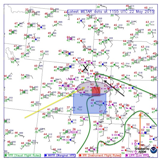
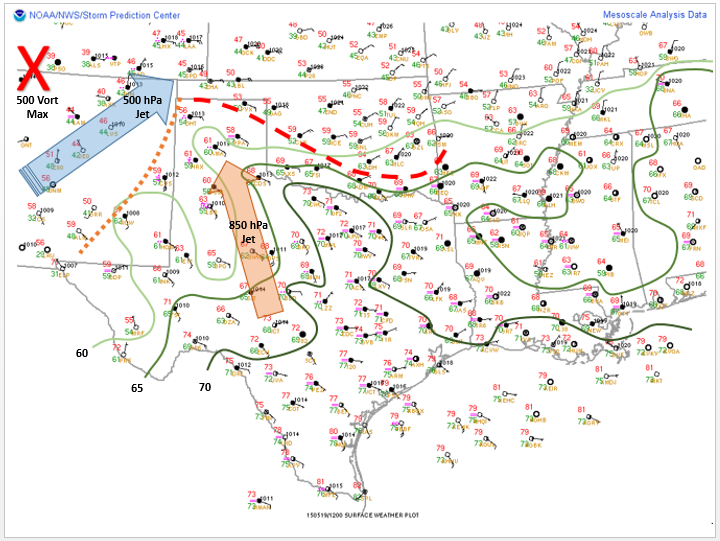
We began the day in Garden City, Kansas after chasing in southeastern Colorado. The surface analysis shows observations from the morning just before we left to chase and also model outputs for convection parameters. The 250mb jet(yellow arrow) is coming out of the south west, the 500mb jet(light green arrow) and 850mb jet(dark green) are primarily out of the south. The analysis also shows the local vorticity max(red circle) over south central Oklahoma/northern Texas. This overlapped with the local helicity max(light green circle) which, with a little help from the dry line(light orange dashed line) could potentially cause enough lift to produce storms over the target area(red box). Dew points started off in the mid to upper 50s and lower 60s across the area of interest. With the upper level winds lacking the essential profile needed for good sheering, the dry line was our key factor for the target.
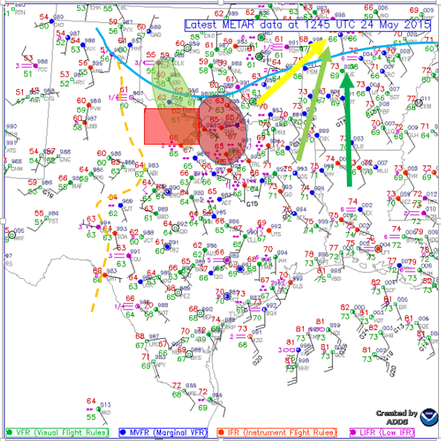
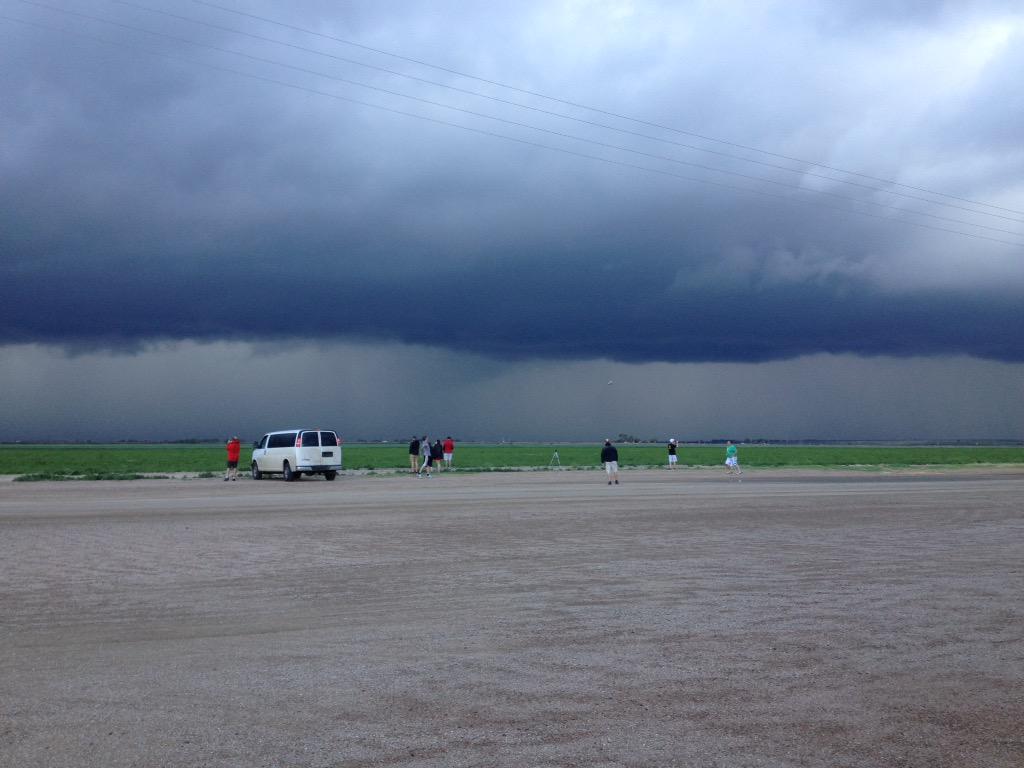
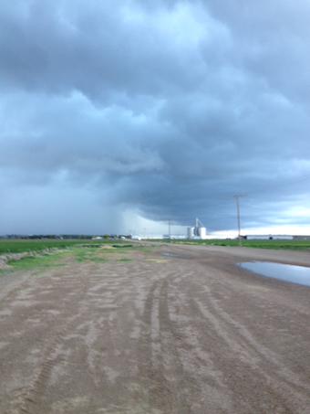
surfaceday6We departed Garden City, KS a little before 10am and were heading south towards Canadian, TX. We stopped in Hooker, OK where the group grabbed a bite to eat at the local Subway and gassed up. After heading more south towards the target we decided to stop and admire a wind farm outside of Borger, TX.

David Lipps Jr.

David Lipps Jr.

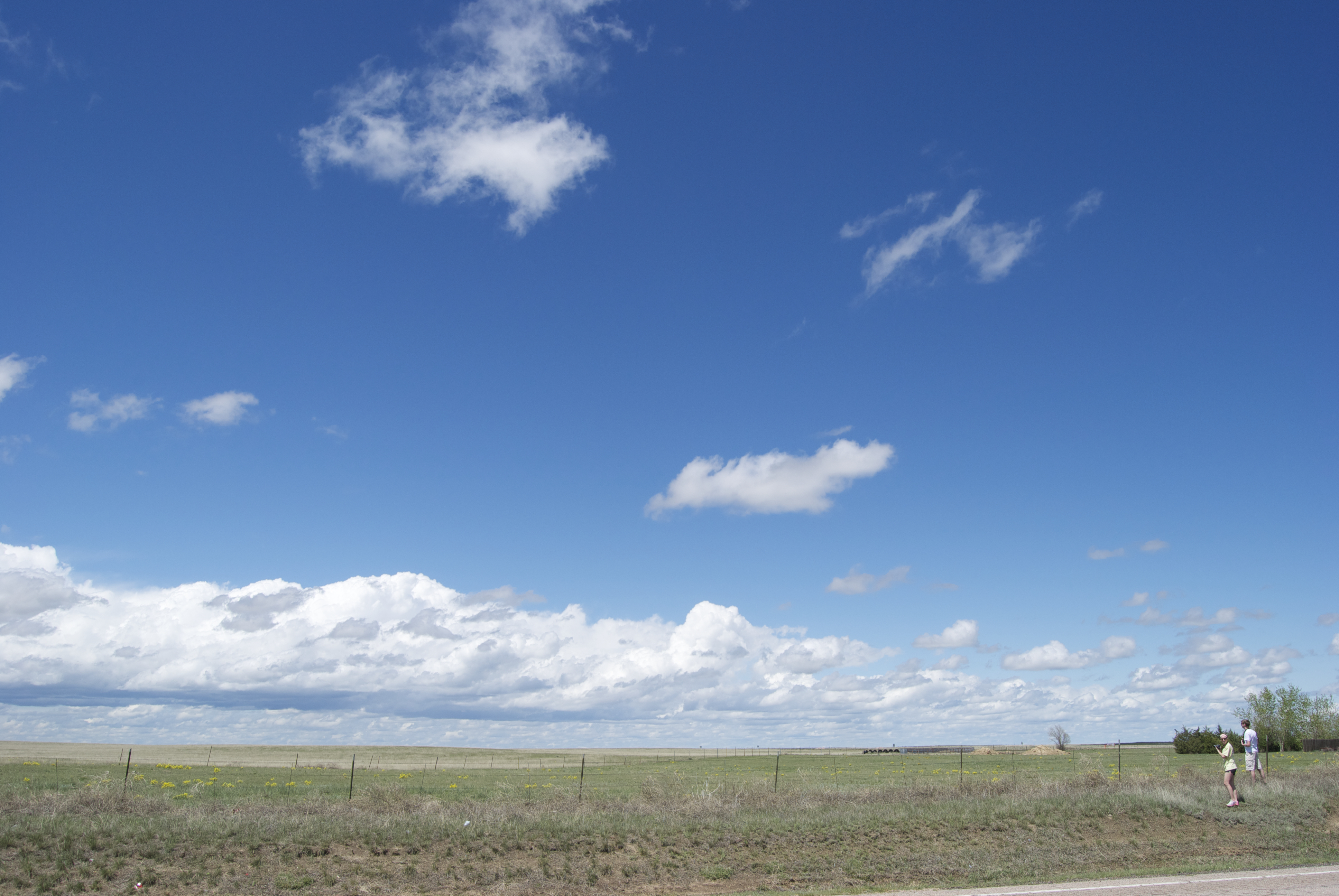
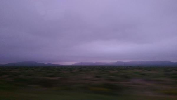
After about 20mins of observing them, we took off and continued to our target. Continuing the drive, we past a local landmark known as Palo Duro Canyon. We stopped in Silverton, TX to wait for the storms to initiate along the dry line. After tossing the football around for a bit and noticing nothing was really initiating we drifted more south to Turkey, TX. Here we sat for primarily the rest of the day waiting on initiation but due to lack of lift from the dry line, nothing was firing up. Blue skies dominated the area we were in other than a few passing clouds. Around 7pm, we made the decision that due to the lack of  lift we were going to head to our hotel located in Altus, OK, 110 miles away. We arrived at the hotel at 8:30pm.
Posted in Kentucky Weather | Comments Off on Storm Chase 2015 Day 6

Storm Chase 2015, Day 5

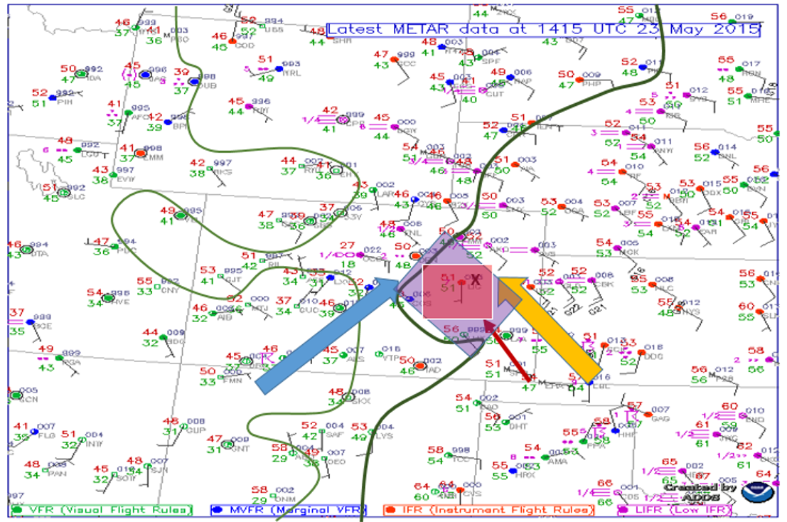
Today we started our chase day in Limon, CO after chasing in Southeast Colorado the day before. The surface analysis below displays observations of the mornings conditions before the chase, as well as the parameters that model output was giving for the afternoon. The Surface analysis displays current morning dew points (green lines), 250 mb flow (blue arrow), 850 mb flow (yellow arrow),  greatest area of instability (purple box), greatest quantity of vertical velocity (X), and our target itself, which was Lamar, CO (red box). 250 mb winds were setting stage for a greater amount of upper level support in our area which there has been a lack if in previous forecast days. With the combination of the 250 mb flow and the 850 mb flow, the directional change in height of the winds gave the atmosphere a sheered profile in Southeastern Colorado. The dew points reached the mid 50 degree marks which is enough moisture in the high plains to produce severe thunderstorms. The greatest amounts of instability and vertical velocity were also located in the Southeastern Colorado region. With the parameters mentioned above, and outlying boundaries left from morning convection, Lamar, CO was chosen as our target for the day.

d5sfc


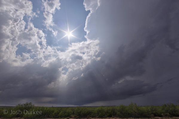
After sticking around the hotel in Limon, the group ate lunch on their own and left towards Lamar, CO around noon. Due to the lack of a capped environment, storm initiation was already occurring to the southwest of Limon. The group traveled south and closed in on a tornado warned storm just southwest of Arlington, CO. This storm had several reported funnels descend from a wall cloud, but none officially reached the ground.

CFt53-YUkAEgXaT

Josh Durkee

After the many instances of poor road networks the group decided to keep proceeding eastward ahead of the line of storms and get fuel in Lamar. After fueling up, we went south and let the line of storms hit our van, where we experienced a gust front, heavy rain and pea sized hail. After letting the line pass in front of us, the group followed the storm east and noticed smaller cells forming on the southern end of the line of storms. We stopped just west of Las Animas, CO and viewed the storm as well as threw around the football.

pZ9DjfNA

Melissa Moore

VeSfH9XS (1)

Melissa Moore

After watching the storms just before sunset, we drove about 120 miles east to our hotel for the night in Garden City, KS. But before going to bed, we enjoyed a fabulous supper at Las Margaritas, a Mexican restaurant in Garden City.


Posted in Kentucky Weather | Comments Off on Storm Chase 2015, Day 5

Storm Chase 2015, Day 4

Day 4 of the trip began in Guymon, OK after traveling from Alpine, TX the day before. Guymon put us about 6 hours away from the potential target areas.  The surface analysis below shows isodrosotherms (green), 500mb flow (yellow), 850mb flow (orange), greatest area of helicity (purple), greatest area of instability (blue), 500mb vortmax (black x), and forecasted target area in red. 500mb winds out of the southwest were forecast to assist in upper level support and this combined with 850mb winds, out of the southeast, generated part of shearing wind profile over eastern Colorado. Dew point temperatures reached only into the fifties, but due to high elevation, less moisture is necessary for severe weather development. The low dewpoints also assisted in keeping the storms LP (low precipitation). The greatest area of instability was in SE Colorado and the greatest helicity values were in eastern Colorado. These parameters along with the upsloping flow and mesoscale considerations along the front range of the Rockies resulted in Limon, CO being our target area.

SFC052215

After eating lunch at Oscar’s in Limon, CO, we drove south to Punkin Center to find a view for storm initiation (below). From this location we viewed multiple cells fire and dissipate after a few minutes. However, the blue skies and sunshine were a nice break from the foggy mornings of the past few days. Storms struggled to maintain so after a couple of hours we decided to head to Hugo, CO. From here we were able to monitor two potential areas of storm development. Both the HRRR and NAM-4k painted development near Limon around 21z. This didn’t pan out and we ended up playing a game of football pig at a local park.


Colton Lindsey

Colton Lindsey

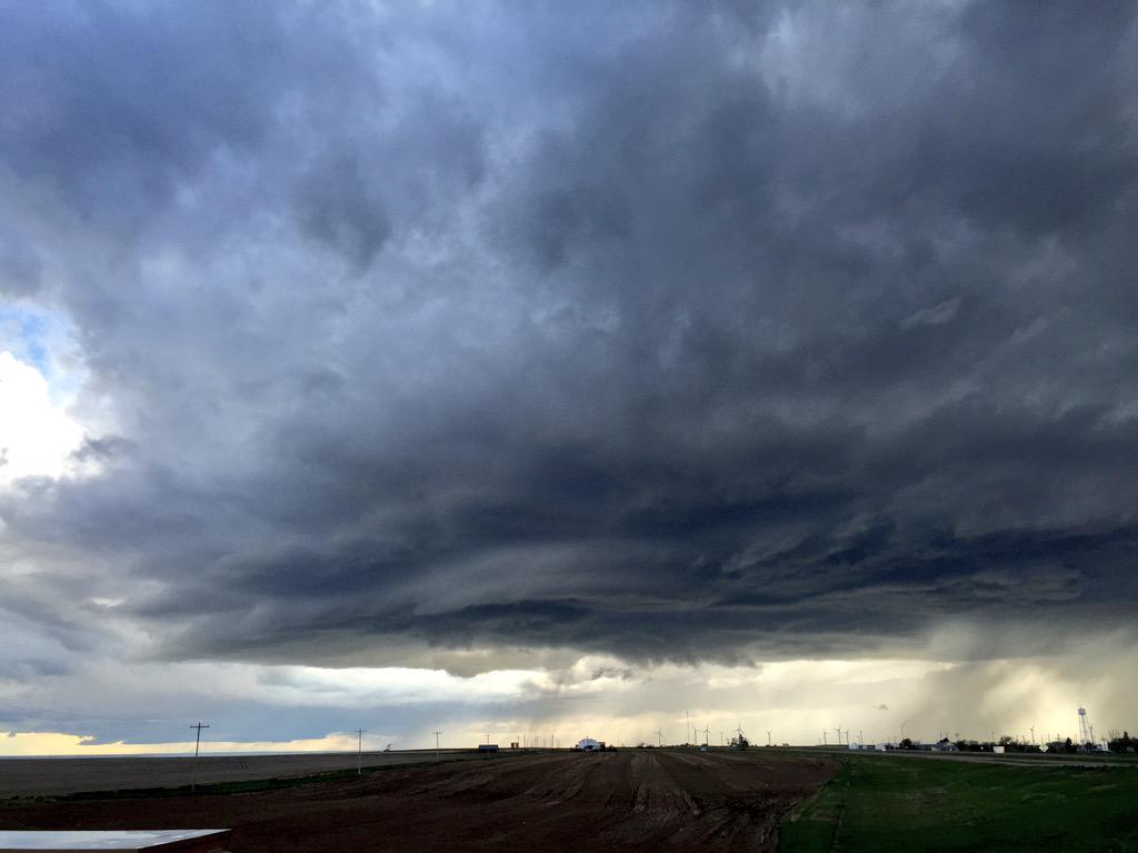
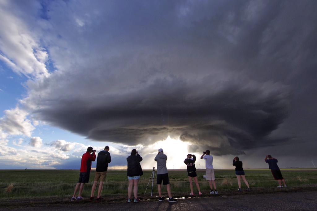
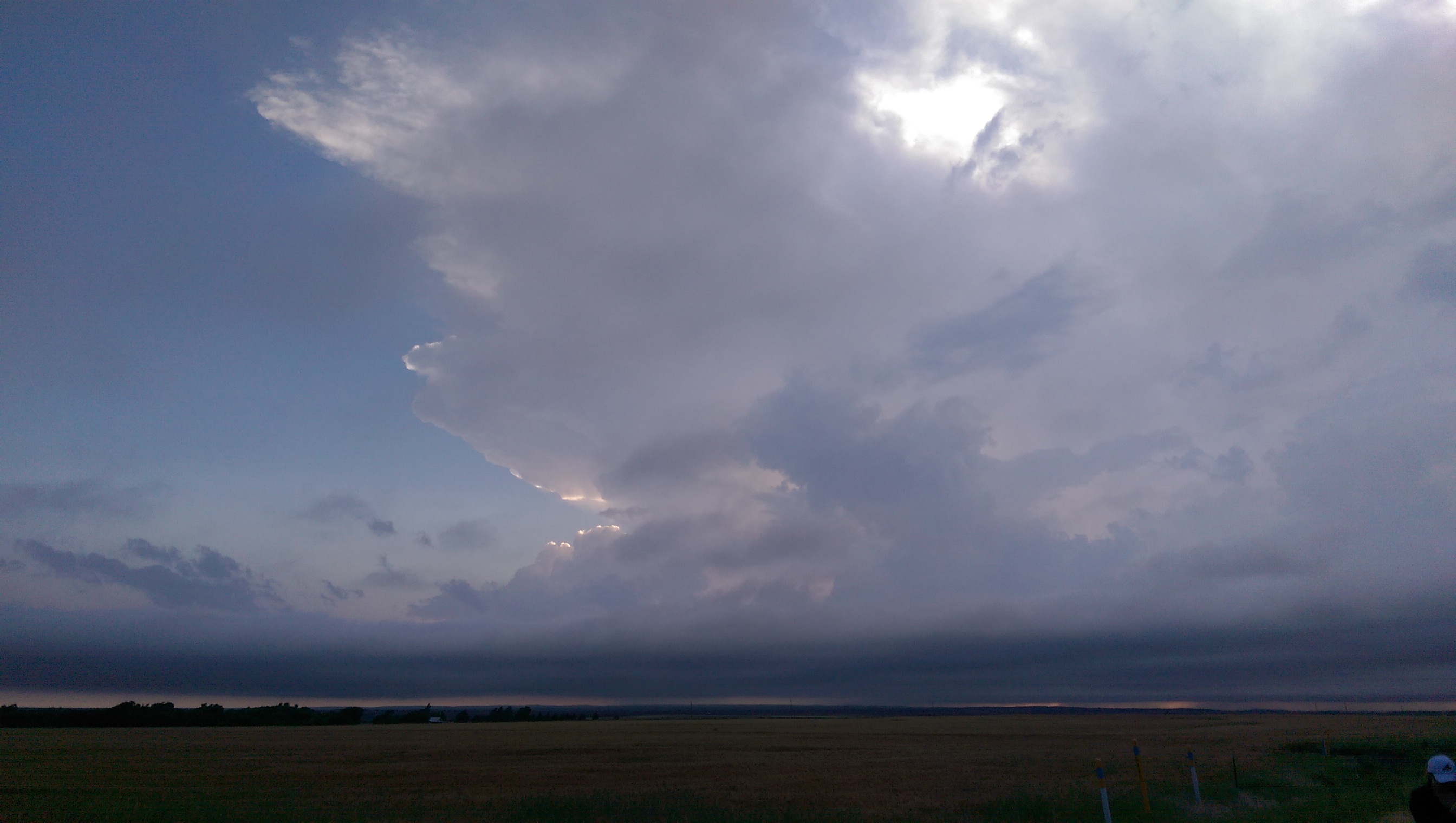
Around 6pm a cell was able to develop slight rotation so we decided to ditch the park and intercept it. Although the storm was not impressive on radar, it eventually produced some decent supercell structure. While chasing the storm we were able to stop and capture great images of it’s lifecycle.

Colton Lindsey

Colton Lindsey

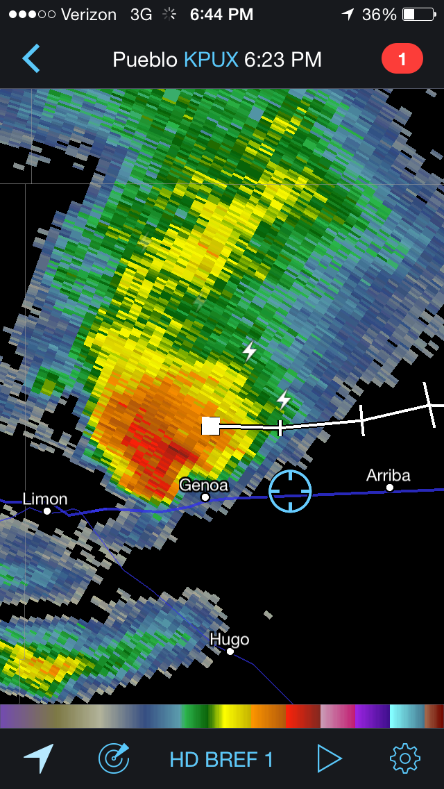
The radar image below shows our location relative to the picture above.

Radar screenshot by John Thomas

Radar screenshot by John Thomas


Josh Durkee

Josh Durkee

Colton Lindsey

Colton Lindsey

Jacob Wilkins

Jacob Wilkins

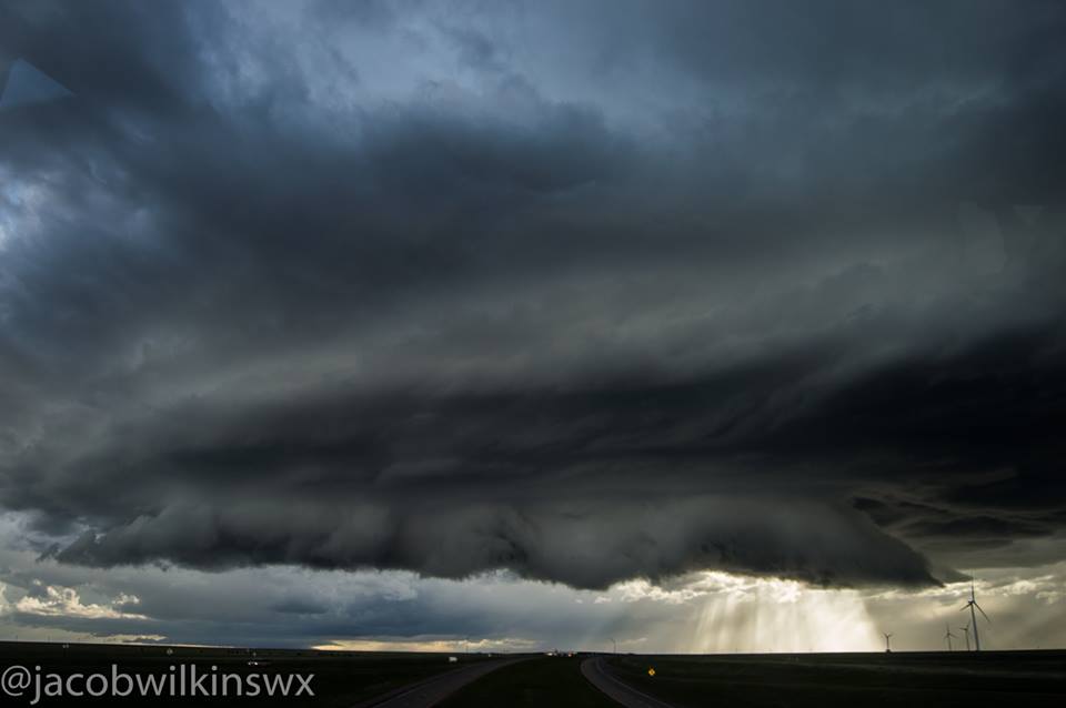
After this supercell began to dissipate we decided to leave it and head east to observe other cells. One of these being a low precipitation supercell, pictured below.

Jacob Wilkins

Jacob Wilkins

We attempted to grab a few lightning photos at dusk but strikes were sparse so we decided to head back to our hotel in Limon, CO to prepare for tomorrow.

Posted in Kentucky Weather | Comments Off on Storm Chase 2015, Day 4

Day 3 – Travel Day

Day 3 of our chase shaped up to be a transition day on the road as the frontal boundary responsible for the initiation of thunderstorms on our first two days continued on a persistent southward progression. Numerical weather models were having to play catch up it seemed.

Surface analysis valid for 1400 Z

Surface analysis valid for 1400 Z

As you can see in the surface map above, the frontal boundary location, (blue contour), sagged more south than expected, undercutting our chances for organized thunderstorm development in our location. We spent the night in Alpine, TX to be in position, which is close to the circled METAR (KMRF), but the atmosphere had different plans.

Thus, this morning we decided to travel northward to spend the night in Guymon, OK, which is in the Oklahoma panhandle. This move was to get us into position for Day 4 where an approaching shortwave trough, and other upper-air support, is expected to move into the region and support better chances of thunderstorm activity nearby.

The move also allowed for the opportunity to stick to WKU Storm Chase tradition and eat dinner at The Big Texan in Amarillo, TX! The food here was great, as usual I hear.

11351287_1453143411649758_85340545866753808_n

CFkevn0VAAAadzU


We could find ourselves moving northwest early in the morning into the High Plains of Colorado as models currently suggest some mesoscale features that could promote the initiation of thunderstorms. We’ll continue to monitor the important observation data in the morning and follow up with a forecast discussion. We’ll post our decisions on Twitter at @wkustormchase! Stay tuned! -Alex S.

Posted in Kentucky Weather | Tagged , | Comments Off on Day 3 – Travel Day

Storm Chase 2015, Day 2

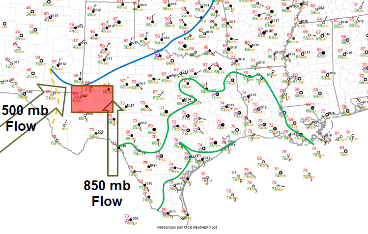
After a successful first day of chasing, during which we analyzed and documented one of two supercells in the panhandle of Texas, we stayed the night in Childress, TX to analyze data for Wednesday. We woke up Wednesday morning and determined we needed to move further south where a cold front was moving south, intersecting a dryline in southwest Texas. Below is the composite map based on 12z observations.

May 20, 2015 12z Composite Map

May 20, 2015 12z Composite Map

Flow aloft remained rather weak as mid level ridging was noted across the entire region. However, the cold front and dryline intersection was located in a moist and unstable atmosphere conducive for robust updrafts in thunderstorms. While the magnitude of the shear was not great, the directional wind shear in the low levels was conducive for multicell and supercell development.

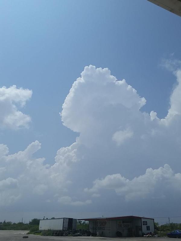
Cells trying to form over Fort Stockton, TXCells trying to form over Fort Stockton, TX

Cells trying to form over Fort Stockton, TX

Click the image below to view a time lapse of cells trying to form around Fort Stockton, TX between 3:15 PM and 4:10 PM. FtStocktonLoRes

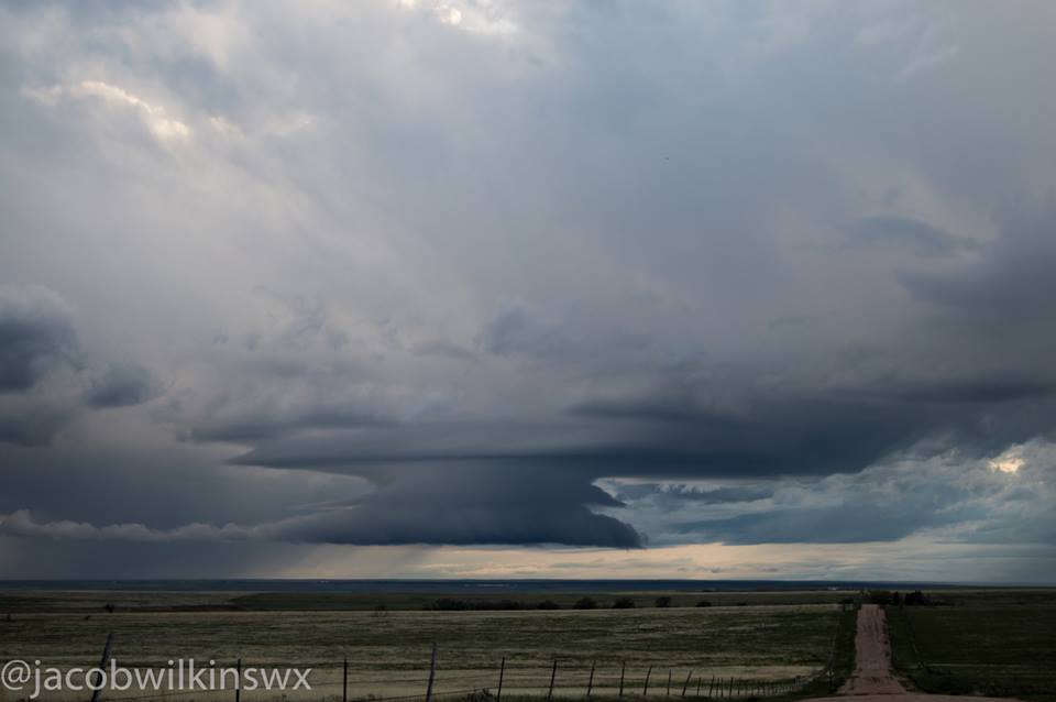
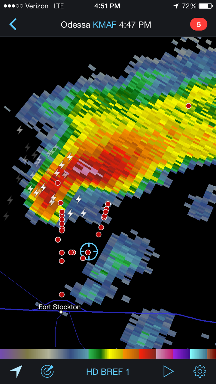
As we moved toward the region, cells began developing along the cold front, just as forecast. However, these cells quickly became elevated as the cold front cut underneath them. Thus, we headed further south toward Fort Stockton, TX to wait for initiation closer to the dryline and cold front intersection point. Shortly after 4 PM, we left Fort Stockton, TX in order to get a better view of a small, developing supercell. We got as close as 4 to 5 miles from the storm where the base and inflow were clearly visible.

KMAF Radar valid at 4:47 PM depicts a supercell north of Fort Stockton, TX

KMAF Radar valid at 4:47 PM depicts a supercell north of Fort Stockton, TX

Supercell north of Fort Stockton, TX

Supercell north of Fort Stockton, TX

Supercell north of Fort Stockton, TX

Supercell north of Fort Stockton, TX

As this storm got closer to our location we moved to the east to get in better position. However, by this time the storm began to grow, as well as lose some structure. A hail core remained stationary over I-10, limiting our progress to the east. Around 6 PM, we decided to drive southeast as the storm began to make a right turn. At this time a wall cloud was reported on the storm, however we could not see it due to precipitation in between us and the storm. We called the chase off shortly after and have staged for Thursday in Alpine, TX, which is at an elevation of around 4,500 feet.

Topography surrounding Alpine, TX

Topography surrounding Alpine, TX

Google Earth image of Alpine, TX

Google Earth image of Alpine, TX

Be sure to follow @wkustormchase on Twitter for more frequent updates about the 2015 Storm Chase!

Posted in Kentucky Weather | Comments Off on Storm Chase 2015, Day 2

Storm Chase 2015, Day 1

Our trip to the Great Plains began with a few road delays, but after 13 hours of persistent travelling we eventually reached our destination in Hays, KS. Nonetheless, our first objective of this trip was to pick up our friend and colleague Dr. Grady Dixon, who regularly accompanies Dr. Josh Durkee as an instructor for the class.

Miles and miles of wind mills throughout the Great Plains!

Miles and miles of wind mills throughout the Great Plains!

On the morning of May, 19th 2015, we departed Hays, KS and headed south. Model guidance and group forecast discussions led to general agreement to head towards the Texas panhandle where a target of Plainview, TX was established. A tricky forecast followed through as complicated mesoscale  variables, including positioning of surface boundaries and convective parameters that allowed little to no convective inhibition, led to storms forming to our east early on in our day. These storms tracked eastward into Oklahoma where the SPC had issued a tornado watch later on.

Surface analysis valid for 12Z 19 May 2015

Surface analysis valid for 12Z 19 May 2015

After departure, we passed through Dodge City, KS around 10 am, stopped for lunch at Subway, continued southward and were in the Oklahoma panhandle by noon. A quick 30 minutes later and we were in Texas and already having to make changes to our target destination. Storms and convection were ongoing throughout the morning and were very close to our track southward, this led to our decision to make a play farther east, attempting to get ahead of the storms moving into southwest Oklahoma.

After chasing these storms in the newly issued tornado watch area, we realized that the game of catch up would be much more effort for the reward and took a quick break in Childress, TX where we then waited for the dry line to initiate more storms to our west. You can see the dry line in surface analysis in the brown dashed line, this pushed eastward throughout the day and was the focus for storms throughout the evening.

Storms did eventually form south of Amarillo where we initially idealized early on in the day, so we headed back northwest to see whatever we could find, unfortunately complicated by persistent fog!

A nice organized severe thunderstorm NE of Plainview, TX

A nice organized severe thunderstorm NE of Plainview, TX

However, our efforts paid off as we were able to document some amazing storms throughout the evening as we traveled along to the southeast, back towards Childress, TX for the night.

A nice sunset and view of thunderstorms as we ended our evening and headed into Childress, TX for the night.

A nice sunset and view of thunderstorms as we ended our evening and headed into Childress, TX for the night.

Day 2 begins soon, we’re headed southward, stay tuned for more updates as we continue the 2015 WKU Storm Chase! Follow @wkustormchase on Twitter for live updates from the field! – Alex S.

Posted in Kentucky Weather | Tagged , , , , , | Comments Off on Storm Chase 2015, Day 1

Rain Makes a Return

Today: High – 74, Low – 52

It will be an active weather day for the southern plains, but mostly sunny skies and temperatures in the mid 70’s will dominate the Ohio Valley.

NWS Surface Map

NWS Surface Map

This active weather will begin to shift east toward the end of the week.

Thursday: High – 82, Low – 66

Thursday will start out partly sunny and warm. However, rain starts to move in during the late afternoon to early evening hours. By 6 pm, the NAM shows rain showers knocking on the door.

NAM Simulated Radar Reflectivity

NAM Simulated Radar Reflectivity

The rain should be light, but several more rounds of storms are expected throughout the weekend.

Friday: High – 80, Low – 68

Spring time thunderstorms make a return Friday. Nothing severe is expected, but pack an umbrella if heading outside as scattered storms will be present much of the day and into the evening.

These storms will be firing along and behind the warm front moving through the region early Friday morning. That is what will help us heat up near 80 degrees despite the cloud cover.

NWS Surface Map

NWS Surface Map


Weekly Outlook:

Today
Sunny, with a high near 74. Northeast wind around 7 mph.
Tonight
Mostly clear, with a low around 51. Northeast wind 3 to 5 mph.
Thursday
Partly sunny, with a high near 81. East wind 6 to 8 mph becoming south in the afternoon.
Thursday Night
A 20 percent chance of showers and thunderstorms. Mostly cloudy, with a low around 65. Calm wind becoming southeast 5 to 7 mph in the evening.
Friday
A 50 percent chance of showers and thunderstorms. Mostly cloudy, with a high near 80. South wind 7 to 13 mph. New rainfall amounts of less than a tenth of an inch, except higher amounts possible in thunderstorms.
Friday Night
A 40 percent chance of showers and thunderstorms. Mostly cloudy, with a low around 68.
Saturday
Showers and thunderstorms likely. Cloudy, with a high near 78. Chance of precipitation is 70%.
Saturday Night
A 20 percent chance of showers and thunderstorms. Mostly cloudy, with a low around 67.
Sunday
A 40 percent chance of showers and thunderstorms. Mostly cloudy, with a high near 83.
Sunday Night
A 50 percent chance of showers and thunderstorms. Mostly cloudy, with a low around 69.
Monday
Showers and thunderstorms likely. Mostly cloudy, with a high near 82. Chance of precipitation is 60%.
Monday Night
A 40 percent chance of showers and thunderstorms. Mostly cloudy, with a low around 62.
Tuesday
A 20 percent chance of showers and thunderstorms. Partly sunny, with a high near 78.


Posted in Kentucky Weather | Comments Off on Rain Makes a Return

A Storm Start to the Week

Sunday: High – 88, Low – 66

A few showers will move through the area this morning, so make sure to pack that umbrella if your heading out to church. These morning clouds will thin out this afternoon, allowing for a decent amount of sunshine to warm temperatures into the upper 80’s. It is going to be a sweat box outside as dew points are already in the mid 60’s.

The Low Pressure system to our west will move northeastward over the next day and the accompanying cold front will inch closer to the region. The severe storms will stay to our west for today, but an isolated shower can’t be ruled out.

NWS Surface Map for Today

NWS Surface Map for Today

Monday: High – 86, Low – 62

Severe storms are possible tomorrow. A Squall Line out ahead of the cold front will be approaching the area early tomorrow evening. The main threats will be gusty winds within the bowing segments of the line, however a small tornado or two can never be ruled out in these particular setups.

The SPC has placed our area in an Enhanced Slight risk for tomorrow.

SPC Day 2 Outlook

SPC Day 2 Outlook

The NAM 4 km brings the squall line through between 6 pm and 8 pm tomorrow evening.

NAM 4 km - via COD

NAM 4 km – via COD


Keep an eye on the weather tomorrow and stay up to date with the latest forecast.

Tuesday: High – 75, Low – 52

Tuesday will be quite nice with temperatures in the mid 70’s and sunny skies. It should feel quite nice after this week of hot and humid temperatures.

Weekly Outlook:

Today
Isolated showers and thunderstorms before noon. Partly sunny, with a high near 87. South wind 6 to 9 mph. Chance of precipitation is 20%.
Tonight
Isolated showers and thunderstorms after 4am. Mostly cloudy, with a low around 67. South wind 3 to 6 mph. Chance of precipitation is 20%.
Monday
Showers and thunderstorms likely, mainly after 11am. Mostly cloudy, with a high near 85. South wind 5 to 14 mph. Chance of precipitation is 70%. New rainfall amounts between a tenth and quarter of an inch, except higher amounts possible in thunderstorms.
Monday Night
A 20 percent chance of showers and thunderstorms before 1am. Partly cloudy, with a low around 60. Southwest wind 5 to 10 mph.
Tuesday
Sunny, with a high near 75. West wind 6 to 10 mph.
Tuesday Night
Partly cloudy, with a low around 51.
Wednesday
Mostly sunny, with a high near 72.
Wednesday Night
Partly cloudy, with a low around 52.
Thursday
Partly sunny, with a high near 77.
Thursday Night
A 20 percent chance of showers and thunderstorms. Mostly cloudy, with a low around 58.
Friday
A 50 percent chance of showers and thunderstorms. Cloudy, with a high near 76.
Friday Night
A 40 percent chance of showers and thunderstorms. Cloudy, with a low around 60.
Saturday
A 40 percent chance of showers and thunderstorms. Mostly cloudy, with a high near 80.
Posted in Kentucky Weather | Comments Off on A Storm Start to the Week

Sunny Ending to the Week

Summer has started to make its return in the beautiful Bluegrass state with the spread of 80 degree temperatures all across the Commonwealth. Currently in Bowling Green, the temperature is a warm 85 degrees with an occasional breeze.

Untitled

Photo courtesy of the KY Mesonet.

The sun and warmth will be staying throughout the end of the week into the weekend, with isolated storm chances increasing as the weekend progresses. High pressure will bring an abundance of sun, as well as temperatures close to the 90 degree mark on  today and Friday. With the exit of high pressure,  A cold front stationed to our west will slowly close in on  the region Sunday night into Monday, bringing increased storm chances along with it. No organized severe weather is expected to occur this weekend with the isolated storm chances.

92f_init_2015050712

5 Day Forecast

Thursday Night: Clear and Calm. Low of 63.

Friday: Sunny, High near 88.

Friday Night: Party cloudy, Low near 65.

Saturday: Mostly sunny, with a chance of isolated thunderstorms. High near 89. Chance of rain 30%.

Saturday Night: Mostly cloudy, Low near 66.

Sunday: Partly sunny, with a chance of thunderstorms. High near 85. Chance of rain 40%.

Sunday Night: Chance of showers and thunderstorms. Low near 66. Chance of rain 30%.

Monday: Showers and thunderstorms, high near 80. Chance of rain 50%.

Posted in Kentucky Weather | Comments Off on Sunny Ending to the Week

Temperatures on the rise this weekend

Today is the first day of May and with it a temporary relief from “April Showers”. Bowling Green is currently 64 degrees and sunny according to the Kentucky Mesonet. Current satellite shows clear skies across most of the state. We expect to reach a high of 70 today. We have had ample amount of sunshine this week with some brief scattered showers yesterday. This weekend will be similar with an upper-level ridge and surface high pressure system in place allowing for southerly flow and sunshine.

blog1

Daytime temperatures will rise to the upper 70s this weekend and will continue to rise into the 80s for the majority of next week. Both Saturday and Sunday will be beautiful days for outdoor activities. The NAM Surface Temperatures for Sunday afternoon shows wide-spread warm weather for the area.

blog 2

Definitely enjoy this beautiful start to May and have a wonderful weekend!

Bowling Green’s 5 Day Forecast:

Today: Mostly sunny, with a high near 70. North wind around 8 mph.
Tonight: Patchy fog after 5am. Otherwise, mostly clear, with a low around 47. North wind around 5 mph becoming calm in the evening.
Saturday: Patchy fog before 8am. Otherwise, mostly sunny, with a high near 75. Calm wind becoming west around 5 mph.
Saturday Night: Partly cloudy, with a low around 52. Light and variable wind.
Sunday: Mostly sunny, with a high near 79. South wind 3 to 7 mph.
Sunday Night: Partly cloudy, with a low around 56.
Monday: Mostly sunny, with a high near 79.
Monday Night: Partly cloudy, with a low around 58.
Tuesday: Mostly sunny, with a high near 81.
Tuesday Night: Partly cloudy, with a low around 58.


Posted in Kentucky Weather | Comments Off on Temperatures on the rise this weekend