The last couple of days have been incredible weather-wise. The early part of last week was warm and humid making it feel very uncomfortable. Behind the front which passed through Thursday afternoon MUCH cooler and drier air moved in. In fact if you look at the average of last weeks highs before the front and after the front you clearly see a noticeable difference.
At the Bowling Green – Warren County Regional Airport
Avg High Sunday – Thursday: 89.4 | Avg High Friday – Sunday: 76.0
Avg Low Sunday – Thursday: 68.2 | Avg Low Friday – Sunday: 50.3
The difference in the average highs is over 13 degrees while the difference in the average lows is nearly 18 degrees! Lows dropped into the mid to upper 40s Saturday morning in nearly all of south-central Kentucky and highs only made it to the low to mid 70s. So is summer weather over for good? Well, of course this depends on your definition of summer like weather. If we consider this 90 degree temperatures then yes it certainly is possible. On average the last 90 degree day in Bowling Green occurs on September 9th; last year it occurred Sept. 7th. There is some hesitation whether we have hit our last 90 degree day already this year. This is because there will likely be a few close calls in the next couple weeks, including one later this week. Our pattern expected through late next week (based on long-range models which should be taken with a grain of salt) bring in a couple of trough/ridge sequences. With that said, often times an upper-level ridge is associated with warm weather. Such a ridge will be working its way over the mid-south later this week and long ranges forecasts suggest this possibly occurring again next week as well.

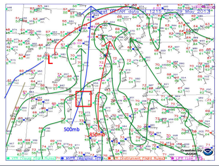
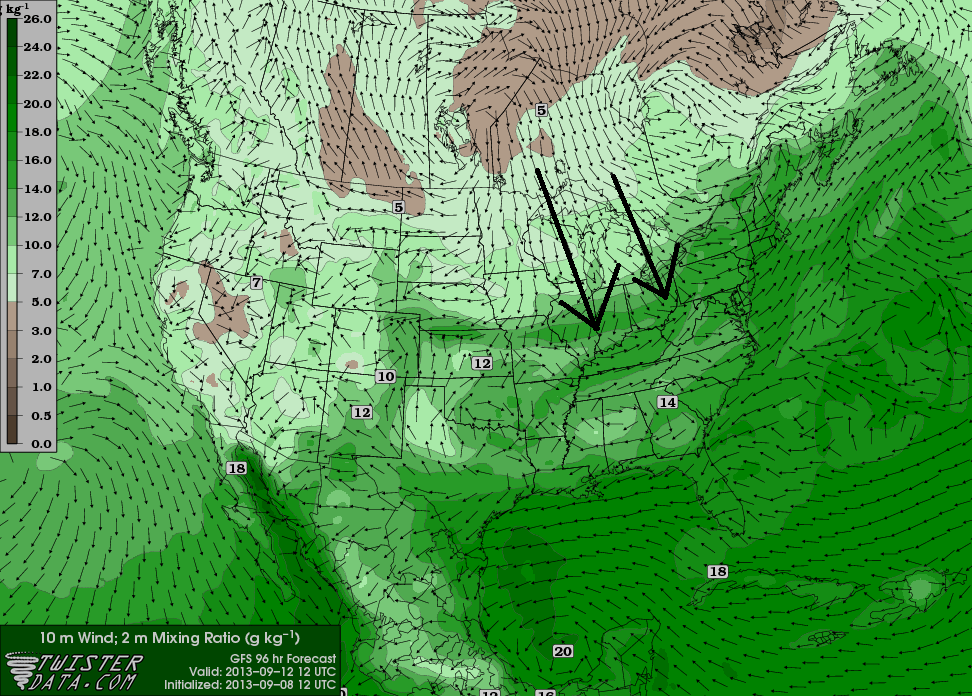
Forecast upper-levels for late this week and mid-week next week. The zig-zag line indicates the axis of the forecast ridges. A ridge is often associated with warm temperatures at the surface. Could we hit the 90 degree mark during these ridges?
What does this mean for the weather this week? By the end of the week it means we will be warming back to above average temperatures (Avg High is 82). This trend will get off to a slow start however thanks to a couple small disturbances during the first half of the week. First, a weak front will push through the Bluegrass State early Monday morning. The front will not bring in more cool air but the clouds will prevent temperatures from getting any warmer than they were today (Sunday). The front will not bring a substantial chance for rain either. Nevertheless do not be surprised if there are a few showers around to start your work week; showers will generally be light. Overall the day will be cloudy to mostly cloudy. By Tuesday the front will push south of Kentucky allowing for partly cloudy skies but by Tuesday Night into Wednesday another weak disturbance moves into the Ohio Valley thus creating the chance for some showers and possibly a storm. The chance for a shower/storm will continue into Wednesday evening and Thursday morning before conditions begin to clear by Thursday afternoon. The warmest day appears as though it will be Friday ahead of the next frontal boundary. On Friday some locations could flirt with the 90 degree mark (thus the hesitation on saying summer is over!).

Forecast valid for midday Wednesday indicates showers and thunderstorms (shades of green circled by the red oval) over the midsouth.
Daily Forecasts:
Monday: 30% chance of showers with mostly cloudy to cloudy skies. Morning low near 61 and a high around 80. Light ENE winds less than 8 mph.
Monday Night: Mostly cloudy skies will become partly cloudy to even mostly clear at times. Very light winds will be out of the ENE. Some patchy fog is possible early Tuesday morning. Low near 59.
Tuesday: Partly cloudy skies with a high near 82. Easterly winds generally less than 8 mph.
Tuesday Night: Increasing clouds becoming mostly cloudy by midnight. 30% chance of a shower after midnight with light southerly winds generally less than 8 mph. Low around 66.
Wednesday: Mostly cloudy to cloudy skies with a 40% chance of showers/thunderstorms. High near 81.
Wednesday Night: Mostly cloudy to cloudy skies with a 30% chance of showers/thunderstorms. Low around 67.
Thursday: Mostly cloudy with a 30% chance of showers/storms to start the day with some clearing into the afternoon hours. High near 85.


 It has been a wet August for most of Kentucky, which is quite the contrast to this time last year. Here’s a look at the monthly rainfall across the state.