Field Methods– Day 3 Recap

By: Nathaniel Shearer

Each day has continued to set the bar for the next as we chase storm after storm erupting within the plains. Today we got a real taste of the power associated with these storms as well as the structure that can come with a select few of them.

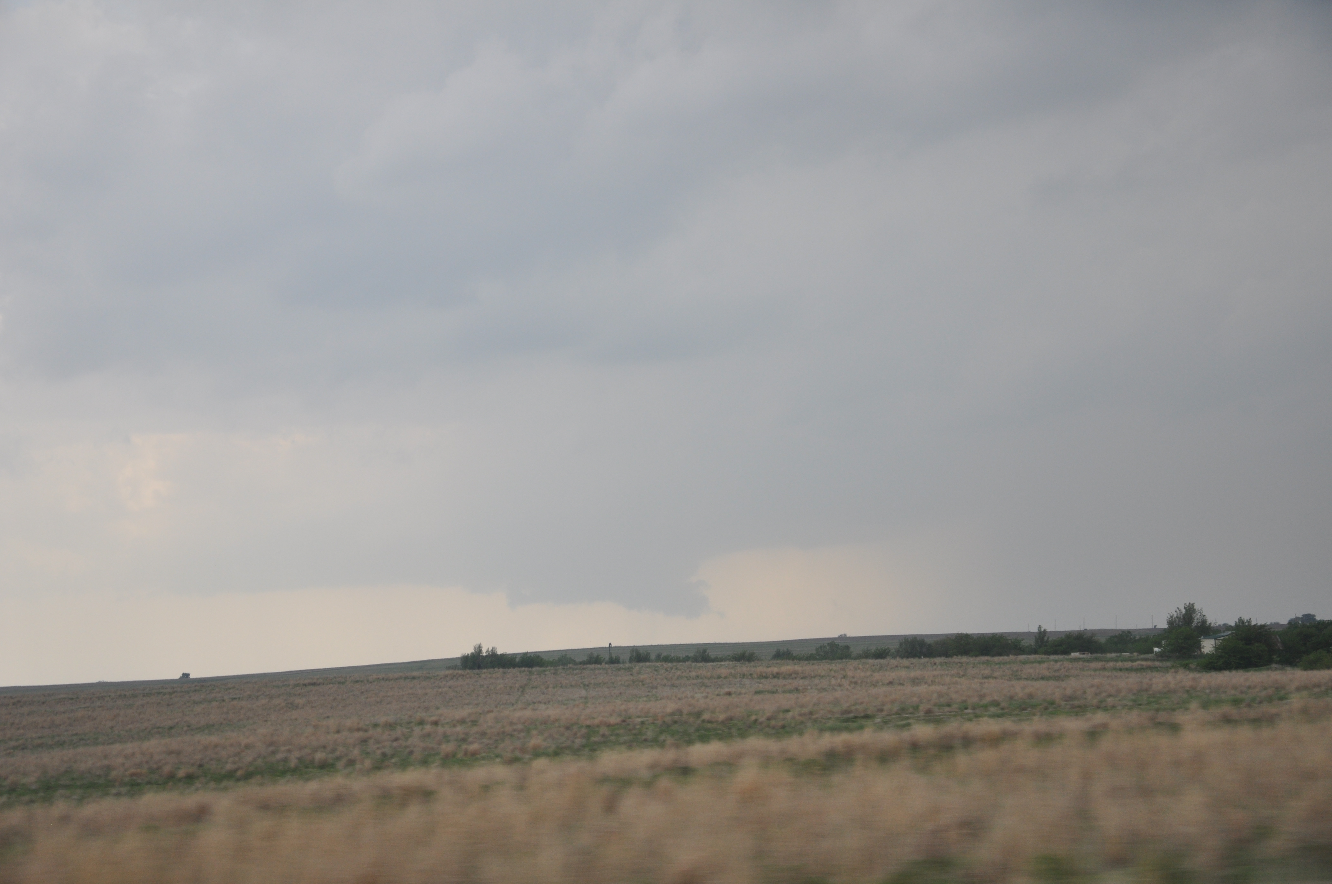
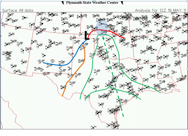
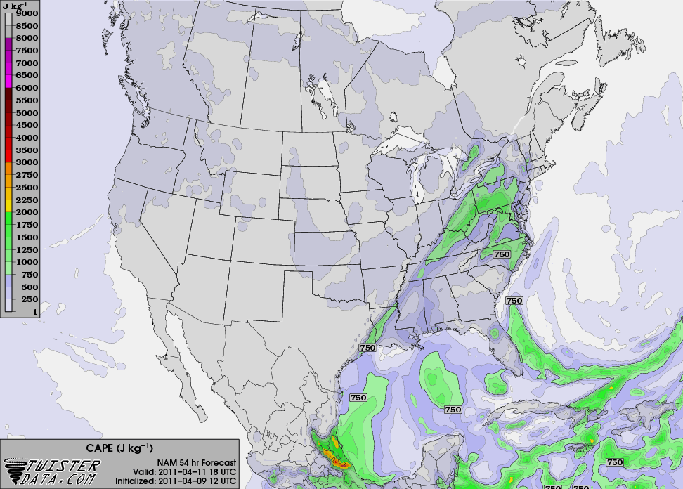
After waking up in Pratt Kansas and analyzing data, parameters led me to believe that the best area to witness tornadoes would be in eastern Oklahoma. Better instability along with shear values approaching 60 knots from zero to six kilometers, a bulging dry line associated with a developing surface low in western Kansas, and higher helicity values made that area seem like the best choice.  Instability refers to CAPE, which is the energy an air parcel could tap into if it reaches a certain height in the atmosphere.  Shear describes changing winds with height. The apex of dry lines tend to initiate strong thunderstorms, and helicity describes the ability for a storms updraft to rotate   Sounding observations also agreed with this area in relation to greater backing of winds at the surface in eastern Oklahoma, which provides a more favorable environment for tornadoes.  Except for a fairly unstable atmosphere with mixed layer CAPE approaching 2000, Kansas had very little going for it.  One thing unconsidered amongst the group was the road network in eastern Oklahoma which turns out to be terrible.  After that revelation, we decided to play our cards in north eastern Kansas and see what we would be dealt.

We left Pratt Kansas to head east around 10 a.m. and ended up in Wichita Kansas where we enjoyed the sights of Wichita State University, home of the shockers.

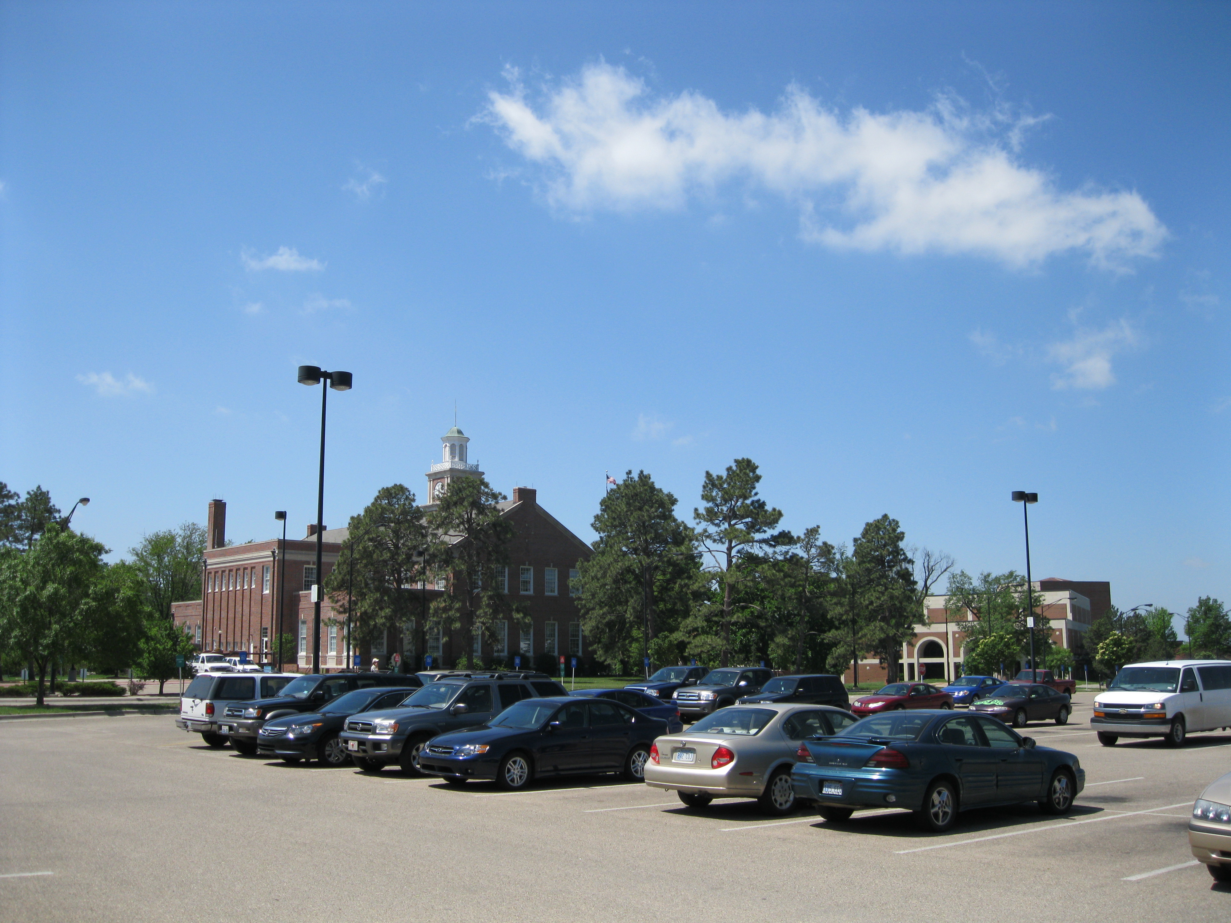
Photo taken on Wichita State University Campus

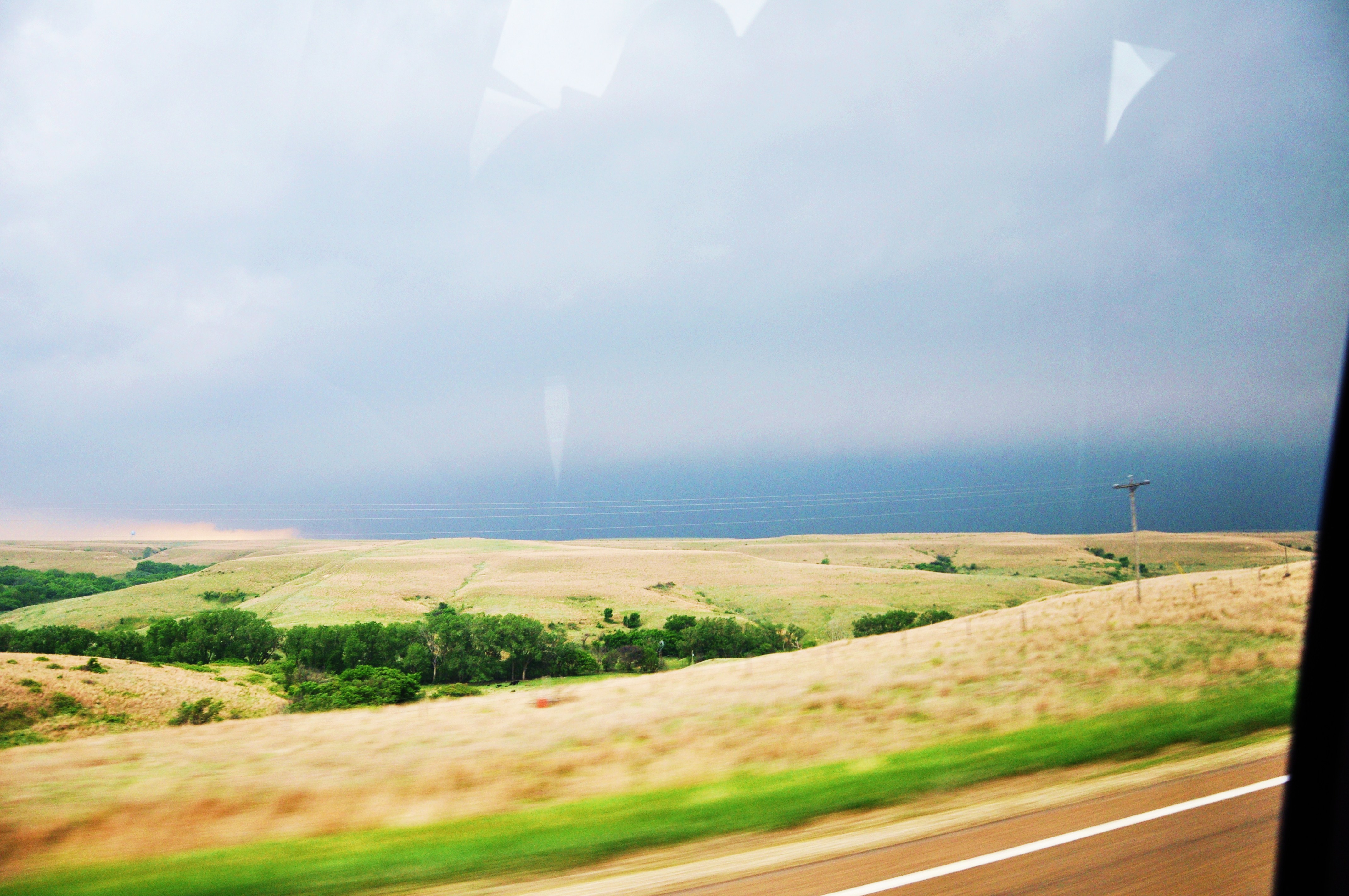
Fairly clear skies all around gave visual clarification of CIN in place, which is a measure of the amount of energy a parcel needs to reach the level of free convection and continue to rise in the atmosphere. Although CIN can inhibit storms to develop if too strong, it can also be a good first step in severe storm development because this setup essentially places a lid on the atmosphere, allowing moisture from the Gulf Of Mexico and surface heating provided by the sun to build up at the surface.  This scenario makes the atmosphere increasingly unstable, and similar to a balloon being filled with too much air, eventually something’s gonna give.  We continued east after eating lunch at Jason’s Deli (highly recommend) and were forced to wait for cells to initiate. After viewing the countryside in Emporia Kansas waiting for initiation, storms finally began to fire just north of Miller Kansas around 5 p.m. moving northeast toward Topeka; the chase was on.

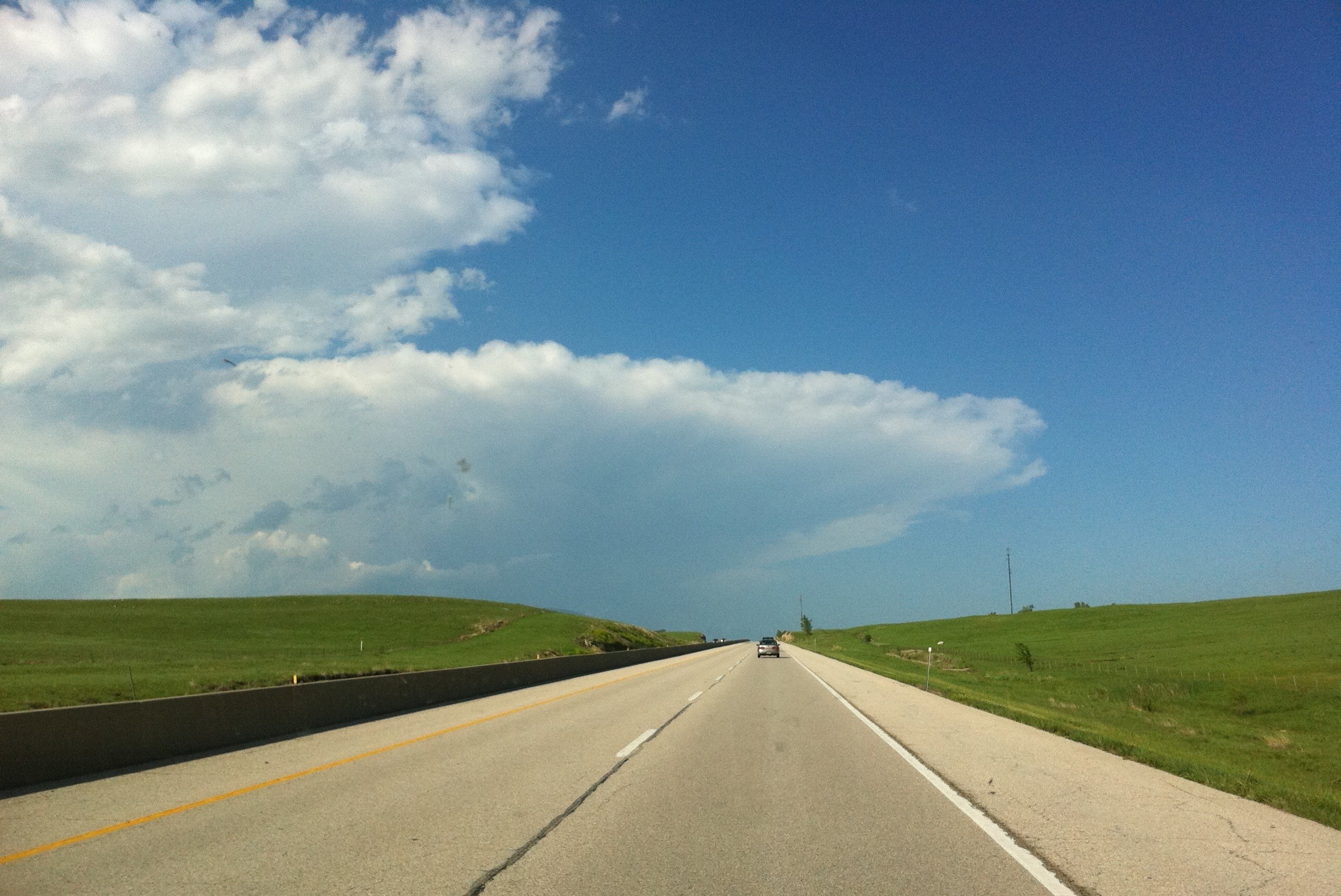
Thunderstorms beginning to build while traveling northeast on I-335. Photo taken by Dr. Durkee.

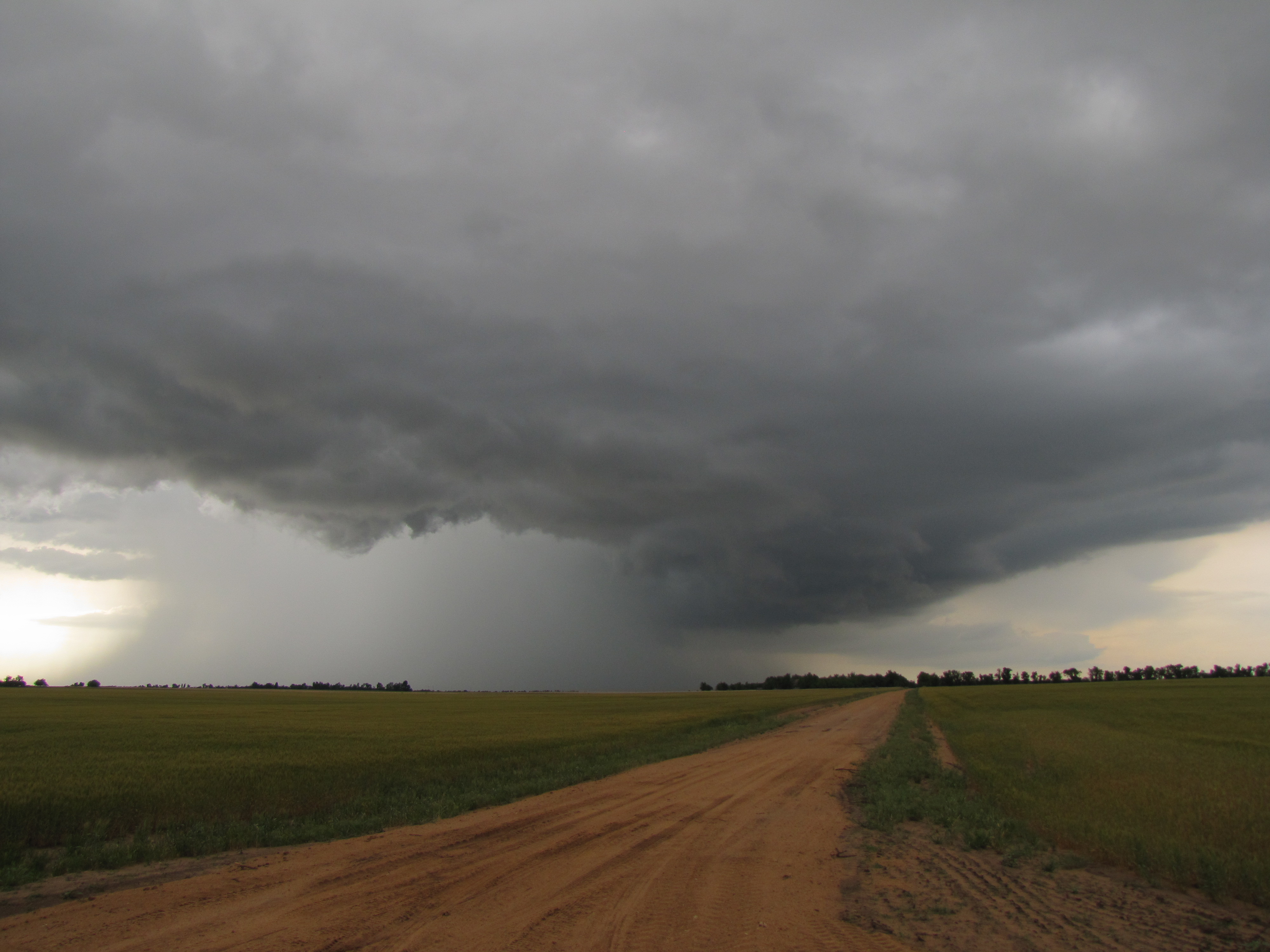
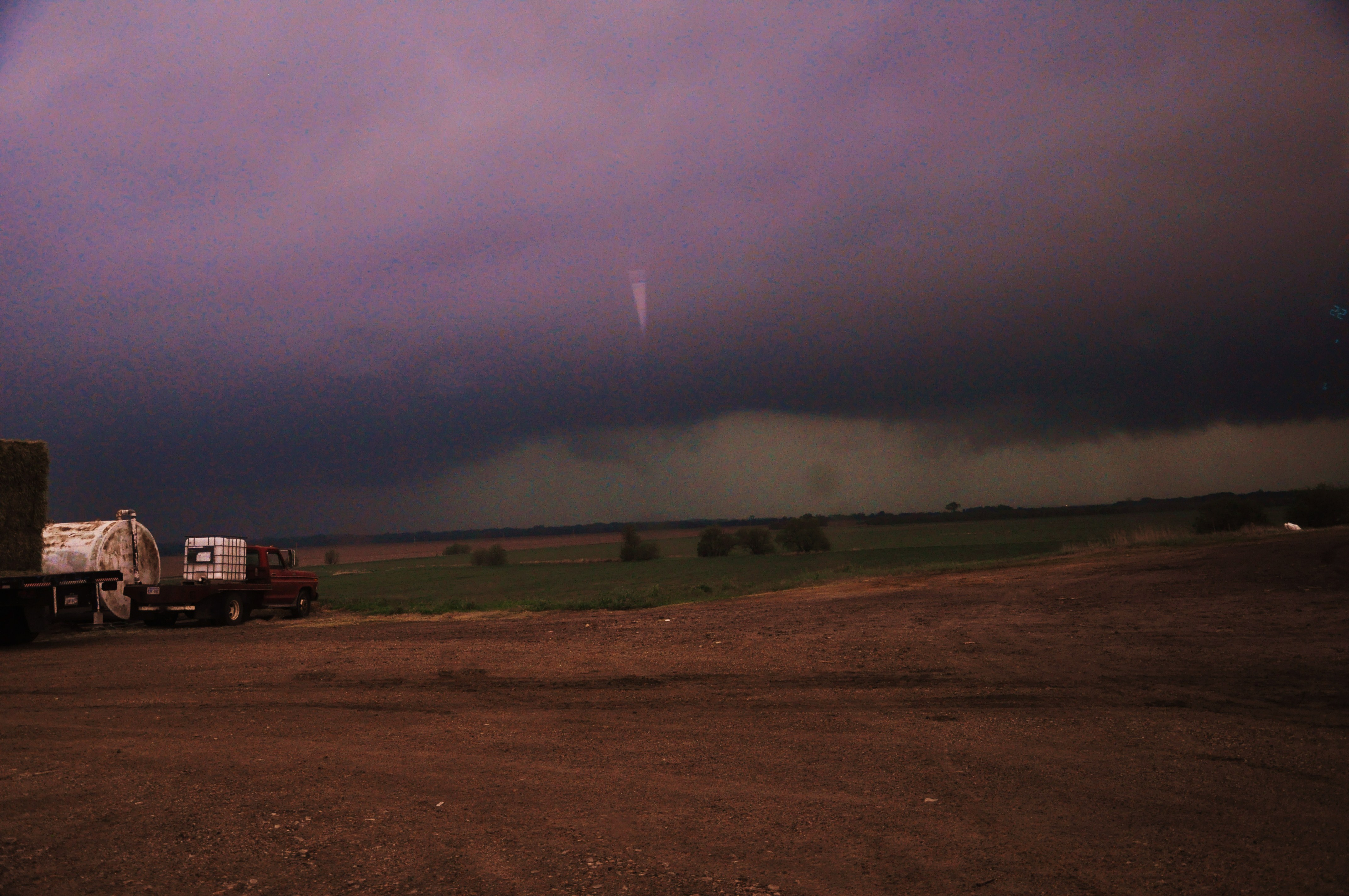
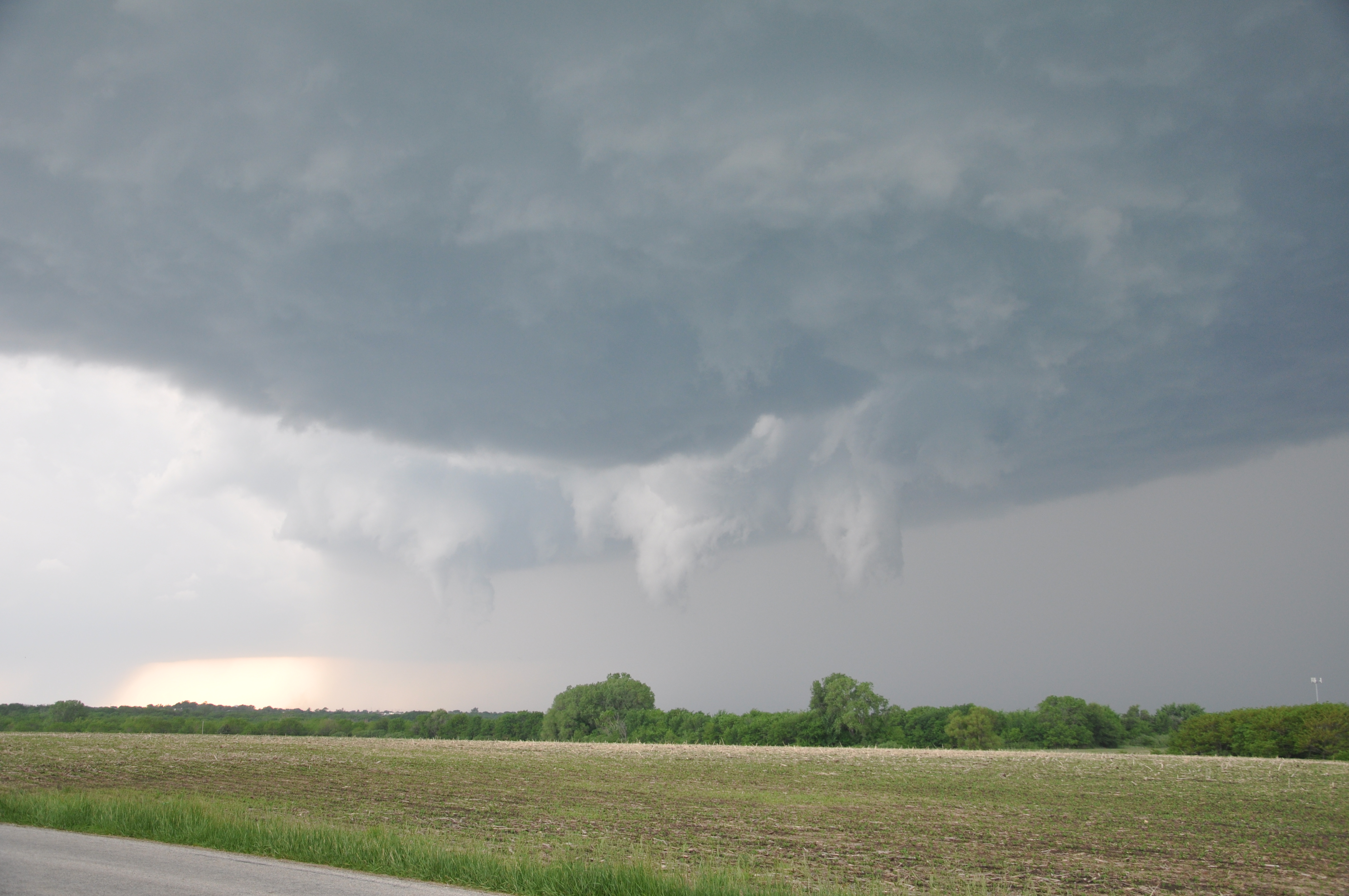
Initial view of the storms showed two typical air mass thunderstorms with decent hail on base reflectivity, which detects water particles within a storm. But as we got closer to the cells, strong rotation began to develop on base velocity which detects how winds are blowing in relation to the radar.  A closed road detoured us away from the storm, but after catching up to the northernmost storm, strong rotation was evident in a cell as a mesocyclone rotated just to the west of us with a pronounced wall cloud and funnel cloud peaking out of the base.

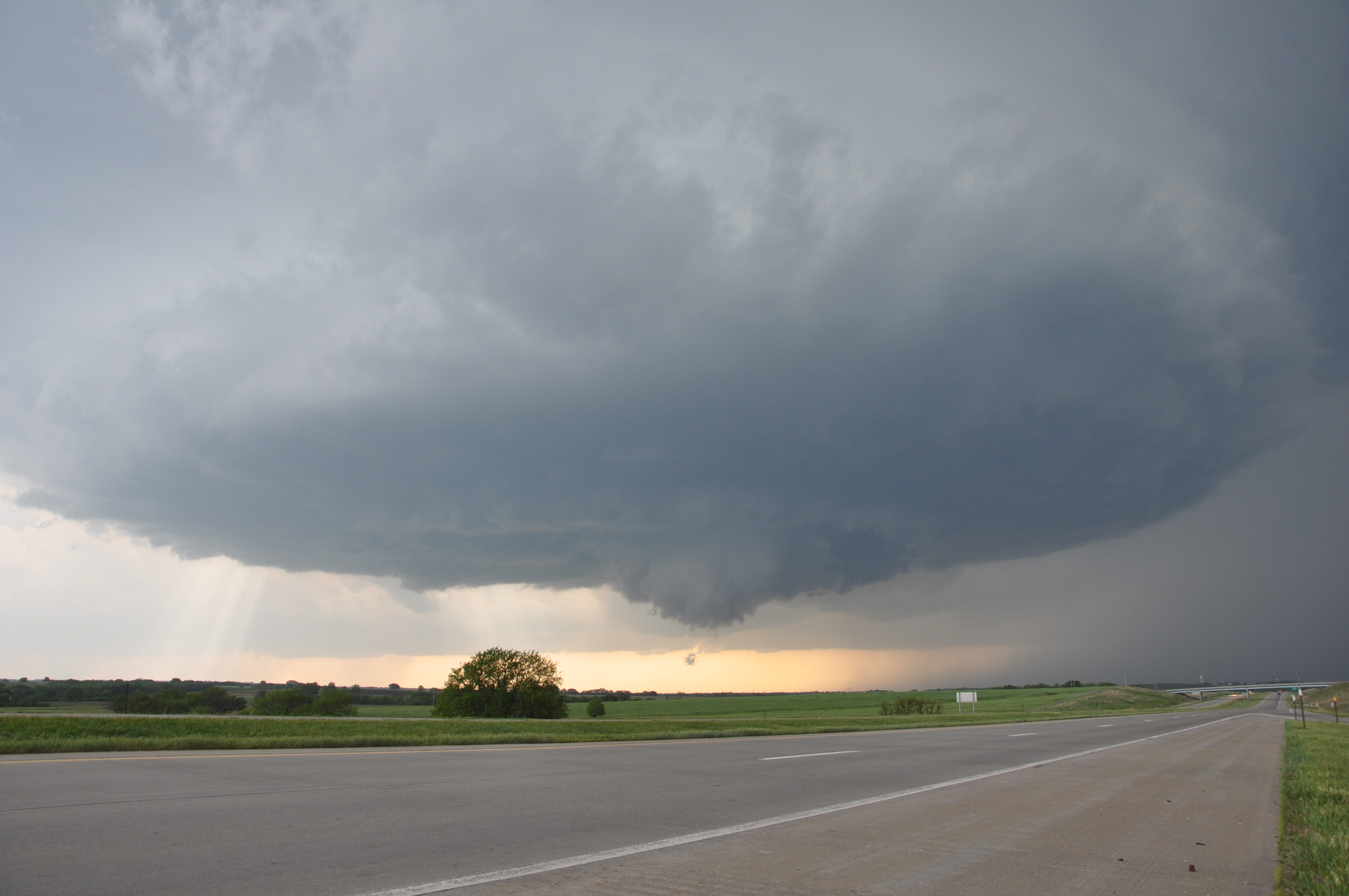
First view of the mesocyclone/funnel cloud looking northwest

Speaking for myself, this was the first time I had seen storm structure so pronounced, or even a funnel cloud!  Many features associated with this supercell; which are rotating thunderstorms, are clearly identifiable in this photo.  It was essentially a “textbook” idealization of what makes up a supercell. We continued northeast in a stair stepping motion and captured more incredible photos and video as the storm began to rotate even quicker.

Three funnel clouds rotating through the base of the wall cloud

Rotation beneath the wall cloud beginning to tighten as funnel tries to reach the ground. The motion was unbelievable

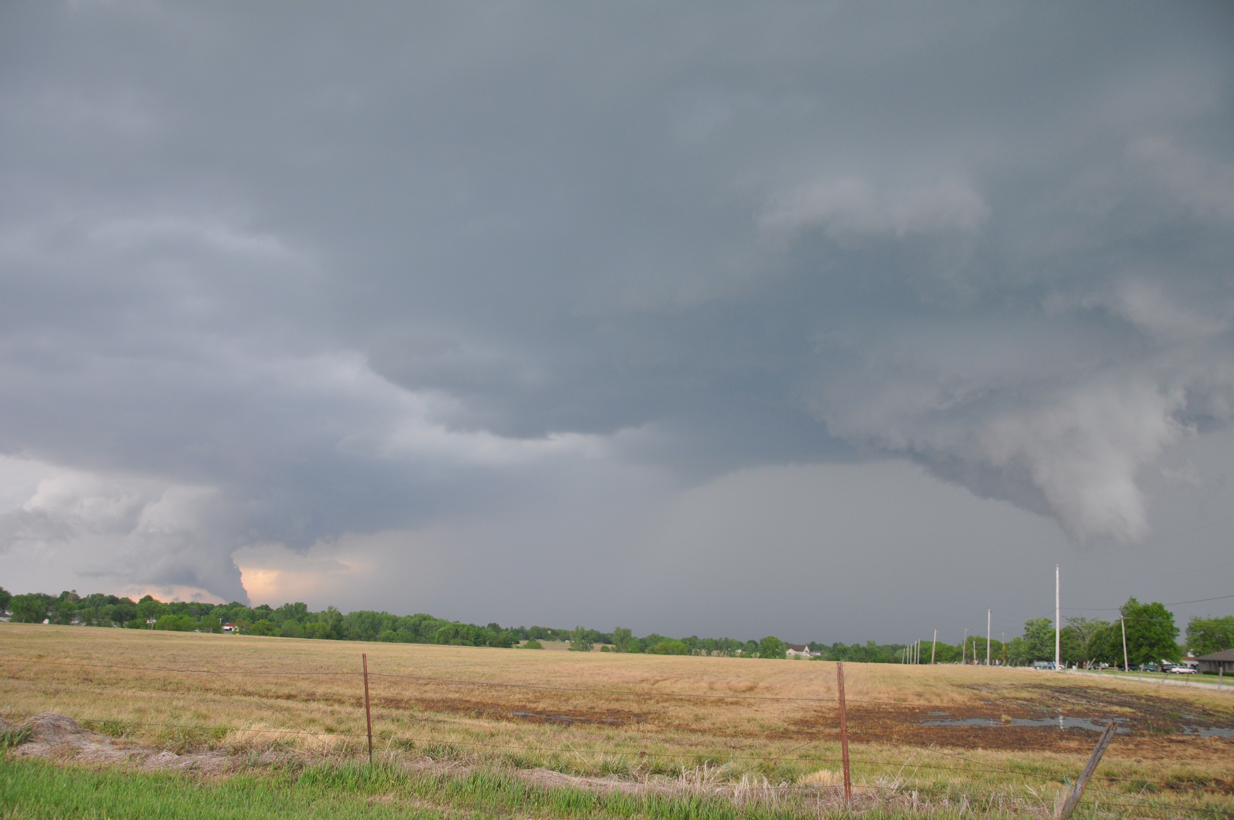
View of two strongly rotating areas of the supercell

While continuing to keep up with the storm, we encountered two more hurdles along the way; one being a large mass of Kansas residents and other storm chasers driving around to see the storm, as well as damage the storm had produced.  As we drove along a road headed north alongside the supercell, tree damage was noticed, and just ahead of us a very large tree was laid out across the road blocking our path, forcing us to turn around and go back the way we came.  At this point it would be difficult for us to catch back up to the storm, and the system seemed to begin to weaken, so we decided to change route and chase the other storm continuing to develop just south of out location.

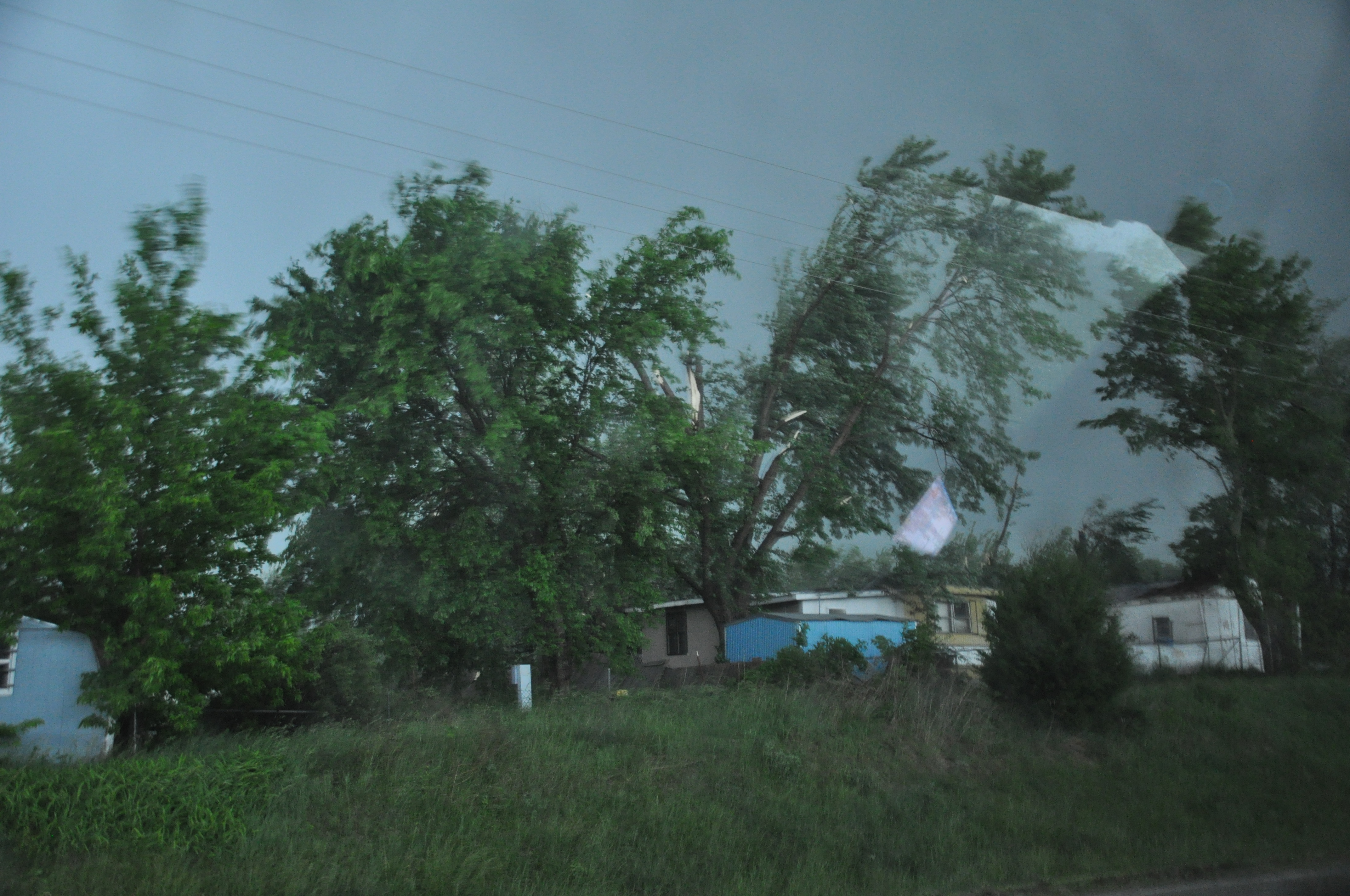
Damage that occured to trees all along the road, few were down like the tree that lay across the road, but many were snapped half way up like the tree in this photo. Apologize for the glare

It is not apparent to us that this was related to a tornado.  Although the funnel was spinning quite rapidly and making its way to the ground, we could never confirm that it actually made it to the ground.  It’s believed that the tornado never  made it to the surface because lower level helicity was not strong enough to speed up and tighten the rotation toward the surface.  The damage certainly also could have been caused by strong winds that develop on the back sides of supercells, which is known as RFD, or the Rear Flank Downdraft.  I’m sure a National Weather Service survey will be conducted to determine how the damage was caused, and a confirmation of how it actually was caused will be added to this section when available.

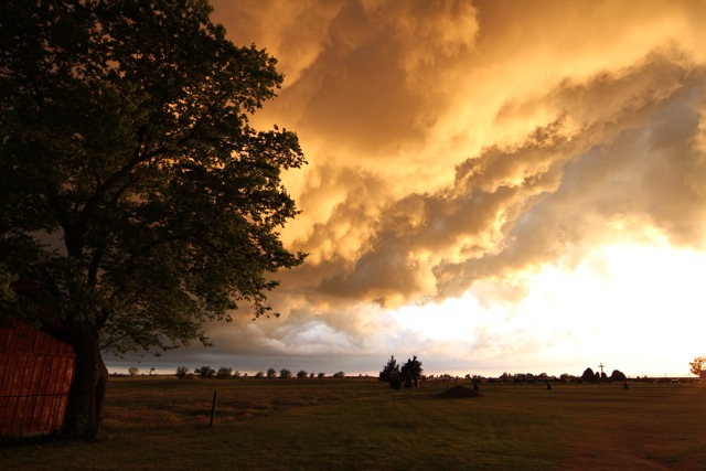
We continued to chase the supercell and witness the structure on the second cell as well.  Eventually the sun set and distinct features visible during the day faded into black.  However, lightning was incredible with the storm, so we decided to find the best position possible and gather lightning photos.  The continuous bolts of lightning continued to light up the horizon until well after midnight.  After it was all said and done, we chased behind the cells from Emporia Kansas all the way into Kansas City Missouri where we checked in for the night and enjoyed a meal at Ruby Tuesdays to recap the day’s adventure.  All photos/videos taken by me excluding photo crediting Dr. Durkee.

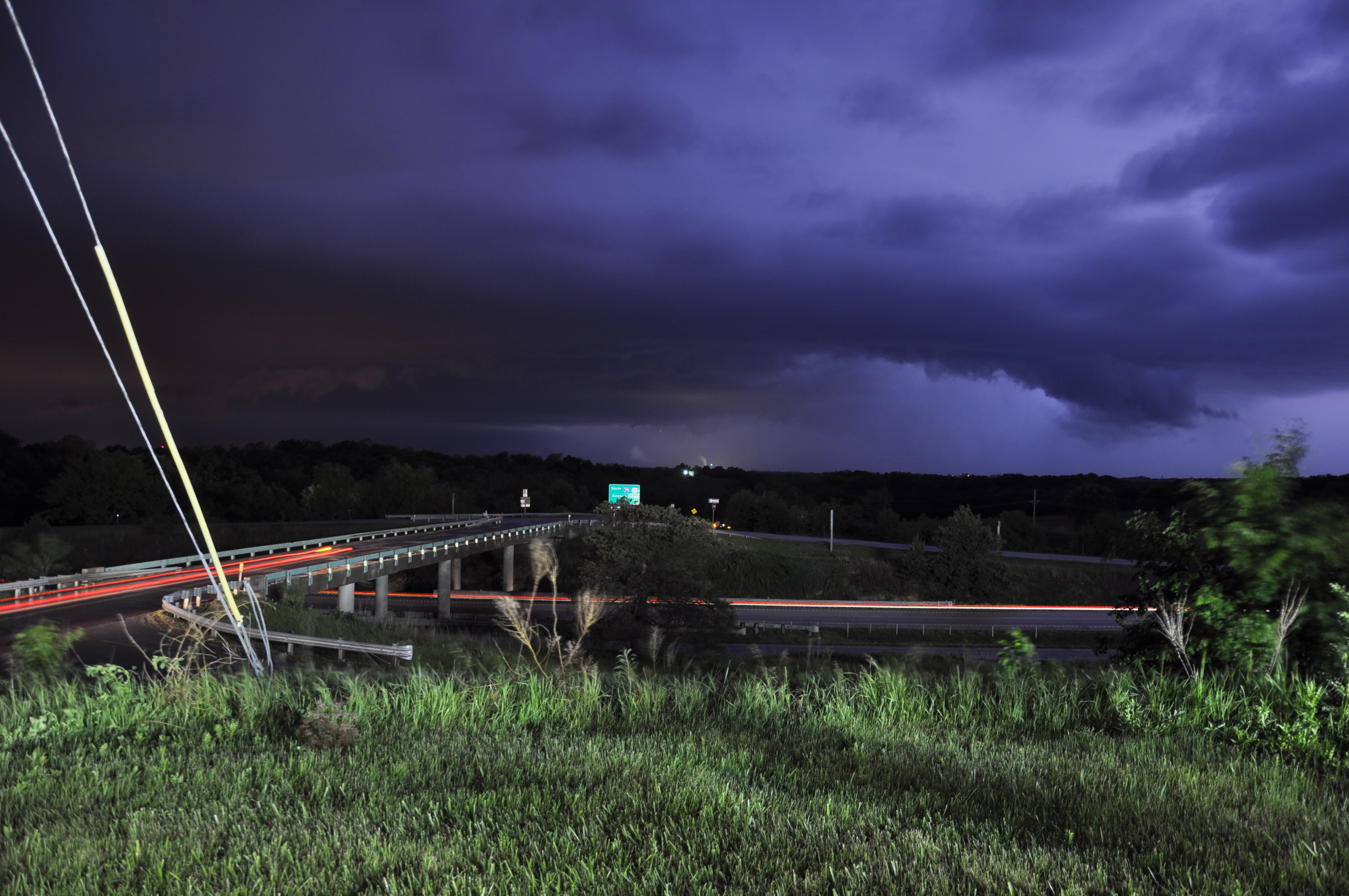
Lightning shot of storms in the distance while located in Missouri.


Posted in Kentucky Weather | Comments Off on Field Methods– Day 3 Recap

Field Methods–Day 2 Recap

On Friday morning our group woke up in Salina, KS where we discussed possible targets for storms for the day. An MCS came through in the morning causing cloud cover in most of eastern Kansas, limiting thermal instability. With this knowledge, we decided that the game plan would be to try to find the clearing in the cloud cover for storms to possibly initiate by afternoon. So our group headed WSW towards Great Bend, KS in search of a clearing. The outlook for the day was marginal with low instability even in the clear skies. In south central Kansas, CAPE values were around 500 J/kg, which is very weak. CAPE is the Convective Available Potential Energy, which is basically the energy a storm could tap into given that a storm initiates. The other problem was the low shear values around 30 knots. Shear is the direction/speed of wind as it changes with height in the atmosphere. Instability, shear, moisture, and lift are all key in supercell development, maintenance, and strength. In this case, the instability and shear values were on the lower end, however, the moisture convergence boundary was evident extending through south central Kansas providing moisture and lift. Dew points near Greensburg, KS were in the low-mid 60’s, while just an hour west of that dewpoints were in the low 40’s. The cold front extending down through central Kansas into Oklahoma provided sufficient lift to aid in storm initiation. By 3:00 p.m. storms were in firing along this boundary and we were able to follow them as we drove south into Pratt where newer cells initiated. Just outside of Pratt, we stayed with a supercell moving at 20-25mph. This cell showed very broad, weak rotation which inhibits the production of tornadoes. However, this storm did provide great structure along with a fairly strong hail core. Nickel to quarter size hail was reported, but fortunately we were able to stay ahead of this. Below are some pictures highlighting the day.

Photo By: Dustin Jordan

Photo By: Nathaniel Shearer

Photo By: Josh Durkee

Photo By: Josh Durkee

Photo By: Josh Durkee


Posted By: Olivia Payne

Posted in Kentucky Weather | Comments Off on Field Methods–Day 2 Recap

Field Methods Class–Day 1 Recap

The class nailed the forecast target area where cells fired up early afternoon and dropped two tornadoes.  However, they were high precipitation super cells so unless we got dangerously close we would not be able to see the reported tornadoes as they were rain wrapped.  It was a very successful day though, because the students got their forecast right which is what this is all about! Here are some pictures from yesterdays storm.  First photo displays the structure of the supercell we were on, second one is of the wall cloud that dropped and was rotating but quickly retreated back up, and third photo is the shelf cloud as we let it approach the van. Hope you enjoy the photos and we plan to recap every chase day.  A blog update should be posted later this morning concerning the plan for the day.

Posted in Kentucky Weather | Comments Off on Field Methods Class–Day 1 Recap

Field Methods Class–Day 1

The first day of the class started early in Tulsa, OK where the students were learning the daily rituals of the trip.  Each morning the students will conduct their own individual surface analysis and state where they would position the van for the best chance in catching storms.  Each student will work alone, but come together before leaving with the professors and explain why each of the students chose those particular spots.  After a brief forecast discussion and small debates, the selection is made and we hit the road.

Today, the target city was Wichita, KS where the class and professors both feel is the optimal spot for convection and rotating storms.  An upper level trough that is slightly negatively tilted is ejecting out of the four corners region northward.  Synoptically, that means just east and northeast of the upper level trough is where the maximum positive vorticity advection will take place along with maximum theta-e advections at the surface. At the surface, a low pressure system located near the CO/KS border will translate northward and bring the advancing warm front northward with it.  As the low translates northward, as does the warm front, winds at the surface will become from the southeast.  Which is favorable for supercellular development given that the winds are veering with height (winds turn clockwise and increase in speed with height).  Bulk shear values range from 40 to 60 knots, where 45 is a baseline value for supercellular development.  Moisture has recovered nicely from early in the week bringing dew points into the mid 60’s.  Instability is expected to increase throughout the day as the warm front advances north, leaving south of the front to clear skies for maximum surface heating.

The thought process of students and professors was to move close with the center of low pressure and advancing warm front at the surface where winds will be veered, moisture advections will be maximized, and instability will be the greatest.  Here is a surface analysis done by myself (Lee Campbell).  Blue circle indicates our target area, blue line indicates cold front, orange line indicates the dryline, red line indicates the warm front, and green lines indicate dew point values (65, 70), and dashed green lines show the fetch off the Gulf of Mexico indicative of the low level jet.

A recap of today will be posted either tonight or tomorrow morning with the best photos taken from the day. Enjoy your day and wish us luck!

Posted in Kentucky Weather | Comments Off on Field Methods Class–Day 1

WKU’s Field Methods in Weather Analysis and Forecasting Trip

Hello blog readers…
I am happy to report that our annual Fields Methods class has already embarked on our trip across the Great Plains in search of weather and greater understanding.
With any luck (and a little skill), we will be as successful as last year’s group and come back with many good pictures, memories, and learning experiences.
This years group includes: Mitchell Gaines, Nathaniel Shearer, Lee Campbell, Kate Wilson, Dustin Jordan, Olivia Payne, Lindsay Rice, as well as myself (Kyle Berry). The instructors, are the same as last year, as we are led by Dr. Joshua Durkee from here at WKU and his colleague Dr. Grady Dixon.
The next couple of weeks the blog will be very active, as there will be daily updates concerning that day’s weather, pictures, as well as our current location.
For now, we are currently in Arkansas heading for a good nights sleep in Tusla, OK. Tommorow looks to be a “chaseable” day with the target area being somewhere in central Kansas. Expect an update soon…

Posted in Kentucky Weather | Comments Off on WKU’s Field Methods in Weather Analysis and Forecasting Trip

forecast for weekend

Highlights
– scattered showers and storms still in the forecast for Thursday
– much welcomed dry period Friday and Saturday
– another frontal system Sunday

Forecast: The frontal boundary which produced numerous rounds of
severe weather and flooding over a large portion of the south, Midwest
and east coast is now moving away. However the upper low behind this
system will still produce some afternoon showers and rumbles of
thunder with a threat for pea size hail in the afternoon. Afternoon
heating will lead to an increasing temperature gradient with height
which will promote the redevelopment of these clouds and scattered
showers in the afternoon. After sunset these will quickly end. Highs
will be in the mid to upper 60’s Thursday. For Friday and Saturday
conditions will clear for a few days with highs in the 70’s and lows
in the 50’s. Unforntauntrly by Sunday another strong frontal boundary
which could also be another slow mover will move into the region.
Rounds of heavy rainfall are very well possible from Sunday to beyond
the forecast period. parameters suggest the potential for another
squall line event as well Sunday night or Monday. Details will be
refined as needed on the hvy rain and severe threat Sunday night.
MWG

Posted in Kentucky Weather | Comments Off on forecast for weekend

forecast for first half of week

Highighlights:
– frontal boundary to remain in region throughout forecast period

– periods of thunderstorms each day with severe weather threats

– risk for flash flooding by Wednesday night

Discussion:
A frontal boundary which has been nearly stationary along the Ohio river will shift slightly northward Sunday night and Monday. Another round of showers and storms will be likely from Sunday afternoon into the overnight hours as this boundary shifts north, locally heavy rain and isolated severe storms are possible. During the day Monday isolated storms are still expected along the boundary instability present may allow a few of these to reach severe limits with a threat for gusty winds and hail. A low pressure system will enhance the coverage of showers and storms late Monday night with another threat for heavy rain( up to 1.5 inches from Sunday afternoon-Monday night)and severe weather in the form of gusty winds. Once again during the day Tuesday coverage of storms becomes more scattered with a continued isolated severe threat. A stronger low pressure system will track over the region along the boundary late Tuesday night through Wednesday night. These features will enhance the heavy rain threat and lead to a likely widespread additional 2 to locally 4 inches of rain which may result in flash flooding. In addition severe storms are possible on the leading edge of this system in the form of gusty winds and isolated tornadoes. With a almost constant threat for severe weather and likely hydrological hazards throughout the forecast period the STN will remain on alert for the foreseeable future. Further statements for severe watches and warnings, activations and flood warnings may be needed. lows will be in the 60’s with highs in the 70’s and 80’s.

Posted in Kentucky Weather | Comments Off on forecast for first half of week

Severe Weather Possible Late Tuesday.

Highlights
-Big Warm-up through Tues.
-Severe weather potential Tuesday Night into Wed.
-Heavy rain not out of the question Tues. night into Wed.
Forecast
As the trough that affected last weekend’s weather moves offshore, a ridge has begun to build across the south and temperatures will rebound under southerly flow with high temperatures on Monday reaching the upper 70’s. Monday Night a stray shower or thundershower cannot be ruled out as moisture continues to stream in and overnight lows only dip down into the mid 60s. The bigger story is on Tues, where temperatures will continue to climb as a surface low pressure moves out of the plains and into Missouri. The warm sector of this mid latitude cyclone is more early summerlike, as temps will climb into the upper 80’s, with abundant moisture in place. There will be a chance of rain Tues. ahead of a cold front that is forecasted to move through our region late Tues. Night into Wed. Severe weather is likely associated with this cold front; however more details will follow as this system approaches. For now, the Storm Prediction Center has placed our region under a slight risk, but this risk may be altered depending on how the system progresses.

Make sure you keep updated through Tues. on any changes.
The front should be through our area by Wed returning temperature to a more seasonable range of around the low 70’s.

d13_fill2

Posted in Kentucky Weather | Comments Off on Severe Weather Possible Late Tuesday.

Severe Chances Fri?

Highlights

• Approaching low pressure system will bring clouds Thursday night
• Severe weather threat on Fri, with more moderate/heavy rain possible.
• Highs in mid 50’s on Saturday, returning to the 70’s by Monday.

Forecast
As convection and severe weather in Oklahoma and Missouri continue overnight, expect high clouds to start streaming into the area overnight. Lows tonight will only get down in the mid to lower 50’s under cloudy skies. Friday, conditions are favorable for thundershowers, perhaps with some severe storms later in the day. A surface low pressure system will approach our area on Friday, with winds turning out of the south-east throughout the day. This will help to bring ample moisture into the region, and bring a good chance of rain and thundershowers for Fri morning. With the approaching system, wind fields and cooler heights aloft are supportive of stronger thunderstorms for the afternoon. Because of this, the Storm Prediction Center has placed South-central Kentucky under a slight risk for severe weather Tomorrow.

However, severe potential will be limited by early morning thundershowers, with temperatures trying to rebound throughout the day. Should we get ample sunshine are severe threat would increase. Regardless, the main threat appears to be heavy rain falling on already saturated ground, with widespread 2 inch rain totals and continued river flooding is of concern.
d12_fill1
Thunderstorms should come to an end in the late evening as a cold front associated with the aforementioned surface low crosses the region. Saturday looks to be cool and raw with rain ending in the morning and high temps struggling to reach the mid 50’s. A return to 70’s is expected by Monday.

Posted in Kentucky Weather | Comments Off on Severe Chances Fri?

Severe Threat Decreasing; Near-Record Highs Tomorrow

The severe weather threat for Sunday evening / Monday morning advertised earlier this week now appears to be much smaller than initially thought. Both the GFS and the NAM have pushed back the timing of the cold frontal passage to late morning or early afternoon on Monday, and instability is expected to be very limited when the front moves through. The best dynamics associated with the system are expected to be well to our north, associated with a deep surface low and jet streak in the Great Lakes region. With this in mind, the SPC has dropped the slight risk for the area on Monday. However, the situation still bears watching for possible changes to the forecast, and a good dose of rainfall is also expected with this system.

NAM CAPE forecast for 1 PM CDT Monday, showing limited instability:
nam_221_2011040912_f54_cape_surface

More on record high potential and severe storms in eastern Kentucky…

Posted in Kentucky Weather | Comments Off on Severe Threat Decreasing; Near-Record Highs Tomorrow