WKU Storm Chase Day 12

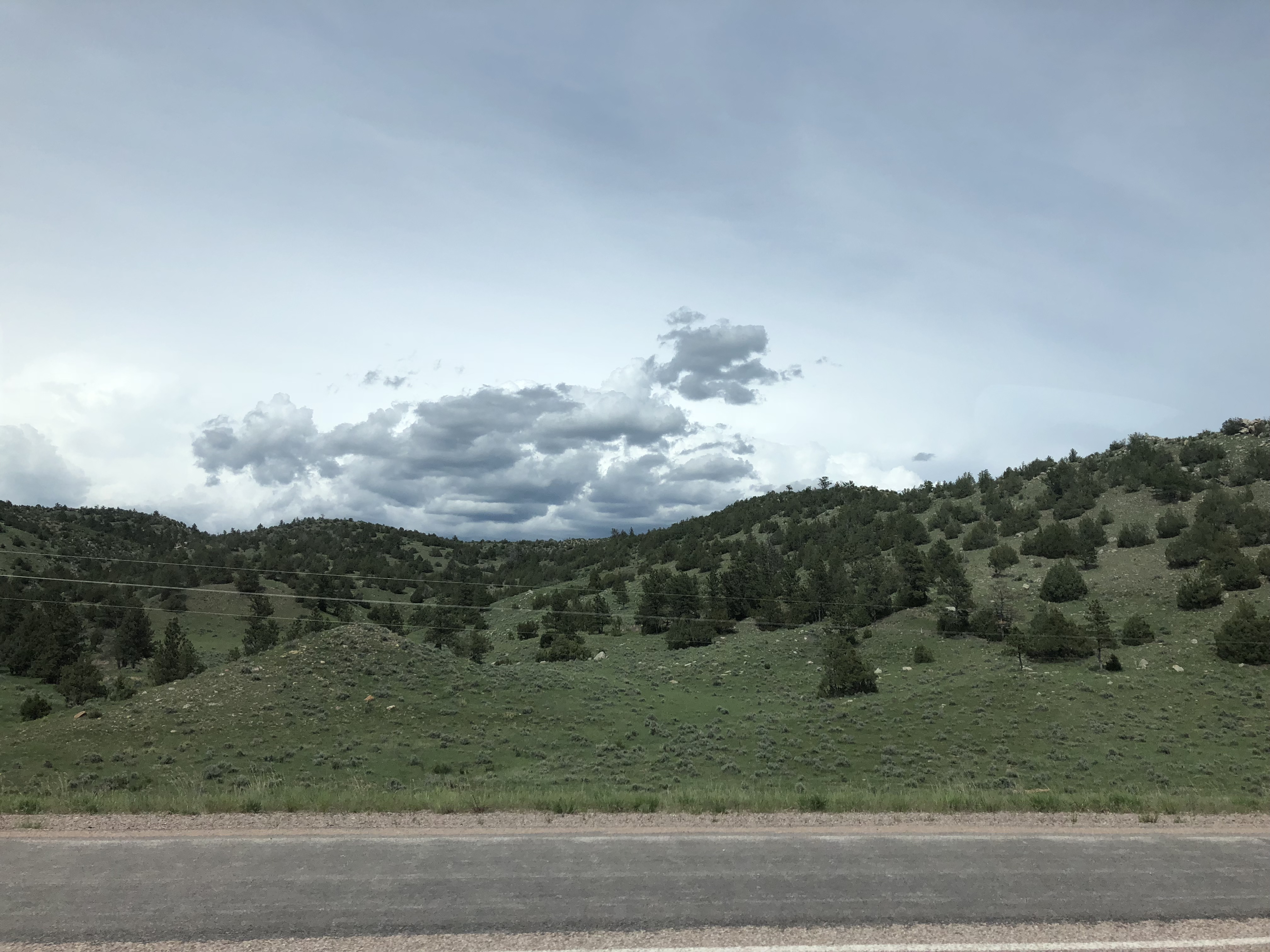
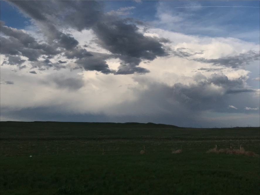
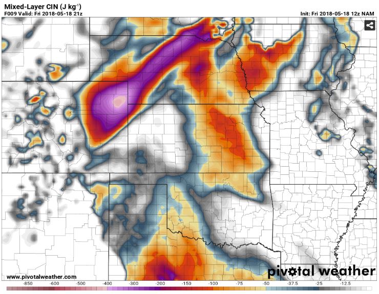
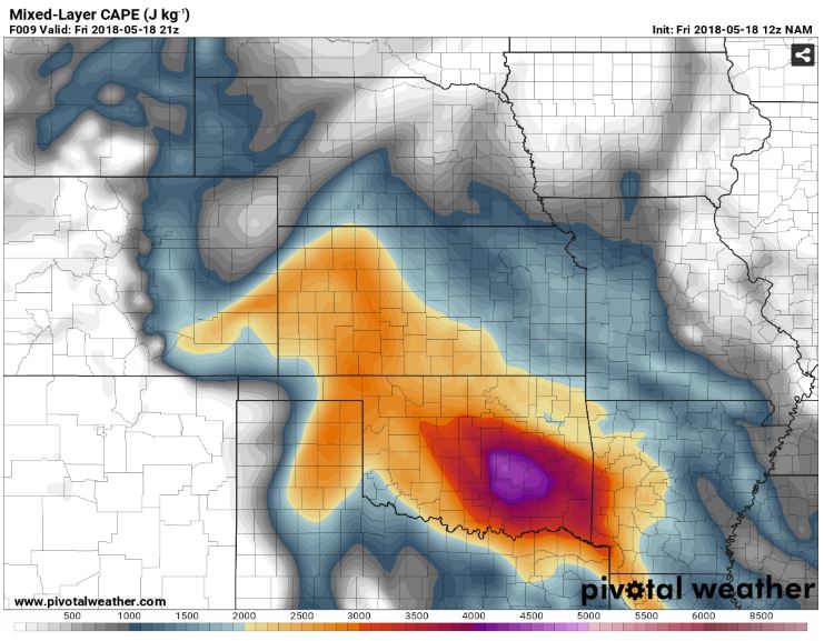
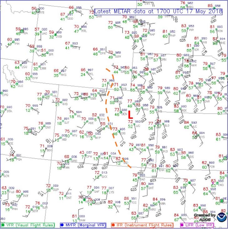
We awoke in Colby, KS this morning and had a fairly quick FD as we were looking at a “hurry up and wait” kind of day/set up. The initial target was Woodward, OK. Several models were showing storms firing up in the TX panhandle to western Oklahoma behind some initial morning convection sweeping through Oklahoma. Like most other days on this trip, models show the storms initially discrete before congealing into a cluster in the 21z to 0z time frame. There are multiple sources of lift (outflow boundaries, low pressure) but with fairly weak upper level winds and shear. There is plenty of instability however, and we are fairly confident that we can get on a fairly structured storm today and hopefully witness some Panhandle magic.

Kook’s in Greensburg, KS


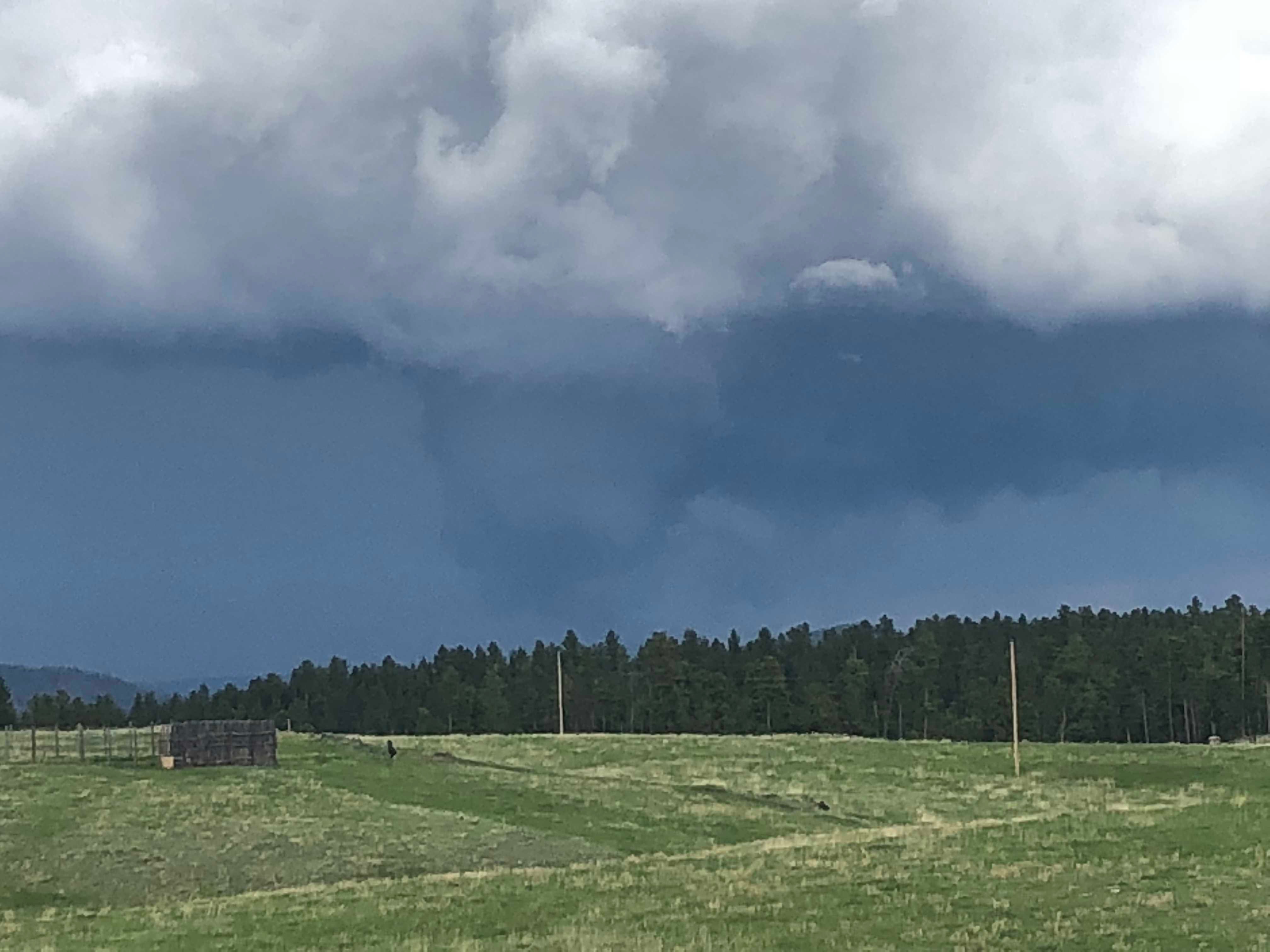
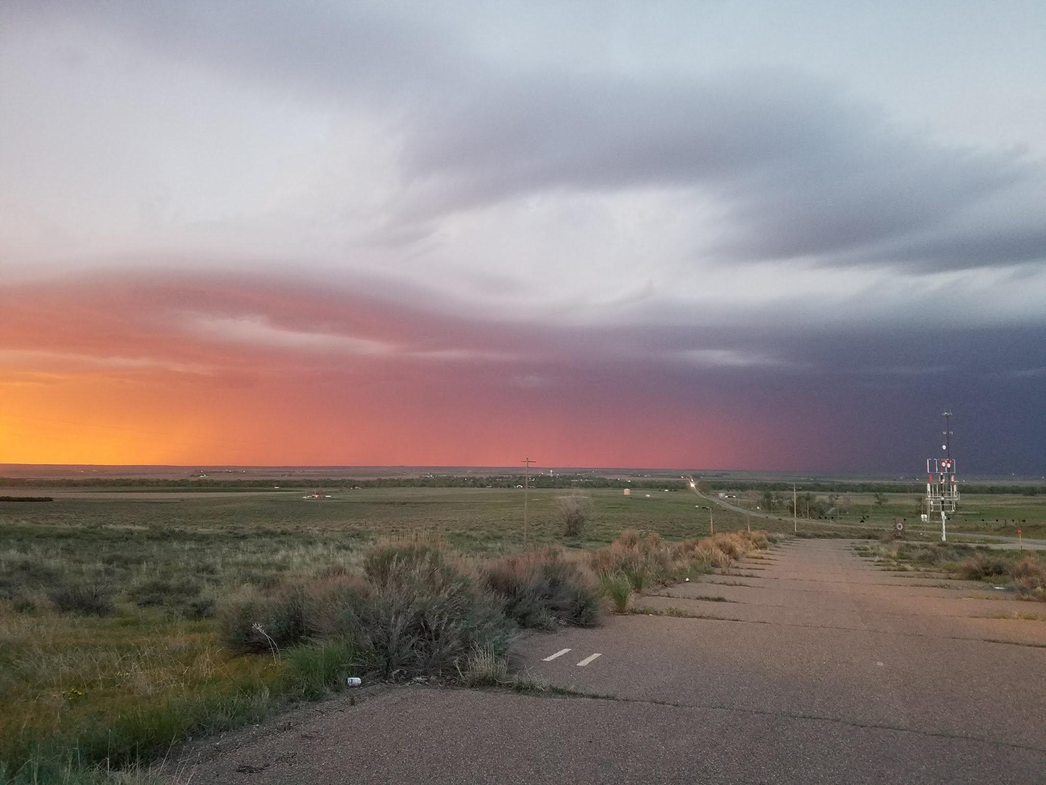
We stopped at Kooks deli in Greensburg, KS and had a delicious lunch, a storm chase tradition, and a little tornado history lesson. From there we finished our journey to Woodward and killed a few hours at a large park that we enjoyed very much last year waiting for initiation. It took a while but winds finally started to back around the surface low and thus we re-positioned southwest towards Canadian, TX. Sure enough, a tower started to go up and remained discrete for its entire lifespan and was moving into a really good environment!

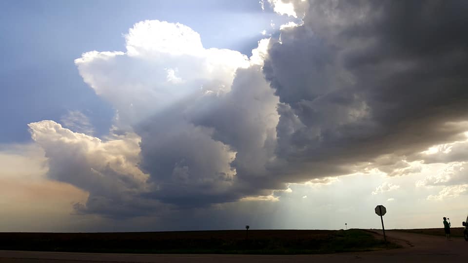
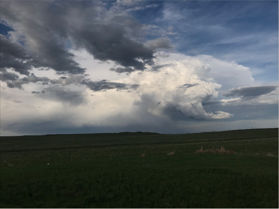
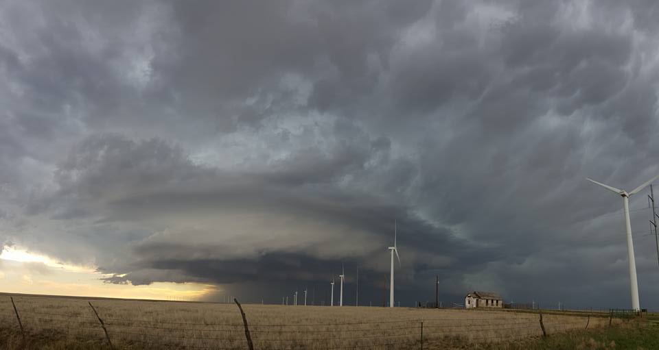
Our storm initiating around Canadian, TX


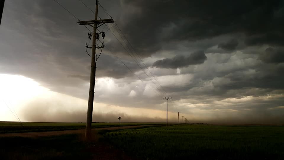
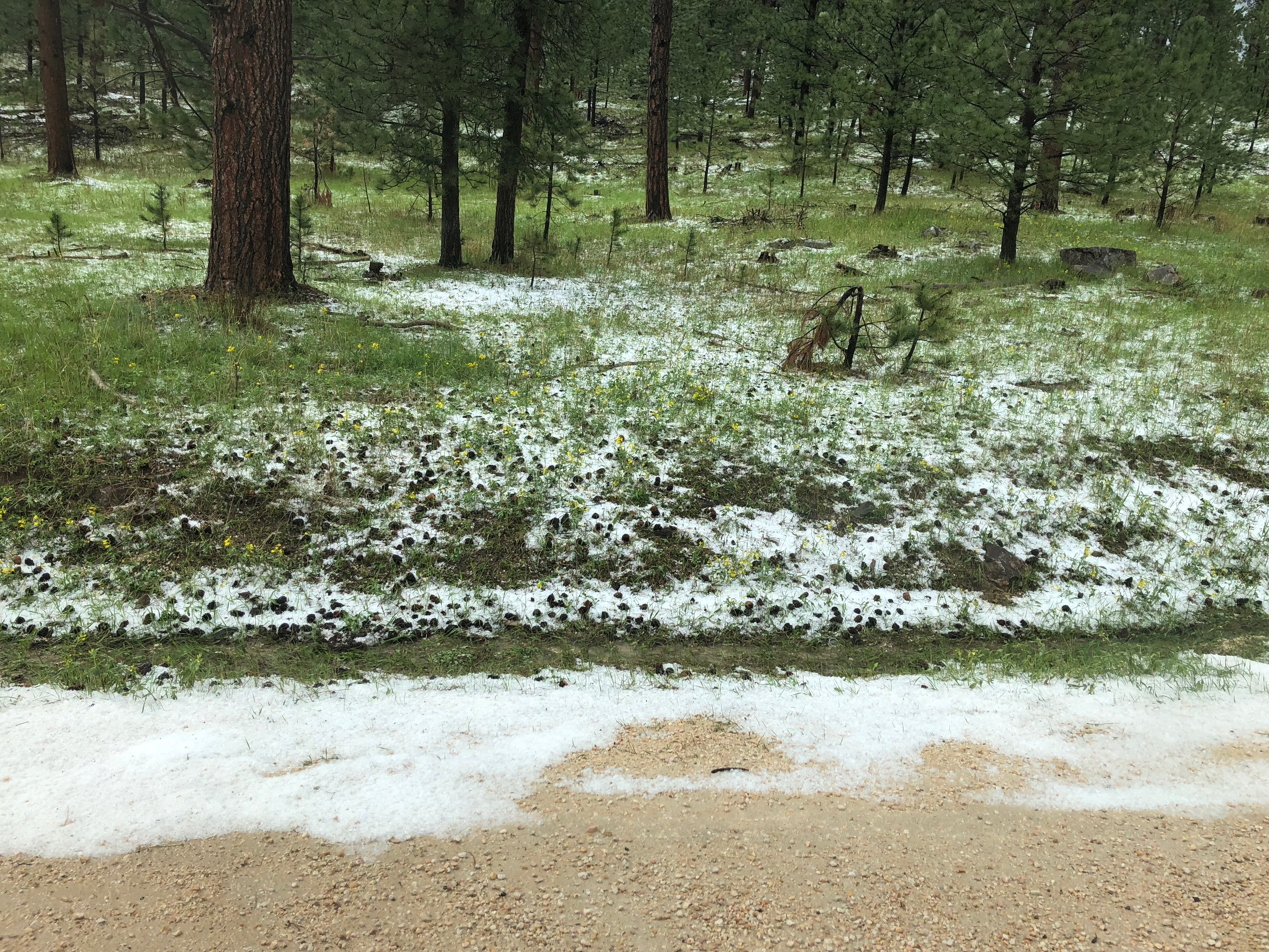
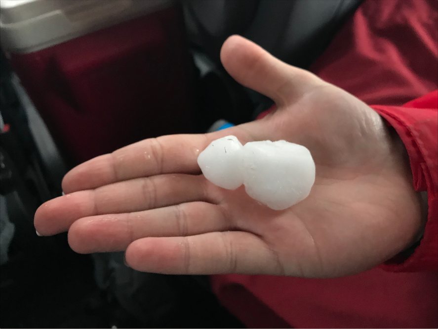
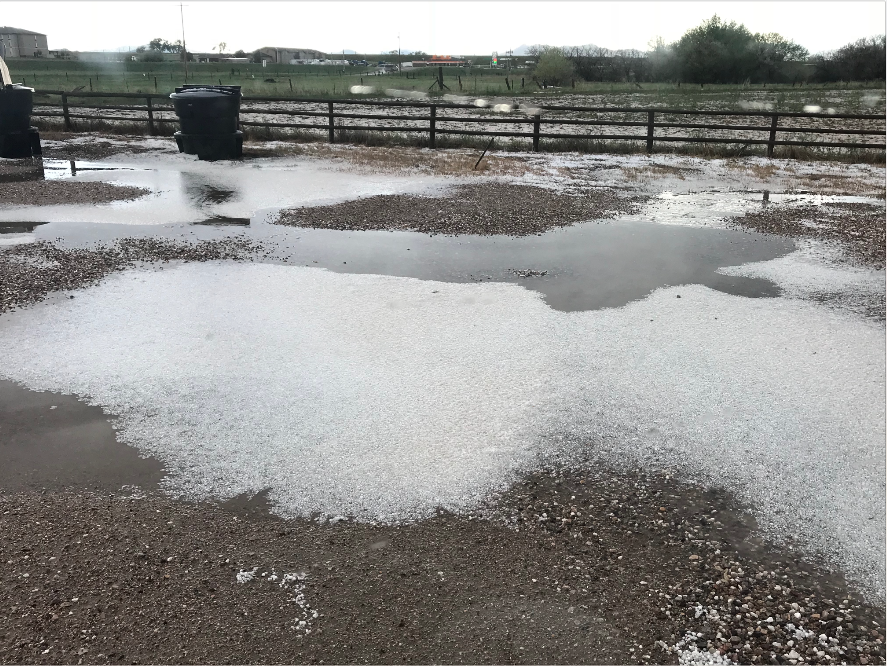
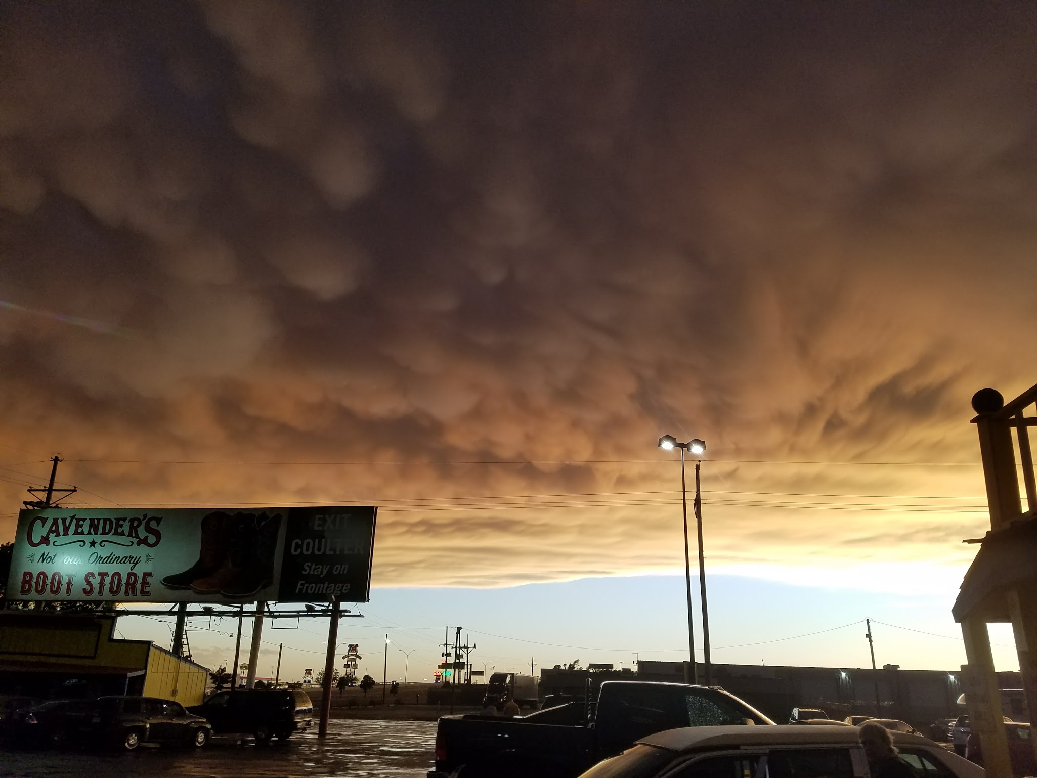
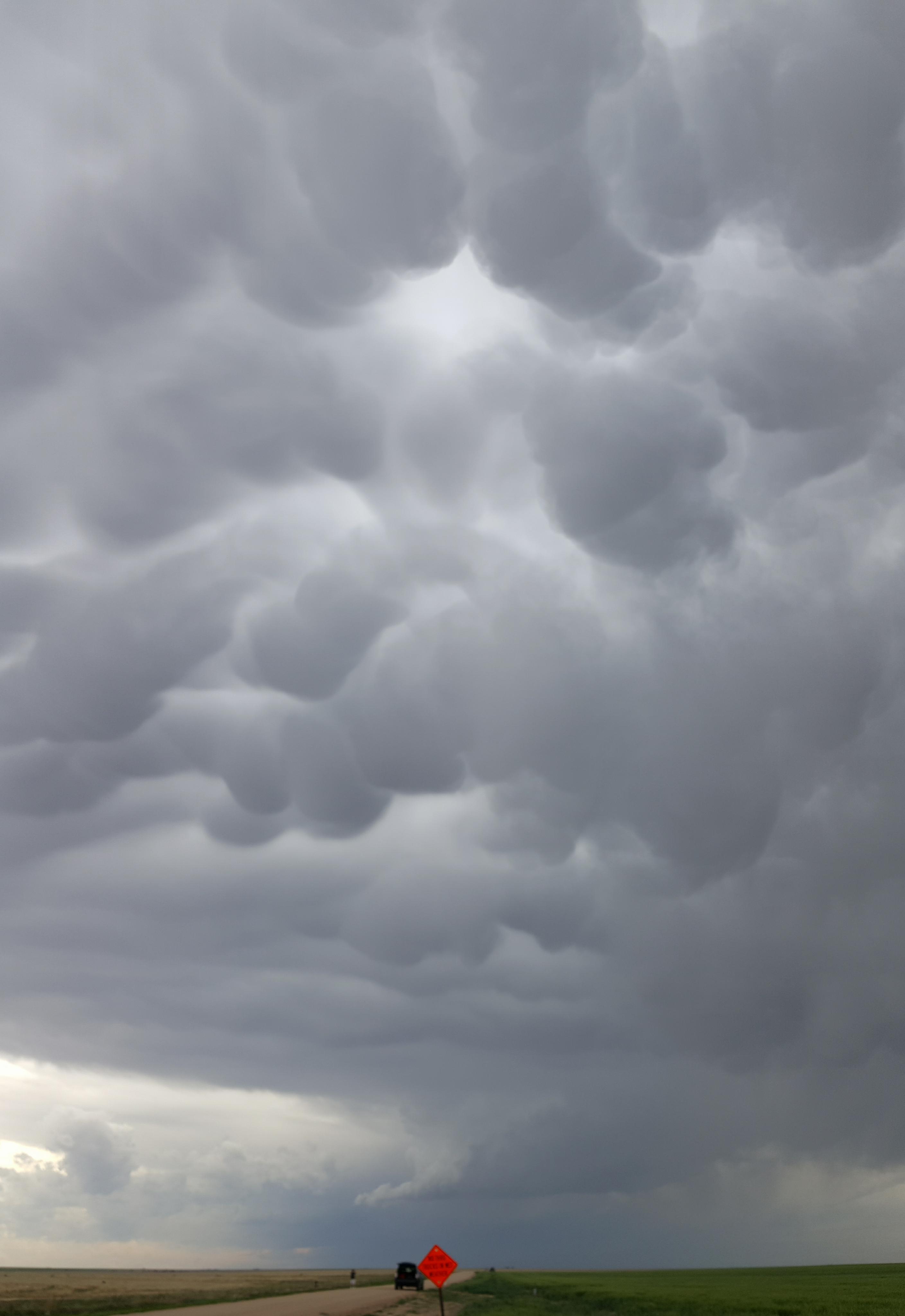
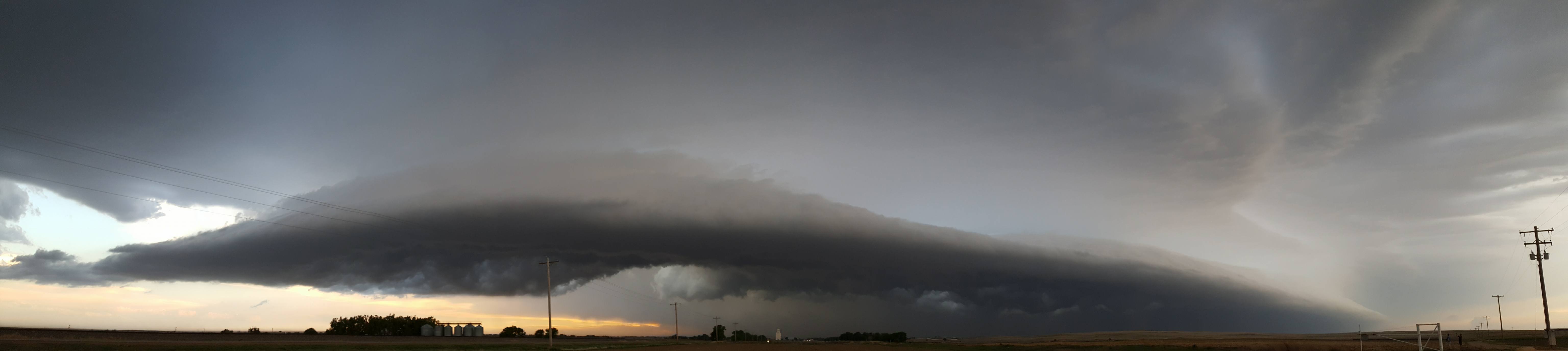
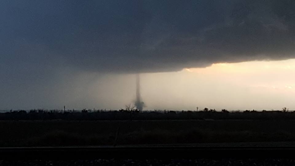
We stayed on this storm for a good amount of time and were rewarded with some great mammatus, LP structure including a rapidly rotating updraft, and even an elevated funnel near Mobeetie, TX! The funnel was fairly long and was probably 12,000 feet up and was not associated with lowering but it was still quite a sight to watch it grow and die.

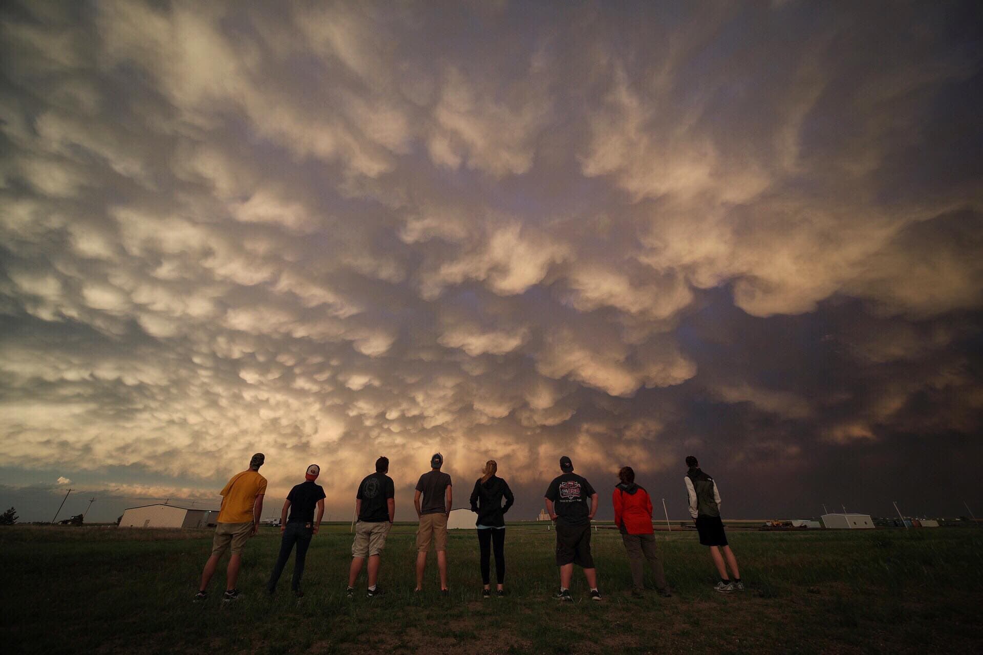
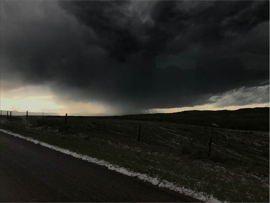
Standing underneath a rotating updraft on our LP storm


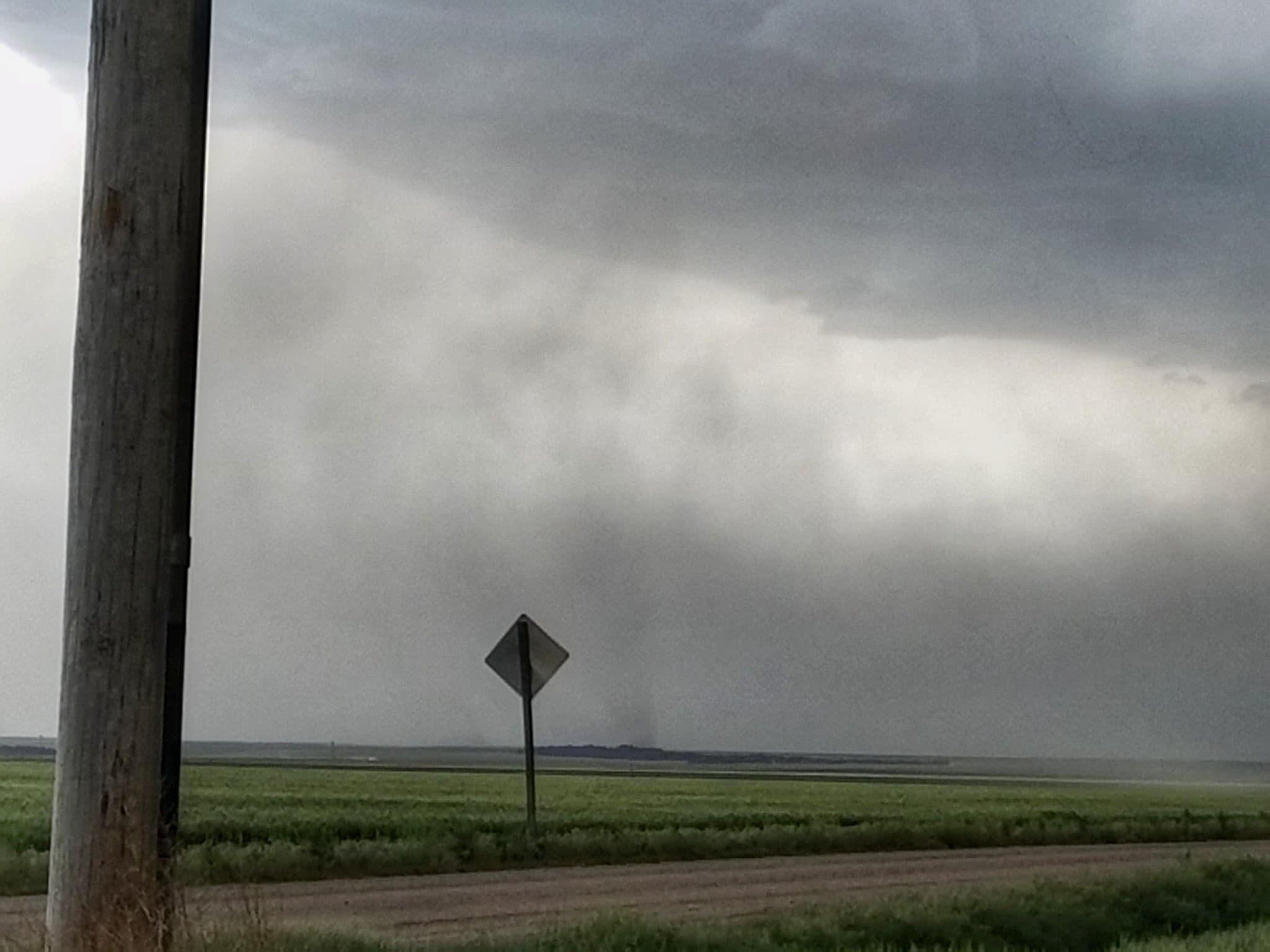
Elevated funnel on our Canadian, TX storm


Mammatus and the moon to end the day & trip


To cap off a great day and an excellent trip, we had a steak dinner at Big Vern’s Steakhouse in Shamrock, TX and even got to meet Big Vern himself! Overall we had a great time and really learned a lot on this trip, and considering the pattern we were given, we made some great lemonade. We would all like to sincerely thank Dr.Durkee, Dr.Dixon, and everyone back at WKU who support this trip and help make it happen. Until next year!


– Thomas Giebel

Posted in Kentucky Weather | Comments Off on WKU Storm Chase Day 12

WKU Storm Chase Day 11

We started our day out in North Platte, Nebraska, wondering what the game plan for the day would be; convective initiation seemed possible across several areas in the Great Plains, but because of our location, the best target appeared to be far west-central Kansas through far east-central Colorado. Given the latest NAM, NAM-3km, and HRRR runs from that morning, it seemed that most storms would fire along a boundary line that would become more defined throughout the day. That being said, the unimpressive bulk shear values, coupled with the linear convective mode that would appear to dominate that evening, convinced us that the best approach to this chase day would be to spend the day in North Platte and then later in the evening head down to Kansas to catch a nice lightning show.

As such, we spent our morning and early afternoon visiting the Union Pacific Railroad Line and learned a great deal about the Line and trains. We then went down to Penny’s Diner where we scored some great breakfast options.

Union Pacific Railroad Line, North Platte, Nebraska.

Penny’s Diner, North Platte, Nebraska.

It was soon after the diner that we started to notice that initiation had indeed begun in far east-central Colorado and that some storms were poised to start following up ahead of a boundary line to our south. Given the opportunity to watch storms initiate before our eyes, we decided to drive south past McCook, Nebraska, and into Kansas.

Initiation began in the early-to-mid afternoon hours.

The storms that eventually went off began to appear more linear with time and soon even kicked off a dust storm due to the fairly strong winds associated with them. These conditions further lead to the development of a couple of gustnados which turned out to be an unexpected surprise  as well. By the time the dust storm and the gustnados had settled down we had already made it fairly close to Colby, Kansas.

Dust storm from that afternoon.

Gustando that developed soon afterwards.

As they began to wind down we made it out to our Holiday Inn Express in town and then headed to dinner at the Twister, which was without a doubt one of the most appropriate restaurant settings we have eaten in during this chase and even got some nice mammatus clouds ahead of the storms.

Mammatus clouds from that evening.

And so while the day may have taken a slightly different turn from what was originally intended, we did manage to witness the initiation of some storms, gustnados, and got some of the most phenomenal mammatus cloud structure we have seen over the last couple of weeks.

Posted in Kentucky Weather | Comments Off on WKU Storm Chase Day 11

WKU Storm Chase- Day 9

A change in the forecast for today ended up resulting in a change of plans. Yesterday we traveled north to South Dakota to get into place for today’s severe weather threat. However, later model runs yesterday evening and into this morning showed northeastern Colorado becoming a more favorable target. Eastern South Dakota appeared to have more favorable ingredients for supporting severe thunderstorms for today. Storms, however, weren’t expected to begin initiating until later on in the day after these favorable ingredients had virtually disappeared. Since the favorable ingredients for supporting severe thunderstorms would decrease throughout the late afternoon/early evening hours, strong storms would not survive long in this environment. Modeled reflectivity showed storms initiating late afternoon in eastern South Dakota and quickly dying due to the lack of these necessary ingredients. Northeastern Colorado was the opposite. Northeastern Colorado was expected to start off lacking ingredients necessary for supporting severe storms but would gain them later on in the day. This environment was expected to be favorable for producing supercells. Since we were in South Dakota, we had to make our way down to northeastern Colorado as soon as possible in order to make it in time for any storms that would fire up.

We made our way down to Fort Morgan, Colorado where we stopped at a local park for about an hour, waiting for storms to initiate. As storms began to fire up in northeastern Colorado, we headed northeast to stay ahead of them. These storms started off as high based storms and maintained the same intensity for an extended amount of time.

High based storm near Crook, CO.

After awhile, the storm we were chasing began to intensify more and become better organized. This storm developed a very nice supercell structure as it moved into a more favorable environment. Rotation within this storm could be seen but never was able to produce a tornado.

Supercell becoming better organized near Big Springs, NE.

The storm became a beautiful HP supercell as it moved northeast into southwestern Nebraska. We experienced approximately 40mph wind gusts from the storm’s RFD as we watched it.

Storm strengthening into a beautiful HP supercell near Lemoyne, NE.

This storm put down plenty of hail as it moved through. Roads became covered with hail at some points while we were driving. This hail was approximately pea to marble size. We didn’t observe anything larger than that.

Hail covered roads near Author, NE.

After a long day of chasing, we ended the day in North Platte, Nebraska. Today’s supercell turned out to be one of the most beautiful storms we have seen on this trip!

Posted in Kentucky Weather | Tagged , , | Comments Off on WKU Storm Chase- Day 9

WKU Storm Chase- Day 8

Today was a day in which options had to be weighed during the morning’s forecast discussion. Storms were expected to take place across the Wyoming region and even slightly to the east and then drift to the north-northeast. Unfortunately, the storms were not expected to take place in a great environment in terms of supporting supercells. However, that’s not to say cool storms won’t take place, but they would most likely be a clustered mess, which can be hard to chase.

After some discussion, we decided to forgo picking a target and chasing today for setting up to chase tomorrow. After looking at the model data and another forecast discussion, we decided to head to western South Dakota, where models were hinting at possible storms taking place tomorrow. We knew things could and most likely would change tomorrow, so we didn’t want to commit too far in any specific direction. Spearfish, SD seemed like a good area to get to.

As we headed north to Spearfish, a severe storm popped up over the Black Hills in South Dakota. The storm was practically stationary and provided a unique opportunity to chase the isolated storm.

Storm developing over the Black Hills

Despite the rough terrain and limited access to roads in the area, we went for it. The storm began to show a couplet on radar, but we were still a good distance away since we had to get halfway around the mountains to find a way up them. Fortunately, the storm remained practically stationary and the couplet also stayed around. It was hard to find a spot that was both high and clear enough to see the storm though. We finally found a dirt road that had a nice viewing spot. When we got out to take pictures, we immediately noticed a lowering where the couplet on the radar appeared. The lowering also appeared to have a left to right motion to it. The storm was located to the northwest of Hill City, SD. Finally, we had witnessed our first funnel cloud of the trip.

Funnel cloud northwest of Hill City, SD

The funnel lasted for a few minutes but never appeared to get to close to the ground. Eventually it lifted and the storm began to weaken. After a few more minutes of picture taking, we made the trek down the mountains and toward out hotel. As we went down, we ran in to a few spots where a large amount of hail had fallen. So much so, that it looked like it had just snowed on the hills. The van even slid a few times due to the icy conditions.

Hail on the trek down the hills

Some spots within valleys had hail and very foggy conditions. These areas looked straight out of a scary movie. We also witnessed some other cool, non-weather related things on the way down such as deer, streams, and interesting cabins.

One of many foggy spots on the trek down the hills

We eventually made it out of the Black Hills and headed toward our hotel in Spearfish, SD. For what was suppose to be an off-day, it turned out to be a great day. Now our eyes turn to tomorrow in hopes of seeing more cool storms and learning more!


Posted in U.S. Weather | Tagged , , | Comments Off on WKU Storm Chase- Day 8

WKU Storm Chase – Day 7

With the first week in the rear view mirror, the start of the new work week presented a dilemma for the storm chase team. The previous day, we decided to spend the night in Limon, Colorado in order to be within driving distance of two potential chase targets: either east-central New Mexico or northeastern Colorado/southwestern Nebraska/southeastern Wyoming.

May 21 12Z RAP Surface Moisture Convergence, valid for 22Z (4pm MT). Notice the greater moisture convergence over central New Mexico. Also near Cheyenne (thanks to the Cheyenne Ridge)

The decision wasn’t easy as the best forcing for thunderstorms was across eastern New Mexico but the best ingredients like instability, moisture convergence and upper-level shear were across northeastern Colorado, stretching into western Nebraska and into southeastern Wyoming. The limiting factors, however, included a lack of very deep moisture and the lack of low-level wind shear. Winds at 500 MB were around 40-45 knots, while they dropped off to only 10-15 knots at the surface. Essentially, we were more likely to see storms in New Mexico, but they would congeal into a messy line too quickly. In addition, chasing down south would put us out of position for future chase days in the northern plains. Storms in the tri-state target would be less numerous but more photogenic, since they would likely be low-precipitation supercells that have a tendency to be picturesque.

After the forecast discussion wrapped up around 9:30am Durkee went back to Grady to hammer out the logistics, we departed from the hotel around 11:00am. After a no-hurry lunch at Subway in Fort Morgan, Colorado, we moved toward our northern target and even a little farther north, intending to set up near Cheyenne, Wyoming.

The extent of May 21’s travel. Map created by Carson Meredith.

Finally, around 3:30pm MDT, we ran across a nice-looking cell on the interstate outside of Cheyenne. While it never produced severe weather, it was a pretty sight to look at.

Thunderstorm near Cheyenne, Wyoming. May 21, 2018 around 3:30pm MT.

As this storm began to weaken, we were in striking distance of another storm around 30-40 minutes to the north, closer to Chugwater and Wheatland. This storm did go severe-warned for a time and dropped some small to medium-sized hail that collected on the ground. We did stop to take come pictures of the hail and make a report to the National Weather Service.

Thunderstorm near Wheatland, Wyoming. May 21, 2018 at 5:43pm.

Quarter to half dollar sized hail from near Wheatland, Wyoming. May 21, 2018 at 5:42pm.

Hail collected on the ground in Wheatland, Wyoming. May 21, 2018 at 5:29pm.

After this thunderstorm began to dissipate as well, we started moving back south toward our hotel in Cheyenne and ran into another cell just east of the city. This thunderstorm was rotating well for a little bit of time but never produced a tornado. Shortly after we pulled over at a Port of Entry to watch the storm, it began to quickly fall apart.

Rotating thunderstorm near Cheyenne, Wyoming. May 21, 2018 at 7:00pm.

Weakening thunderstorm near Cheyenne, Wyoming. May 21, 2018 at 7:12pm

Weakening thunderstorm near Cheyenne, Wyoming. May 21, 2018 at 7:17pm

Once this storm moved off to the east and dissipated, we moved on to our hotel in Cheyenne to wrap up the first day of week 2.

Posted in Kentucky Weather | Comments Off on WKU Storm Chase – Day 7

WKU Storm Chase Day 6 and First Week Highlights

Travel path for Day 6 form Wichita, KS to Limon, CO.

After the first bust of the storm chase on Saturday, Sunday would prove to be another travel day rather than a chase day. While there were marginal severe weather chances across far southern Texas as well as much of Missouri, both of these locations in relation to where we woke up in Wichita Sunday morning were not logical to travel to. Both locations were very far drives from Wichita and the environment was just not conducive enough to chase in either area of interest. With that in mind, the focus for Sunday became setting ourselves up for the next chase opportunity on Monday.

Initial model guidance for Monday (Day 7) suggested two areas of interest for possible chasing opportunities. The first area is across northeastern Colorado and southwestern Nebraska. The other area is across eastern New Mexico. At the time of our forecast discussion at 9:30 Sunday morning, it was still unclear as to which area would become more primed for chase opportunities on Monday. However, it was clear that the strategy for the day would be to travel towards those two areas of interest and find a middle point to stay the night that would allow us to pivot to whichever location we chose to be the more favorable chasing environment. After much discussion, we decided that Limon, Colorado would suit our needs for the night. Limon is about a 6-hour drive from Wichita and sets us up nicely for either of the two chase opportunities on Monday. A decision on where we will try to chase will be made during our Monday morning forecast discussion.

With the decision settled, we departed Wichita just before noon Sunday. Much of the ride to Limon was very quiet, as most of us took the opportunity of the inactive weather to catch some extra sleep on the ride westward. In the meantime, we made a stop at Qdoba in Salina, Kansas for lunch around 1:30 Sunday afternoon. A couple hours later, we stopped briefly in Hays, Kansas to meet some of Grady Dixon’s relatives and to have some time to stretch our legs before the rest of the ride. We arrived in Limon by 6:30 Mountain Time or 7:30 Central Time. Dinner was at the South Side Food and Drink, a family-owned restaurant on Main Street in Limon. They have a wide variety of food options that everyone will enjoy. So if you are ever traveling towards Denver (or perhaps on a storm chase trip of your own!), be sure to stop by South Side for a nice meal.

With that, the first week of our storm chase trip is in the books. Although most of the severe weather threats have been categorized as marginal or slight by the SPC, we have still had some great chase opportunities over the first week as well as some great sight-seeing experiences. The biggest highlight so far is the landspout tornadoes near Syracuse, Kansas on Friday evening (Day 4). We also saw an incredible lightning show and shelf cloud from the southern tail of a bow echo trekking across northeastern Colorado and western Nebraska and even a hail producing storm across eastern New Mexico. We have also seen a spectacular Rocky Mountain sunset and even climbed the Capulin volcano in New Mexico! Here are a few pictures capturing some of the big moments from the first week of our trip.

Mammatus clouds over the Big Texan in Amarillo, TX (May 15, 2018).

Panoramic view from the peak of the extinct Capulin volcano in Capulin, NM (May 16, 2018).

Sunset over the Rocky Mountains from Castle Rock, CO (May 16. 2018).

The sun begins to set as a bow echo churns across western Nebraska and northeastern Colorado (May 17, 2018).

A landspout tornado touches down just to the west of Syracuse, Kansas (May 18, 2018).

All things considered, this first week has been an incredible start to our storm chase and we can’t wait to see what the second half of our trip has in store. The chasing continues on Monday!

-Carson Meredith


Posted in Kentucky Weather | Comments Off on WKU Storm Chase Day 6 and First Week Highlights

WKU Storm Chase Day 5

We woke up this morning in Garden City, Kansas to what seemed like the best chasing opportunity of the trip thus far. We had to get a move on as we had a decent distance to cover so we had a mobile FD in the van as we drove east.  Large hail and even tornadogenesis are possible in eastern/northeastern Kansas but should fairly quickly merge into a messy HP mesoscale convective system. The window (both spatially and temporally) to catch these discrete cells is very small so we have to be in the right place at the right time. A logistical concern that we have is chaser convergence; it’s been a slow season, it’s the weekend, and we are near a couple different large population centers. My initial lunch target is Salina, KS and we stopped at the famous Cozy burgers, a storm chase favorite!


After lunch we became torn over whether to go north where it looked best on satellite with spreading mid-level winds, or go southeast where the best surface observations are located. Our plan is to closely watch data and models for an hour and then decide. Based on model output, the northern target area has initiation around 3pm and the southeastern target area has initiation around 5pm and waiting for an hour gives us a better idea of what is going to happen and allows us adequate time to reach either area.  We talk ourselves out of the northern play and begin driving south towards the El Dorado / Newton area. There is already a decent looking storm down there and the surface observations are much better. Oddly enough there is an Undular bore sweeping in that will hopefully stall and act as a boundary for storms to fire and ride along. It could also sweep in too fast and kill storm chances. Up north we were worried that the cold front would arrive too quickly and undercut storms and make them elevated and weak.

We got on and tried to follow multiple storms but as soon as we got on them and they started to look good & became sever e warned, they would fizzle out. Everywhere busted, no storms could survive and sustain themselves for more than a few radar scans. The only plus side to this was that no forecast was right and just about all chasers had a bust day. The exception being the few who stayed down near Fairview, where a tornado warned supercell eventually formed a few hours later. This was pretty frustrating but busts are a good learning experience. I think the storms kept dying because there was virtually no shear in the area and thus couldn’t sustain themselves for very long. Like everybody else, we called it quits and headed back to Wichita and enjoyed a good dinner and some beer with good company. It could’ve been worse!

-Thomas Giebel

Posted in Kentucky Weather | Comments Off on WKU Storm Chase Day 5

WKU Storm Chase – Day 4

After meeting for a FD at a local coffee shop in Ogallala, NE, the team decided to head south towards Lamar, CO given the set-up for the day. Initiation was expected to develop along the armpit of the lee-low that was developing over the state of Colorado with a dry line expected to make its way from eastern Colorado all the way down to the Texas Panhandle. CAPE values were sufficient along the expecting source of lift, there being an expected break in the CAP around 21Z over western Kansas and parts of eastern Colorado, decent simulated dew points in the 50s, and sufficient 500mb wind speeds around 35-40kts.

CAPE and CIN values expected for 21Z by the 12ZNAM-run.

As we moved south towards Lamar, CO, we grabbed a quick bite from McDonald’s and then found ourselves driving through an outflow boundary that had developed in an east-west pattern, which led to our driving into a phenomenal clearing which housed the center of the lee-low while the Red Hot Chilli Peppers played in the background.

Driving over the clearing, approximately around 17-18UTC and the McDonald’s in Burlington, CO.

We eventually made it to Lamar, CO, where the team spent just under an hour waiting for initiation by spending some time at Willow Creek Park.

Willow Park.

Not long afterwards, we immediately began to chase a cell that was developing just outside town and were able to see some rather impressive storm structure as it entered an enriched environment. Several cells were visible to our east but began to resemble a very clustered mode and as such did not become our primary chase targets.

Mammatus clouds ahead of the developing storms outside of Lamar, CO.

View of the storm outside Lamar, CO, as it continued to develop.

Phenomenal supercell time-lapse that was recorded by meteorologist Caitlyn French.

In order to get ahead of it we ended up driving through it and got to experience first-hand just how strong the outflow was on several occasions, including around the time we had finally gotten ahead of it and it was beginning to develop an incredible shelf cloud as we neared the Colorado/Kansas border. The actual shelf cloud itself was by far one of the most impressive structures we have seen thus far on this trip, rivaling and in many ways outpacing the shelf cloud we had seen the night before.

Shelf cloud that developed as we moved east into Kansas.

After the outflow began to kick up the winds again, we began to retreat east towards Garden City, KS but were surprised when chaser Evan Hatter pointed out what ended up being a landspout just outside of Syracuse, KS. We immediately stopped the van, ran out, and were in awe by the landspout and several others that were trying to get going. On top of that, we also called in the landspout, leading to a tornado warning and the flaring of the sirens in Syracuse. Rotation also became very evident as we looked immediately above our heads and were stunned by what we saw.

Landspout just outside Syracuse, KS.

Had the lightning not become so violent, we probably would have stuck around a little longer, but by the time we began to once again drive over to Garden City, KS, the  adrenaline from the culmination of phenomenal storm structure, outflow, rotation, and the landspouts had left us exhausted. Considering we had already seen incredible storm structure earlier that day, the landspout was nothing short of the cherry on top of the milkshake that was Day 4.

Posted in Kentucky Weather | Comments Off on WKU Storm Chase – Day 4

WKU Storm Chase – Day 3

After spending the previous day travelling north to get in place for the next weather set up, we woke up in Castle Rock, Colorado, which is just south of Denver. The forecast for this day would prove to be fairly challenging due to the lack of upper level wind support. Similar to our first day of chasing, we would end up chasing a pocket of 500mb level winds. Models suggested that the best upper level wind support would occur in northeastern Colorado where a shortwave trough was also located. A surface low in northeastern Colorado was expected to become more organized and aid in the enhancement of the veering wind profile for this area. Storms were expected to fire along a dry line located in eastern Wyoming and central Colorado, which would progress eastward throughout the day. We targeted Bush, Colorado where we thought we would stand the best chance of seeing a nicely structured storm.

A surface analysis for the area of interest

Once we made it up to northeastern Colorado, we stopped at Taco Johns in Fort Morgan for lunch and waited for storms to begin initiating. We noticed storms were beginning to initiate in southwestern Nebraska so we travelled north to chase one of these storms. We went as far north as Kimball, Nebraska until we realized the storm was beginning to fizzle out. We noticed new storms beginning to fire along the dry line in northeastern Colorado, so we turned around and headed south back to Fort Morgan. Once we made it back to Fort Morgan, we hung out at the park and kept an eye on the storm as it made its way toward us. This storm quickly congealed into a multi-cell cluster of thunderstorms, becoming fairly disorganized. We made our way up the road to a gas station in Crook, Colorado where we observed a shelf cloud associated with this storm.

Shelf cloud in Crook, CO

From there we went to an abandoned gas station up the road in Sedgwick, Colorado where we ended our chase watching a beautiful sunset along with an amazing lightning show!

Beautiful sunset in Sedgwick, CO

These storms may have not turned out as we had anticipated, but they were very neat to watch! We were able to take many great pictures of these storms over the several hours we chased it. We look forward to seeing what else is in store during our storm chase!

Posted in Kentucky Weather | Tagged , , , | Comments Off on WKU Storm Chase – Day 3

WKU Storm Chase- Day 2

Route for Day 2

We woke up in Amarillo, TX, to a slightly difficult decision. We could track south to Lubbock, TX, and possibly see some storms or we could track north toward Colorado to set up for the next day. After some deliberation, we decided that Lubbock didn’t present enough to waste a good travel day to set up for a better next day.

We left from Amarillo and went through New Mexico. We stopped in Clayton, NM, for lunch at a taco stand called Si Senior Tacos. It was a fantastic stop and fueled us for the next few hours!

Si Senior Taco truck in NM (pardon the snapchat filter) and the Taco Plate (was delicious)

After the taco truck stop, we continued to Capulin Volcano National Monument for a quick hike around the rim of the volcano. It was definitely a struggle, even for us experienced Hilltoppers. The combination of dry air and thin air (8,000ft) made for a difficult go.

Capulin Volcano welcome sign

We finally made it to Castle Rock, CO, in time for dinner. We went to the wonderful Rockyard Grill and Brewery. I highly recommend the Yard Burger with bacon. After dinner some went to a local tap house, while the rest of us took a quick walk and then played a game of Jackpot in the pool. It’s a football game where the thrower calls out a point amount and whoever catches it earns those points.

All in all, a great travel and sight-seeing day! We can’t wait to see what the next day has in store for us!

Posted in Kentucky Weather | Comments Off on WKU Storm Chase- Day 2