Today will be mostly sunny with high temperatures in the low 60’s. Some clouds may try to work in early in the morning, especially to the east of Bowling Green. But overall, today will be a nice Fall day.

NWS Current Visible Satellite
Sunny skies and a warming trend will continue into the weekend as a stubborn low pressure continues to move off the east coast. Our winds will start to shift more westerly to southwesterly by Friday, allowing warmer air to pump into the region.

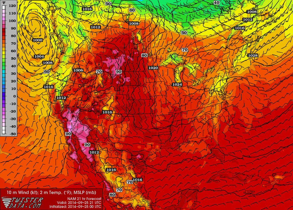
NAM Temperatures Friday Afternoon
A small ridge moving into the area later Saturday through the end of the weekend will allow for more sunny skies and temperatures to warm into the low 70’s. High temperatures for Saturday through next Tuesday look to remain in the low to mid 50’s. Get out and enjoy the week ahead. You may have to wait until next spring to find another week as pretty as this one will be.
5 Day Forecast
Today: Sunny, with a high near 62. North wind around 6 mph.
Tonight: Mostly clear, with a low around 36. Light northeast wind.
Thursday: Patchy frost before 8am. Otherwise, sunny, with a high near 63. Calm wind.
Thursday Night: Partly cloudy, with a low around 45. Calm wind.
Friday: Mostly sunny, with a high near 68. Calm wind becoming west around 6 mph in the afternoon.
Friday Night: Mostly clear, with a low around 46.
Saturday: Sunny, with a high near 69.
Saturday Night: Mostly clear, with a low around 46.
Sunday: Sunny, with a high near 73.
Sunday Night: Mostly clear, with a low around 50.