Day 10 Recap

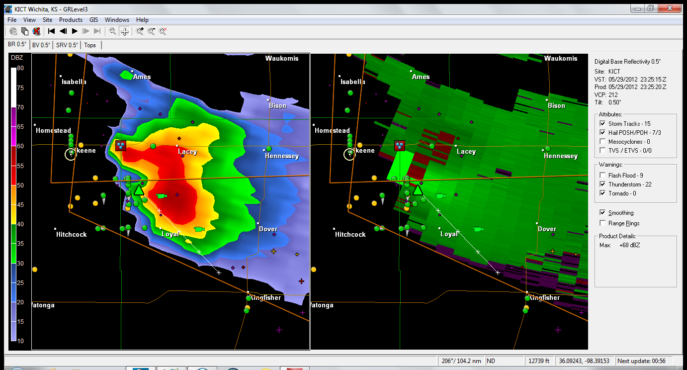
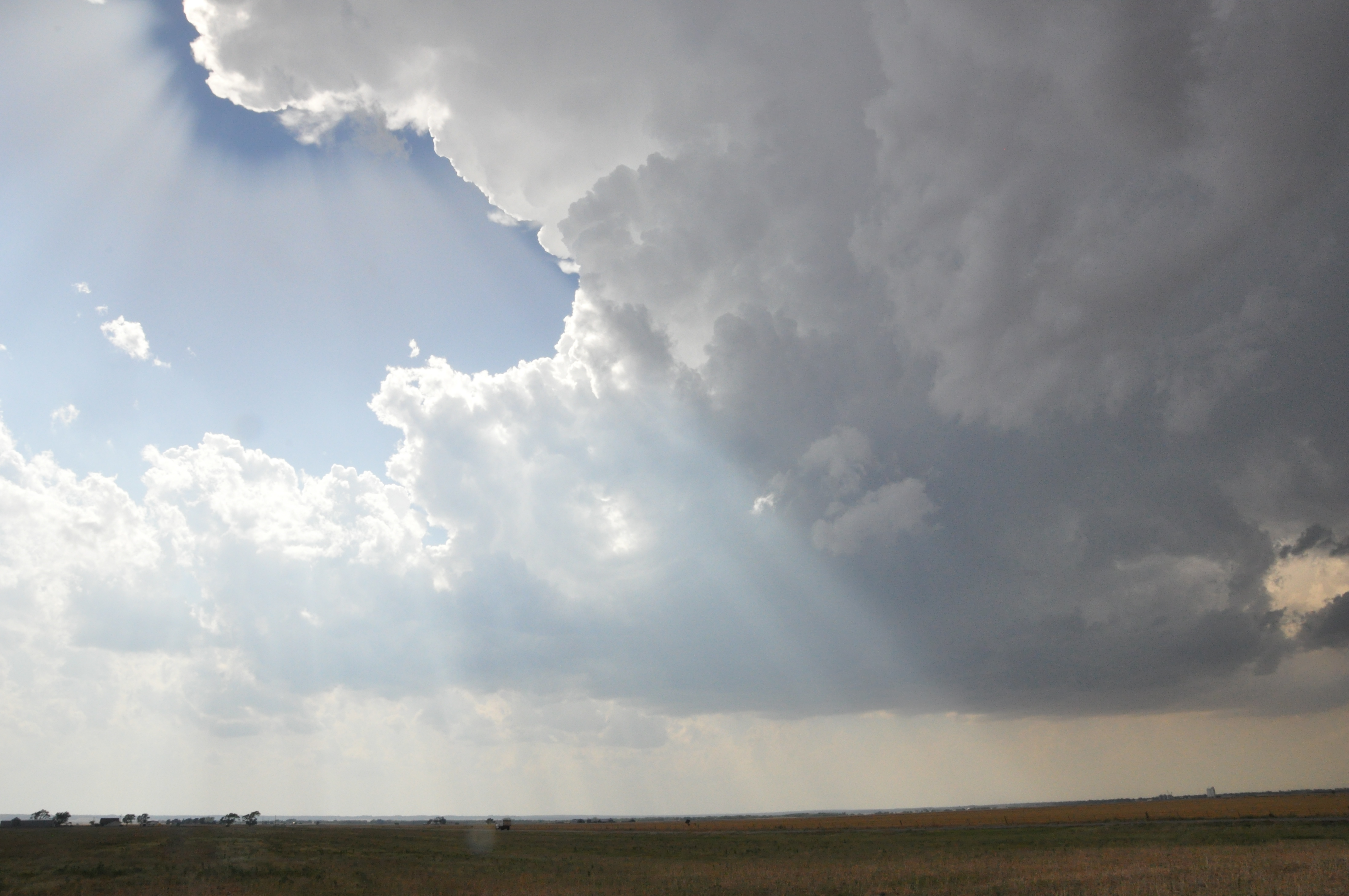
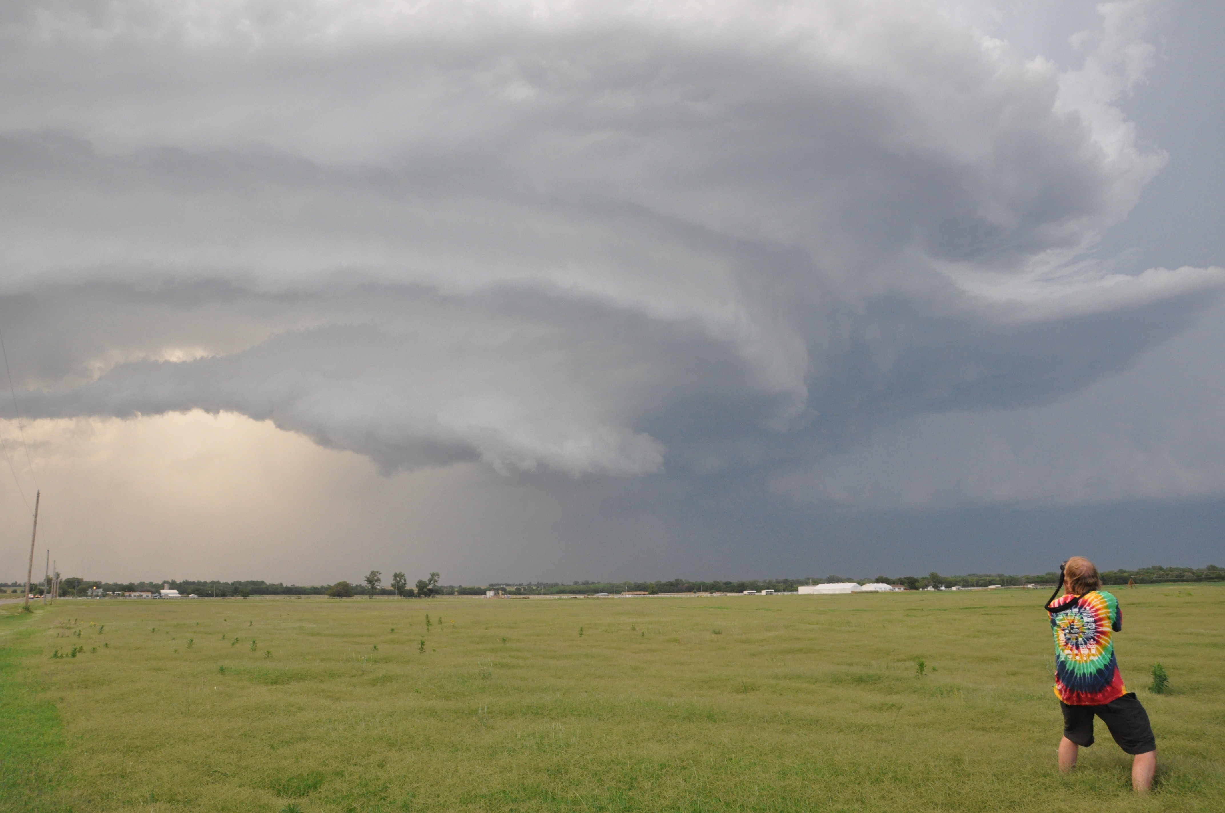
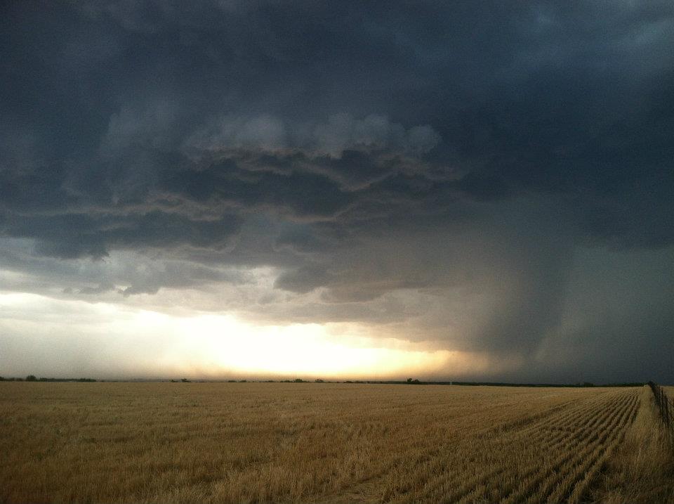
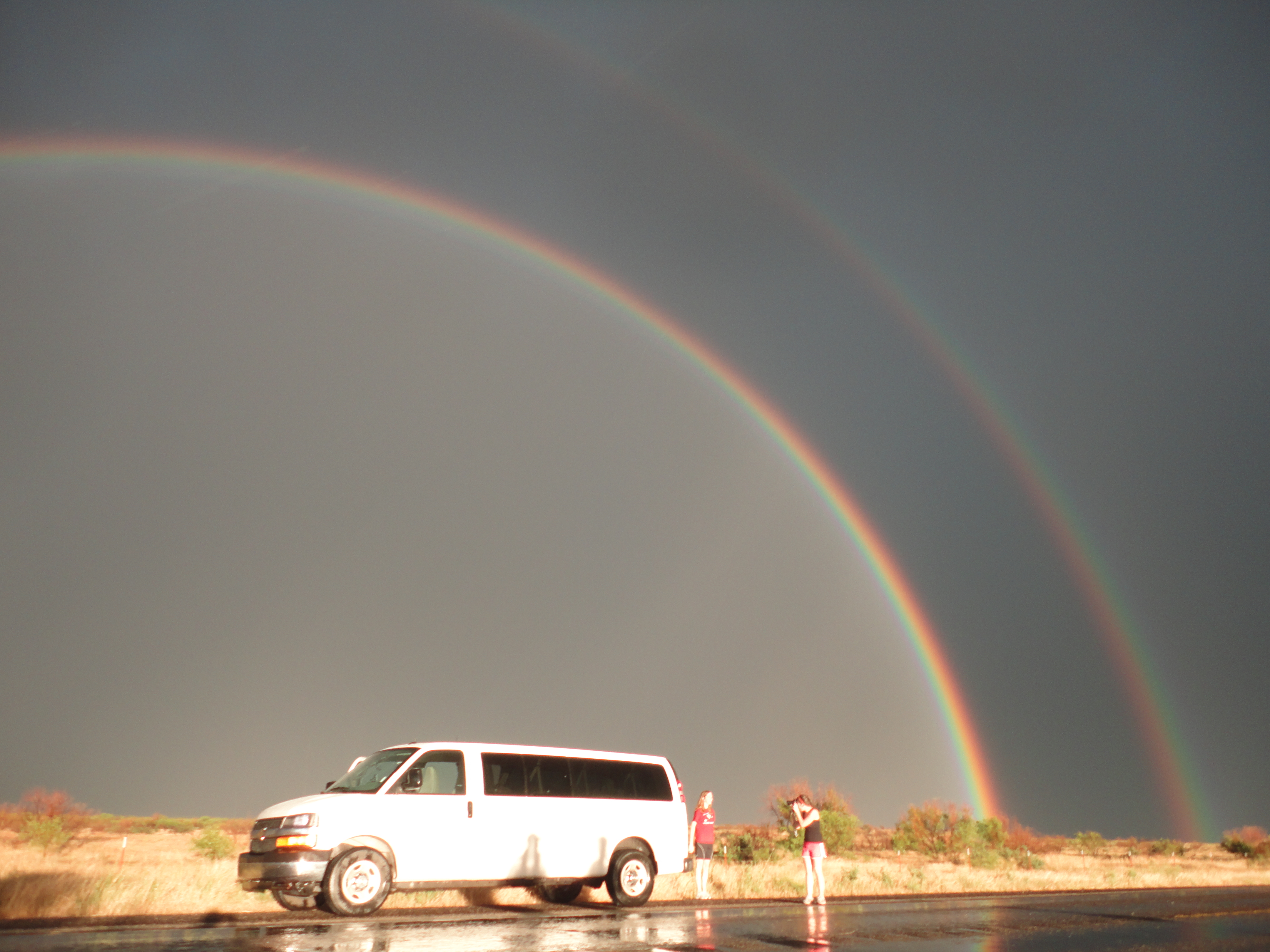
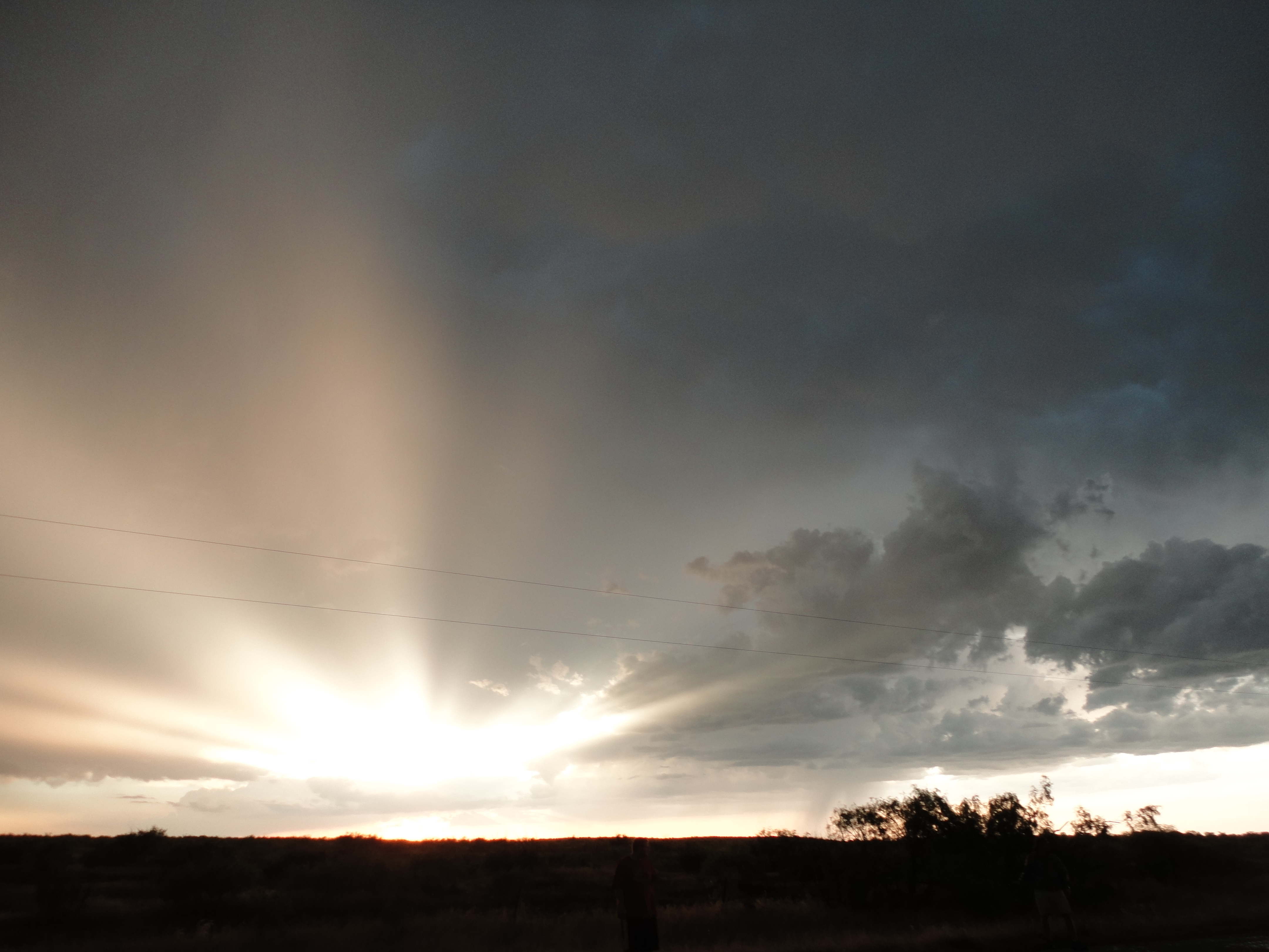
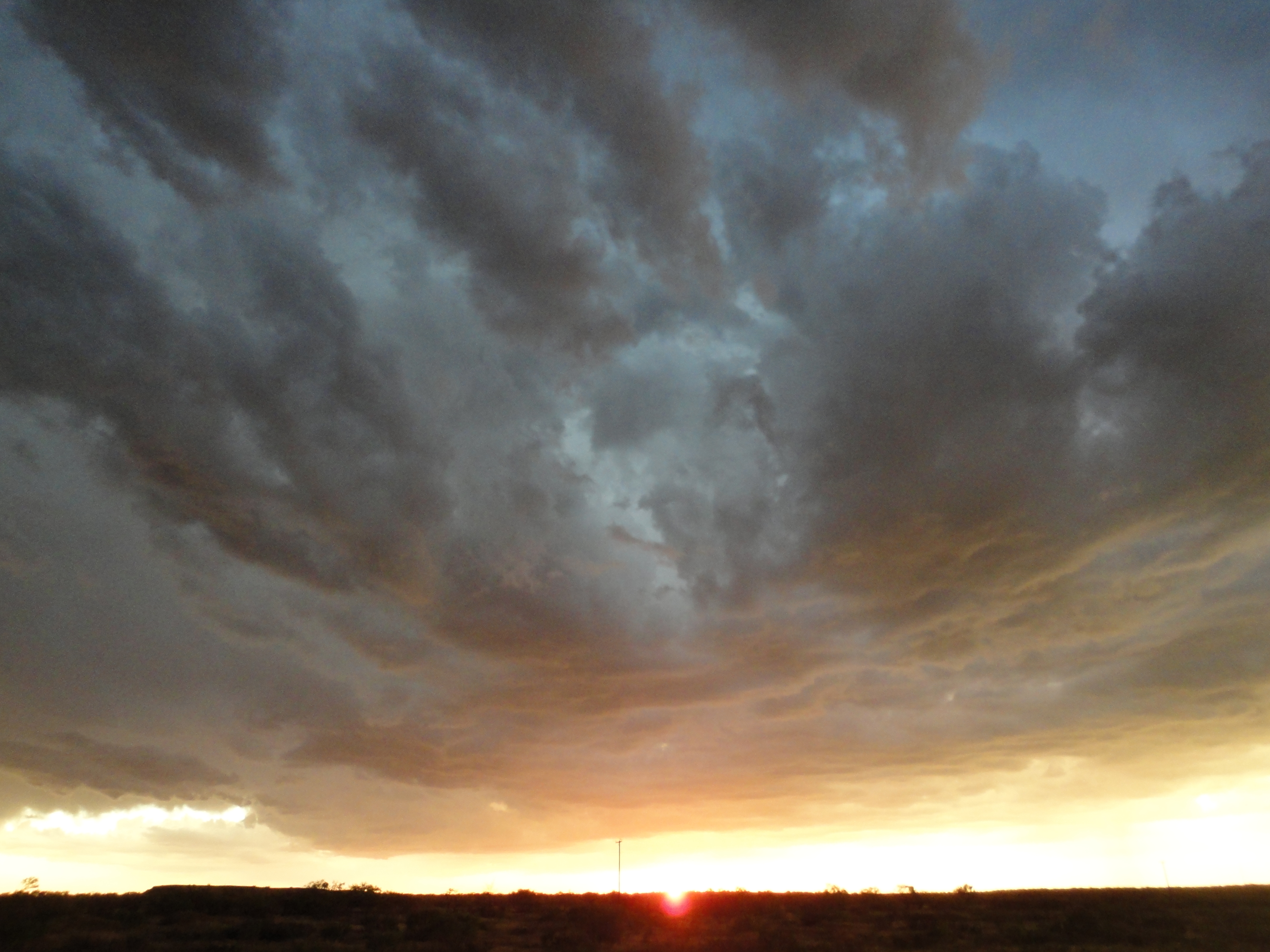
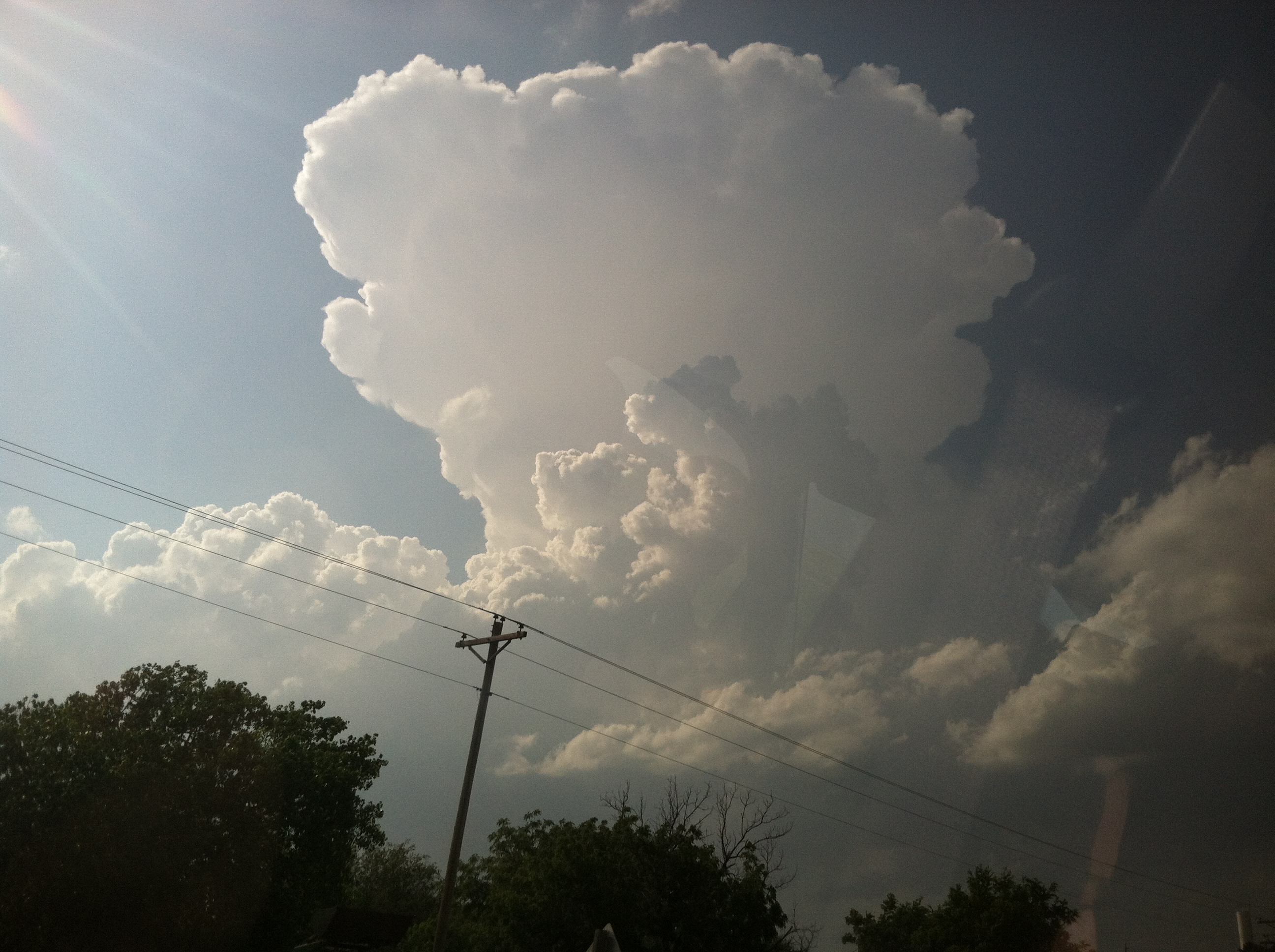
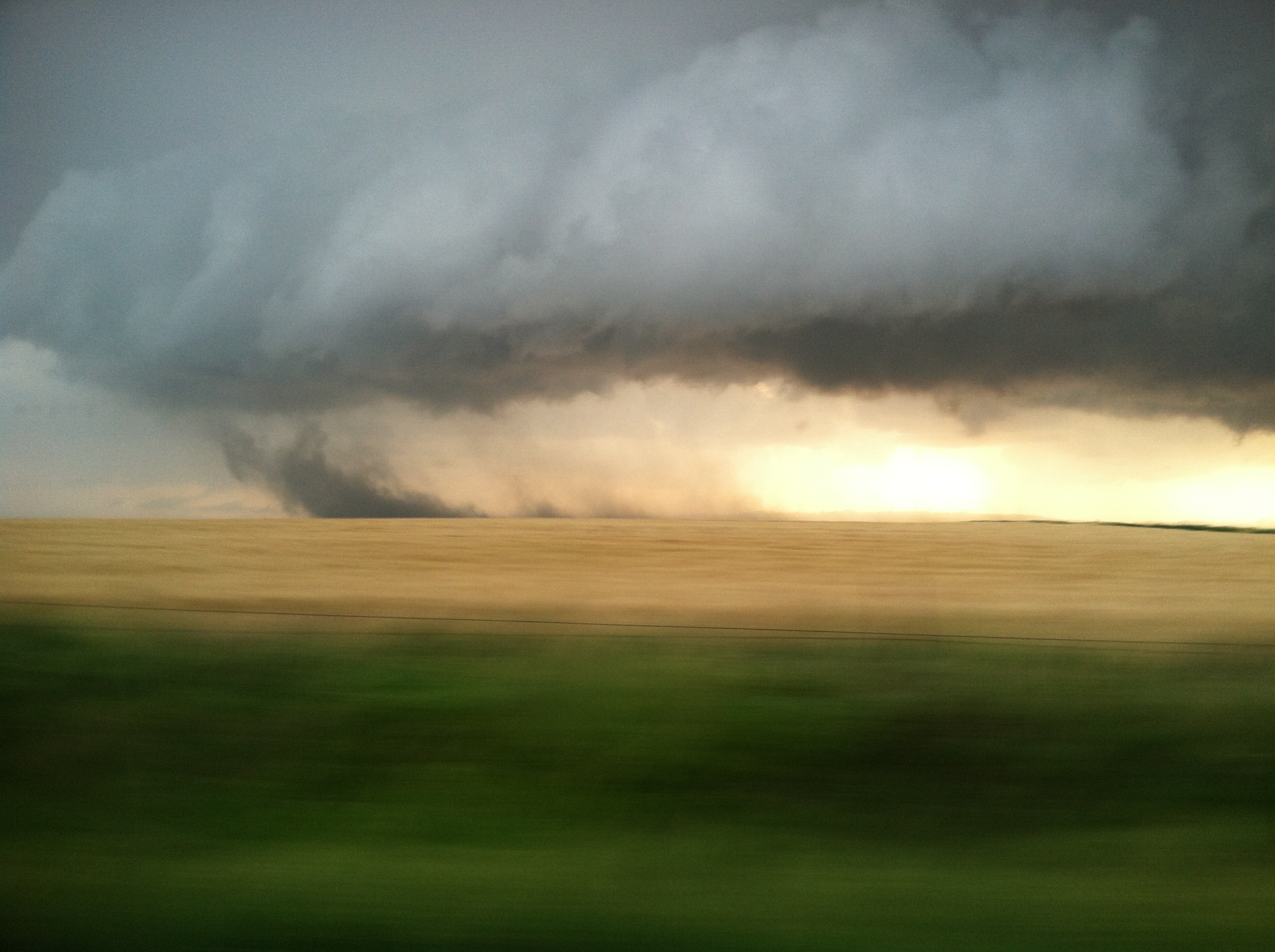
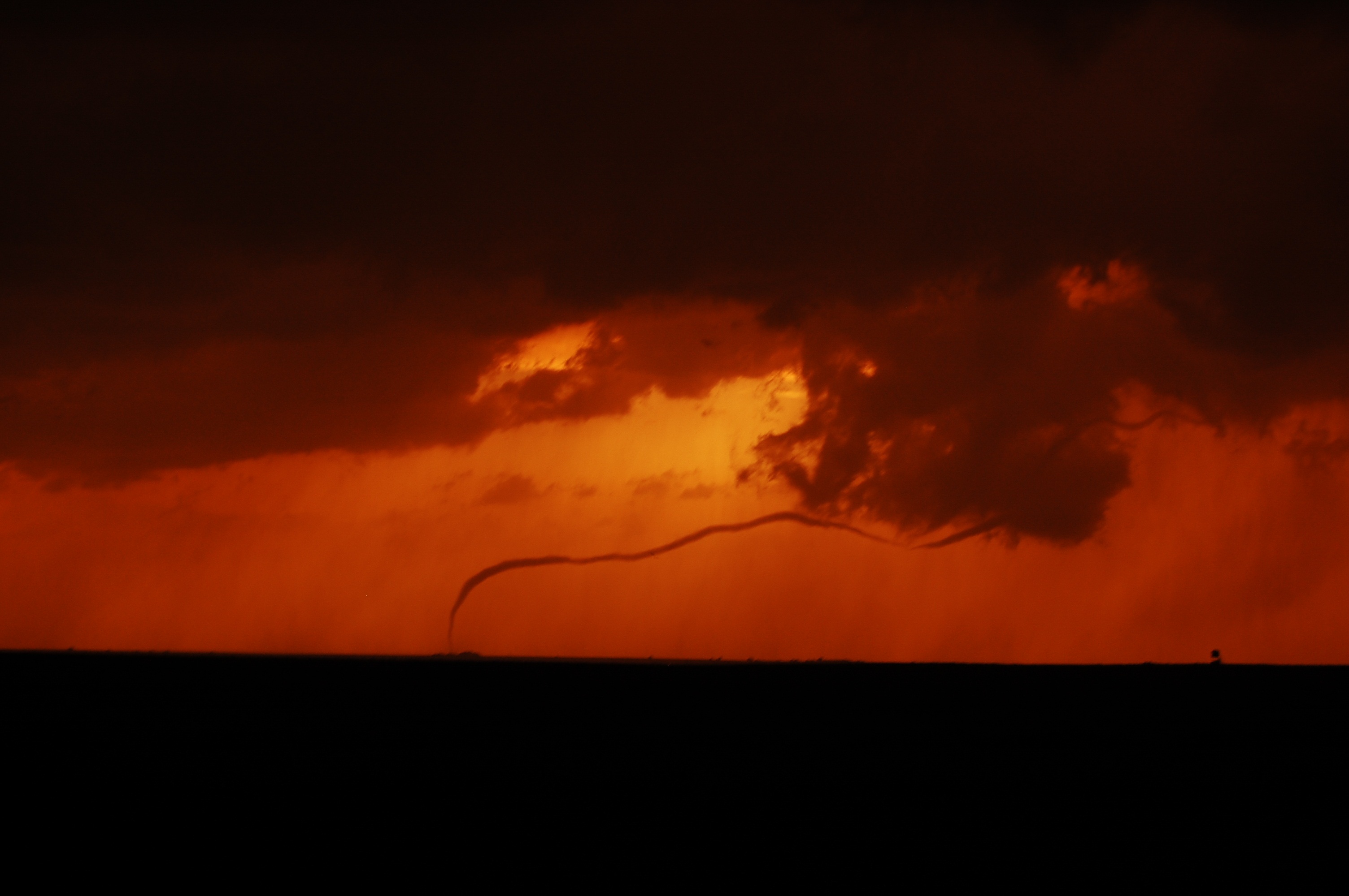
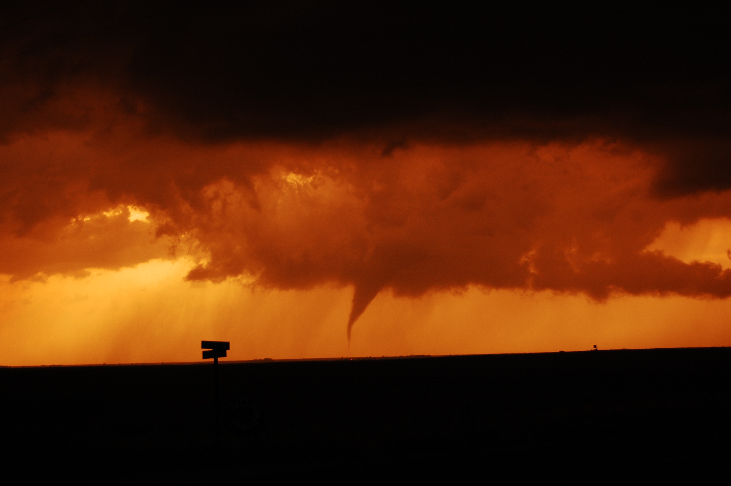
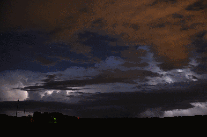
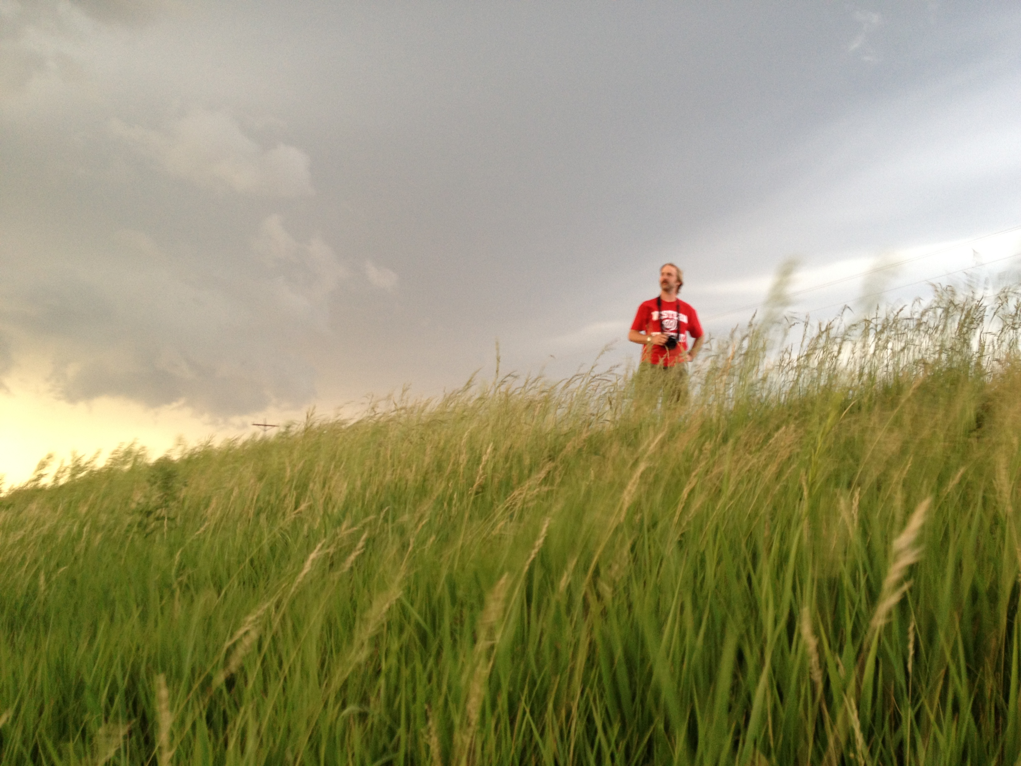
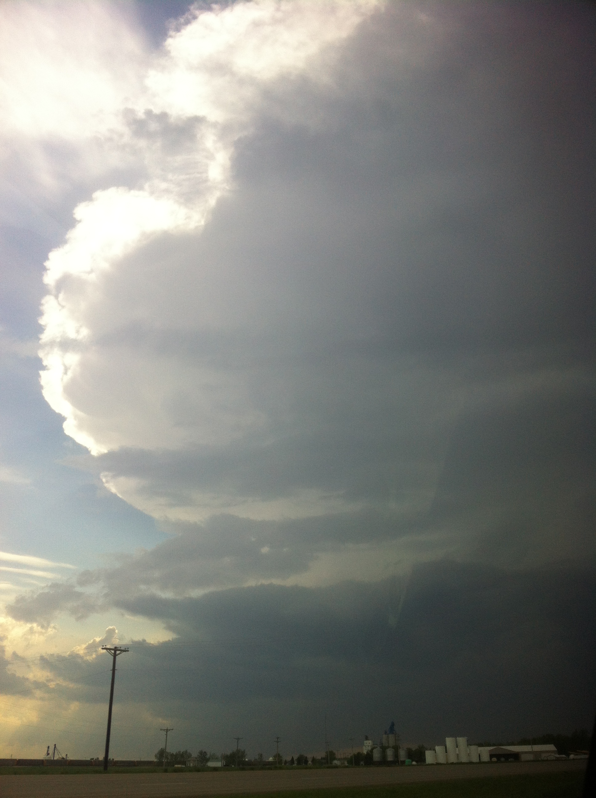
We woke up in Stillwater Oklahoma after a successful day the previous day with insane structure on storms we witnessed just northwest of Oklahoma city.  Storms continued to persist throughout our region along a boundary that was left from the decaying storms throughout the night, and it was thought that this boundary would help to increase the threat of tornadic storms in northwestern Oklahoma.  A broad surface thermal low situated on the TX/OK border with an attendant upper level shortwave would provide added forcing to an already potent thermodynamic setup situated in western Oklahoma.  A clear dryline bulge was forecasted to enter extreme southwestern Oklahoma initiating storm development, but another noticeable dryline bulge was depicted along a tight gradient from the panhandle of Oklahoma to around the El Reno region in west-central Oklahoma.  The upper dryline bulge with both better dynamic and thermodynamic support seemed to be the best play for severe storms in the afternoon.

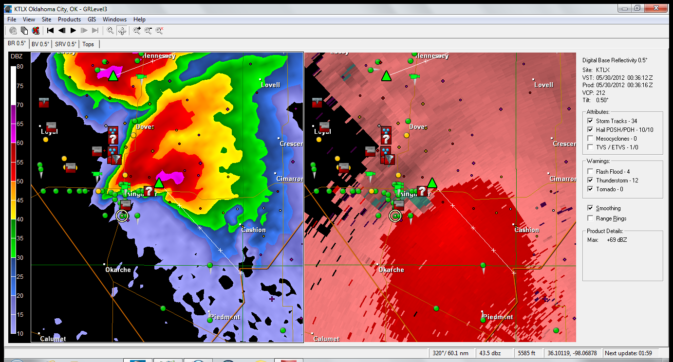
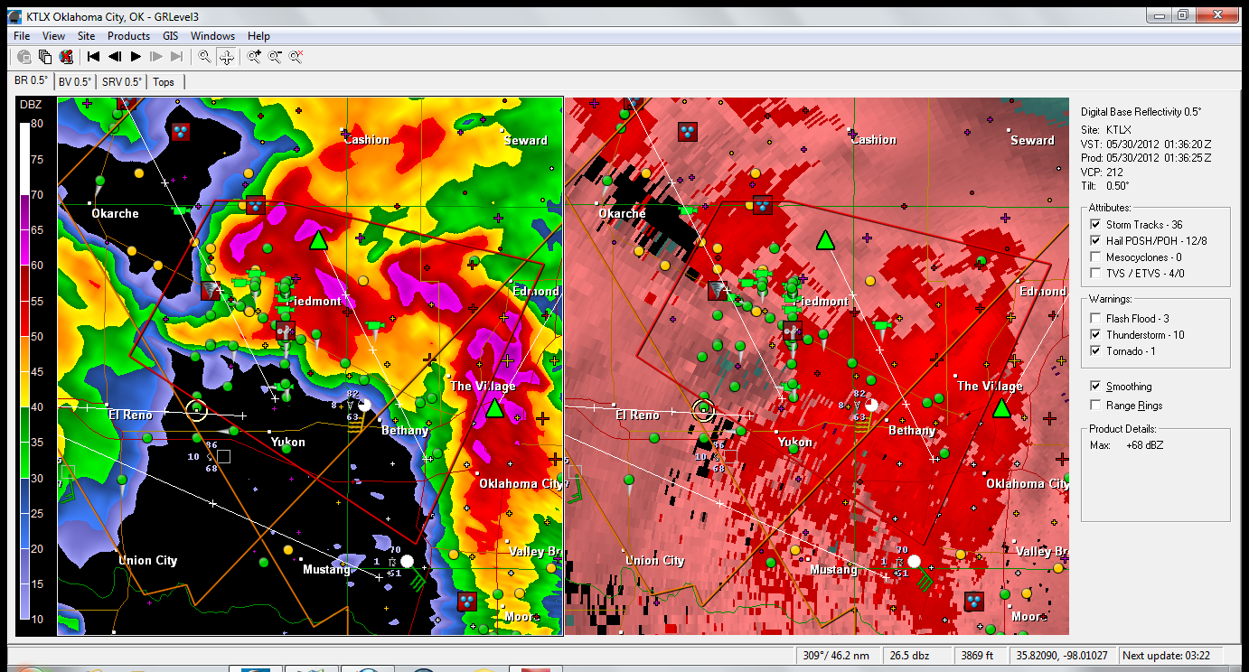
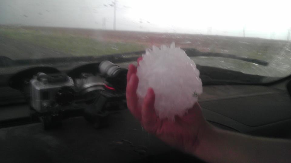
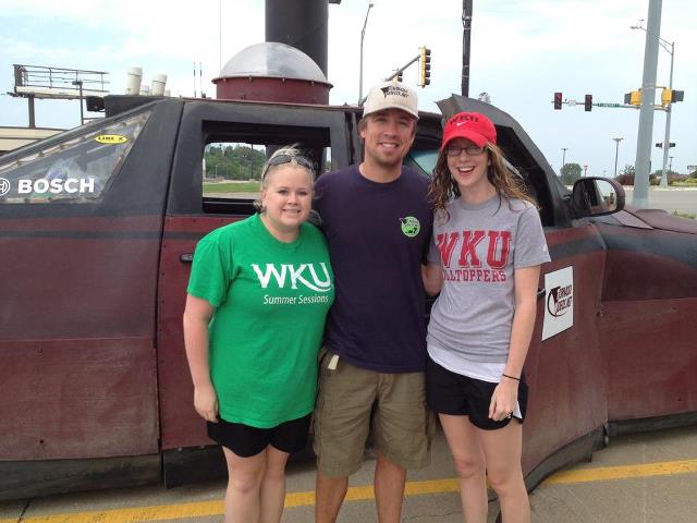
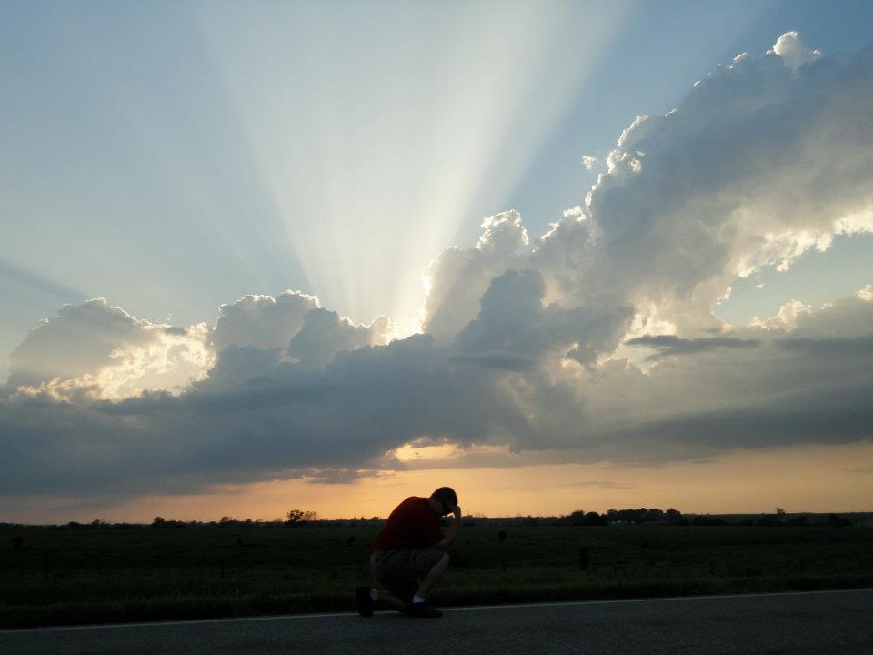
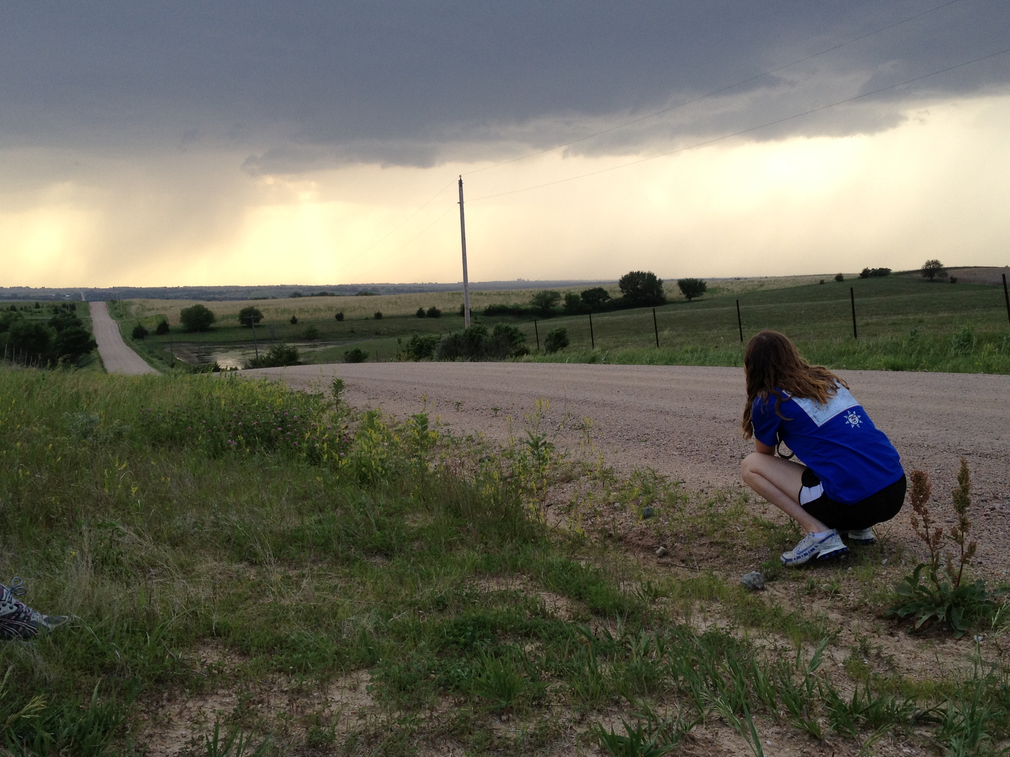
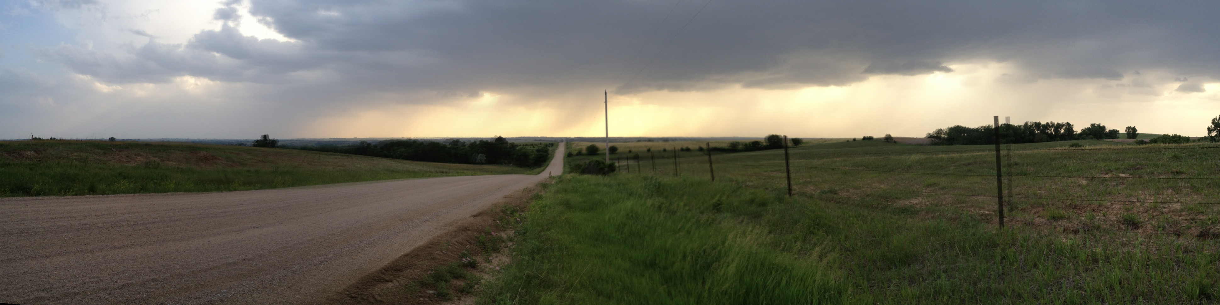
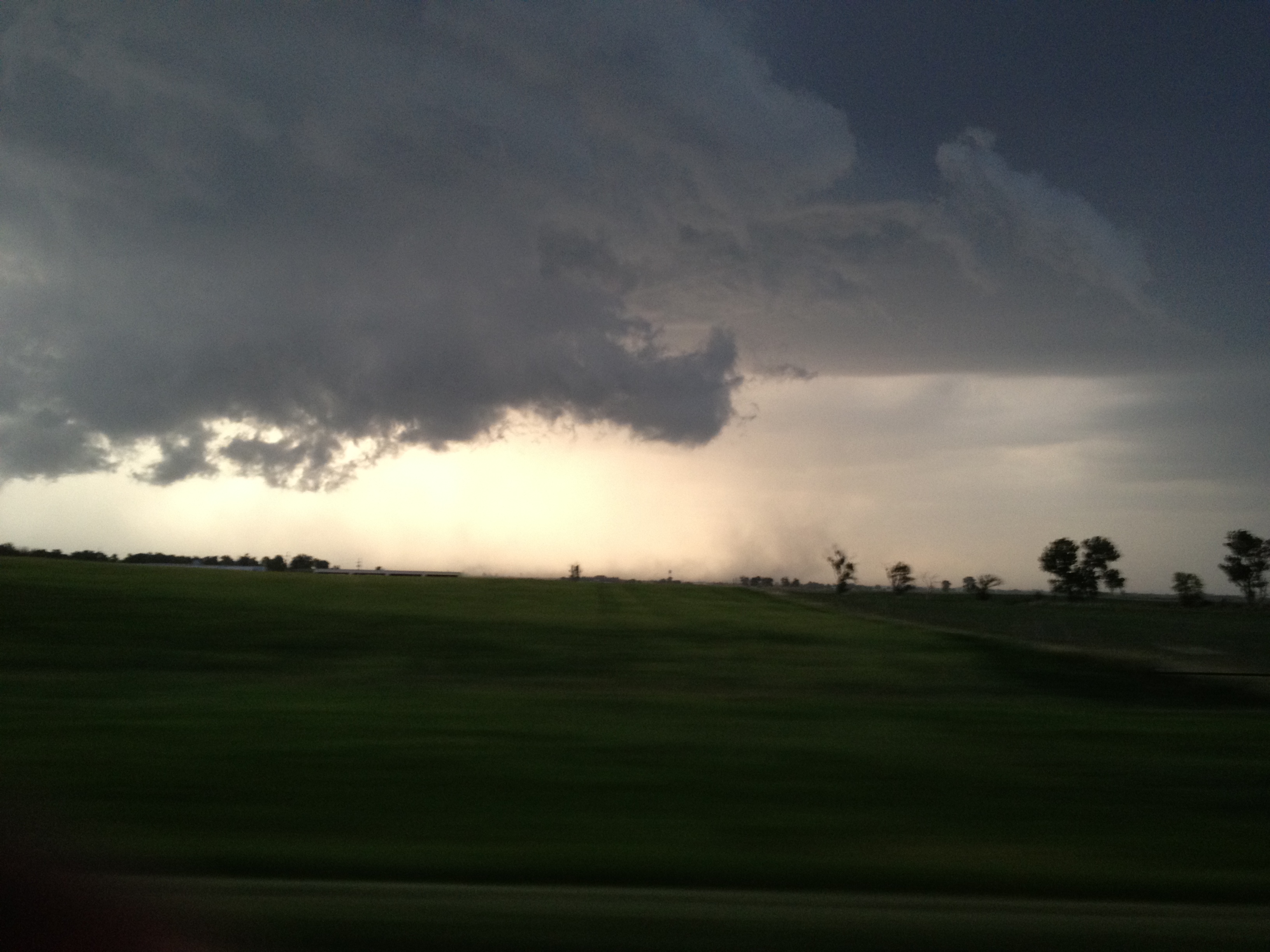
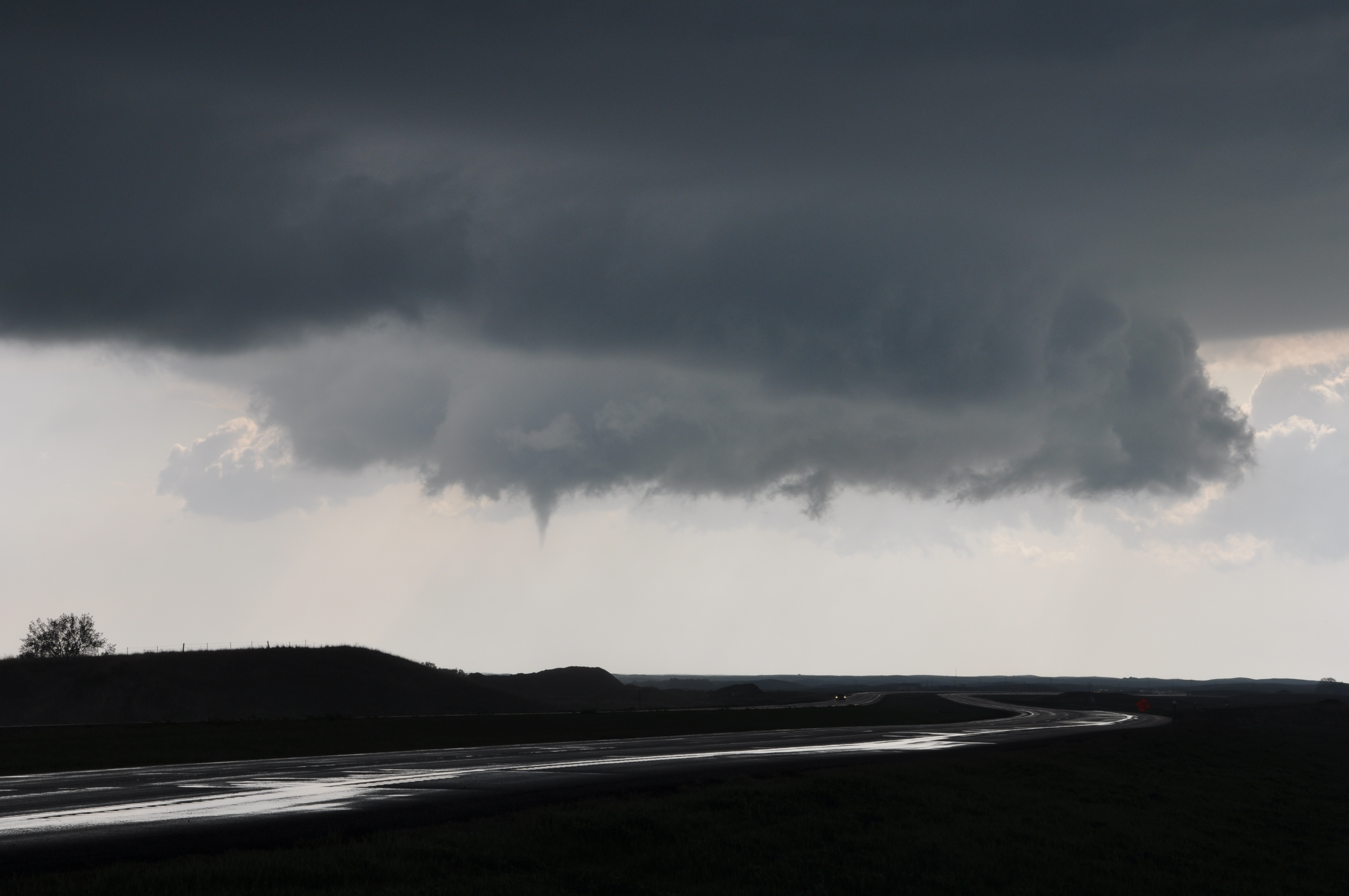
We decided on the location of Alva Oklahoma for storms to initiate, but as we continued to monitor data throughout the treck northward, it started to become clear that our location was in fact not the best location to see storms.  SPC mesoanalysis continued to depict a pocket of very shallow low level lapse rates with a developing surface low forming much further south than anticipated around the Wichita Falls, TX region.  Given our far location from storms that began to initiate, we headed west to hopefully intercept storms along the border of Oklahoma and Texas next to Woodward, but no storms ever initiated.  We ended up staying in Amarillo Texas, enjoying a fantastic dinner at the well known restaurant Big Texan! I took on the man vs. food challenge (and lost).

The Big Texan Restaurant


Man vs Food Challenge. Includes a salad, potato, jalapeno pepper, and large 18oz sirloin steak!

Posted in Uncategorized | Comments Off on Day 10 Recap

WKU Storm Chase Day 9 Recap

After spending the night in Wichita Falls, TX, the group had decided on an initial target of Weatherford, OK with the anticipation of driving northward to position ourselves near the triple point. The triple point is defined as the point where 3 boundaries intersect and in this case was where a warmfront, coldfront, and dry line intersected with a developing low pressure center in western Oklahoma.

Aside from the increased lift and shear provided by the triple point, this target was chosen because an axis of instability with CAPE values near 4000 J/kg resided up to and near the triple point, under a very weakly ‘capped’ environment. Also an upper level impulse with northwesterly flow was forecast to slowly deepen and provide an environment favorable for supercells or multi-cellular storms.

The only limitation from today was the higher cloud bases and very modest low-level flow, that likely limited the tornadic threat. Nonetheless, with minimal expectations of tornadoes, we knew we would at least get to see some terrific structure, and boy did we!

After finally stopping for a sit down lunch, and one other than Subway, moved northward to the warm front and watched cells initiate near O’Keene, Oklahoma. After some initial linear development the southernmost cell began to rotate and move southeast towards Kingfisher, OK.

Photo by: Nathaniel Shearer

Not long after, the storm began to progress and root itself in the boundary layer,  and the group got to witness a wall cloud that briefly took shape as the storm cycled In Kingfisher.

Kingfisher Wallcloud. Photo by Nathaniel Shearer

Near Peidmont, which is a suburb of Oklahoma City, the storm quickly intensified, as another storm from the south interacted with it and was absorbed into the parent storm’s updraft. This likely caused an increase in low level shear and lead to the birth of what may have likely been a rain wrapped tornado. There were reports from other spotters that this indeed was the case, but was not readily visible from our location.

Photo by Nathaniel Shearer

What was visible from our safer location, was truly the most remarkable structure in a thunderstorm that I have yet to see. It by far exceeded the ‘idealized’ storm that is often noted in textbooks, and the students got to witness this first-hand in the Meteorology laboratory that is the American Great Plains. It truly is an awesome sight that a picture can do no justice in describing.

Photo by Emily Yates

Despite narrowly ‘missing’ a tornado, the forecasted main risk for the day was high winds and large hail which all occurred. We were able to witness the high wind after dark (no pictures) as a 71 mph wind gust was recorded at a Oklahoma mesonet station near our location near Minton, OK. The high winds presumably knocked down power lines and we observed many large ‘power flashes’ as transformers blew and knocked out power to the nearby town. Also many reports of hail the size of 5″ were collected from this massive storm.

Photo Taken from Reed TImmer's facebook fan page

Another special treat was we happened to see Mike Bettes and the Weather Channel’s crew do a live broadcast on the side of the road as we all watched a nice storm west of (and out of) Oklahoma City, just after dark.

After a long and successful day, we have finally settled down in Stillwater, OK with eyes on another great chase day tomorrow, which looks to be as good, if not better, than today.

Posted in Uncategorized | Comments Off on WKU Storm Chase Day 9 Recap

WKU Storm Chase Day 8

The WKU Storm Chasers rose this morning in Salina, Kansas and, after a gas station breakfast, hit the road south. Our plan was to first drive southwest of Wichita Falls, Texas, where we could reassess the situation.

At 13Z this morning (May 28), a cold front extended through western Oklahoma and north-central Texas. As we drove early this afternoon, a cumulus field formed in a band along the dry line in west Texas as well as along and ahead of the cold front. By 4:15 pm, a few nice towering cumulus clouds had formed near Seymour, Texas. There was good mid and upper level shear of around 30-40 knots, as evidenced by the leaning towers.

Leaning towers of Cu.

Mixed layer CAPE values were around 3000 J/kg, and there was virtually no CIN. By mid-afternoon, temperatures were in the 90s with dewpoints in the 60s.

Cells started popping and strengthening along the boundary, and 2-inch hail was reported four miles west of Greyback, TX. The line continued to move east-southeast, and we tracked one storm in particular. At one point, a clear wall cloud was visible. However, no funnel or tornado seemed likely. Damaging winds and hail were the main threats with this line.

The WKU Storm Chase class did experience a new first today, however. We drove out ahead of the line, parked under the carport at the Pipeliner Inn in Olney, Texas, and let the storm blow over us.

The most memorable portion of the day came during the evening as we made our way back to the hotel. We drove north out in the middle of nowhere in Texas, with the sun setting to our west, when a double rainbow suddenly became visible to the east. It was a double rainbow all the way across the sky. What could it mean? None of us had ever seen violet so vivid. As if that wasn’t enough, lightning was lighting up the sky in every direction. Needless to say, some mesmerizing images were shot of lightning along with the double rainbow and sunset. We will stay in Wichita Falls, Texas tonight and shouldn’t have to drive too far for action on Tuesday. The SPC currently has a slight risk out for most of central Oklahoma.

Posted in Uncategorized | Comments Off on WKU Storm Chase Day 8

Storm Chase Day 7 Recap

Today began in Sioux City, IA. We stopped to get gas and preform the necessary window cleaning and Rain-X applications. While at the gas station, we noticed that Reed Timmer, storm chaser with Tornado Videos. net, and his team were parked across the street. Becca Ollier and I walked over and got our picture with him. He was pleased to find out we were fellow chasers.

Students Emily Yates and Becca Ollier meet storm chaser Reed Timmer

The discussion for the day was held in the van on the way to our target. Today was my day to give the forecast discussion. I began my discussion by naming my target to be Hays, KS. This target was generally agreed upon by the students as well as professors.

The set up for the day began at the 250 mb level with an upper level low situated over Idaho and Montana. A trough axis was situated just over the four corners region with a potent jet streak at it’s base with winds in the center reaching 100 kts. This jet streak was sustained into the 500 mb level with winds in the center around 70 kts. The surface theta-e analysis showed a moisture axis stretching from the gulf into Minnesota. The 850 mb mixing ratio analysis showed a moisture convergence boundary draped from Kansas into Nebraska. A weak circulation was beginning for the formation of a low in north east Kansas. A cold front was draped from Minnesota down through the Dakotas and to the east of Kansas and Nebraska. As the weak development of the low progressed in eastern Kansas, a warm frontal boundary also evolved. The dry line was located just to the east of Kansas and Nebraska and was forecast to move into the states as the day progressed.

The general discussion was that the dry line was the best target for the initiation of storms. Dew points were forecast to be in the mid-50’s to 60’s over the area. CAPE (convective available potential energy) was forecast to be 1000-1750 j/kg with only minor CIN (convective inhibition). Surface to 500 mb shear was forecast to be anywhere from 30-50 kts. The LCL levels were forecast to be high, leading us to decide that any storms that developed would have high bases and the tornado threat would be low. The thought was also that storms would be more linear in nature rather than individual cells. The hope was that the development of the low in eastern Kansas would help the winds begin to back.

The Storm Prediction Center had placed our target area in a moderate risk for today. This was based upon the likelihood of widespread wind and hail events.

We got lunch at a Subway in York, Kansas. We then decided to drive into Smiths Center, KS and take a moment to relax and look further at developing data at Wagoner Park. By 4 pm, we had decided to move to Athol, KS as we watched storms develop to our north and south east. Storms continued to develop along the dry line throughout the day and we moved along it targeting storms we thought to be the most promising. We even ventured across the Nebraska border for a few cells.

Around 7 pm we were east of Gaylord, KS watching a storm to our west. We began to notice the cell to our south east beginning to move to be ingested by the storm we were on. We were hopeful that the interaction of these two storms would allow them to amplify and begin to organize some kind of circulation. The cells did merge and intensify initially. However, no substantial circulation evolved.

This photo of radar was taken around the time when the two cells to either side of the blue indicator (our location) were about to merge.

As we neared the end of the day, the storms had become more linear. We caught a view of a beautiful shelf cloud between Gaylord, Kansas and Smiths Center, Kansas. We also stayed around long enough to feel the winds of the associated gust front. We then began to travel east to catch another glimpse of it.

This shelf cloud was captured around Smith Center, KS. Photo taken by Emily Yates.

WKU Storm Chasers as the gust front moved through. Nathaniel Shearer adjusts his camera settings to better document the storm.

As we began to head back our hotel, we were able to see another beautiful lighting show. We stopped off in Cawker, KS to see the worlds largest ball of twine on the way back to our hotel. Weare staying in Salina, KS for the night

Posted in Uncategorized | Comments Off on Storm Chase Day 7 Recap

Storm Chase Day 6 Recap

This morning we woke up in Junction City, Nebraska and headed north. Unlike the day before, there wasn’t really a focal point for the storms. Our target was northeastern Nebraska where the CAPE levels were forecast up in the 5000s, so instability was promising. A warm front was draped across this area as well and a moisture axis was punching up towards South Dakota. The shear wasn’t too bad either, though it could have been stronger. As the day progressed though, capping kept increasing. We ended up near Brunswick, NE waiting for the cap to bust. There was a little lift from a short wave, but the atmosphere was too capped off for the storm to develop any further. We enjoyed a beautiful sunset before we head back to Sioux City, Iowa.

Photo by Nathaniel Shearer

During our long drive towards our target we stopped at a local school and stretched our legs on the playground. The town of Brunswick held a few interesting features, such as a broken down hearse in front of an old home and a lot full of rusting automobiles. Our find of the day was a rundown shack in a field where we parked to watch the storm. Dr. Dixon was brave enough to look inside and found multiple animal pelts hanging from the ceiling. It was quite a shock!

Photos by Nathaniel Shearer

Though the day was uneventful weather-wise, we had a good time with lots of laughter. We ended our long day with a delicious dinner at Chili’s near our hotel before calling it a night. Tomorrow we’ll hopefully encounter a better setup for severe storms!

Posted in Uncategorized | Comments Off on Storm Chase Day 6 Recap

Storm Chase Day 5 Recap-First Tornado!

First of all, it was one of the chasers birthdays today and what a birthday it was!  We started off our day in in Andover, Kansas and met up to talk about what was going to go on today.

The ingredients were all there for a storm to develop.   At the beginning of the storm, there was 3500 level CAPE, which means instability was definitely there.  The wind shear was very good at the time of the storm and along the warm front there were the best hodographs, which showed very organized super cell development. There was moisture convergence in the surface mixing ratios and arrows were converging.

We decided to go for western Kansas along the dry line to play the triple point.  There was a 5% chance that tornadoes would occur here. We headed more toward Hays.  We started out thinking it could have been a frustrating day because of the amount of cap that was along our target area.  All we needed was for that cap to break. GOOD THING IT DID!!!

While making our way to Kinsley Kansas, we passed through Greensburg, In 2007, the town got hit by a F5 tornado.  Everything was wiped out in the town.  You can still see the signs of the damage to the trees in the town.  We stopped at a local meat place and got some sandwiches and hit the road.

While waiting for the cap to break, we went to a nice park in Kinsley, Kansas where everyone seemed to enjoy themselves.  Some of us climbed trees and others stayed in the van because of the heat.  Temperatures were in the low 90s at this point.

We left the park and headed out and got to see the cap break.  This was nice to see.  It was really cool to see the progression of the storms as they went through their phases. We moved to where we thought the storm would initiate and had to drive to Liebenthal, Kansas.  We saw a few gustnadoes with this cell.

We moved away from the cell a little ways down the road and stationed ourselves again and our first tornado appeared.  It was a nice and long rope tornado near Walker, Kansas.  It was really cool to see it and most of us chasers have never seen a tornado before hit the ground.  It was definitely a great chase day for the chasers!

Photo by Emily Yates

Three out of the four cells that we saw today fired up in McCracken.  The last three fired around the town and produced multiple tornado reports.

While the last cell was moving through, we decided to follow it through the night and we got a very nice lightning show.  It was reported as a stove-pipe tornado, but we didn’t see any signs of a tornado, just a nice wall cloud.

Photo by Nathaniel Shearer

Things went really well for us today and the storms fired relatively close to our target area.       As for tomorrow, we are headed back to the north.

Posted in Uncategorized | Comments Off on Storm Chase Day 5 Recap-First Tornado!

Storm Chase Day 4 Recap

With the moderate risk in Minnesota and Wisconsin out of driving range from our starting point in Lincoln, Nebraska, our class decided to head south into Kansas to chase. Our target was the tail end of the cold front east of Wichita, KS, along the northern edge of a plume of rich Gulf moisture. With convective initiation before sundown in doubt and capping across the region a concern, we did not have high expectations for the day but were hoping for at least a nice lightning show after dark.

The drive started on a high note with a stop at the Runza restaurant in York, NE, where we feasted on their (in)famous hot pocket-like Runza sandwiches and once again ran into Sean Casey and the TIV.

Mmmmmm

Continuing south toward Wichita, KS, we were able to see the surface boundary slowly come into view over the horizon. A sharp line of cumulus clouds separated the drier air behind the front from the juicy warm sector. This was a neat experience for those of us on our first Plains chase trip, as these types of sharply-defined boundaries are rarely seen in the eastern part of the country.

After a quick souvenir stop at Wichita State University, we headed eastward toward Eureka, KS to position ourselves east of the boundary. During the drive, storms began to fire along the boundary to our north. They did not turn severe or display any rotation, but they still provided some picturesque scenes south of Emporia, KS that we stopped to enjoy.

Kyle Berry having a religious experience

While we were chowing down on a delicious dinner at Bobby D’s in Emporia, a storm to our northeast began to intensify and produce some impressive lightning. After darkness fell we headed north to a field just outside of town and enjoyed the show:

While today didn’t provide anything overly spectacular, things panned out almost exactly as we forecasted and the class got to experience Great Plains thunderstorms for the third straight day. Tomorrow we will have an early morning discussion to assess a complex forecast and likely head to Salina, KS to set up for the day.

Posted in Uncategorized | Comments Off on Storm Chase Day 4 Recap

Day 3 Recap-Nebraska

After rising early in Aberdeen, South Dakota, we analyzed the surface observations and upper air data to determine our chase target. Sufficient moisture was accompanied by 40-60 knot shear in east-central to southeast Nebraska, but highest CAPE values were limited to southeast Nebraska and central Kansas.  Taking these components into account, Grand Island, Nebraska, was determined a good central location to begin our chase day.

After a six-hour haul to our chase city, we stopped for lunch and assessed weather data.  Initiation had yet to begin, and we determined we need to be farther east to see storm structure. So we then headed to Aurora, Nebraska, and stopped at a neighborhood park to enjoy some frisbee and “soccer-tennis.”  After playing while waiting for initialization, we headed further east to Seward, Nebraska.  Here we saw the Tornado Intercept Vehicle, made famous by IMAX film maker, Sean Casey.  Late this evening, we chased a tornado-warned cell in Ceresco, Nebraska, that produced two gustnadoes, which form in the outflow region of a thunderstorm but do not connect to the cloud-base.

While pulling into our hotel parking lot in Lincoln, Nebraska, a tight couplet was seen on radar to our west by Dr. Grady Dixon.  We left the hotel to get a better vantage point of the rotation at a nearby gas station, but the rotation quickly weakened. Tomorrow we could be chasing in Kansas, depending on how the ingredients come together.

Student Emily Yates documenting storm near Ceresco, NE

Panorama of storm near Ceresco, NE

Beginning of gustnado near Ceresco, NE

Gustnado near Ceresco, NE

Our majestic leader!

Written by Tami Gray

Posted in Uncategorized | Comments Off on Day 3 Recap-Nebraska

Day 2 Recap

We woke up in Waterntown SD with a tough decision on our hands as we tried to discern the difficult setup that was ahead of us. Two distinct locations were discussed among the group; one being a central North Dakota play where the best moisture and instability would be, while northern North Dakota provided the best shear to organize storms with limited instability but best backed winds at the surface which supports the development of tornadoes. A cloud deck moving from west to east also added difficulty to our forecast. Strong capping through most of the Dakotas could keep storms from initiating, or initiate in the afternoon hours. Depending on where storms initiated as well, we may end up too far north to make a play on what looks to be a south eastern to south central Nebraska severe weather event Wednesday. Topography would also be a large factor today, because a river running through central North Dakota wold block access to a western route if storms fired west of the river. After discussing the setup and options available, it was decided that we would drive to Bismark North Dakota in order to have plenty of road options depending on where storms initiate throughout the day.

After marching north to Fargo North Dakota and taking a short visit to Moorhead Minnesota, we took a short break in Fargo to spend some time at a park further assessing the setup.

 Fargo Park

Passing time at a park to assess data

After leaving Fargo we headed to Jamestown SD to stop at a Subway and grab lunch. We then continued west toward our target location of Bismark continuing to monitor the developing storm system.

After reaching Bismark, we then took another break to determine our next move, either wait for storms that may possibly develop at our current location or begin to chase storms that were beginning to develop on radar, but with a very weak signature. After continuing to monitor the weak initial cells, one caught our eye that began to blossom with decent structure associated with it. We then decided to follow this storm and headed toward the north just southwest of Minot North Dakota.

Anvil of the storm we targeted

The storm first came into view around 6:00 p.m. The anvil structure associated with it was impressive, and as we began to approach the base of the storm, we witnessed a surprise rapidly rotating wall cloud and lowering funnel cloud.

Very thin funnel cloud that developed very quickly

After watching this funnel rapidly rotate and dangle from the base of the storm, we continued to chase the storm which eventually developed into a garden variety thunderstorm. While continuing to observe the storm, we received one more surprise with a modest intensification of the storm we were viewing to our south. Hail began to fall at a modest rate ranging from pea to quarter size. It was a successful end to a spot on forecast in a fairly difficult setup.

Hail just under the severe threshold of 1". Still fairly large regardless.

We ended the night with a long drive south ending in Aberdeen South Dakota to be in range for our next target Wednesday.

"The Instructor In The Classroom"

Tami Gray, Becca Ollier, and Dr. Dixon engaged in conversation about the unique texture of the hail that fell

Update: Although hard to discern from our own pictures, photos taken from other vantage points show the needle funnel cloud we witnessed in contact with the ground.  No confirmed tornado reports have been made, but it is possible that May 22nd marks the 1st tornado sighting of the 2012 WKU Storm Chase Class! The issue, we believe, is that the contrast and lighting on the back side of the funnel cloud may have washed out a view of the funnel in contact with the ground at our location.  Hopes are that updates on the matter will manifest themselves later on throughout the class.

Posted in Uncategorized | Comments Off on Day 2 Recap

Field Methods in Weather Analysis and Forecasting…..its on again!

Hello readers,
Now an annual event, yesterday 8 students and 2 professors embarked on a journey across the great plains to forecast and verify severe convection. This ‘storm chasing’ class is meant as a capstone experience for young meteorologists to perfect their forecasting skill that they were lectured on at WKU. Daily updates on this blog will begin today, and run through the next 13 days. The blog posts will cover forecasted targets for severe weather,as well as chase day recaps and just our entire journey as us students experience cool things along the way. For those in the ‘twitterverse’ we will aslo be frequently updating our trip @wkustormchase on twitter.

Our journey began yesterday by leaving from Bowling Green, and ended last night ,after 600 miles of driving, in Kansas City, MO. Maybe its a precursor of things to come, but we got to drive through a weak squall line on the way out. At sunset, we were treated to a great view of yesterdays solar eclipse.

Today is being treated as another driving day as we target the Dakotas for tomorrow. A low pressure center is forecast to deepen as moisture begins to return along the front range. Full details will be blogged tomorrow, but this appears to be our first chase-able day. Sufficient instability, forecasted dew points in the 60’s, as well as ample shear, will provide an environment conducive to severe convection. Stay tuned !


Posted in Uncategorized | Comments Off on Field Methods in Weather Analysis and Forecasting…..its on again!