After quite a beautiful week, it’s time for all of our weekend plans.
Friday will start off cool with temperatures in the low 60s. If you happen to get cold easily and need a light jacket while heading to that 8am class, you will be able to shed it by mid-morning as temps will start to edge up into the 80s. While temperatures will top out in the upper 80s Friday, it’s the dew point temperatures that will make for an uncomfortable start to the weekend. DPs will be near, if not above, 70 tomorrow, which is fairly oppressive. There is also a very slight chance for a light, passing, shower in the area Friday evening, but nothing that will necessarily ruin any outdoor pans. The warm mid-levels will likely prevent any rain from occurring, but a cold front passing through in the evening hours could be enough to force a few showers.
With the cold front moving through Friday evening/overnight into Saturday, winds will be out of the north bringing in much drier air for Saturday. DPs will be in the low 60s, and temperatures will be a little cooler with a high around 85.
Sunday will be a little warmer than Saturday, but at least it will still be manageable with dew points in the low to mid 60s. Looks like the perfect weather to do some yard work and then head to the pool for a refreshing dip if possible!
Overall, the weekend really couldn’t be much more ideal for this time of year especially for those that have any outdoor activities. If you have the time, take advantage of the warm, weather, clear skies, and low dewpoints Saturday and Sunday especially. A quick look at the beginning of next work week shows temps taking quite the jump into the 90s, so be ready to take it easy with any outdoor sports or activities next week.
Posted inKentucky Weather|Comments Off on Looking to the Weekend
Hopefully everyone enjoyed their first week of school! If not hopefully you were able to recuperate over the long weekend.
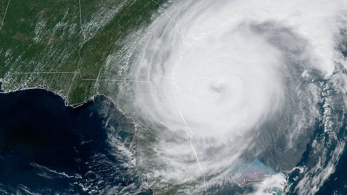
The big weather event on everyone’s minds right now is hurricane Dorian. Dorian’s maximum winds have backed off bringing the hurricane down to a category 2. Here is a current picture of what the system looks like right now.
Dorian will continue its track up the east coast affecting Florida, Georgia, South Carolina, North Carolina, and southeast Virginia.
Greatest flood risks
There are storm surge warnings along the eastern coast coinciding with the flash flood risks. Thankfully we’ll stay outside the risk zone.
There is a cold front that has crossed over the state and is actually sitting on top of Bowling Green right now. That cold front is helping to brings some clouds into the area for this afternoon into this evening. Temperatures will start to go down just slightly.
Hopefully everyone has been enjoying the warm weather and sunshine today, as there is more of that to come this week.
Tonight a high pressure system will continue to move into our region, keeping sky conditions mostly clear overnight with a low around 65°F.
High pressure will remain dominant Tuesday bringing more sunshine to our area, with a high around 90°F. Tuesday night will remain clear with a low around 68°F
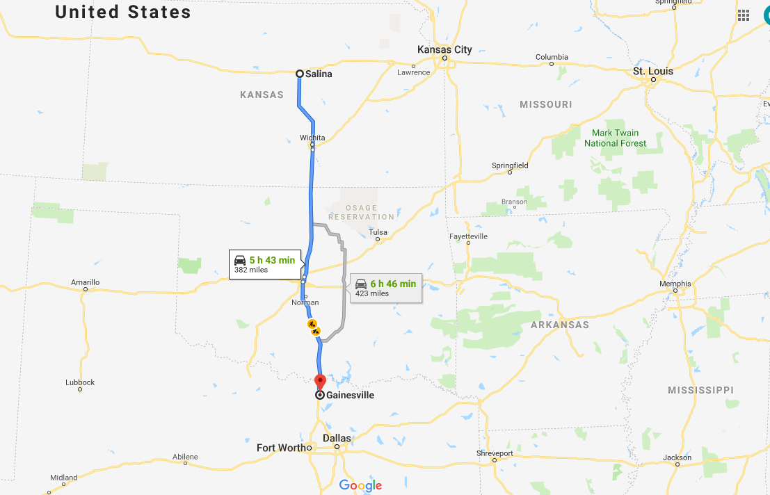
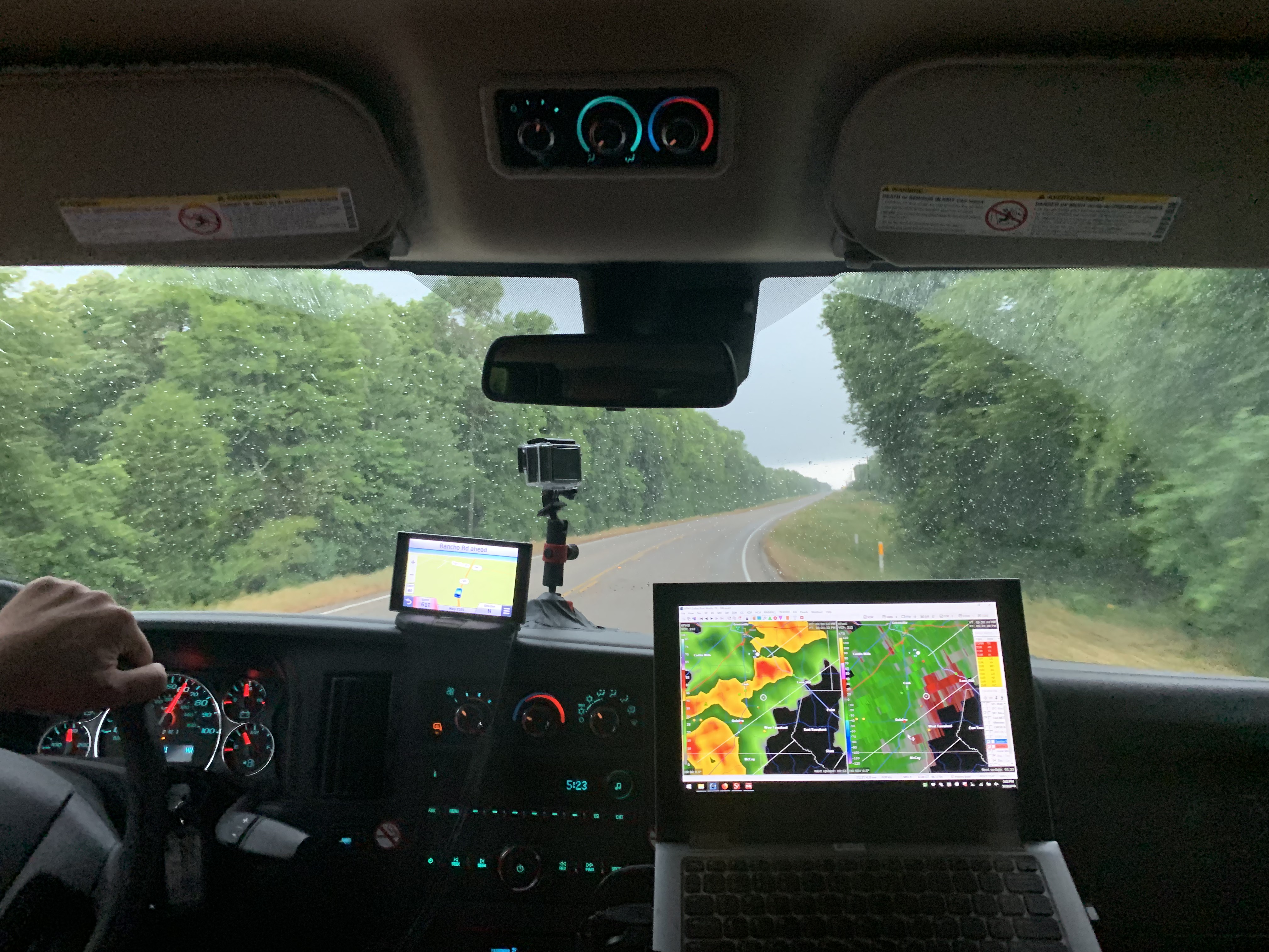
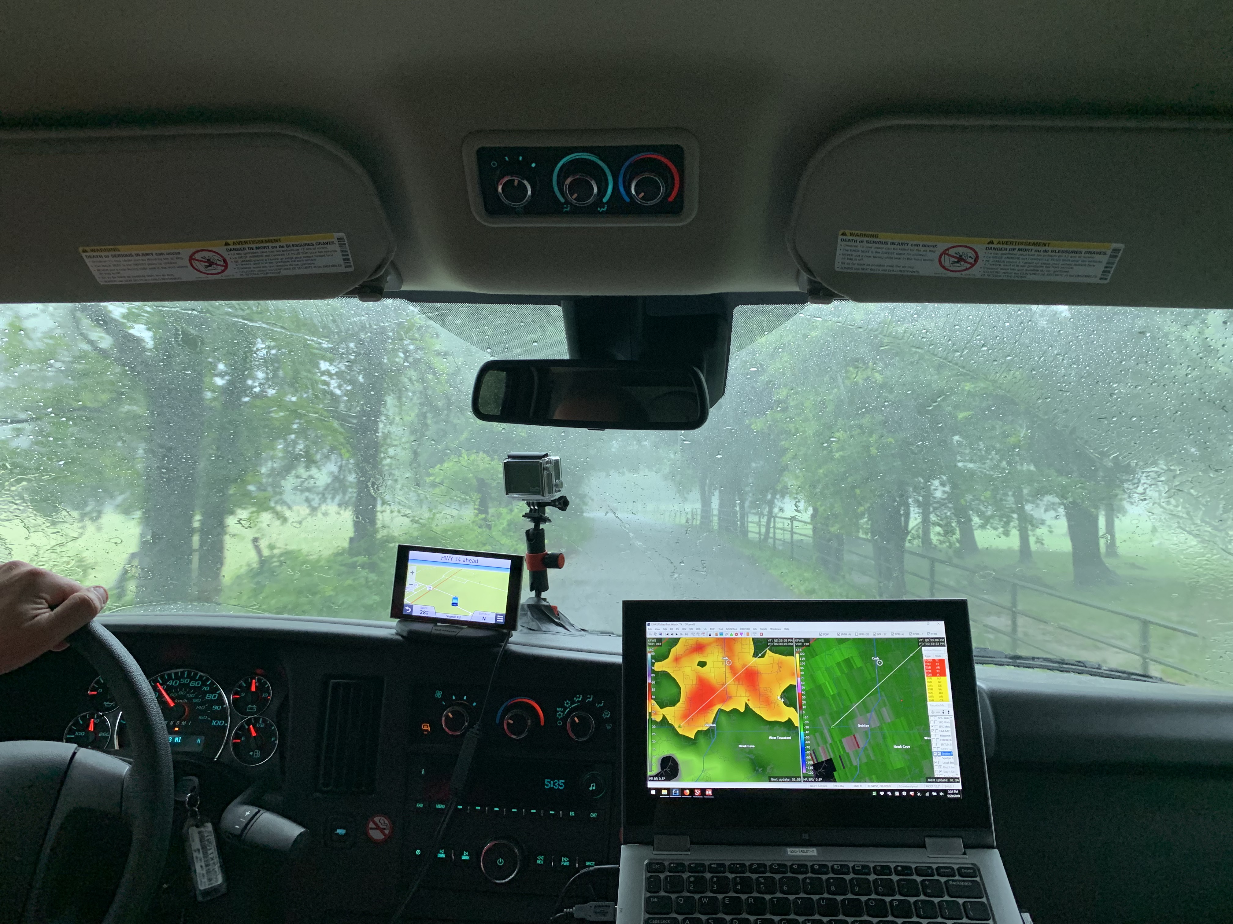
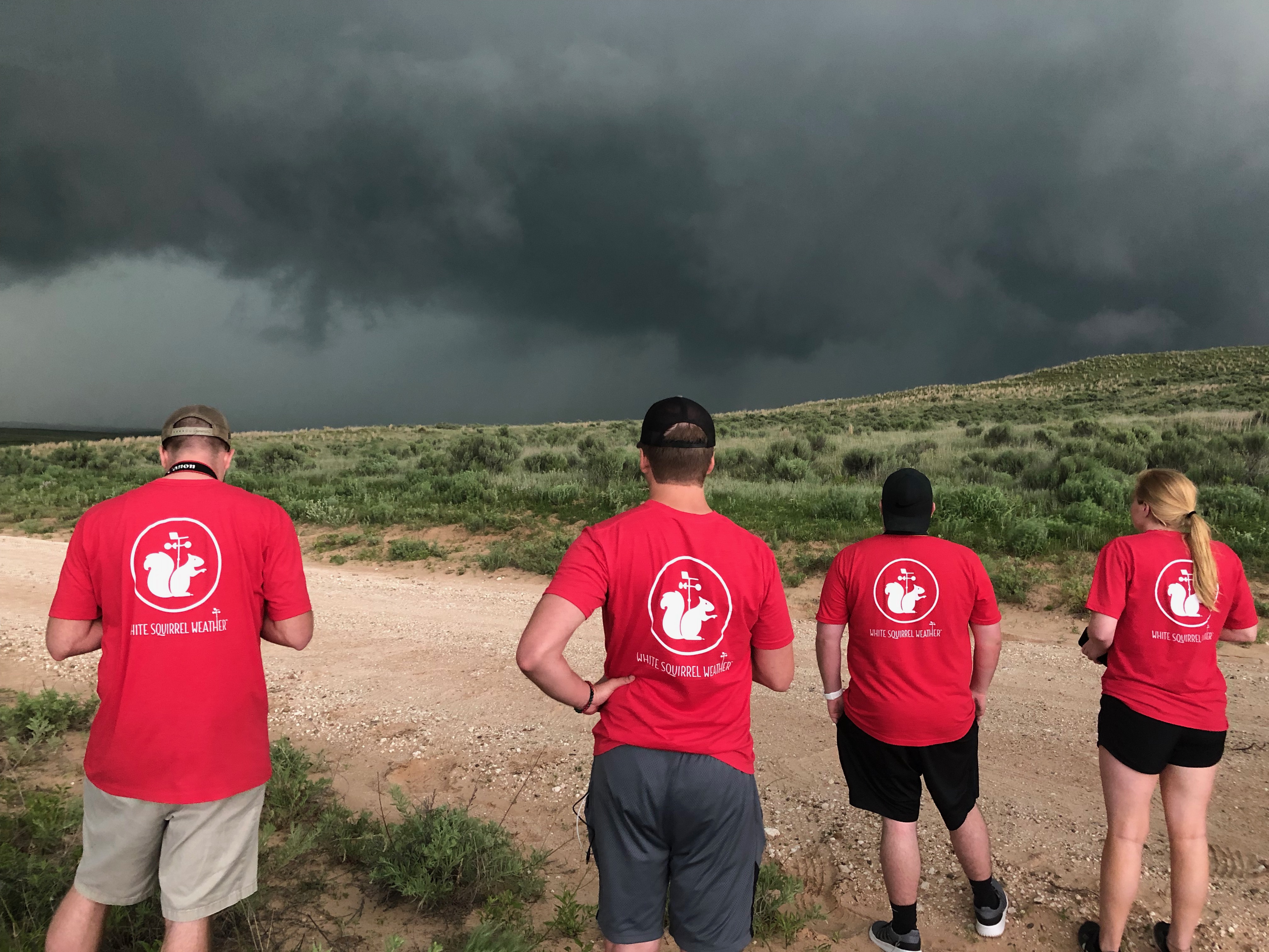
It was another early start for the WKU storm chasers as we planned to drive from Salina, KS to Texas. Our target for the day was Gainesville, TX, which is north of Dallas. It was a 6 hour drive, and storms were initiating early in the morning.
The drive from Salina, KS to Gainesville, TX.
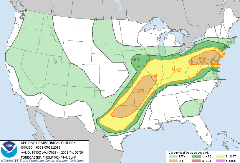
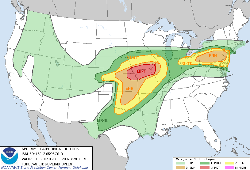
We knew this chase day was going to be a bit different, because we will be showing up to our target as storms are already occurring. The Storm Prediction had yet another Convective Outlook across Texas and Oklahoma. We were focused on the Enhanced Risk, a level 3 out of 5 for severe weather.
SPC severe weather outlook
Atmospheric Set up and Target Decision
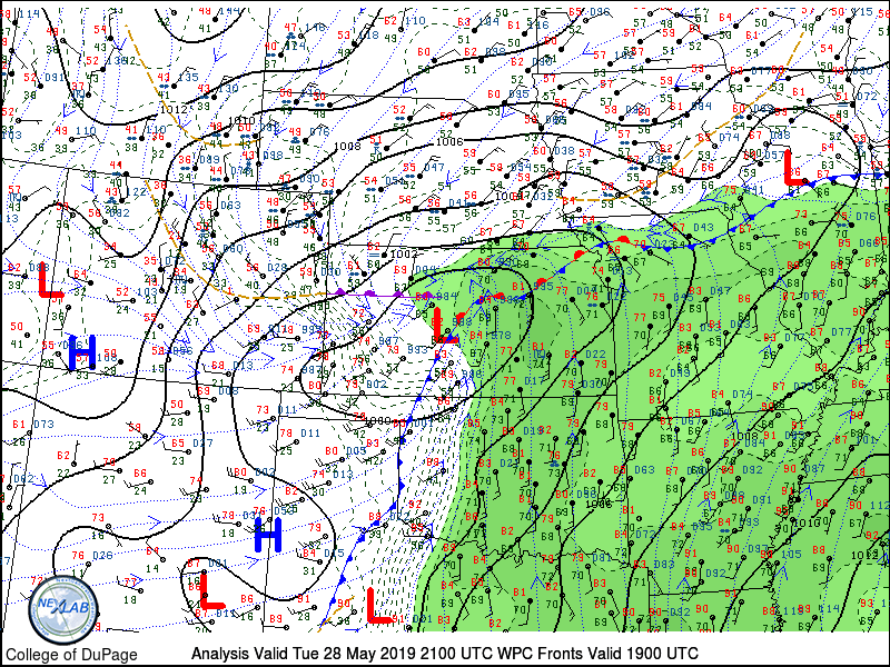
This active pattern continued today with ample shear, lifting, instability, and moisture. We have chased every day except the day we drove from Hays, KS to Amarillo, TX to prepare for the High Risk day. While we prefer to chase further west in Texas, specifically the Panhandle, we would not make it there in time for storms. Instead, we chose to go just north of Dallas, and arrive as storms were already going on. This area is challenging though, as there is a lot of traffic and many trees. We decided to go for the area anyway, and made it work out well.
We made a very quick stop for lunch in Moore, OK. We all preordered Jimmy John’s and had them waiting for us when we pulled in the parking lot. It’s tricky eating a tasty sub in the van going down I-35, but we had storms to see.
Chase
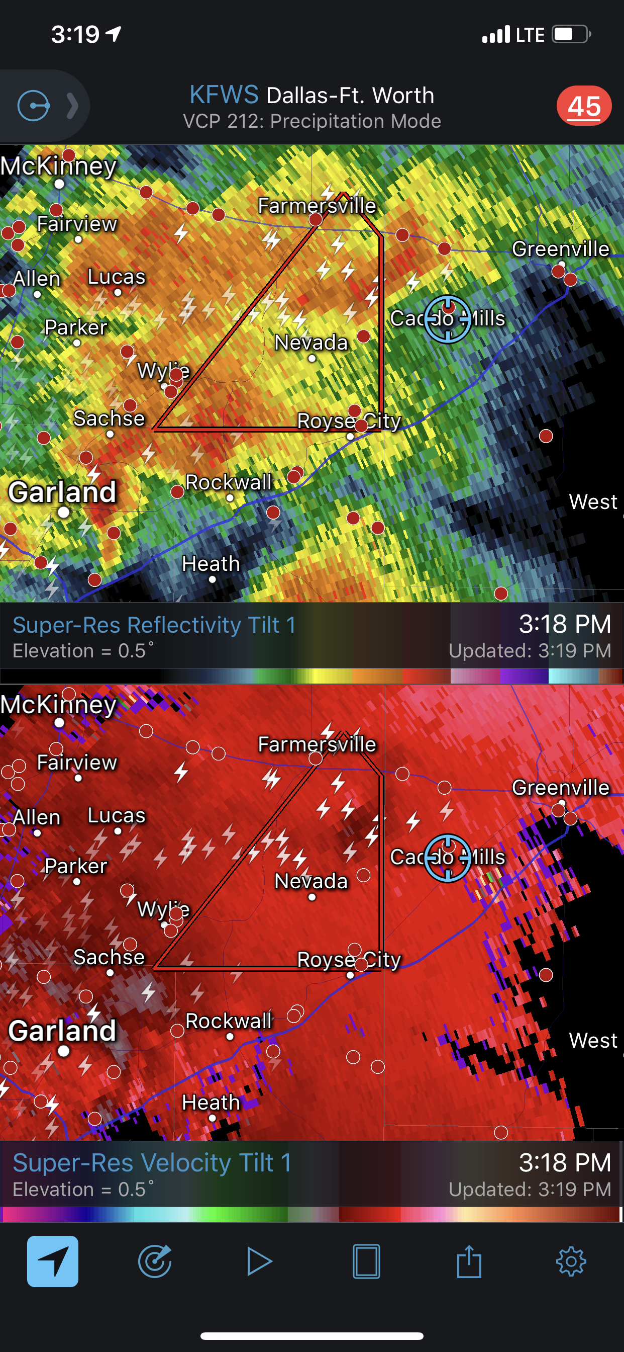
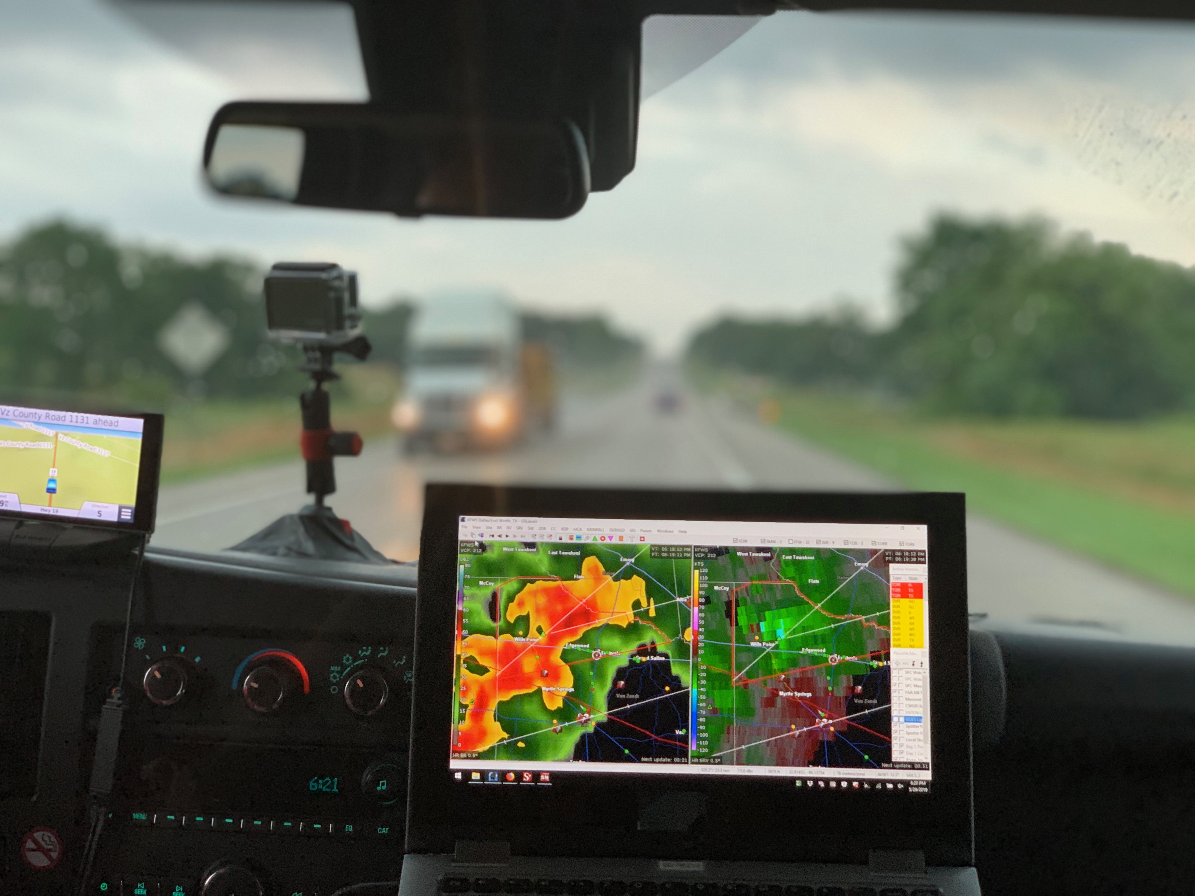
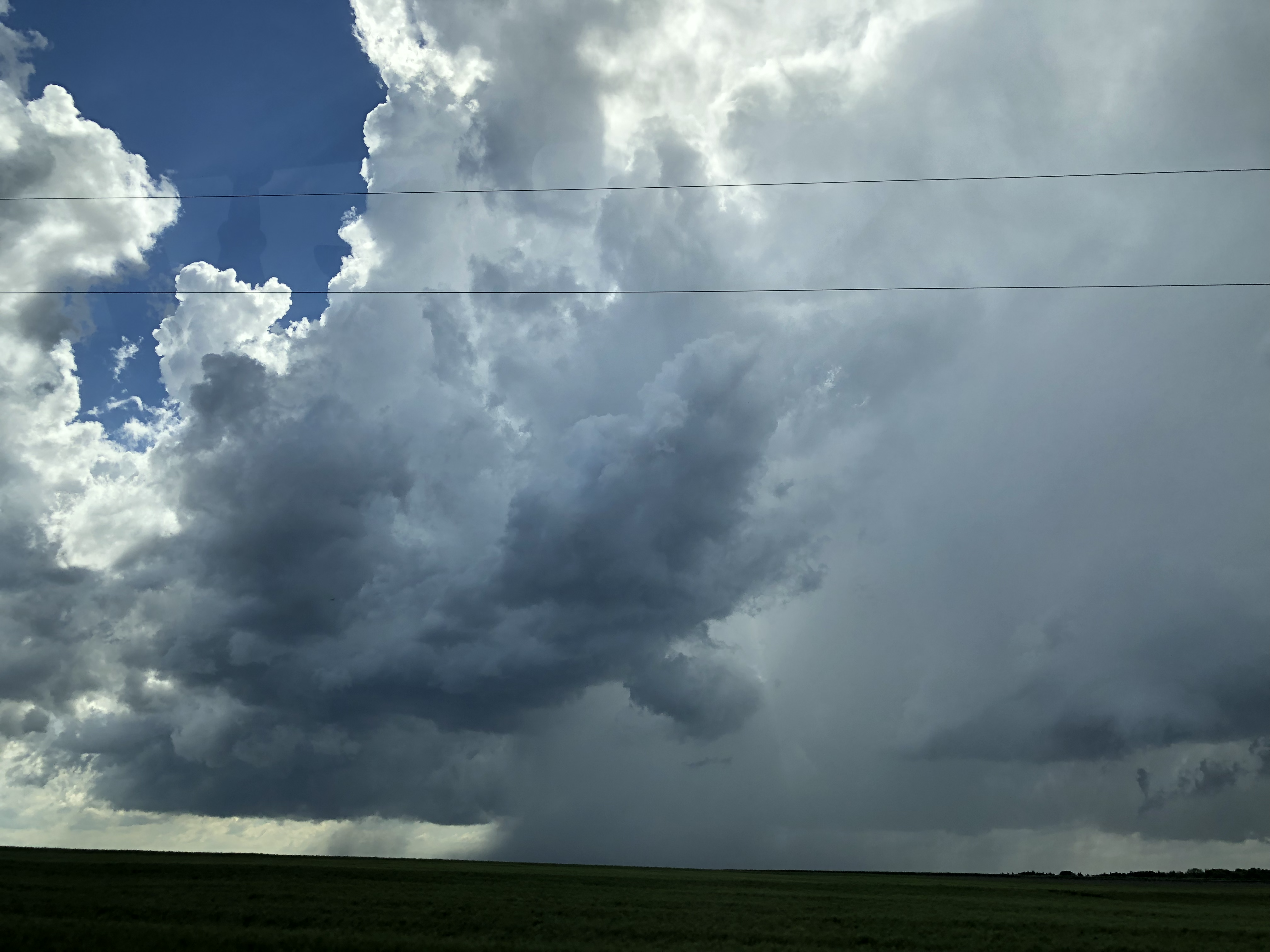
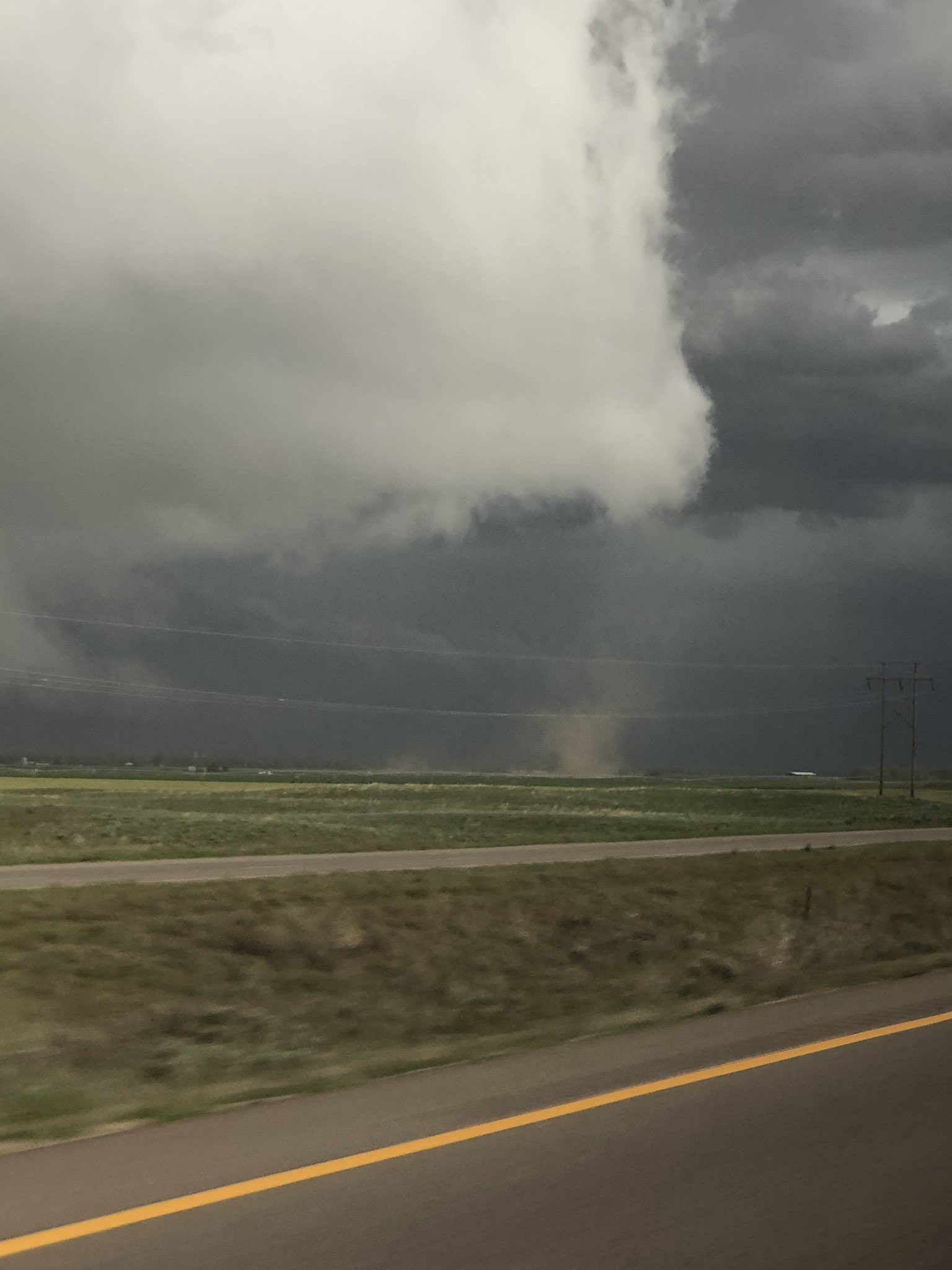
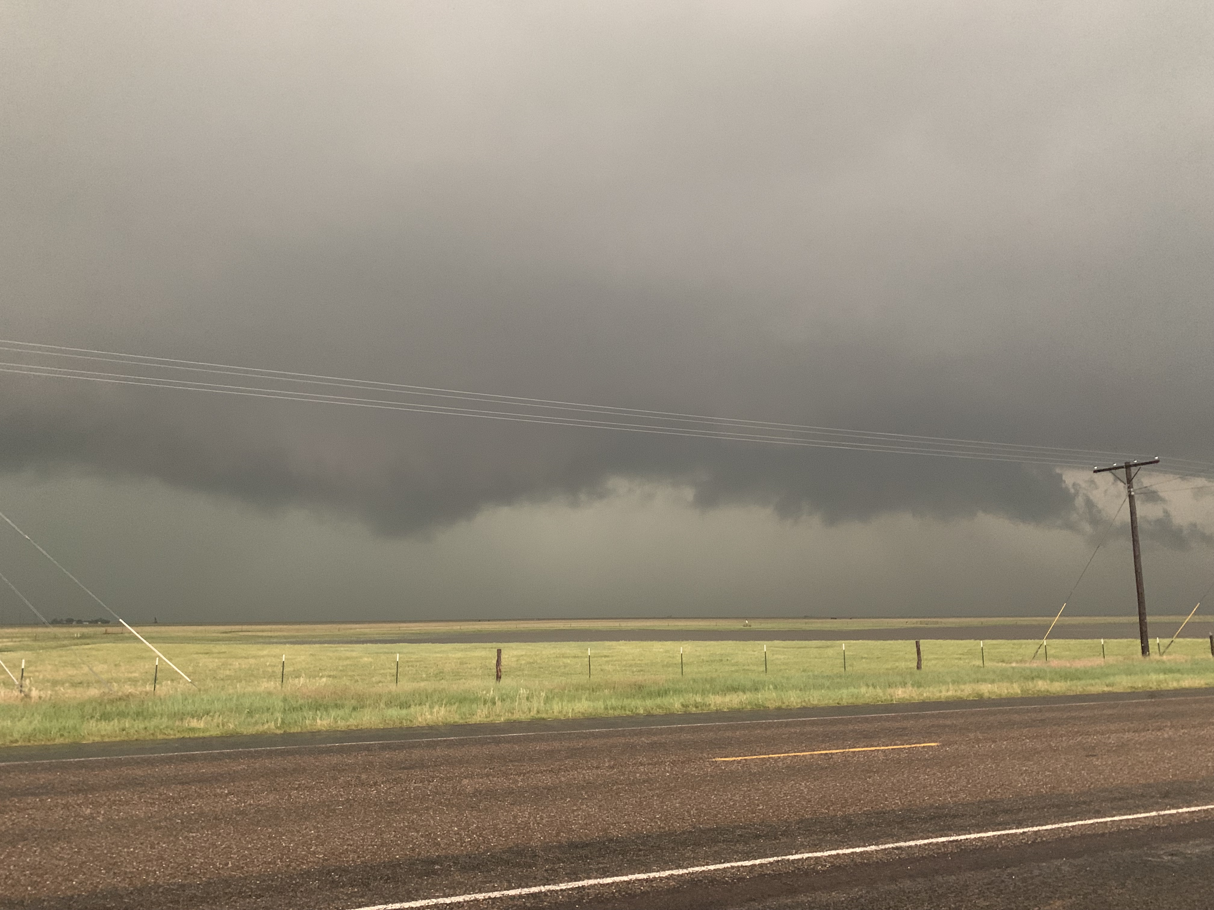
Immediately as we arrived in Gainesville, TX, there was already a severe thunderstorms. We found a storm cell we liked on radar, and decided to chase it near Josephine and Nevada, TX.
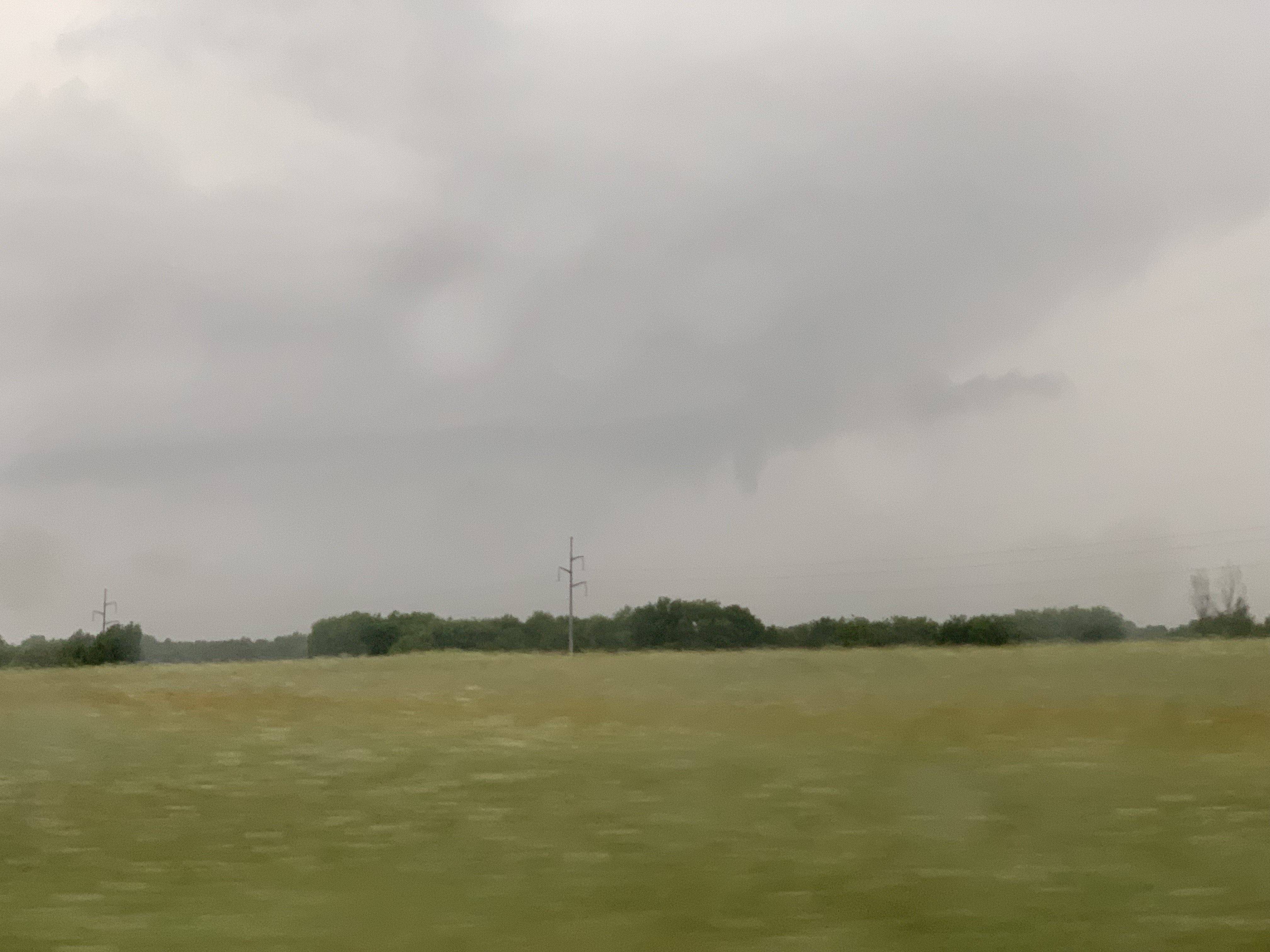
We tried to find a good area to get better visibility of the storm, and after doing so, we were able to spot a funnel cloud. Can you spot the funnel cloud?
Can you spot the funnel?
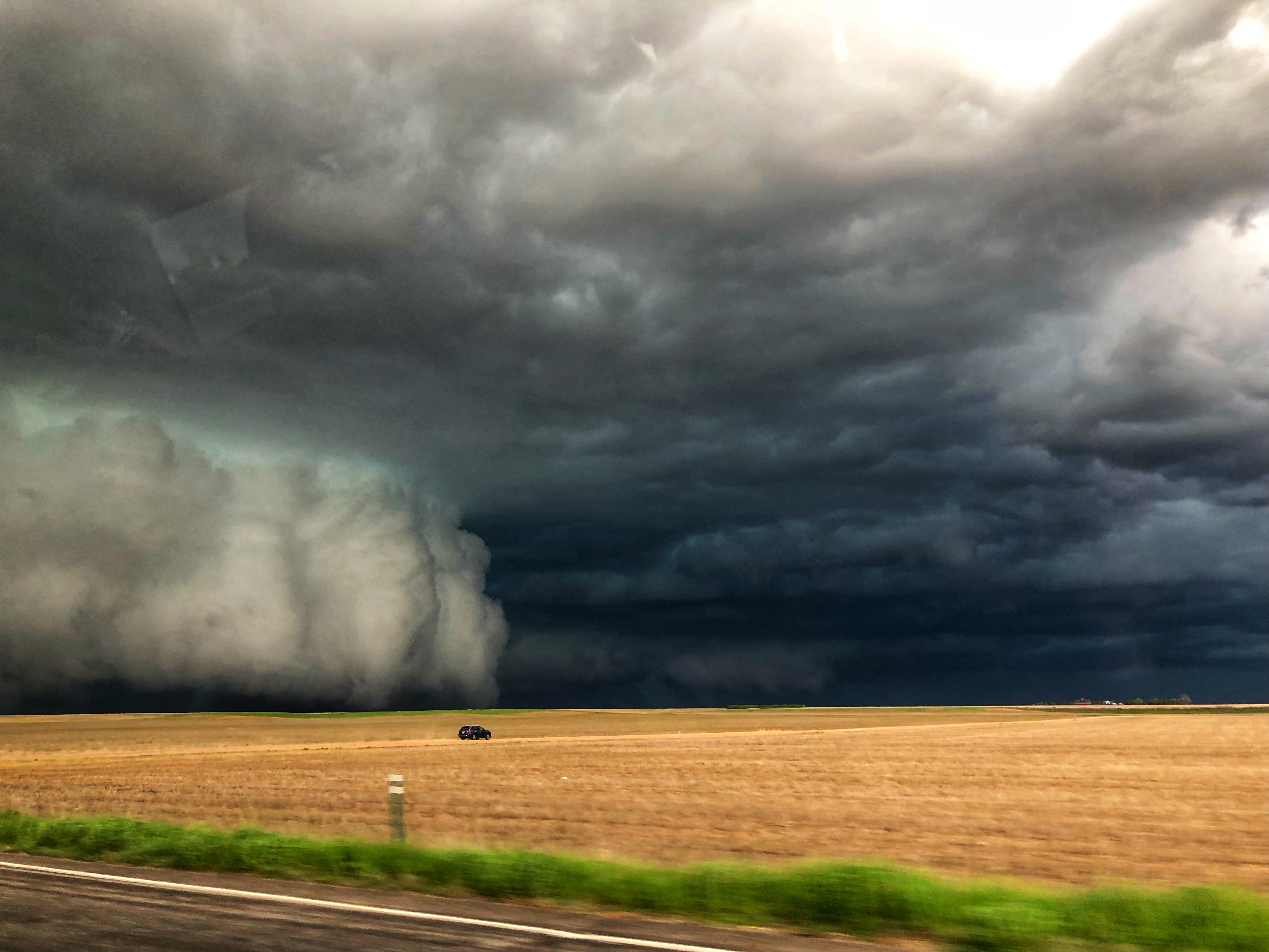
We continued to chase this cell, and eventually saw some ground circulations. These were possibly landspouts, but could have also been very weak tornadoes. We continued to chase, and then ran into more visibility problems.
Trees are not good when trying to view what a storm is doing. Trees are not good when trying to view what a storm is doing.
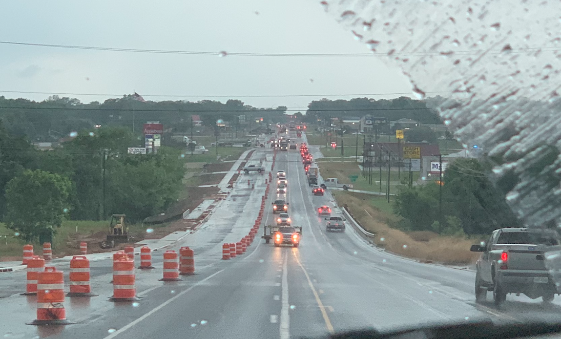
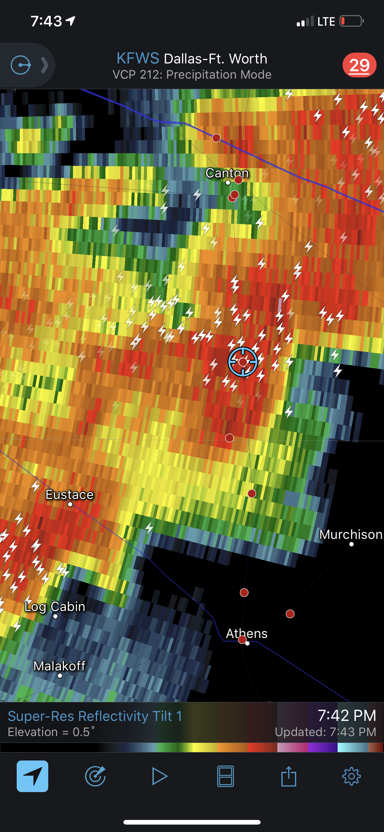
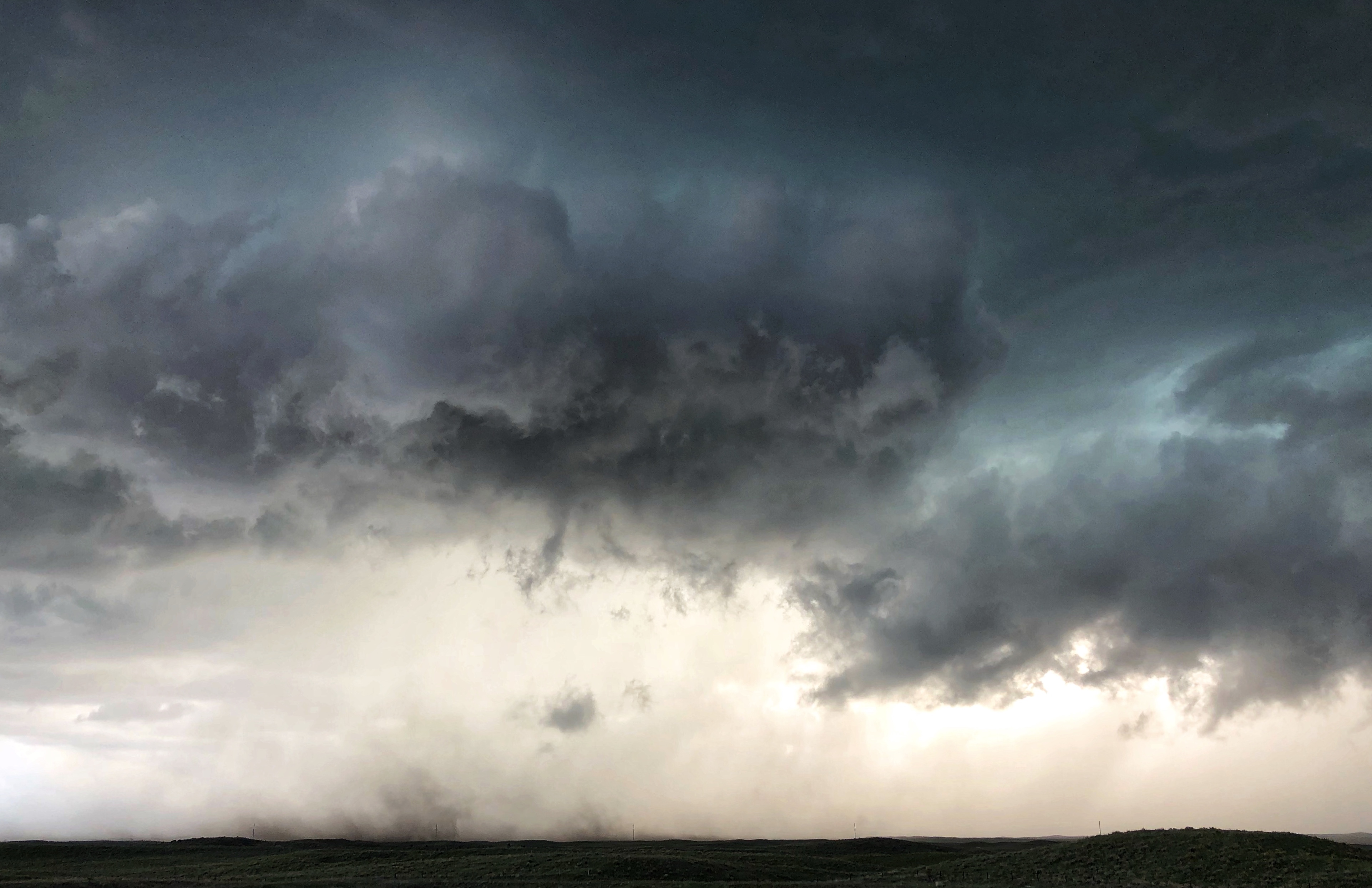
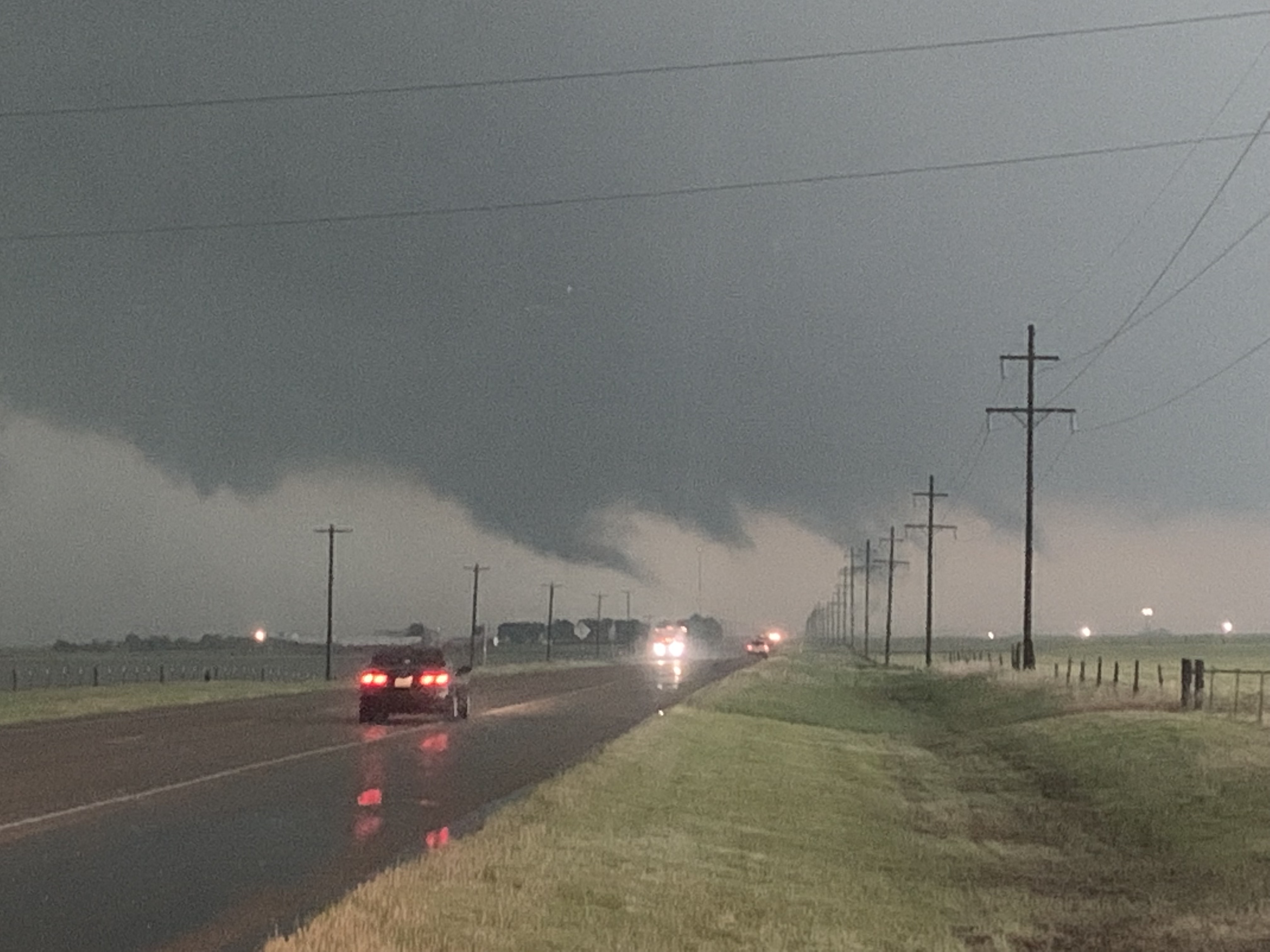
We continued to chase east of Dallas, near Canton, TX. There was a reported tornado, but we did not get a visual of it. Instead, we begin to see some minor tornado damage, and had to take alternate routes while trying to navigate around the storm. We had to turn around a few times due to road closures.
Lines of cars and emergency vehicles up ahead. We had to turn around.
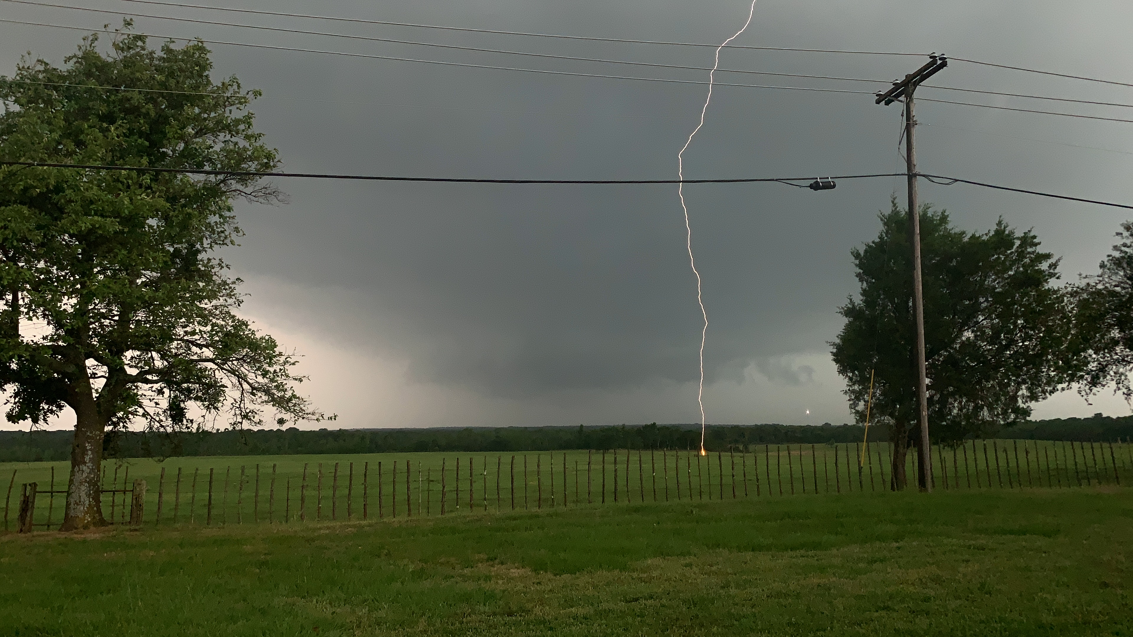
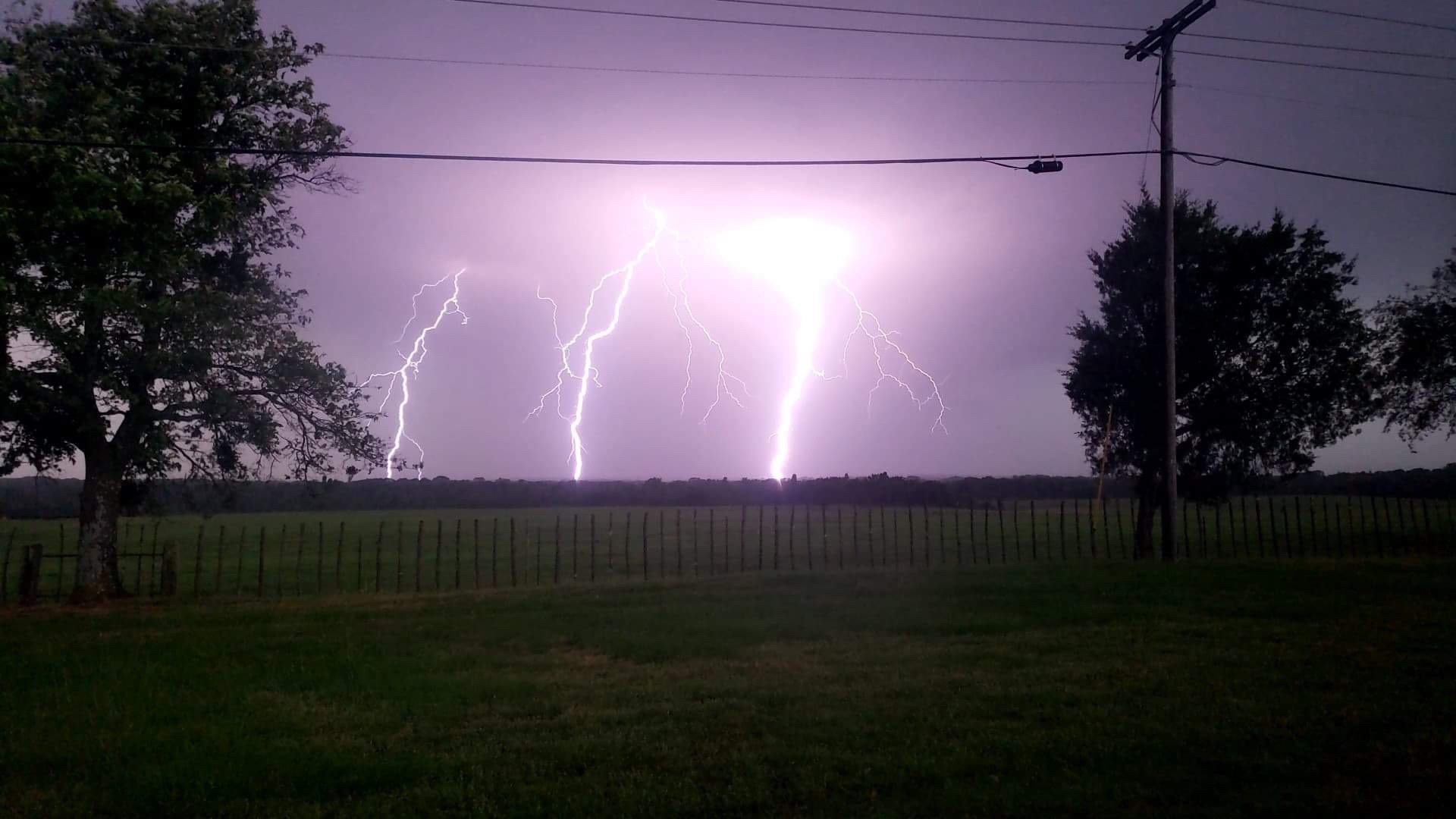
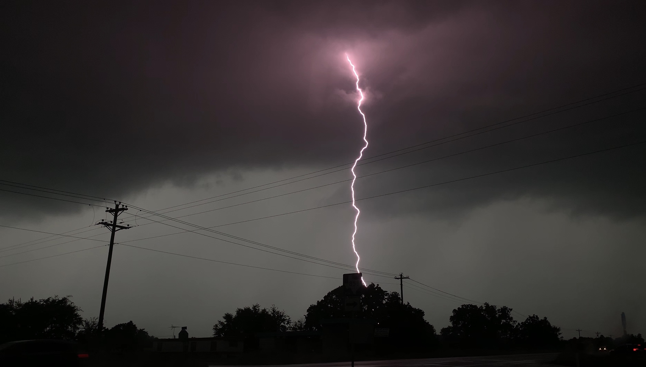
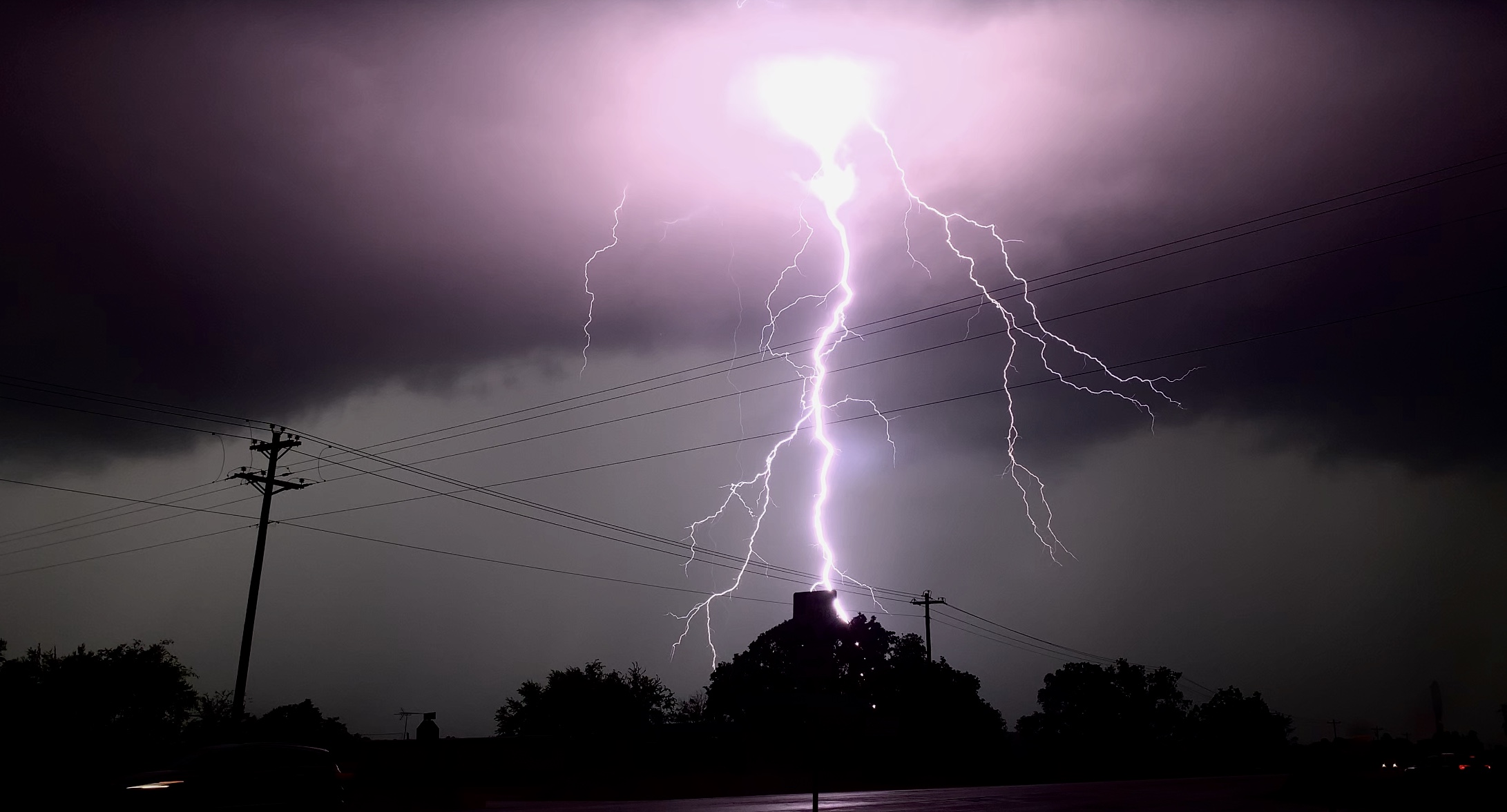
Now well east of Dallas, we continued southward, chasing storms with decent rotation but impressive lightning. We captured quite a few lightning strikes rather close to the van.
This bolt was about 200 yards away.
In the picture above, you can see the fireball that the lightning created from contact with the ground.
As you can see from the radar, there were lightning flashes surrounding us. We stayed in the van for safety, but the entire van would shake each time the thunder roared. It was such an amazing experience to see lightning like this.
Lightning strikes all around us.
We ended our day by driving to the hotel in Athens, TX. We decided to celebrate the epic day by going out to the Jalapeño Tree.
We chased a total of 7 different storms in a relatively small area with low visibility. Overall, it was another great chase day. We saw more funnel clouds, ground circulations, and epic lightning. Thanks for stopping by, and make sure to follow @wkustormchase on Twitter for current updates.
Posted inKentucky Weather|Comments Off on WKU Storm Chase Day 11
Today was one for the books for sure. We woke up in North Platte, Nebraska after a full and exciting day from Day 9. The enhanced risk from yesterday had centralized into a moderate risk for today located over the Iowa, Nebraska, and Missouri borders.
SPC Day 1 Outlook
The Set-Up
The route from North Platte to Southern Iowa is a 6-hour drive. The long drive was cutting it close for time of initiation, which made us rethink our initial target. The set-up for today was classic with the warm front and dry line boundaries.
The surface observations at 21 Z (4 pm)
The typical chase would involve chasing the northeast part of the low. We decided to take the risk and chase the southwest part of the low, where the moisture and winds converge. This method is a risk due to the smaller area with all the ingredients, however, if anything were to develop, the cell will be a beautiful, isolated supercell.
The Chase
Around 5 hours of driving, we ended up in the Hays, Kansas area. We stopped in Stockton at Shirley Mae’s Deli for sub sandwiches. After burning some time, we drove around the lovely city of Stockton and ended up in the little town of Walker, Kansas. We parked the van on the side of the road and noticed cumulus clouds started to tower. After some time throwing the football, we saw that 2 landspouts were reported on this storm. We saw the landspouts forming from the towering cloud and piled back up in the van to chase it.
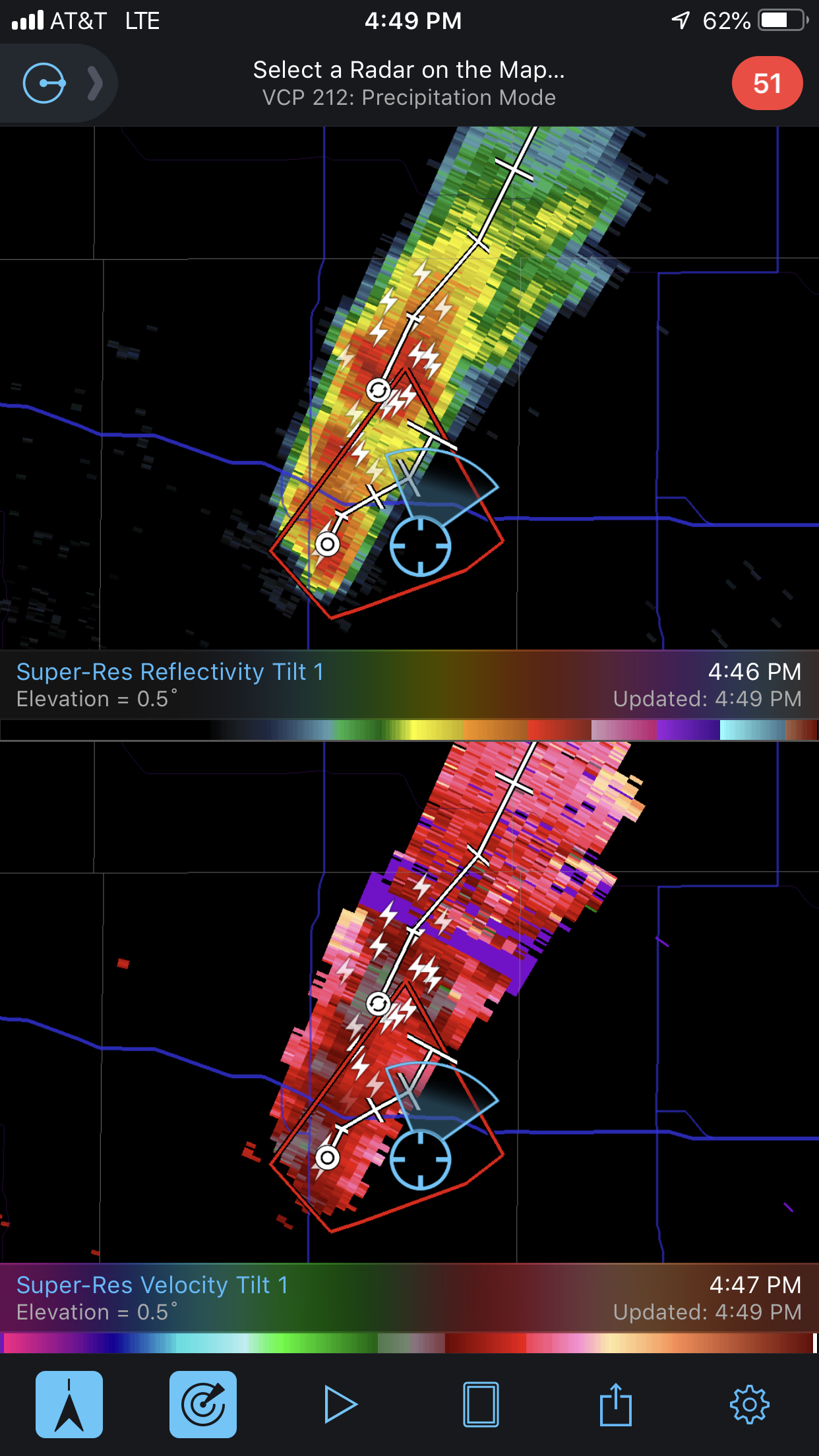
A screenshot of the radar reflectivity on the storm when landspouts were reported (3:59 pm)
From one pixel to several in a few minutes, this storm was growing fast and strong. We drove closer to the storm and noticed the tornado sirens going off in the town of Walker. By the time we pulled over to watch the storm, the reflectivity started showing widespread rotation. This storm was now a supercell in the making.
A picture of the growing storm just after the landspouts lifted.
The growing storm started taking on rotation (4:49 pm)
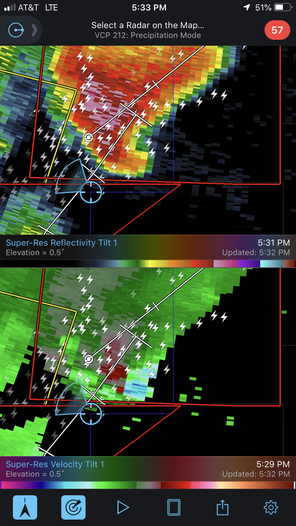
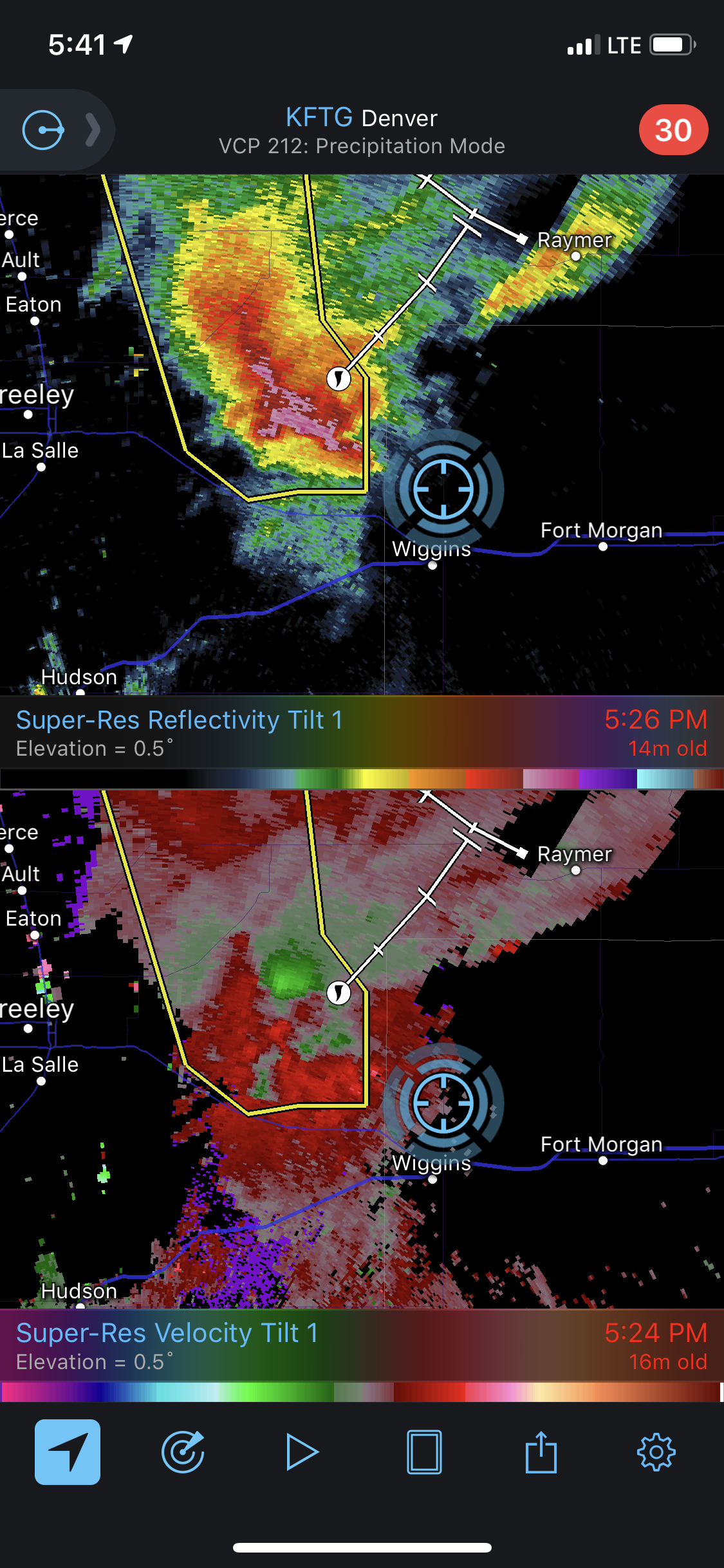
The storm started moving away from us, so we got back in the van and chased it. The reflectivity was now showing tight rotation and a “hook” feature on the south-side of the storm which is conducive of tornado circulation.
The “hook” feature on the Reflectivity (top window) & tight velocity signature (bottom window) (5:26 pm)
While chasing, a tornado was reported on the ground. While we were so close to it, we could not see it. The tornado had become rain-wrapped, disguising it with the rest of the storm.
Our sight of the storm when the tornado was reported (5:28 pm)
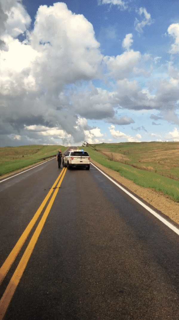
We turned East on a road and notice the power lines down ahead. Multiple power lines were snapped in half from the tornado that had passed minutes prior.
A gif of the down power lines.
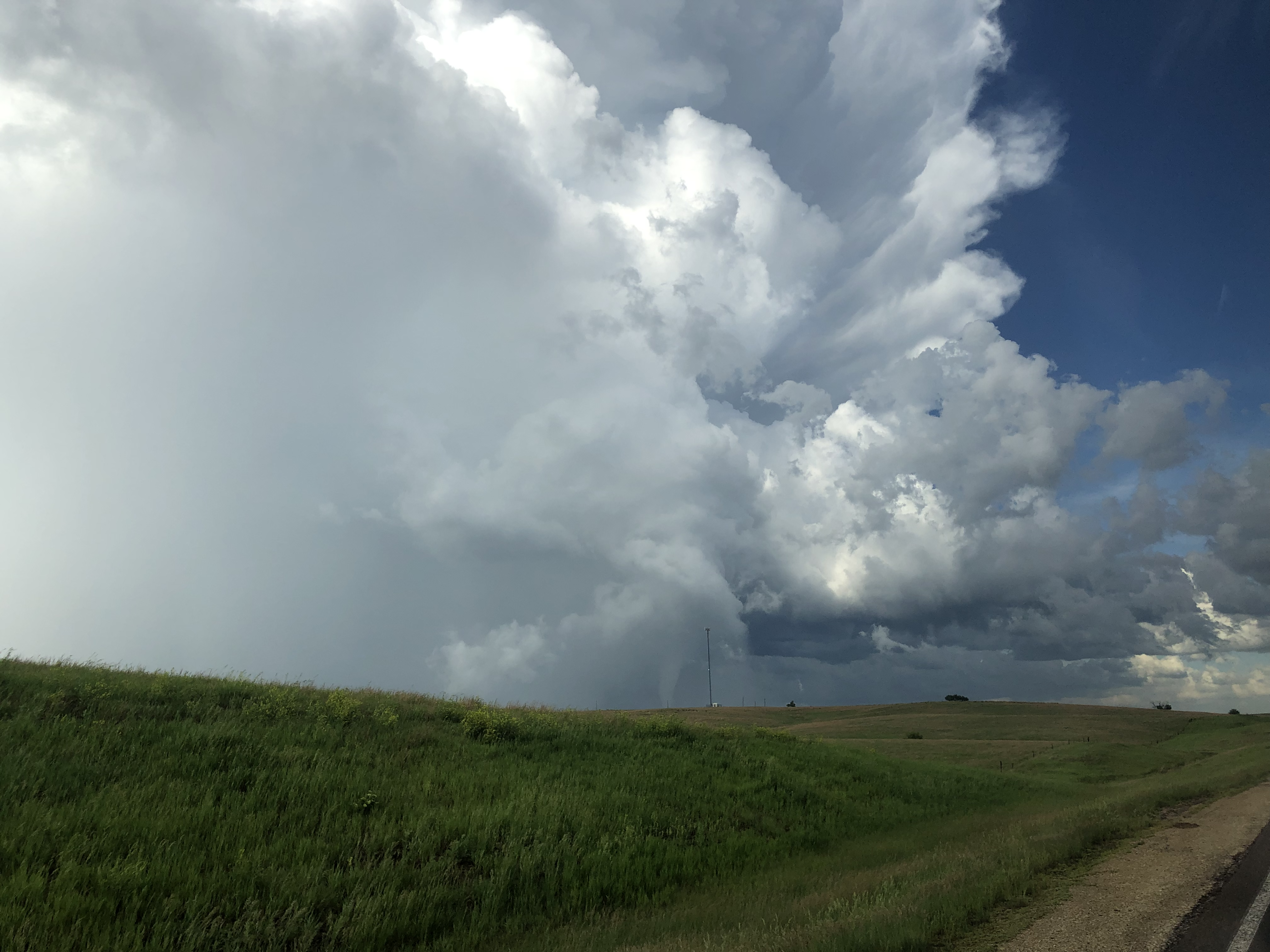
We turned around due to the road closure. The hook feature on radar was now to our backs. We started driving away from the storm with hopes of getting on a new road to catch up to the storm.
The hook was really defined and the rotation was impeccable. (5:29 pm)
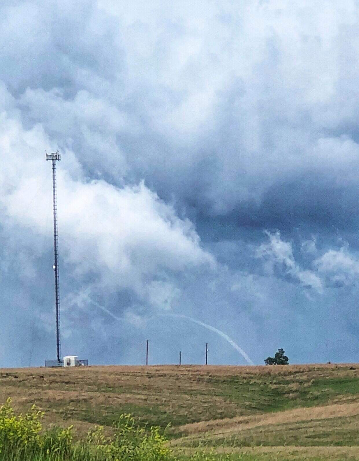
One of the students on the storm chase team, Luke Rogers, kept an eye out in the back and saw a beautiful tornado emerge from the rain. He exclaimed about the stove pipe tornado behind us and we stopped the van and all piled out.
Stove pipe tornado center screen.
We watched the tornado for minutes and soaked it all it. This time was the moment that most of us were waiting for. It was truly a rewarding time for all of us. We saw the tornado rope out and eventually dissipate into a long elephant trunk.
A great picture of the tornado roping out.
We piled up back in the van to keep up with it, however, the roads made it hard to keeps eyes on it. We eventually decided to head to Salina, Kansas for the night. We had burgers at the hotel and reminisced on the success we had on this trip, especially on Day 10 of chase day.
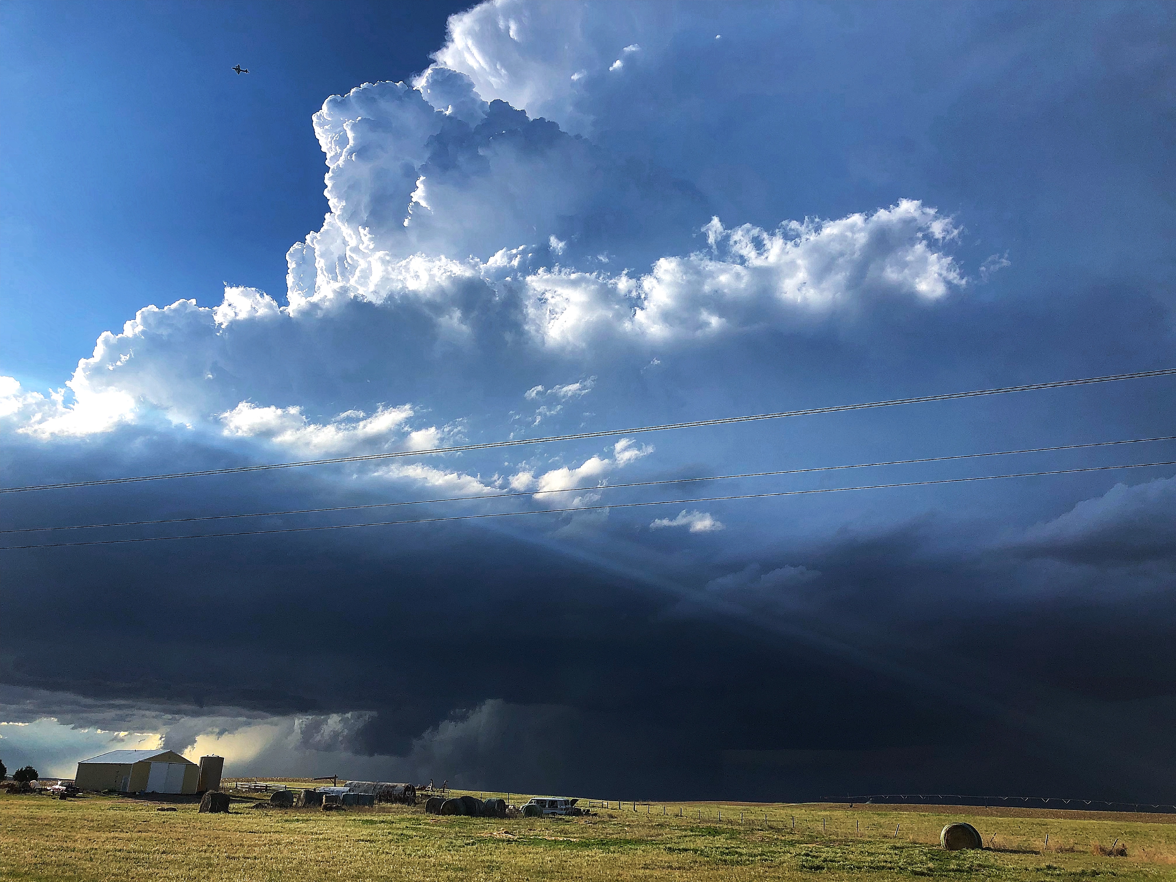
It was another long but eventful day as our team woke up in northeastern Colorado in the town of Sterling, CO. Once again, the visibility within the Front Range of the Rockies was absolutely spectacular and the setup and ingredients for severe storms were all coming together to make for an epic day of chase.
THE SETUP
The setup consisted of a large trough with the center axis over the Four Corners region of the United States. An area of low pressure developed off the Rockies during the first half of the day and moved northeastward in northeastern CO, this feature was the main focus for the forecast team.
The WKU Storm Chase team ironing out Monday’s forecast.
As the center of low pressure at the surface moved into northeastern CO, ingredients conducive for the development of severe weather circulated counterclockwise into northeast CO. With the main forcing mechanism for thunderstorm development being the surface low; combined with shear, instability, and moisture, our forecast target for the day was in the vicinity of Fort Morgan, CO.
BUSY DAY FOR WKU STORM CHASERS
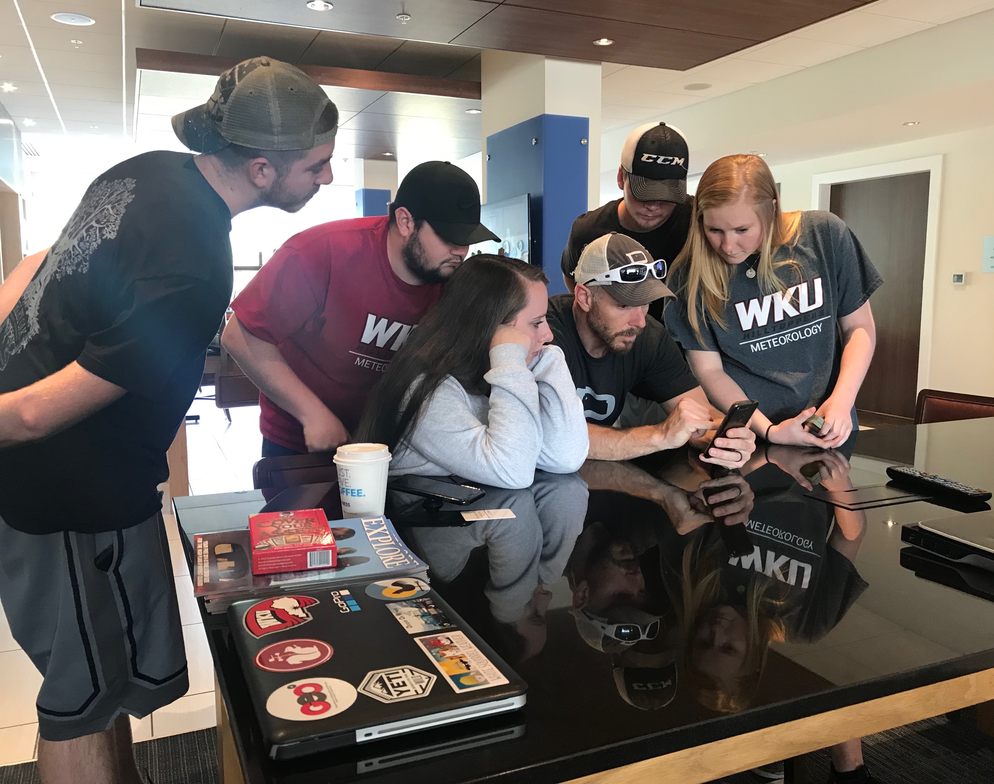
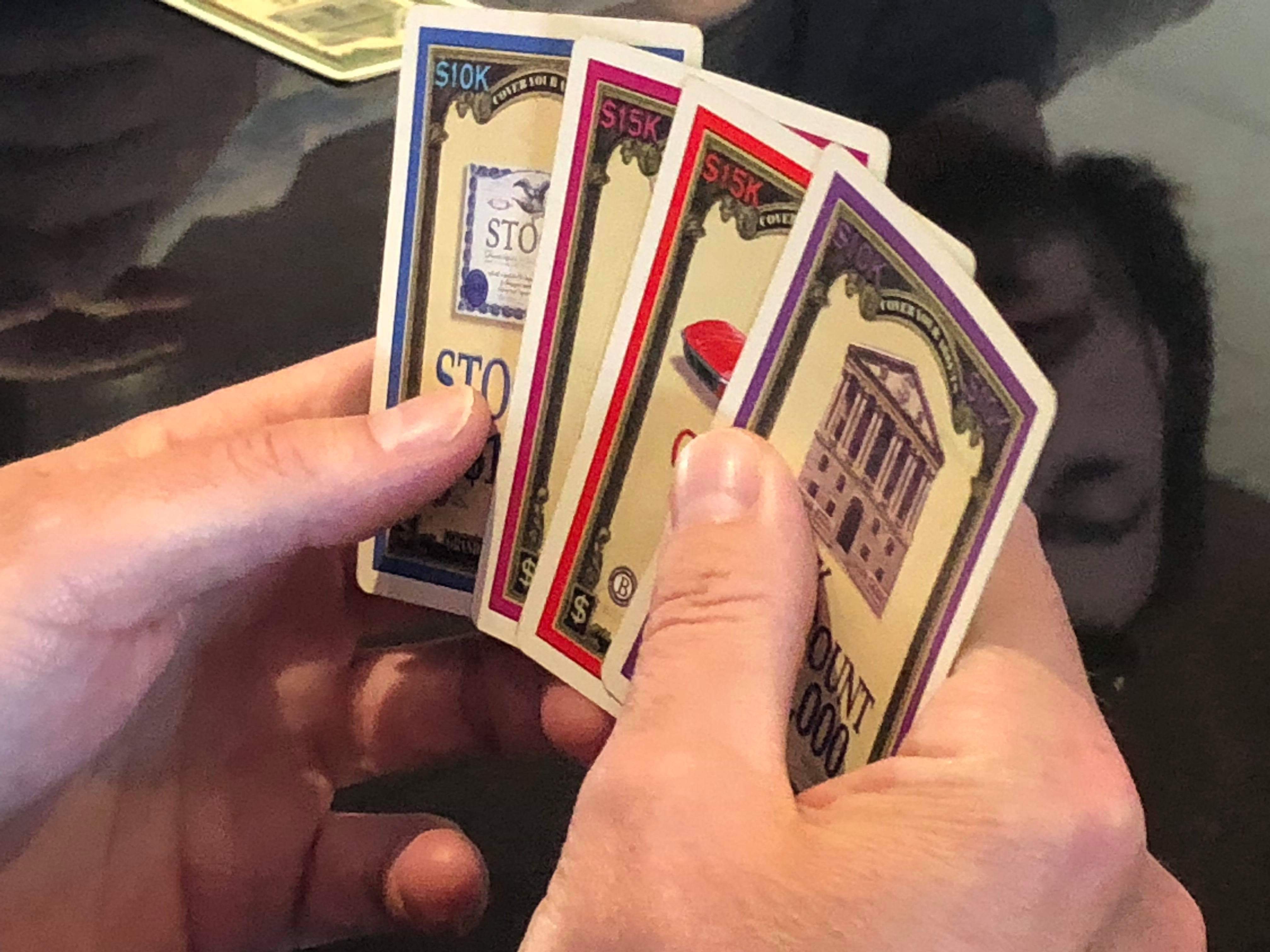
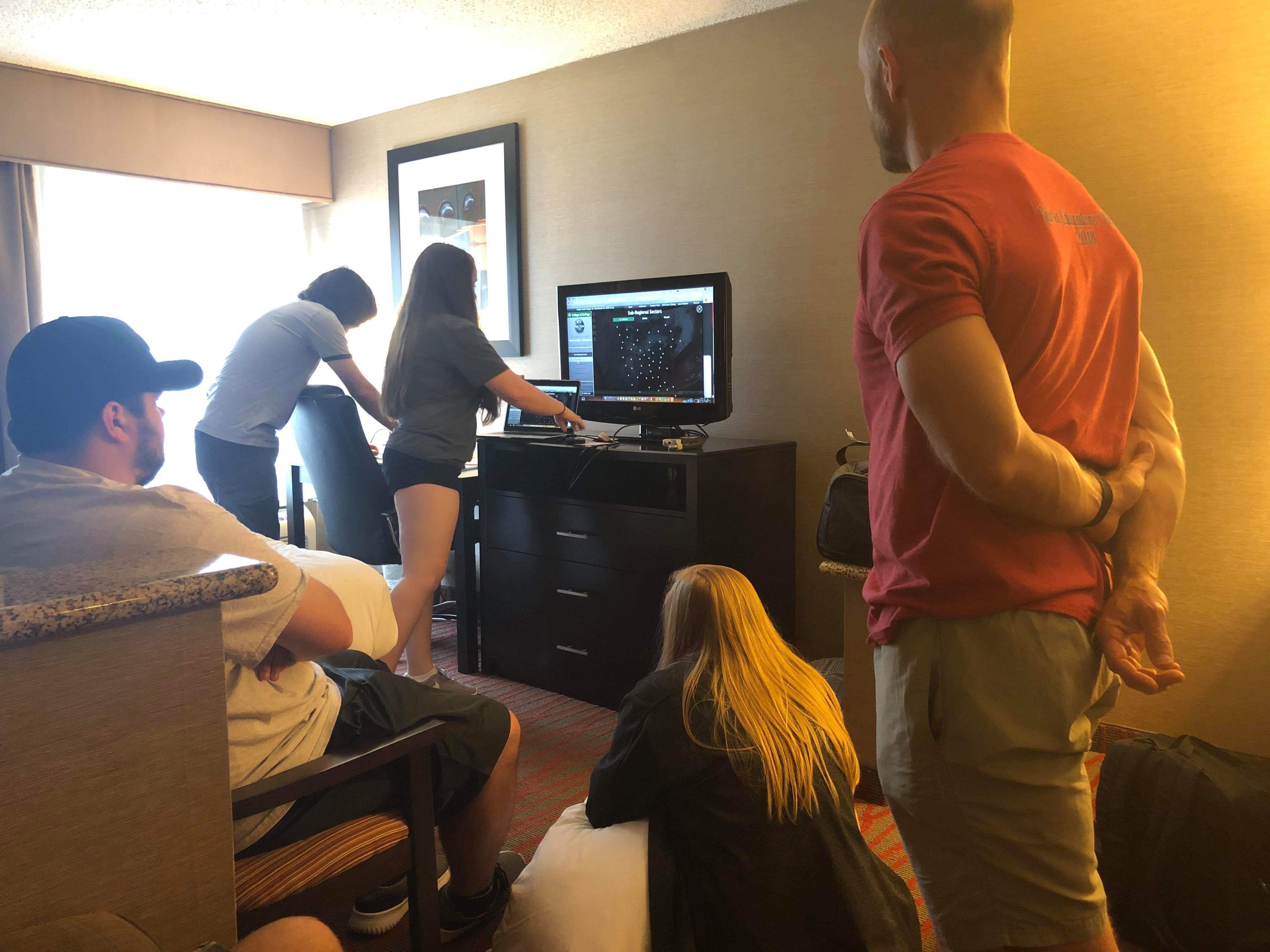
The team woke up bright and early in Sterling, CO and began the day with some breakfast and a group forecast discussion. The chase target that the team aimed for was located in north-central Colorado, in the vicinity of Fort Morgan, CO. After the forecast discussion, the team had some time to spare before thunderstorm initiation and development. With a few hours of some downtime, the team played a very fun card game called “Cover Your Assets”.
Playing cards and waiting for thunderstorm initiation.
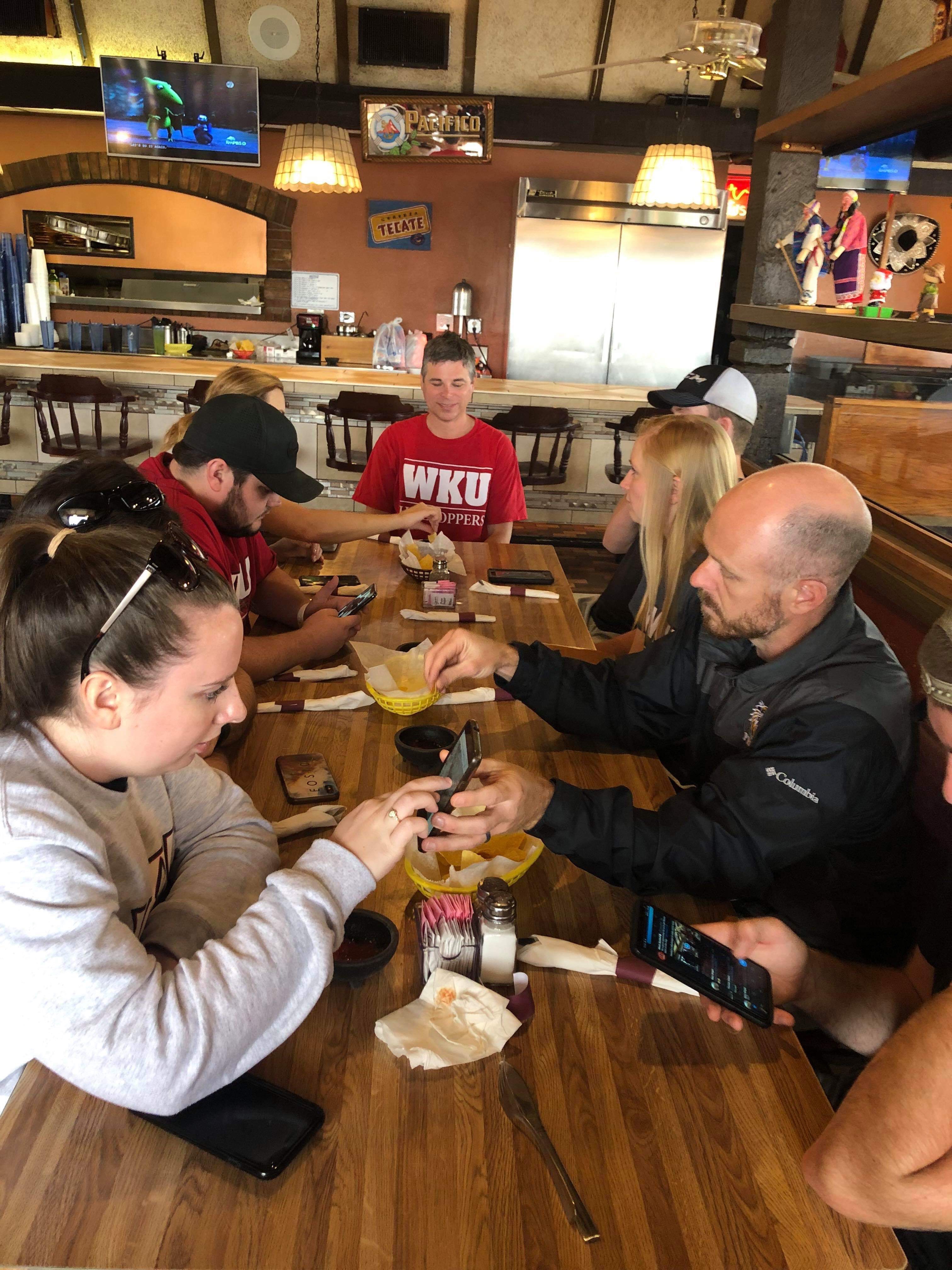
Lunch at Mi Ranchito!
The team left the hotel and stopped to eat lunch at Mi Ranchito in Sterling, CO. Things started getting a little hectic as a storm fired up around the Denver International Airport and began moving northeastward while we were waiting for our lunch. The team made the decision to take our lunch to-go and eat it on the road. The team made its way southwest towards Fort Morgan, CO to watch an awesome rotating supercell produce a wall cloud and a few funnels.
Rotating supercell around the Fort Morgan, CO area!
Gustnado along I-76!
The team continued tracking the supercell as it moved northeastward along the I-76 corridor. The storm produced multiple gustnadoes, sucking up all the dirt and dust in the farm fields. This storm continued to move across the Colorado landscape giving us a lot of opportunities to take some photos of its jaw-dropping structure.
An amazing storm with amazing structure!
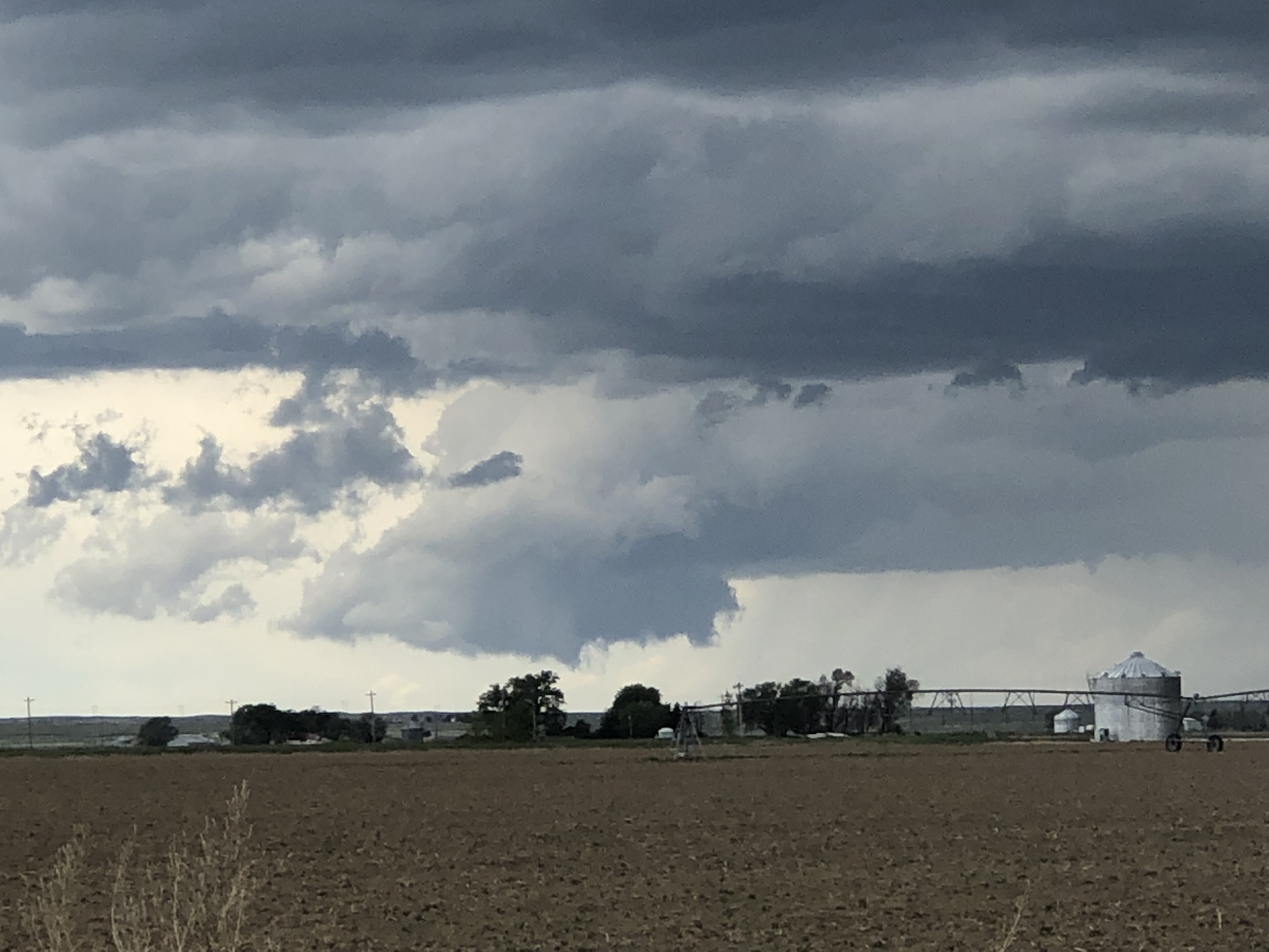
As roads became limited in extreme northeast CO, the team decided to track another storm that developed off to the southwest. The second storm we tracked also an amazing beast. We stopped on the side of the road just to the south of Holyoke, CO and captured some amazing photos of the storm while it produced a brief, not fully condensed tornado.
Brief, not fully condensed tornado south of Holyoke, CO!
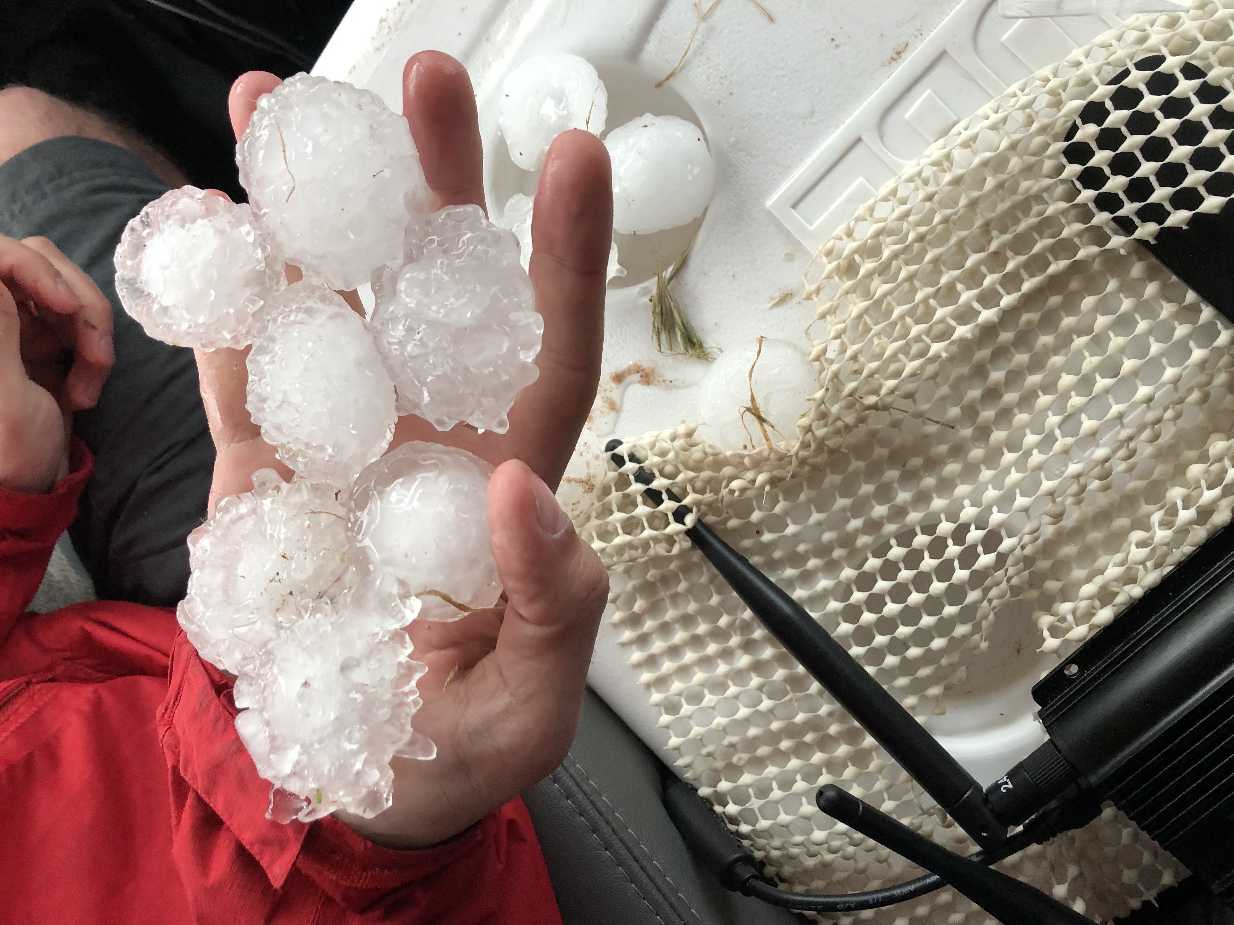
The team continued to track the supercell as it moved eastward across eastern Colorado and eventually into western Nebraska. The team continued to capture some amazing photos of this epic storm as it moved across the open land. This storm produced a lot of large hail that blanketed the landscape, almost like it snowed. The largest hailstone we found was 2.50 inches in diameter!
Large hail in eastern Colorado!
Amazing structure associated with the same storm!
The team continued onward, crossing the border into western Nebraska tracking the same severe thunderstorm which produced a fantastic lightning show after sunset.
What a day the WKU Storm Chasers had!! We saw two tornadoes, experienced strong winds, saw a bunch of large hail, and some amazing structure across eastern Colorado and western Kansas. We safely arrived in North Platte, Nebraska where we enjoyed dinner at Applebee’s!
Please continue following our adventures across the Great Plains on Twitter @wkustormchase.
It was a long day of chasing today as our team ventured north into eastern Colorado in hopes of seeing storms with better visibility. The smoke coming from the wildfires in Mexico had been impeding our vision, and the storm conditions looked good for eastern Colorado.
The Setup
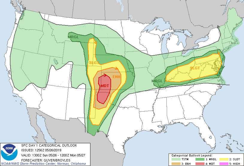
We woke up this day in Garden City Kansas ready to see storms. The models were showing a surface low forming off the Colorado Rockies in the early hours of the afternoon. This low combined with southwesterly flow would create a zone of confluence where storms were likely to develop. The biggest issue would be initiation time. The SPC and models were both calling for early initiation of the storms, and this would lead them to be more linear rather than isolate and discrete. During our morning forecast discussion we determined that north eastern Colorado would be our best target for the isolate super cells we were looking for. This was a moderate risk day for severe weather according to the SPC outlook, and we were ready for it.
The Chase
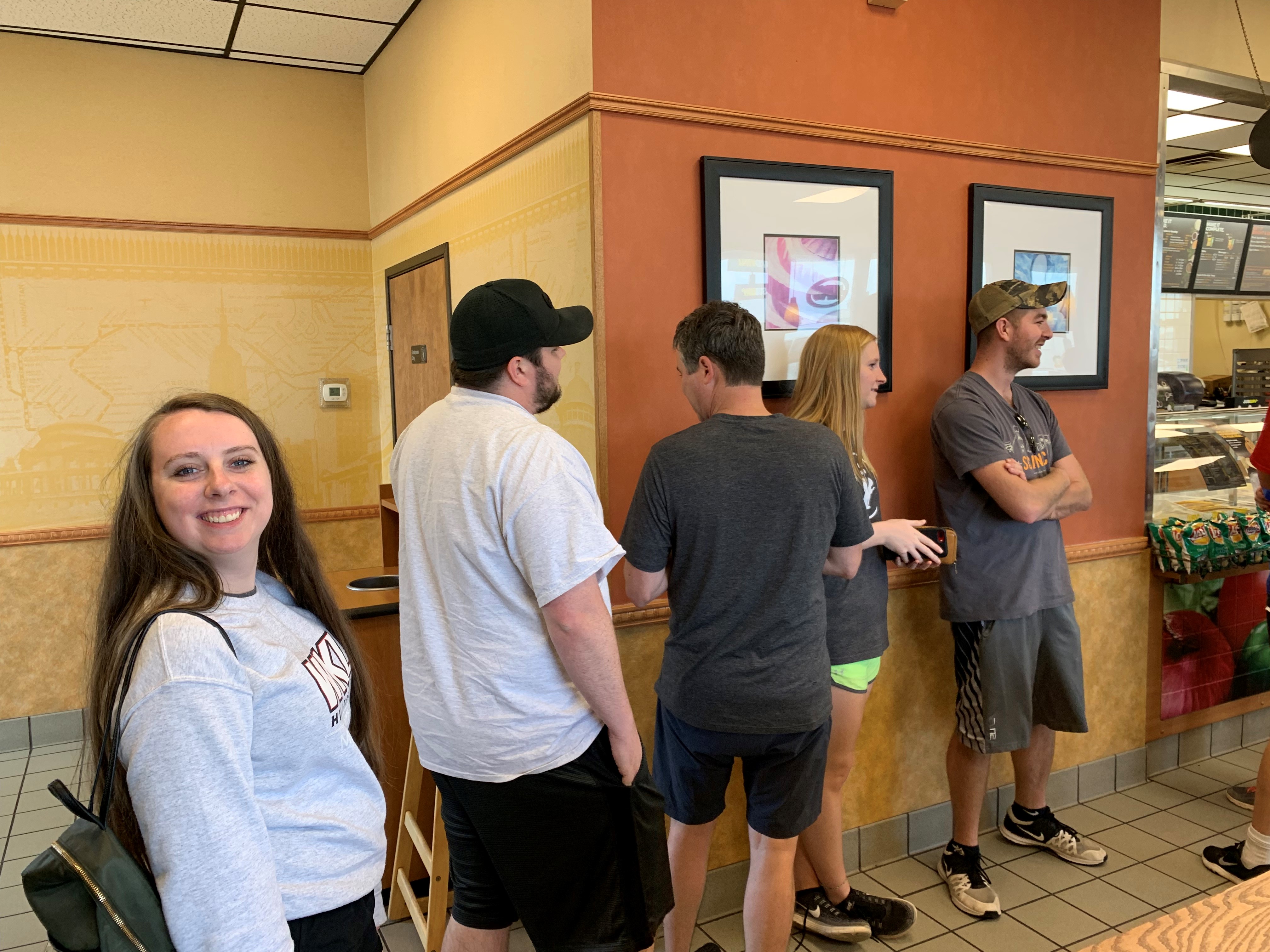
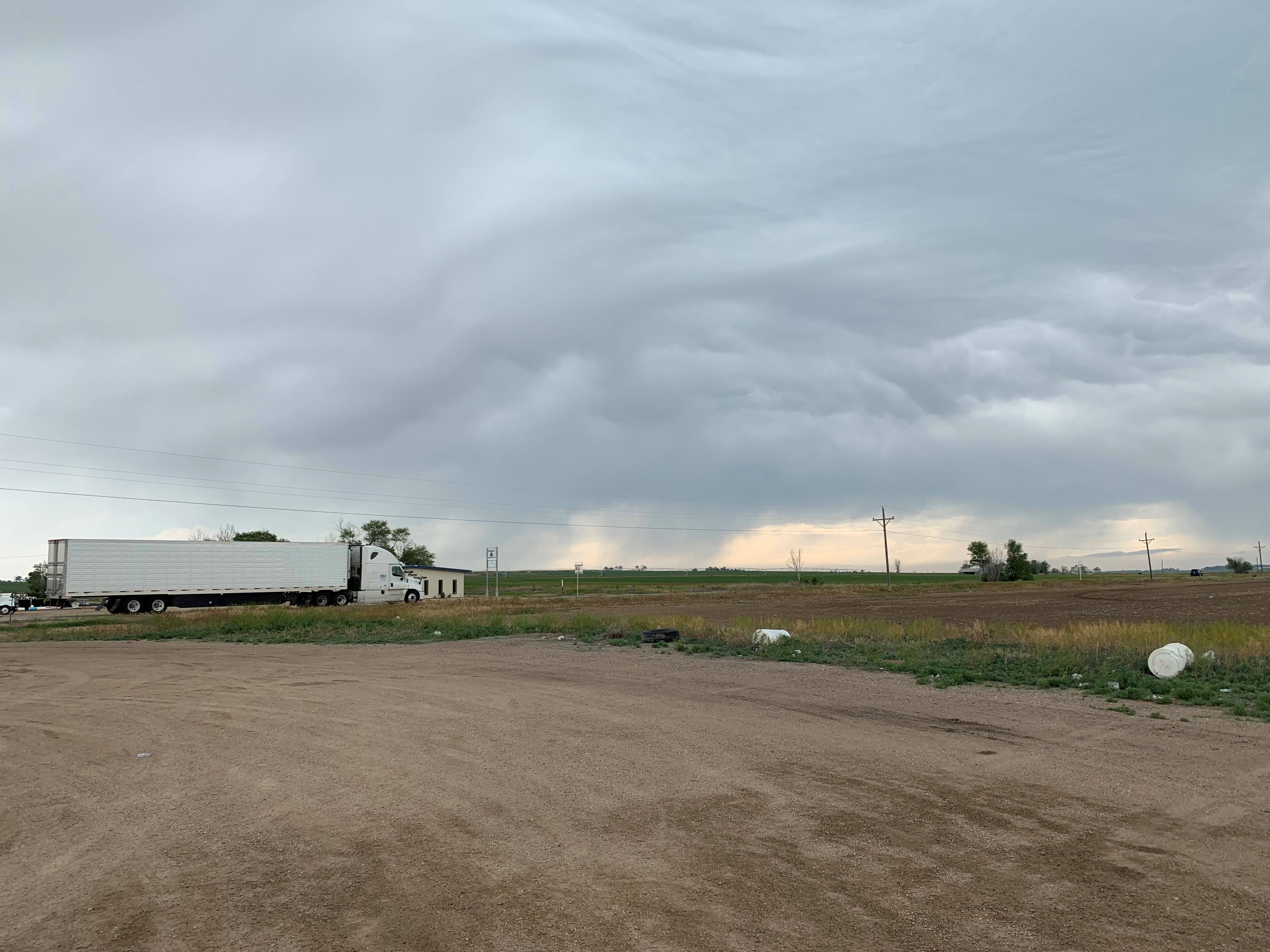
With the forecast discussion over we decided to head out immediately since we were a little ways away from where we wanted to be. The first stop of the day was made in Lamar Colorado for a quite bite to eat from Subway, and a chance to gas up the van. We also saw our first cell of the day in Lamar. It had some cool lightning with it, but it fizzled out without doing much.
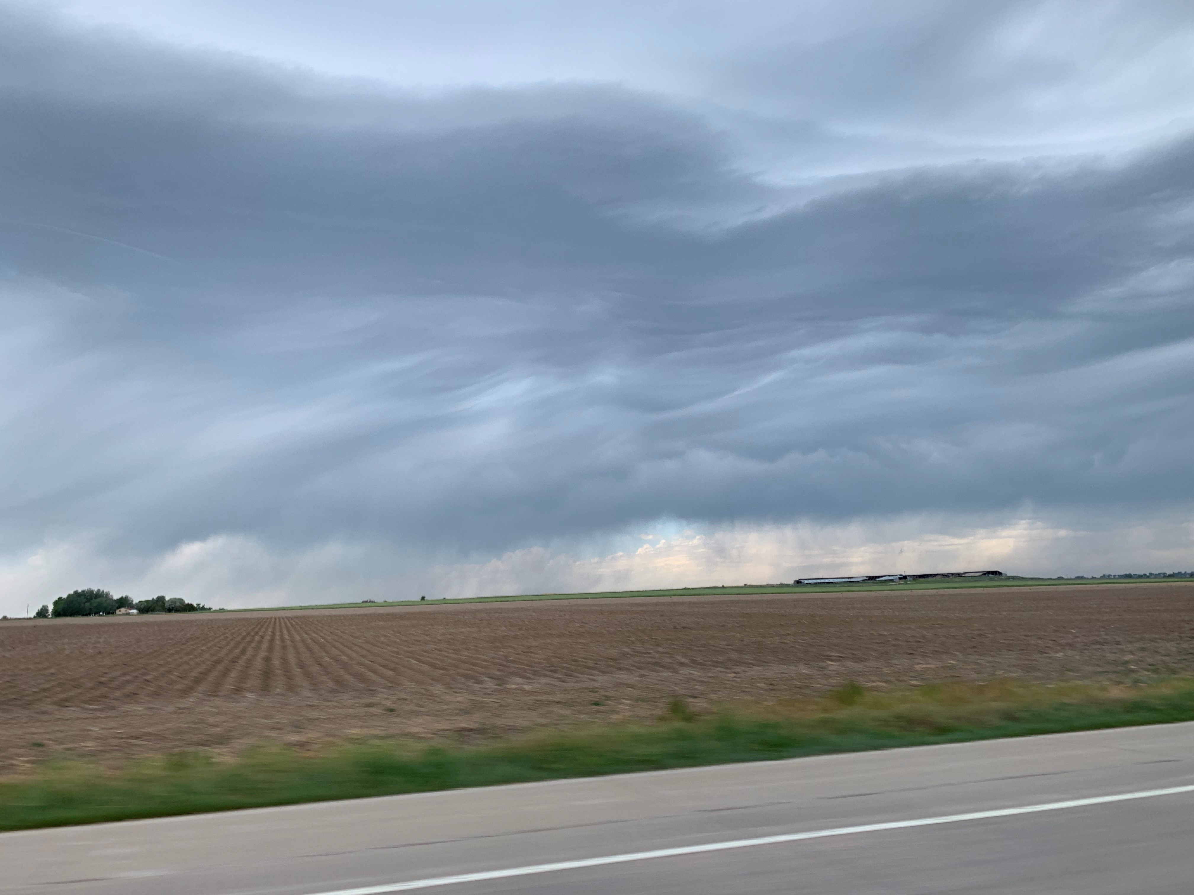
The gang getting lunch at the local subwayFirst storm of the day in Lamar CO
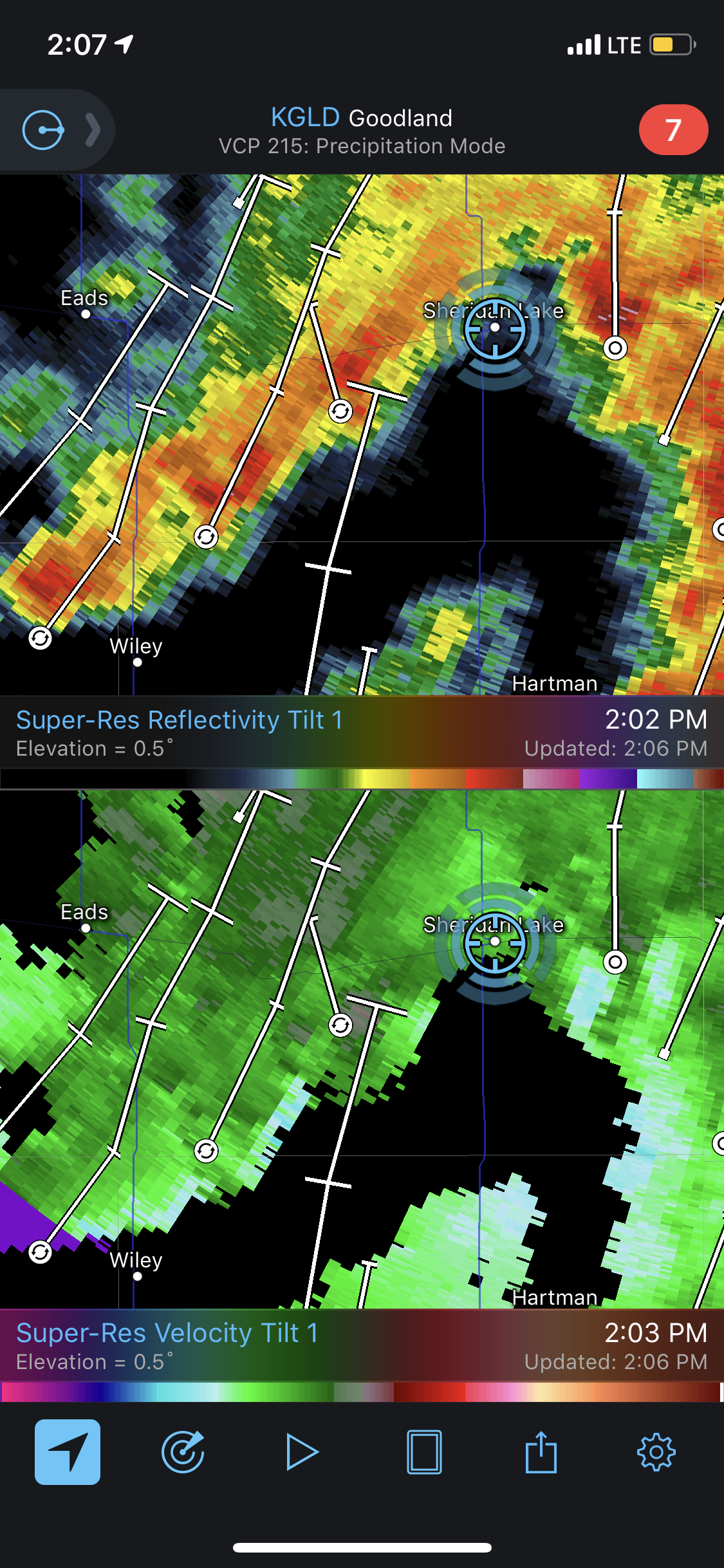
After we left Lamar we headed further north toward Sheridan Lake Colorado. We were waiting for better storm initiation since we knew the best storms of the day would be later in the afternoon/evening. Near Sheridan Lake we were on a cluster of storms that created a daisy chain of small meso-circulations. These storms were not severe warned, but they were interesting to watch until they formed into a single line of storms.
Three individual weak circulations
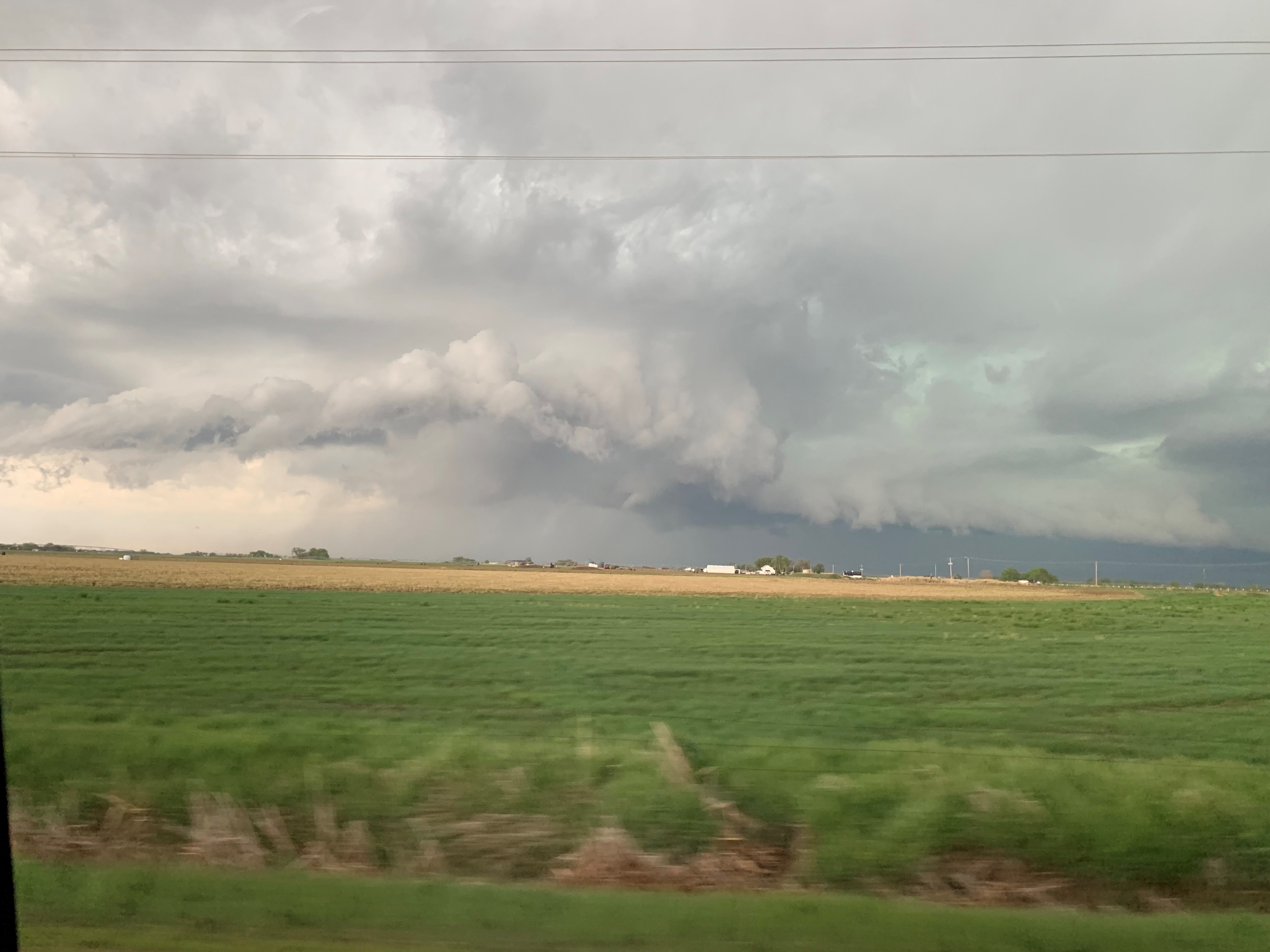
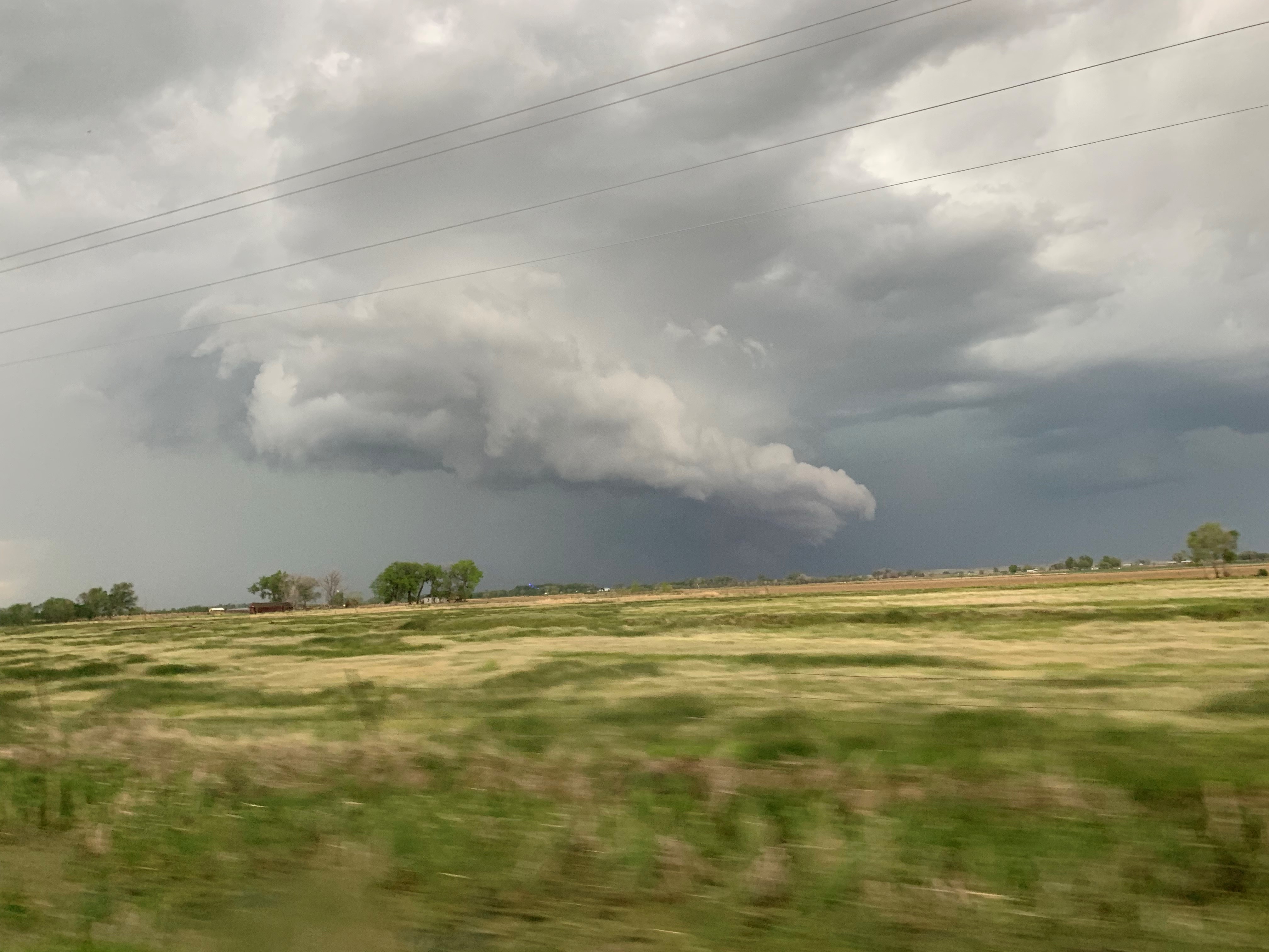
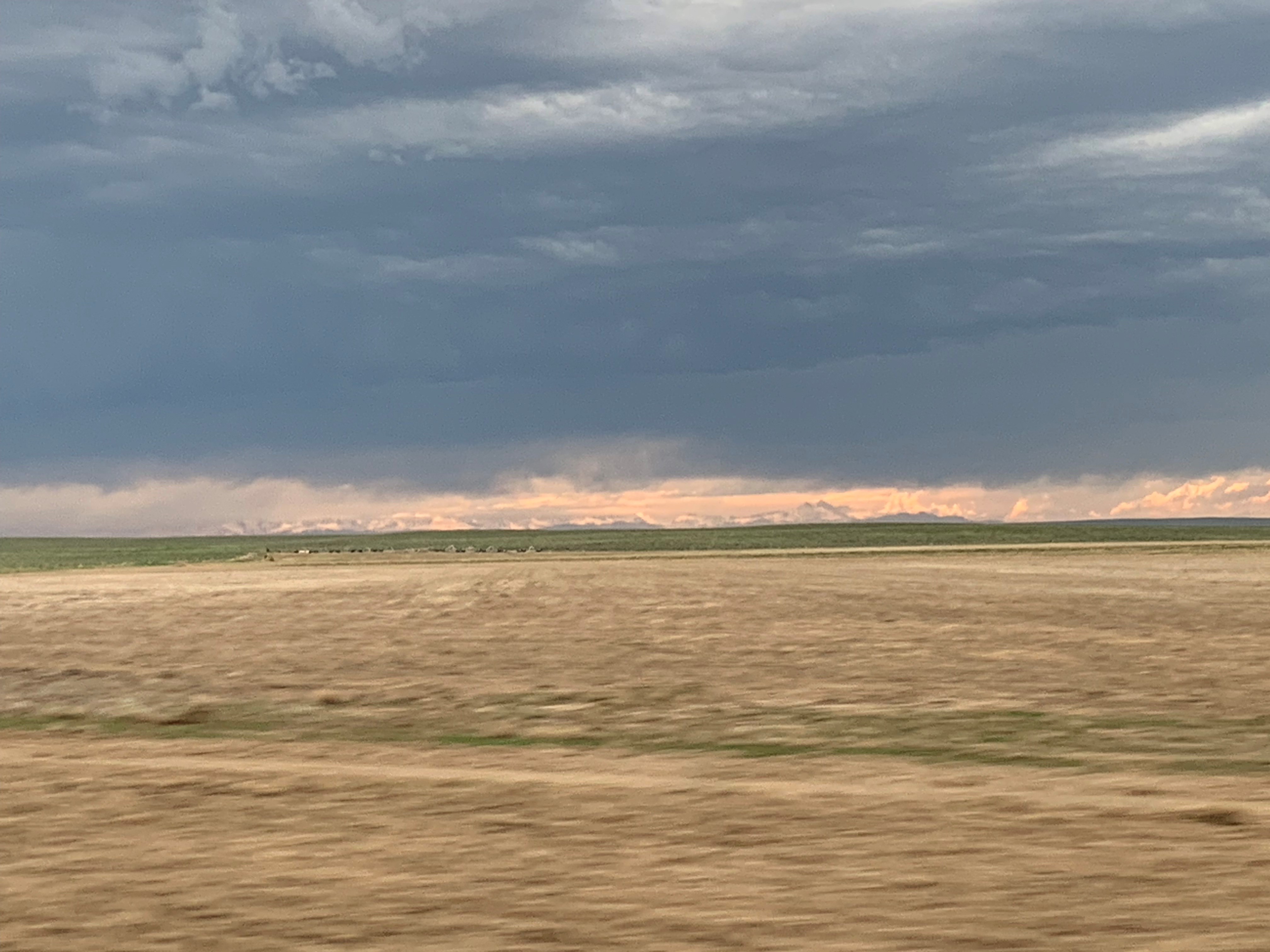
After we left those storms we raced north to be on storms that were firing up near Fort Morgan Colorado. We knew these storms would have better visibility, and they had a greater chance of being isolated longer before they formed into a line of storms with embedded circulations. The best storm we saw today was near Wiggins CO. This storm was isolated, and we had a fantastic view of it. There was some circulation to the storm on the velocity radar product, and we did watch it produce a funnel. However, poor road networks prevented us from staying with the storm long term.
While we were on the storms you could see the Rocky Mountains from where we were. In the sunset they looked amazing.
Look the Rocky Mountains!
Conclusion of day 8
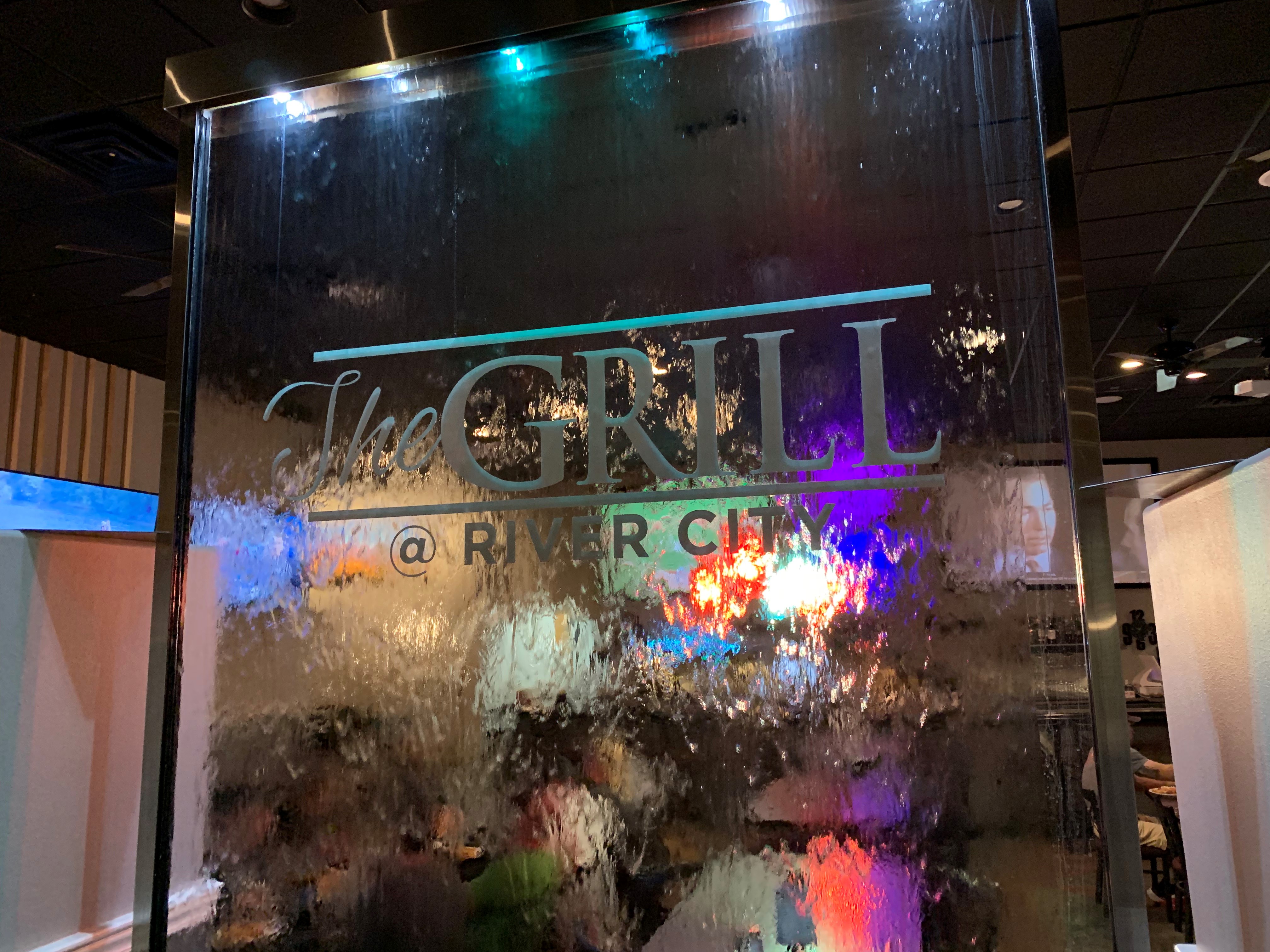
After a long chase day we headed into Sterling Colorado for the night. The long days are starting to show within the group, but our hopes are high to see some incredible storms as we move into the second half of our trip. That night we stopped in a place called The Grill @river city for dinner before heading back to the hotel for bed.
Another day of storm chase in the books. This day was quite tricky, however, we managed to make the best of it.
The Set-Up
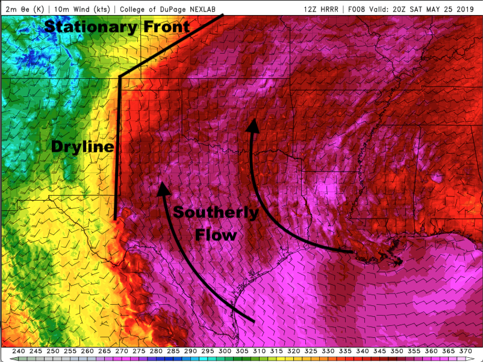
Our day, once again, started out in Amarillo, Texas. The surface observations were showing a stationary front extending from the northeast corner of the Texas panhandle going northeast into central Kansas. The winds throughout Texas were warm and strong from the South and the moisture was high, as well. The 12 Z run for the High Resolution Rapid Refresh (HRRR) model was showing a dry line strengthening and propagating right over the New Mexico-Texas state border any where from 19-20 Z (2 – 3 pm CDT). Along with the dry line, the intersection of the stationary front and the dry line was another point of interest when considering our target for the day.
Annotated Theta-e map generated by the HRRR at 20 Z (3 pm CDT)
The Chase
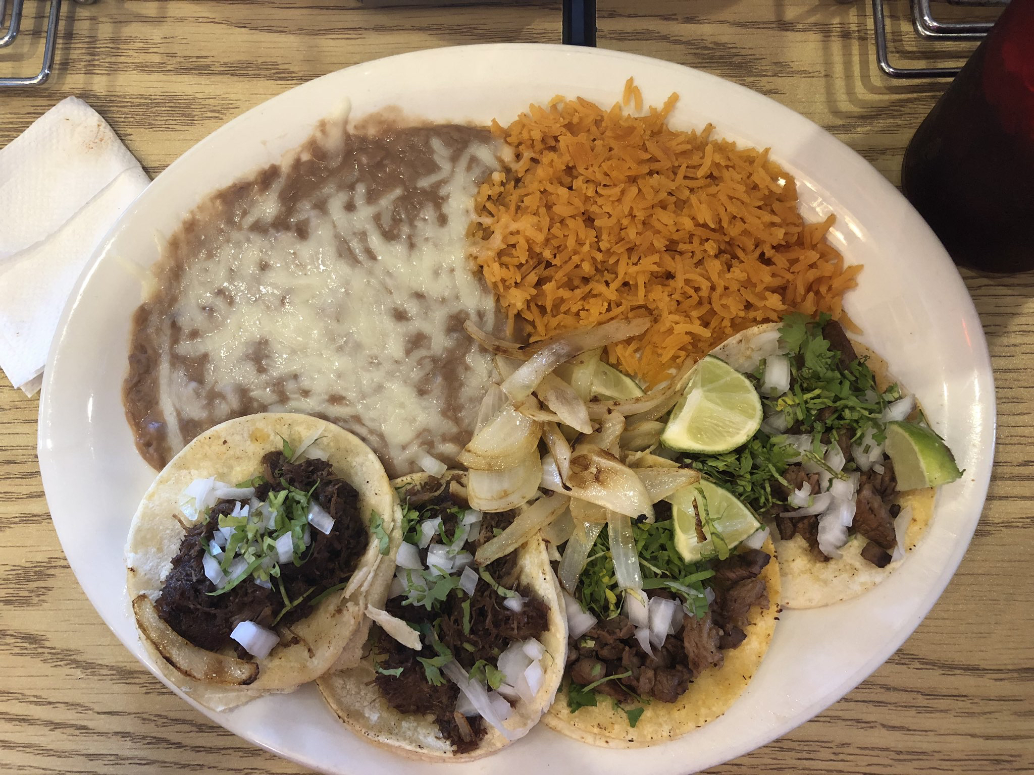
The group packed up and left soon after the forecast discussion. In the van, we decided to head north toward Dumas, Texas. The storms were just beginning to develop in the far west Texas panhandle, which gave us enough time to visit Los Potrillos Mexican Restaurant. The food was great and the service was impeccable.
We recommend the tacos!
We also met Corrina; she remembered the storm chase group from 2017.
Meet our new friend, Corrina!
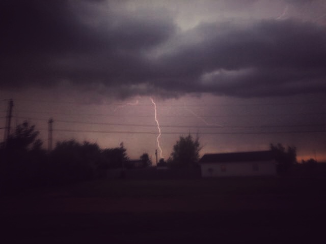
After lunch, we went drove out of the lovely city of Dumas and watched a storm roll in. The lightning was the best part about this storm.
Check this bolt out!
The storm started weakening and another storm in far southeast Colorado caught our eye. We merged onto the highway and headed for the Campo, Colorado supercell. The visibility was improving tremendously, which lightened our spirits for this chase day. In fact, the air was so clear, we could see the storm while we were 50 miles away.
Our view of the Campo, Colorado storm from 50 miles away!
We met the Campo storm near Manter, Kansas. The storm had widespread rotation and looked like it could tighten up at any moment. Our route around the storm consisted of dirt roads that occasionally looked like loose, sandy roads. We maneuvered with the storm and stopped just east of it to watch what it would do. The next radar scan came in, and the rotation was tightening up but the hail was also moving toward us. We started driving around the storm away from the hail and kept our eye on the rotation. A nice funnel formed for seconds and nearly made it half-way to the horizon.
We watched the storm move away and decided to head for our hotel in Garden City, Kansas. We arrived to the hotel relatively early and headed for a nice relaxing dinner at Old Chicago.
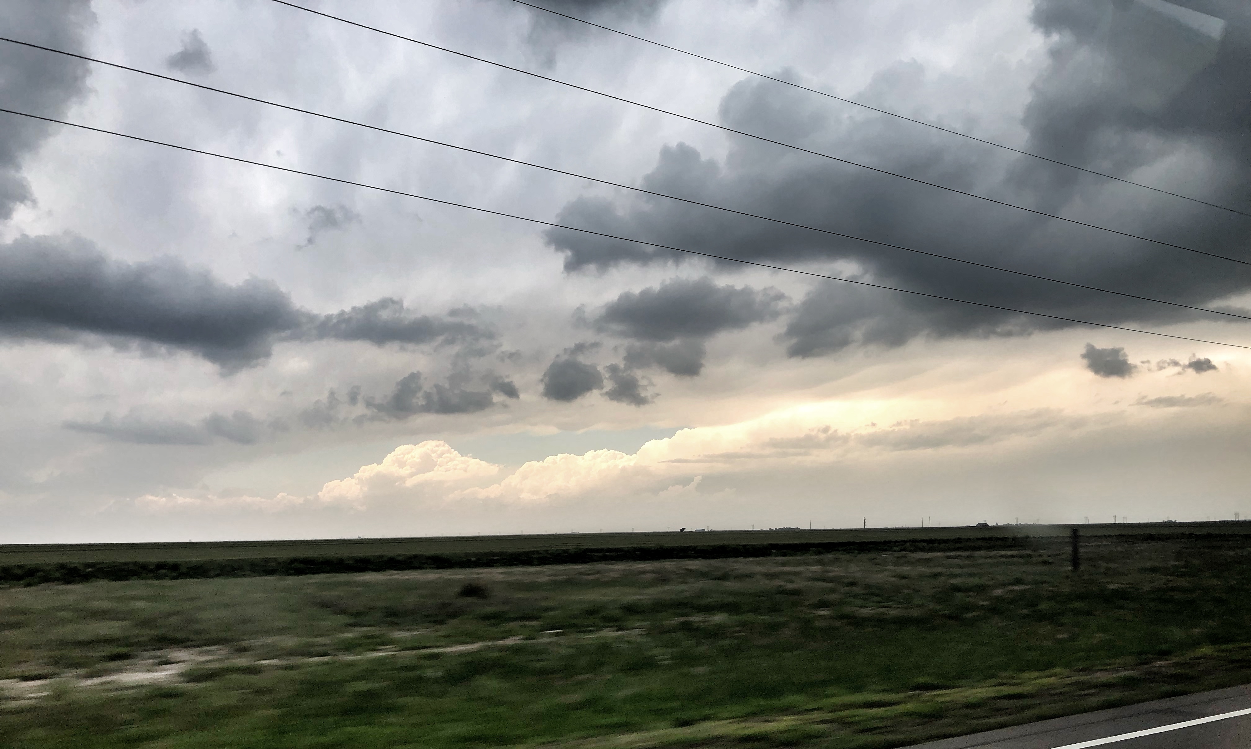
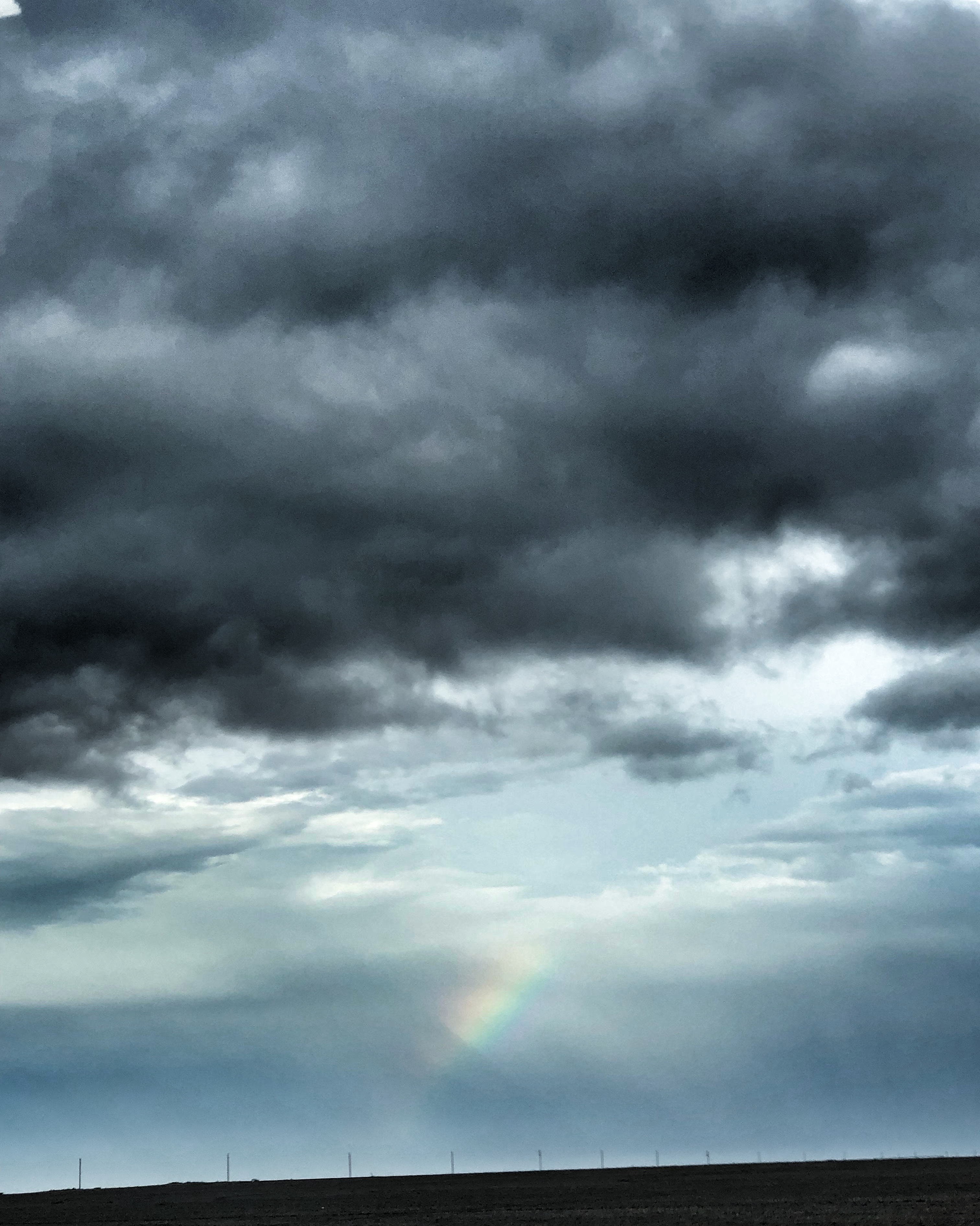
Today was a calmer day for the storm chase group; it was pretty light in travel for us. Also, we spotted a rainbow to top Day 7 of chase off.
Our morning began with a forecast discussion in Shamrock, TX. We knew that our travel distance wouldn’t be as long, so we were able to have a relaxed morning.
Atmospheric Setup
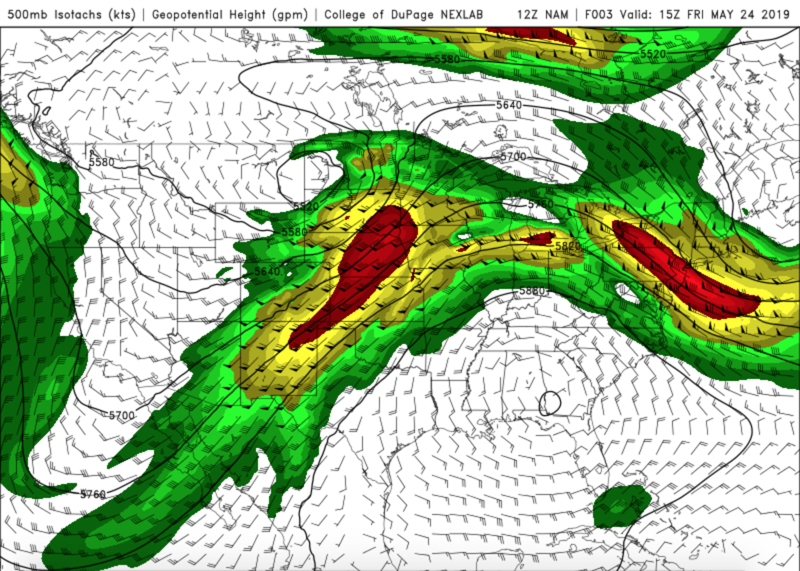
When we went to bed on Thursday night the SPC had a slight risk area extending from Texas to the Great Lakes. During our forecast discussion on Friday morning, our main focus was on the dry line that extended southwest to northeast across the south central part of the panhandle. An upper level low was located over Montana and North Dakota, which was a bit of a change from the atmospheric setup that we had been dealing with earlier in the week. That upper low had continuously gyrated over the western US but has now moved on and is making way for the next wave to come through. The 500mb winds had backed off quite a bit but a large ridge over the Gulf states coupled with the negatively tilted trough over the northern US sandwiched the pressure gradient and caused a jet streak over the central Plains.
500mb Heights and Winds map
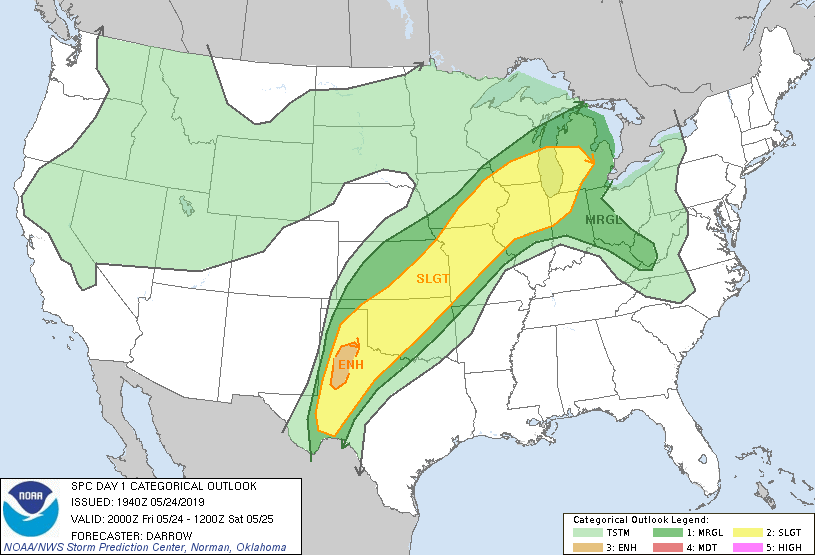
At the end of our forecast discussion, we decided that the best environment would be on the south side of the dry line. We felt that this area was where moisture convergence, CAPE, and low level lapse rates were the most conducive for severe storms. Our goal was to stay along that boundary and follow any storms that fired along it. Later in the afternoon the SPC upgraded an area within the south central part of the Texas panhandle to an enhanced risk.
SPC Day 1 Outlook with an enhanced risk over the south central part of the Texas panhandle.
The Chase
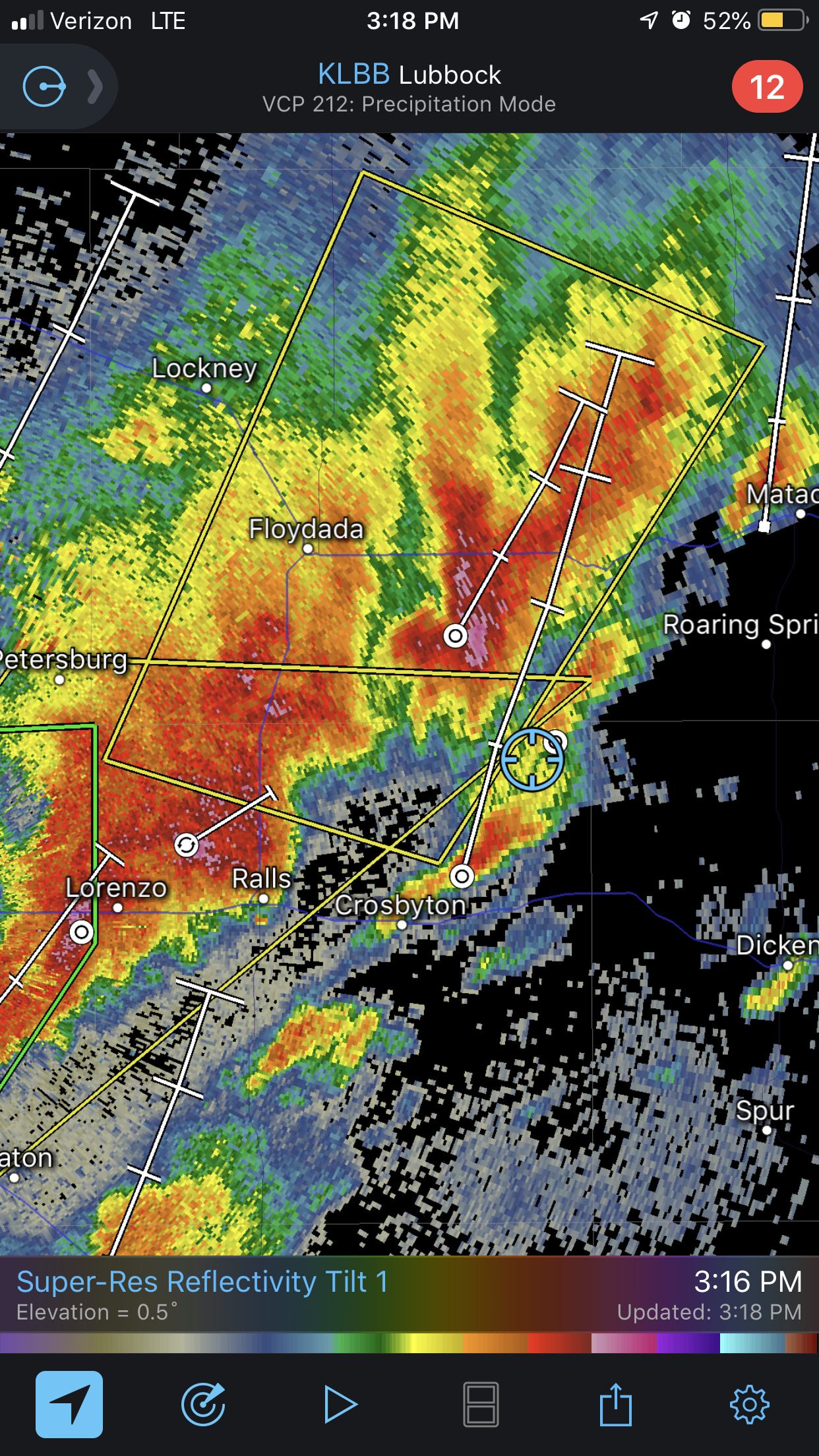
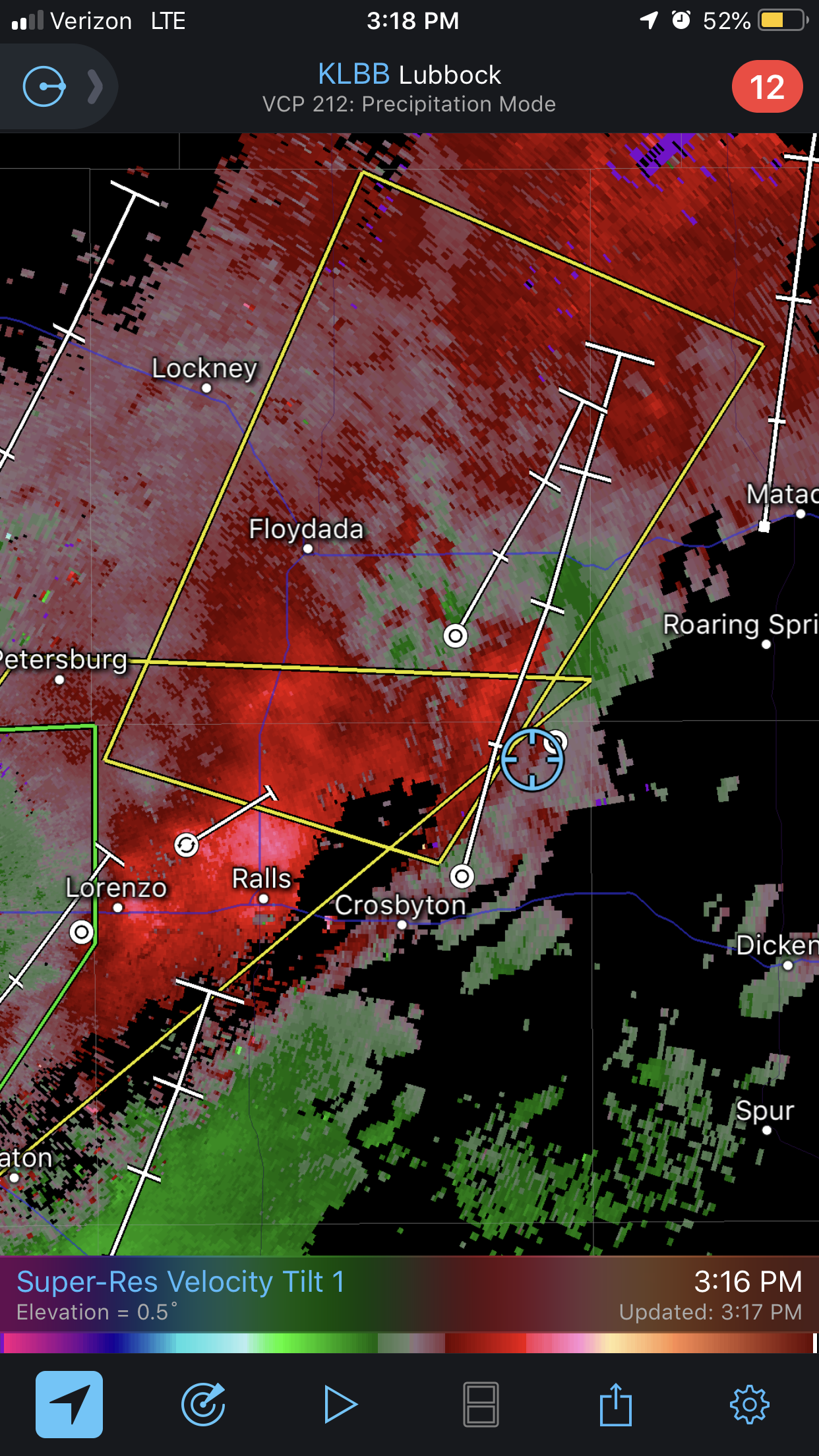
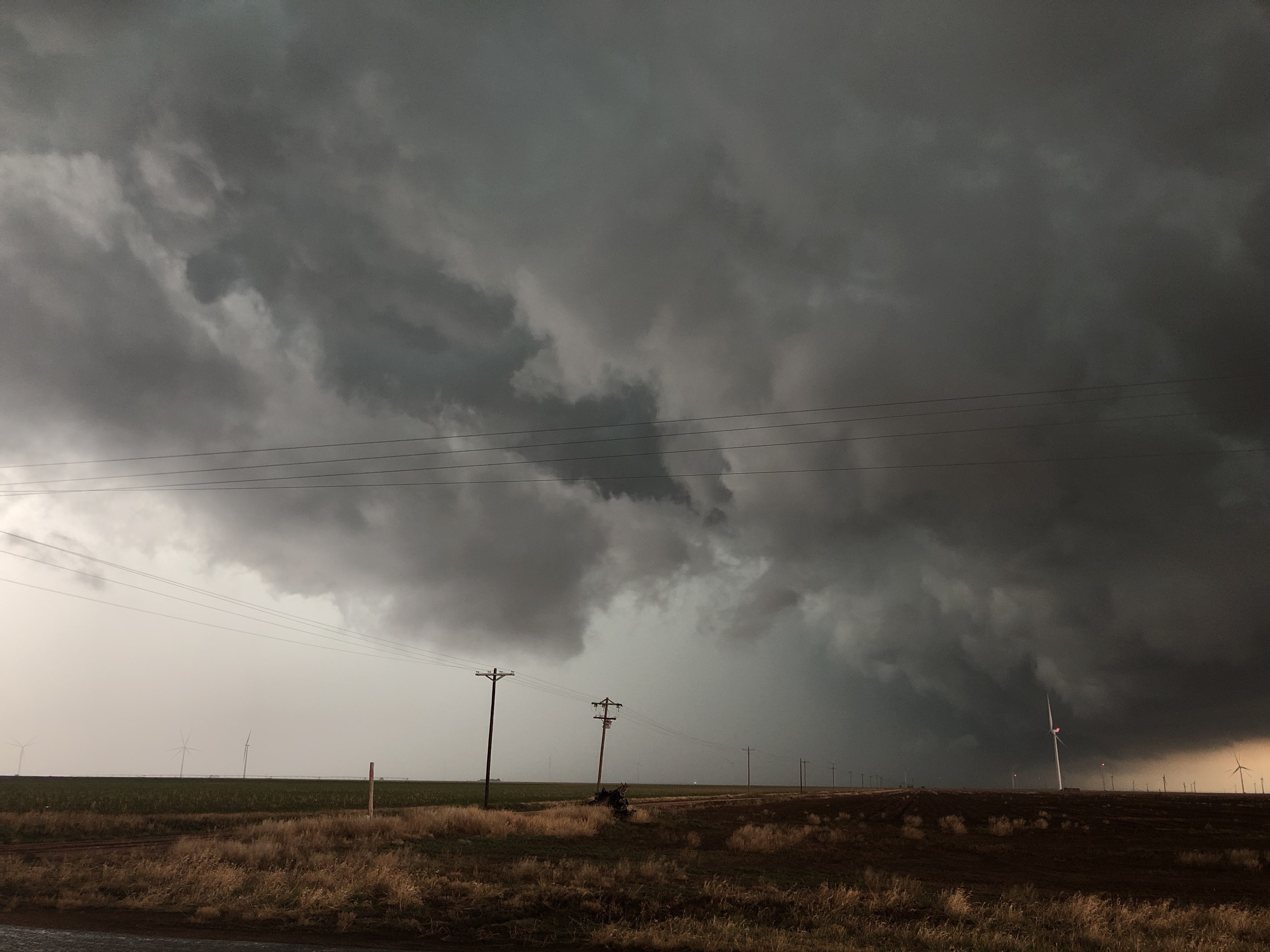
We began our drive from Shamrock, TX and started heading toward Lubbock, TX. Visibility was slightly better as we chased our first storm between Floydada and Crosbyton, TX. This storm had visible rotation and created the most beautiful sight as we drove past a canyon and could see the base of it.
Rotating cell between Floydada and Crosbyton, TX.
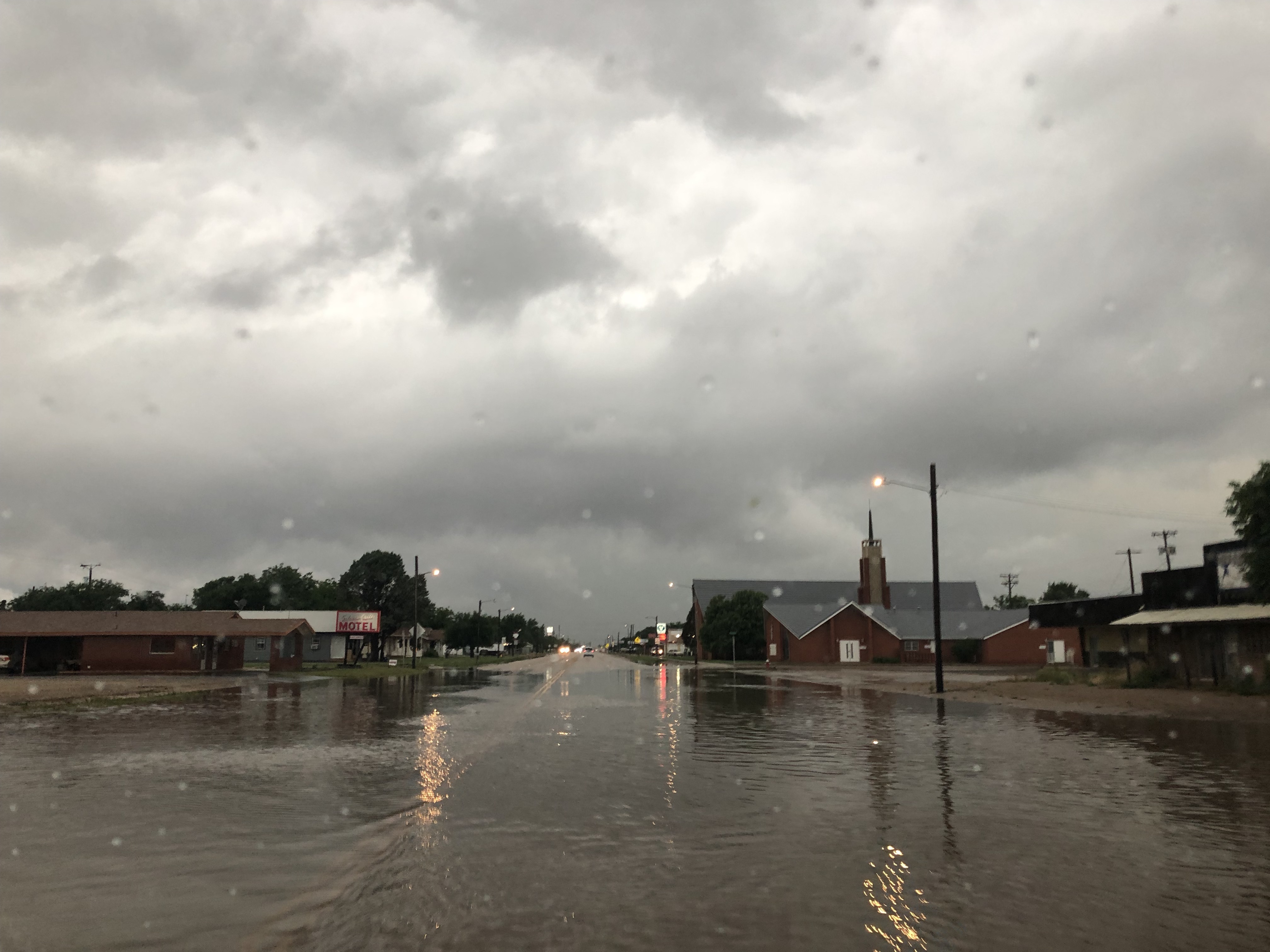
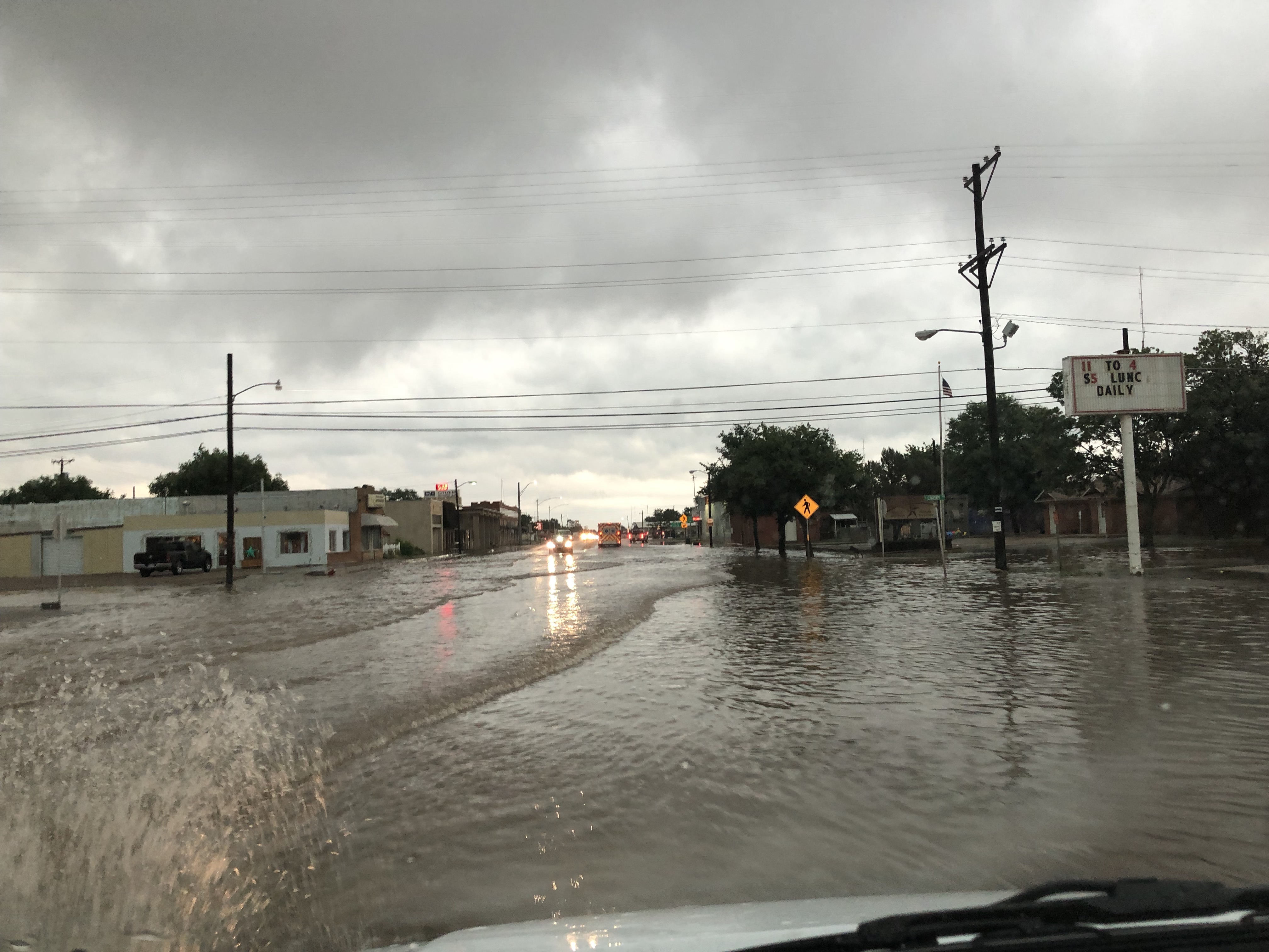
We moved southeast and positioned ourselves to the west of Dickens, TX. We encountered quite a bit of hail from this storm and then moved back into Crosbyton, TX to wait for the next cell to move through. While in Crosbyton, we encountered major flooding. The roads were covered, ditches were turned into moving waterways, and the fields had standing water with ripples going across them. Grass was not visible on much of the land and runoff soil led the water that was coming off the fields and onto the road. We concluded our chase day in Crosbyton and decided to head toward Amarillo for the night in order to be closer to our target for Saturday’s chase.
Conclusion of the Day
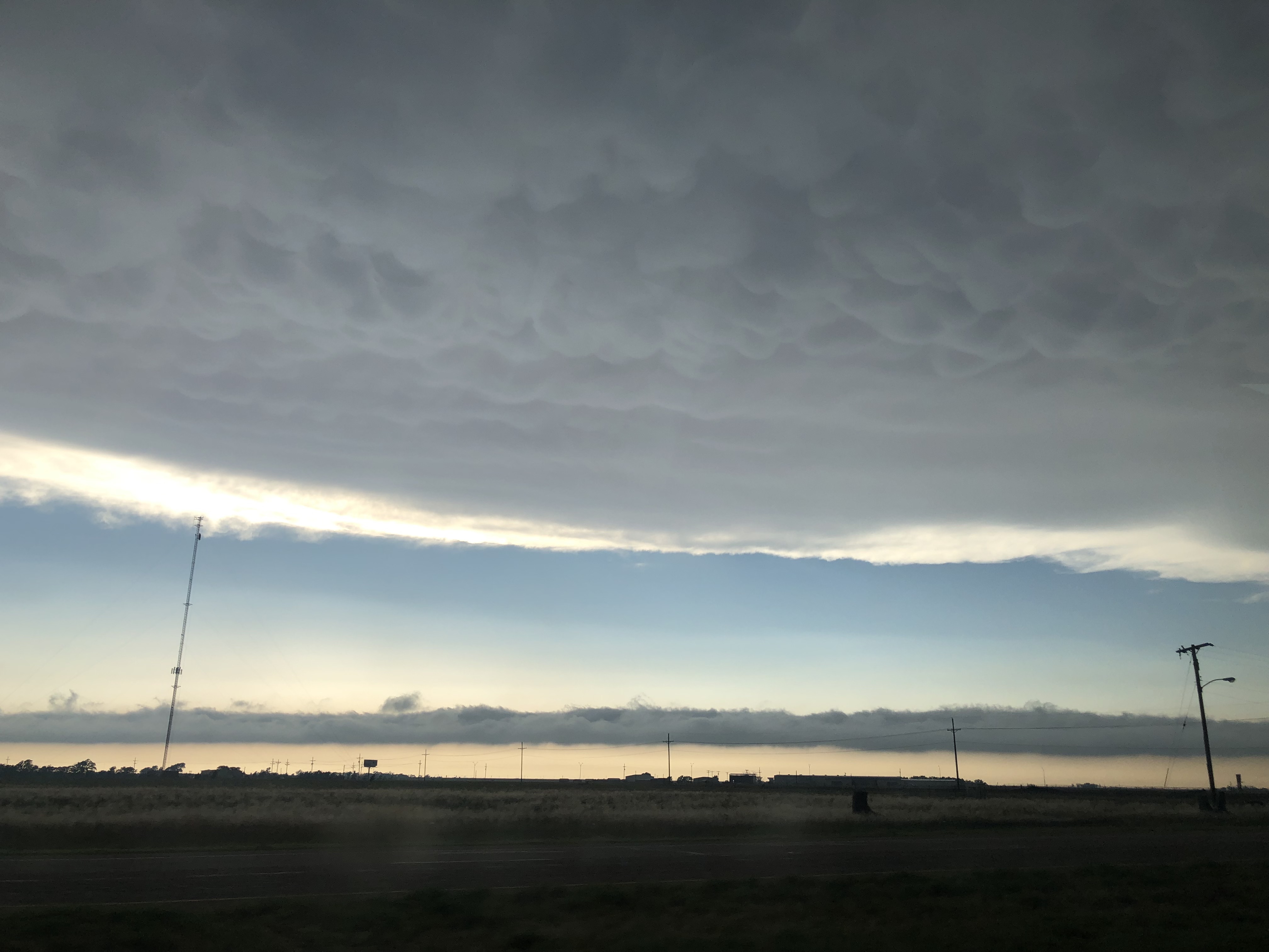
On our drive back to Amarillo at the end of the day, we got to see beautiful mammatus clouds in Plainview, TX.
Mammatus in Plainview, TX.
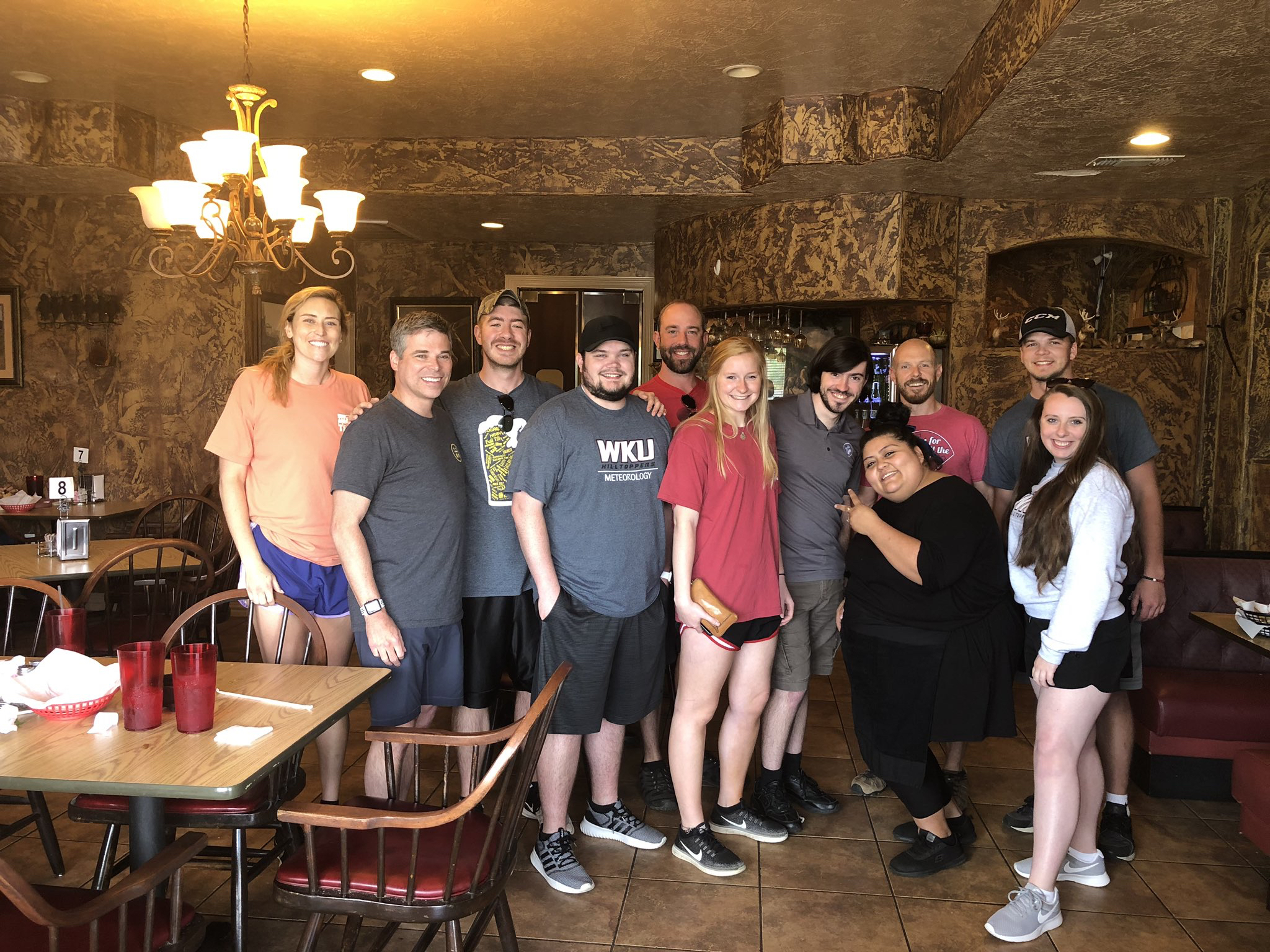
We checked into our hotel in Amarillo and then walked across the parking lot to have dinner at Bubba’s 33. While waiting for our table we got to watch a beautiful sunset. As usual, dinner was filled with good food, good company, and plenty of laughs. Check back tomorrow for another update. Thanks for following along with us!
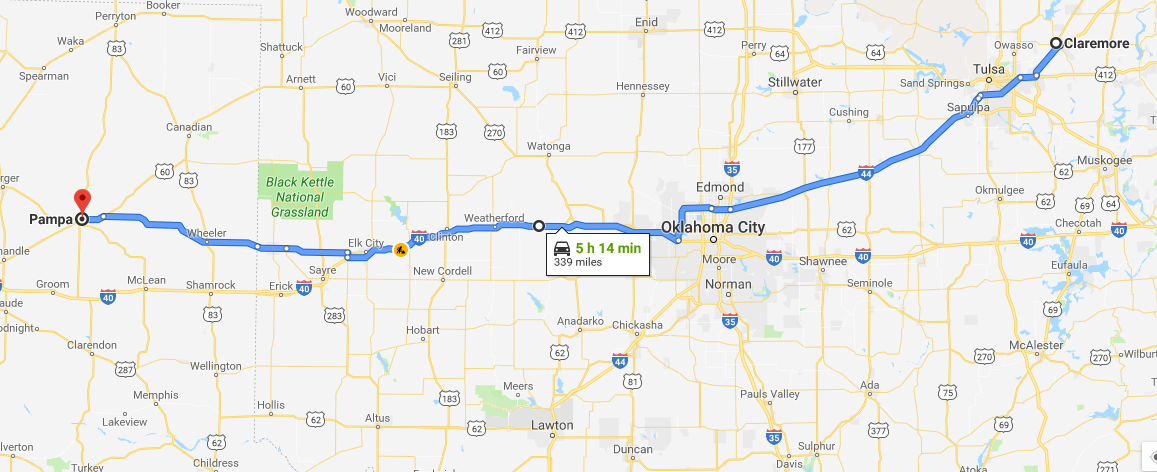
We started our Thursday morning by packing up and leaving Claremore, OK at 8 AM. We also parted ways with David Oliver ( Director of Environmental Health and Safety at WKU) and Dr. Tim Caboni (WKU President). Over the course of 3 days, we traveled just over 1500 miles with the President across Texas, Oklahoma, and Kansas.
President Caboni with the WKU Storm Chasers in Claremore, Oklahoma.
We had a general idea that storms were going to be in the Panhandle of Texas, but this area is much bigger than most people think. After conducting a forecast discussion in the van, it was determined that our target would be Pampa, Texas.
5 hour drive to Pampa, Texas (Northeast of Amarillo)
Atmospheric Setup
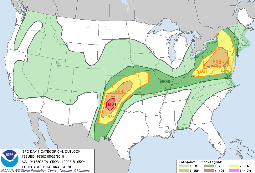
The Panhandle of Texas was expected to be an area of severe weather. The upper level jet streak has backed off a little bit, but still brings upper level divergence/low level convergence to that area. A stationary front was draped west to east across the northern portion of the Texas Panhandle, and the north to south dry line was situated directly over the Texas/New Mexico border. The Panhandle would have plenty of instability, wind shear, and moisture, as the strong low level jet helped pull in deep moisture from the Gulf of Mexico. These ingredients, converging on the boundaries, helped initiate storms west and north of Amarillo. Pampa, TX was our target because we felt that storms would initiate west of Amarillo, and move into a better environment just east where they could develop into supercells. While we were driving to our target, the Storm Prediction Center upgraded the Day 1 Convective Outlook to a Moderate Risk (Level 4 of 5) for the area just east of Amarillo, which was in perfect agreement with our target.
SPC Day 1 Convective Outlook Outlook upgraded to Moderate Risk.
We stopped for lunch in Shamrock, TX, and ate at the Roost, a popular local restaurant. We continued to our target, and then waited for storms to initiate.
Chase
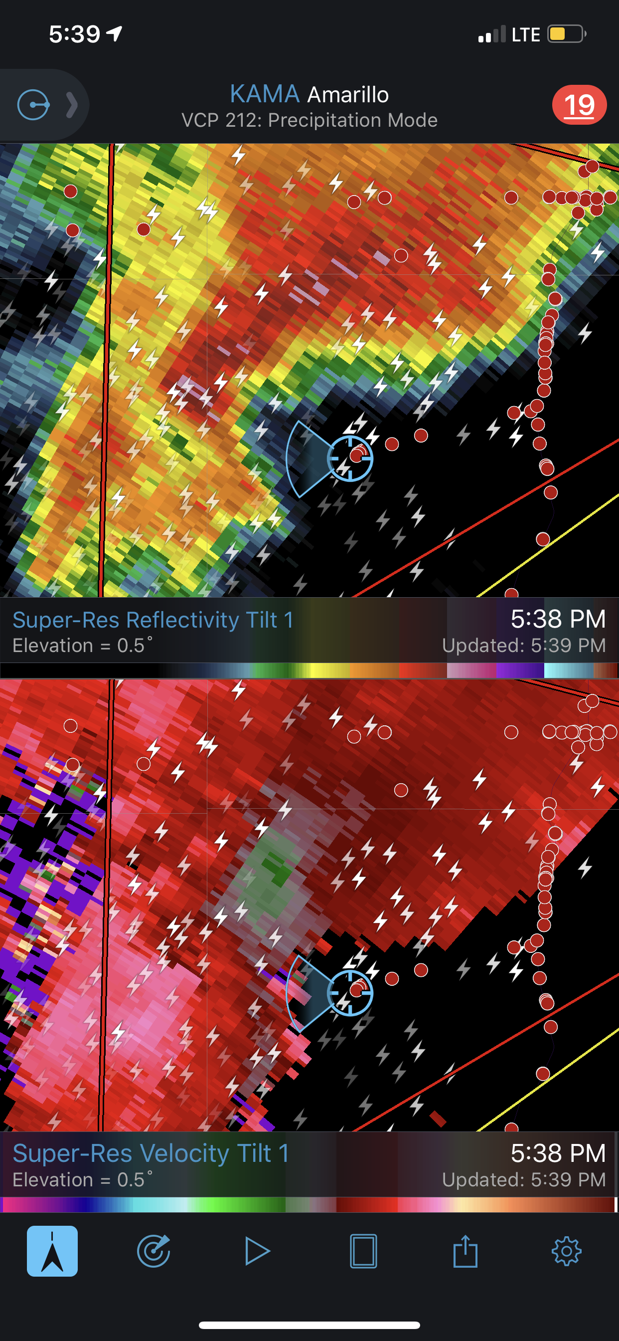
Our first storm of the day was just to the north of Pampa, TX. We chased this unorganized supercell for quite some time. Fortunately, flood roads were not a problem today, and the chaser convergence was a little more spread out over the Panhandle. We continued to chase this storm as it was southeast of Spearman, Texas. We were able to take a sturdy dirt road, and drove within a few miles of the cell.
Radar shows we are close to the area of circulation
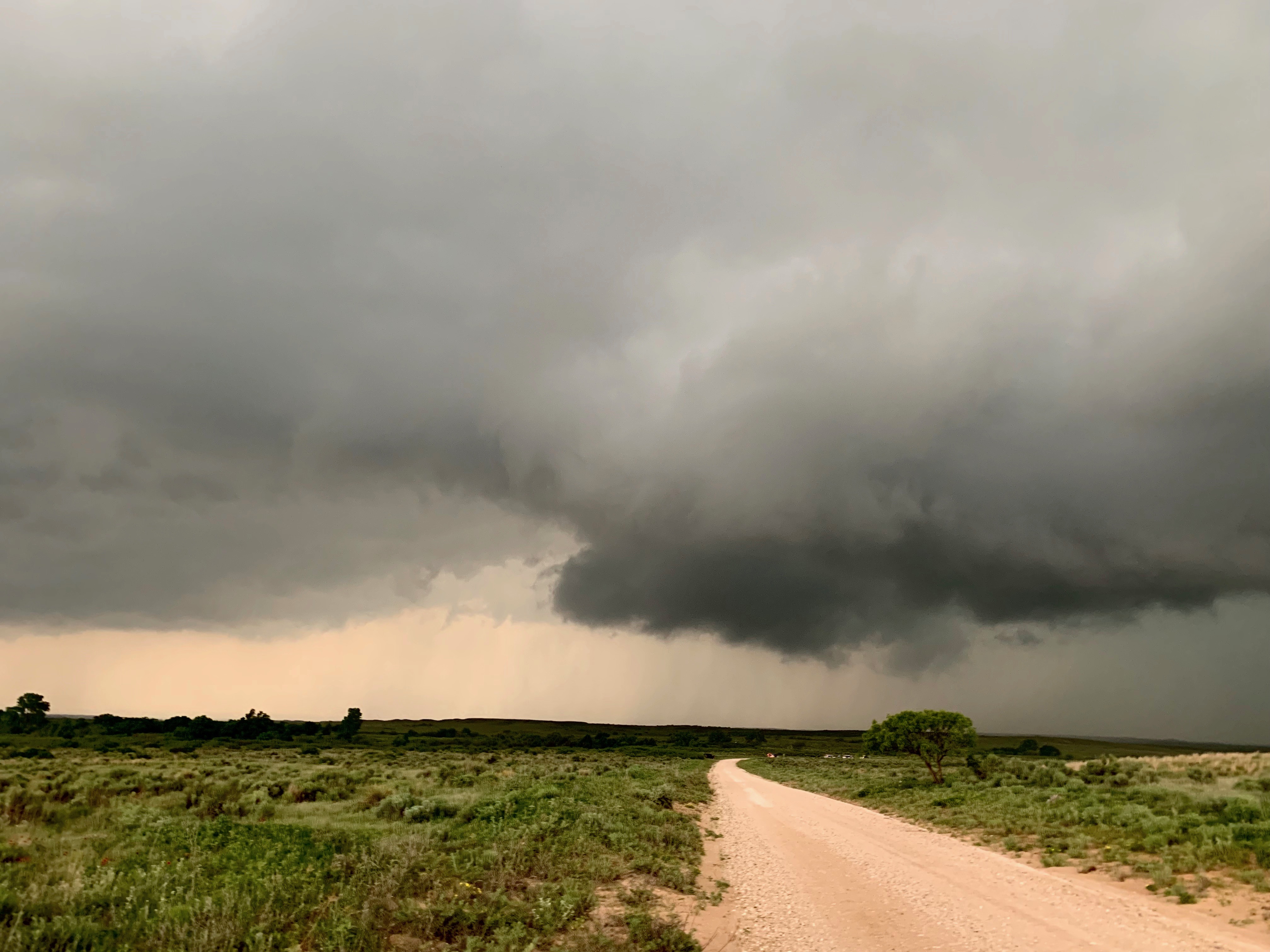
This location brought a nice view of the approaching storm, as seen below.
Not much out there. Neat view of the approaching storm
We continued to chase the storm northward all the way up to Perryton, TX. This is just south of the TX/OK border. Again, this cell produced very ominous clouds, and we sat and watched.
Ominous clouds caught in the inflow region of the storm. Just east of Spearman, TX.
We had trouble with visibilities again. Wall clouds and possible tornadoes were rain wrapped, and when blocked by a curtain of rain, makes it very difficult to see anything. We had several velocity couplets that suggested a possible tornado, but we could not see it. But, overall, it was still a great chase day. The forecast verified that our target would be the location of severe storms. We saw some ominous clouds, ran along side tornado-warned storms, and saw a lot of incredible lightning.
End of the Day
We finished chasing near Canadian, TX, and decided to get a late dinner at the Stumblin’ Goat. We then drove south to Shamrock to spend the night.
Thanks for following along on our storm chase trip. Make sure to follow @wkustormchase on Twitter for current updates.


![[Image of WPC Flash Flooding/Excessive Rainfall Outlook]](https://www.nhc.noaa.gov/storm_graphics/AT05/refresh/AL0519WPCERO+gif/152824WPCERO_sm.gif)